close
-
Layers w
- Weather Layers
- Pro
- Pro
- Pro
- Pro
- Pro
- Pro
- More Layers
- Pro
- Pro
- Pro
- Pro
-
Upgrade to

3D
Trail Conditions
- Unknown
- Snow Groomed
- Snow Packed
- Snow Covered
- Snow Cover Partial
- Freeze/thaw Cycle
- Icy
- Prevalent Mud
- Wet
- Variable
- Ideal
- Dry
- Very Dry
Trail Flow (Ridden Direction)
Trailforks scans users ridelogs to determine the most popular direction each trail is ridden. A good flowing trail network will have most trails flowing in a single direction according to their intension.
The colour categories are based on what percentage of riders are riding a trail in its intended direction.
The colour categories are based on what percentage of riders are riding a trail in its intended direction.
- > 96%
- > 90%
- > 80%
- > 70%
- > 50%
- < 50%
- bi-directional trail
- no data
Trail Last Ridden
Trailforks scans ridelogs to determine the last time a trail was ridden.
- < 2 days
- < 1 week
- < 2 weeks
- < 1 month
- < 6 months
- > 6 months
Trail Ridden Direction
The intended direction a trail should be ridden.
- Downhill Only
- Downhill Primary
- Both Directions
- Uphill Primary
- Uphill Only
- One Direction
Contribute Details
Colors indicate trail is missing specified detail.
- Description
- Photos
- Description & Photos
- Videos
Trail Popularity ?
Trailforks scans ridelogs to determine which trails are ridden the most in the last 9 months.
Trails are compared with nearby trails in the same city region with a possible 25 colour shades.
Think of this as a heatmap, more rides = more kinetic energy = warmer colors.
- most popular
- popular
- less popular
- not popular
ATV/ORV/OHV Filter
Max Vehicle Width
inches
US Cell Coverage
Legend

Radar Time
Activity Recordings
Trailforks uses anonymized public activity data.
?
Activity Recordings
Trailforks uses anonymized public activity data.
?
Personal Heatmap
▶
Activity Types
all
/
none
▶
Options
2
Date range
month
–
Winter Trails
Warning
A routing network for winter maps does not exist. Selecting trails using the winter trails layer has been disabled.
Missing Trails
Most Popular
Least Popular
Trails are colored based on popularity. The more popular a trail is, the more red. Less popular trails trend towards green.
Jump Magnitude Heatmap
Heatmap of where riders jump on trails. Zoom in to see individual jumps, click circles to view jump details.
BC Backroad Status
![map legend]()
Service Road Atlas is a free to use, community-driven service for viewing and creating reports on the numerous back-country service roads around B.C. and Alberta.

Slope Aspect
Direction the slope faces
Trails Deemphasized
Trails are shown in grey.
Only show trails with no bike usage.
Suggested Layers
Based on selected activity type
Save the current map location and zoom level as your default home location whenever this page is loaded.
SaveThe headwaters of the Weber and Provo Rivers, open to a variety of uses. Part of the Uinta-Wasatch-Cache National Forest.
 google parking directions
 Activities Click to view
- Mountain Bike
52 trails
- E-Bike
22 trails
- Horse
40 trails
- Hike
69 trails
- Trail Running
65 trails
- Dirtbike/Moto
22 trails
- ATV/ORV/OHV
21 trails
- Snowmobile
16 trails
- Snowshoe
4 trails
Region Details
- 1
- 15
- 32
- 4
Region Status
Open as of Jun 13, 2026Stats
- Avg Trail Rating
- Trails (view details)
- 68
- Trails Mountain Bike
- 52
- Trails E-Bike
- 22
- Trails Horse
- 40
- Trails Hike
- 69
- Trails Trail Running
- 65
- Trails Dirtbike/Moto
- 22
- Trails ATV/ORV/OHV
- 21
- Trails Snowmobile
- 16
- Trails Snowshoe
- 4
- Trails Backcountry Ski
- 3
- Trails Nordic Ski
- 1
- Total Distance
- 177 miles
- Total Descent
- 23,626 ft
- Total Vertical
- 5,675 ft
- Highest Trailhead
- 12,695 ft
- Reports
- 325
- Photos
- 256
- Ridden Counter
- 8,402
Popular Western Uintas Mountain Biking Trails
• 100 ★ 4.1 • 3 miles • 724 ft • 1,336 •
MTB Trail is the first trail built in the Uinta's, especially for mountain bikes. (hiking is also allowed, but no horses or motorized equipment). It is an unforgettable 5.65-mile clockwise loop experience, running through tall stands of...
• 100 ★ 4.3 • 3 miles • 26 ft • 601 •
MTB Trail is the first trail built in the Uinta's, especially for mountain bikes. (hiking is also allowed, but no horses or motorized equipment). It is an unforgettable 5.65-mile clockwise loop experience, running through tall stands of...
• 100 ★ 4.0 • 2 miles • 100 ft • 381 •
Fantastic DH only trail from the top of to the Slate Creek Trail 4-way intersection. Fast and flowy. This trail is DH only for bikes, and 2-way for hiking.
• 100 ★ 4.5 • 4,518 ft • 17 ft • 269 •
A new easy family-friendly MTB loop that branches off of the MTB Trail. Fun for family and kids. Many banked and smooth flowing turns. The loop is about 1.4 miles and begins and ends on the north side of the parking lot. The trail is...
• 100 ★ 4.0 • 2 miles • 319 ft • 132 •
This ATV trail is a good connector for the Beaver trail and . There is very little elevation gain, and mostly smooth dirt. This dirt road goes through the Campground.
Western Uintas Mountain Bike Routes
★ 2.0 • 6 miles • 777 ft • 1 •
7 miles • 512 ft • 4 •
3 miles • 591 ft • 1 •
3 miles • 199 ft • 2 •
10 miles • 2,862 ft • 1 •
12 miles • 2,157 ft • 2 •
Photos of Western Uintas Mountain Bike
Videos of Western Uintas Mountain Bike
youtuber
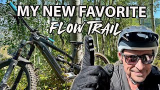
![I Found An Untapped MTB Gem | Slate Creek, Utah]()
trail: Slate Creek Trail, UP
13:47 |
228 |
Sep 23, 2024 , Kamas
trail: Ponderosa MTB Trail
17:17 |
156 |
Sep 25, 2022 , Kamas
youtuber
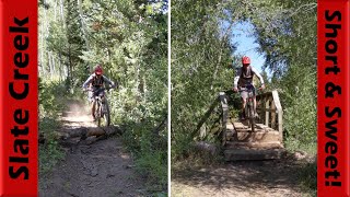
![Slate Creek Is Short & Super Sweet! |...]()

trail: Slate Creek Trail, UP
17:17 |
377 |
Sep 25, 2022 , Kamas

trail: Shingle Creek
37:03 |
249 |
Sep 18, 2022 , Kamas
youtuber
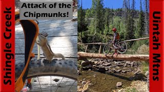
![Shingle Creek is Full of Chipmunks & My...]()
trail: Upper Setting
37:03 |
158 |
Sep 18, 2022 , Kamas

trail: Slate Creek Trail, UP
8:26 |
679 |
Nov 28, 2021 , Kamas

trail: Slate Creek Trail, UP
3:00 |
529 |
Aug 23, 2021 , Kamas
trail: Norway Flats Road
22:27 |
353 |
Oct 12, 2020 , Kamas
Recent Trail Reports
| status | trail | date | condition | info | user |
|---|---|---|---|---|---|
| Slate Creek Trail, UP | Jun 13, 2026 @ 10:46am (America/Denver) Jun 13, 2026 | Dry | codekitchen | ||
| White Fir | Jun 1, 2026 @ 4:44pm (America/Boise) Jun 1, 2026 | Ideal | Ringquist | ||
| Left Hand Loop, Outer | Jun 1, 2026 @ 4:44pm (America/Boise) Jun 1, 2026 | Ideal | Ringquist | ||
| Left Hand Loop, Inner | May 25, 2026 @ 1:51pm (America/Denver) May 25, 2026 | Unknown | rhowe96 | ||
| Slate Creek Trail, DOWN | May 16, 2026 @ 5:31am (America/Los_Angeles) May 16, 2026 | Ideal | msu-alumnus | ||
| Ponderosa MTB Trail | May 16, 2026 @ 5:31am (America/Los_Angeles) May 16, 2026 | Ideal | msu-alumnus | ||
| Upper Setting | Sep 8, 2025 @ 7:55pm Sep 8, 2025 | Ideal | UtahJohn TRAILFORKS | ||
| Lakes Country | Sep 8, 2025 @ 7:54pm Sep 8, 2025 | Ideal | UtahJohn TRAILFORKS | ||
| Shingle Creek | Sep 8, 2025 @ 9:50am Sep 8, 2025 | Dry | UtahJohn TRAILFORKS | ||
| Big Elk Lake | Sep 8, 2025 @ 9:50am Sep 8, 2025 | Ideal | UtahJohn TRAILFORKS |
Activity Feed
| username | action | type | title | date |
|---|---|---|---|---|
| Ralefinley | wishlist | trail | activity #97184297 | Jun 17, 2026 @ 8:04am 1 day |
| grabtharshammer | wishlist | trail | activity #97147048 and 1 more | Jun 16, 2026 @ 4:50pm 2 days |
| ralberti | ridden | trail | activity #97085732 and 3 more | Jun 15, 2026 @ 8:47pm 3 days |
| Hayleyh9DZ7a | wishlist | trail | activity #97070611 and 1 more | Jun 15, 2026 @ 3:54pm 3 days |
| codekitchen | add | report | activity #96914949 | Jun 13, 2026 @ 2:06pm Jun 13, 2026 |
Recent Comments
| username | type | title | comment | date |
|---|---|---|---|---|
| trail | The sign at the four-way junction indicates... | May 16, 2026 @ 8:36pm May 16, 2026 | ||
| trail | People continue to ride horses on this loop.... | May 16, 2026 @ 1:54pm May 16, 2026 | ||
| trail | I’m | Apr 10, 2026 @ 9:15pm Apr 10, 2026 | ||
| report | Oops - right loop not ‘eight’ | Mar 25, 2026 @ 2:44pm Mar 25, 2026 | ||
| report | Right loop not ‘eight’ - Is the right/east... | Mar 25, 2026 @ 2:43pm Mar 25, 2026 |
Nearby Areas
| name | distance | ||||
|---|---|---|---|---|---|
| High Star Ranch | 5 | 8 | 1 | 8.2 km | |
| Duchesne Ridge | 12 | 5 | 8.8 km | ||
| Oakley Trail Park | 10 | 7 | 5 | 9.2 km | |
| Oakley Bike Park | 8 | 4 | 9.5 km | ||
| Murdock Basin | 10 | 4 | 11 km |
Local Badges
-

Completionist0 awarded
Activity Type Stats
| activitytype | trails | distance | descent | descent distance | total vertical | rating | global rank | state rank | photos | reports | routes | ridelogs |
|---|---|---|---|---|---|---|---|---|---|---|---|---|
| Mountain Bike | 52 | 125 miles | 17,234 ft | 55 miles | 3,481 ft | #1,693 | #574 | 162 | 310 | 9 | 4,805 | |
| E-Bike | 22 | 44 miles | 6,243 ft | 15 miles | 3,064 ft | #3,247 | #975 | 1 | 195 | 228 | ||
| Horse | 40 | 103 miles | 13,806 ft | 38 miles | 3,743 ft | #98 | #200 | 41 | 55 | 4 | ||
| Hike | 69 | 177 miles | 23,625 ft | 69 miles | 5,676 ft | #93 | 47 | 313 | 14 | 2,298 | ||
| Trail Running | 65 | 163 miles | 22,031 ft | 67 miles | 5,676 ft | #503 | #201 | 312 | 14 | 254 | ||
| Dirtbike/Moto | 22 | 44 miles | 6,243 ft | 15 miles | 3,064 ft | #110 | #59 | 30 | 3 | 12 | ||
| ATV/ORV/OHV | 21 | 38 miles | 4,692 ft | 13 miles | 3,064 ft | #366 | #90 | 5 | 40 | 3 | 11 | |
| Snowmobile | 16 | 25 miles | 2,598 ft | 8 miles | 2,979 ft | #133 | #31 | 13 | 12 | |||
| Snowshoe | 4 | 8 miles | 1,122 ft | 4 miles | 1,037 ft | #756 | #338 | 50 | 4 | 61 | ||
| Backcountry Ski | 3 | 5 miles | 699 ft | 2 miles | 725 ft | #246 | #58 | 42 | 117 | |||
| Nordic Ski | 1 | #881 | #428 | 9 | 75 |
Frequently Asked Questions About Western Uintas
▼
What are the highest rated mountain biking trails in Western Uintas?
The highest rated mountain biking trails in Western Uintas are:
- White Fir (4.6/5)
- Left Hand Loop, Outer (4.6/5)
- Wall Lake (4.2/5)
- Lakes Country (4.1/5)
- Ponderosa MTB Trail (4.1/5)
▼
What is the best time of the year to ride in Western Uintas?
Based on ride log data, the most popular months to ride in Western Uintas are:
- July (56 activities)
- August (45 activities)
- June (31 activities)
▼
Where can I park to ride in Western Uintas?
There are 19 parking locations listed in Western Uintas. The most popular parking spots are:
- Yellow Pine Trailhead
- Crystal Lake Trailhead
- Pass Lake Trailhead
- Bald Mountain Trailhead
- Yellow Pine Trailhead
▼
What is the longest trail in Western Uintas?
The longest trail in Western Uintas is Soapstone Road at 7.4 miles. View all trails sorted by distance.
Activities
Trails
- By brenthillier
 NSMBA TRAILFORKS & contributors
 - Admins: apply
- #15595 - 10,477 views
- western uintas activity log | embed map of Western Uintas mountain bike trails | western uintas mountain biking points of interest
Downloading of trail gps tracks in kml & gpx formats is enabled for Western Uintas.
You must login to download files.