close
-
Layers w
- Weather Layers
- Pro
- Pro
- Pro
- Pro
- Pro
- Pro
- More Layers
- Pro
- Pro
- Pro
- Pro
-
Upgrade to

3D
Trail Conditions
- Unknown
- Snow Groomed
- Snow Packed
- Snow Covered
- Snow Cover Partial
- Freeze/thaw Cycle
- Icy
- Prevalent Mud
- Wet
- Variable
- Ideal
- Dry
- Very Dry
Trail Flow (Ridden Direction)
Trailforks scans users ridelogs to determine the most popular direction each trail is ridden. A good flowing trail network will have most trails flowing in a single direction according to their intension.
The colour categories are based on what percentage of riders are riding a trail in its intended direction.
The colour categories are based on what percentage of riders are riding a trail in its intended direction.
- > 96%
- > 90%
- > 80%
- > 70%
- > 50%
- < 50%
- bi-directional trail
- no data
Trail Last Ridden
Trailforks scans ridelogs to determine the last time a trail was ridden.
- < 2 days
- < 1 week
- < 2 weeks
- < 1 month
- < 6 months
- > 6 months
Trail Ridden Direction
The intended direction a trail should be ridden.
- Downhill Only
- Downhill Primary
- Both Directions
- Uphill Primary
- Uphill Only
- One Direction
Contribute Details
Colors indicate trail is missing specified detail.
- Description
- Photos
- Description & Photos
- Videos
Trail Popularity ?
Trailforks scans ridelogs to determine which trails are ridden the most in the last 9 months.
Trails are compared with nearby trails in the same city region with a possible 25 colour shades.
Think of this as a heatmap, more rides = more kinetic energy = warmer colors.
- most popular
- popular
- less popular
- not popular
ATV/ORV/OHV Filter
Max Vehicle Width
inches
US Cell Coverage
Legend

Radar Time
Activity Recordings
Trailforks uses anonymized public activity data.
?
Activity Recordings
Trailforks uses anonymized public activity data.
?
Personal Heatmap
▶
Activity Types
all
/
none
▶
Options
2
Date range
month
–
Winter Trails
Warning
A routing network for winter maps does not exist. Selecting trails using the winter trails layer has been disabled.
Missing Trails
Most Popular
Least Popular
Trails are colored based on popularity. The more popular a trail is, the more red. Less popular trails trend towards green.
Jump Magnitude Heatmap
Heatmap of where riders jump on trails. Zoom in to see individual jumps, click circles to view jump details.
BC Backroad Status
![map legend]()
Service Road Atlas is a free to use, community-driven service for viewing and creating reports on the numerous back-country service roads around B.C. and Alberta.

Slope Aspect
Direction the slope faces
Trails Deemphasized
Trails are shown in grey.
Only show trails with no bike usage.
Suggested Layers
Based on selected activity type
Save the current map location and zoom level as your default home location whenever this page is loaded.
Save
No description for Westwood has been added yet!
Login or register to submit one.
 google parking directions
Primary Trail Type: Cross-Country
google parking directions Activities Click to view
- Mountain Bike
71 trails
- E-Bike
29 trails
- Hike
67 trails
- Trail Running
67 trails
- Dirtbike/Moto
8 trails
- ATV/ORV/OHV
7 trails
Region Details
- 14
- 17
- 25
- 14
- 1
Region Status
Open as of Jun 6, 2026Stats
- Avg Trail Rating
- Trails (view details)
- 75
- Trails Mountain Bike
- 71
- Trails E-Bike
- 29
- Trails Horse
- 1
- Trails Hike
- 67
- Trails Trail Running
- 67
- Trails Dirtbike/Moto
- 8
- Trails Observed Trials
- 1
- Trails ATV/ORV/OHV
- 7
- Total Distance
- 38 miles
- Total Descent
- 7,221 ft
- Total Vertical
- 1,911 ft
- Highest Trailhead
- 2,320 ft
- Reports
- 3,386
- Photos
- 321
- Ridden Counter
- 55,259
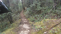
Popular Westwood Mountain Biking Trails
• 100 ★ 3.8 • 2,756 ft • 68 ft • 1,699 •
Popular blue difficulty singletrack. This mountain bike primary trail can be used both directions and has a moderate overall physical rating with a 68 ft green climb. It features bridge. Trail visibility is always easy to follow. On average it takes 5 minutes to complete this trail.
• 100 ★ 4.7 • 1,955 ft • 0 ft • 1,580 •
Old Downhill Trail that has seen some work by our paid trail crew this year! Progressive rollers, a cool wood feature and a table at the bottom, look before you leap Downhill trafic only
• 100 ★ 4.2 • 2,933 ft • 210 ft • 1,535 •
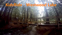
w.trailforks.com/trails/westwood-lake-trail-277973/]Westwood Lake route connecting Westwood trail area to Doumont.
• 100 ★ 3.6 • 1,056 ft • 135 ft • 1,529 •
Climb to access [L=https://www.trailforks.com/trailsSempiternal[/L].
• 100 ★ 4.7 • 2,644 ft • 7 ft • 1,482 •
Very high-speed downhill mountain bike trail, one of the most popular flow trails in Nanaimo. Super fun berms, jumps and two drops with roll downs. Great trail for leaning skills and progression. For everyone's safety, please do not...
• 95 ★ 3.8 • 1 mile • 79 ft • 1,311 •
Popular blue difficulty singletrack. This mountain bike primary trail and has a moderate overall physical rating with a 79 ft blue climb. On average it takes 15 minutes to complete this trail.
Westwood Mountain Bike Routes
★ 4.5 • 5 miles • 969 ft • 8 • Loop •
Nice little quick loop around Westwood Lake - easy climbs for beginners or hardtails.
4 miles • 1,021 ft • 4 •
Nanaimo Mountain Bike Club presents: The NMBC Fiver Race Series A series of five short course races! Five...
★ 5.0 • 10 miles • 1,502 ft • 35 •
Discovery ride to check the highlights of westwood
3 miles • 582 ft • 7 •
Legalize It Arbot rd entrance to Lower to 5 Brothers on to for a bit then up to the freshly groomed...
2 miles • 370 ft • 7 •
Nanaimo Mountain Bike Club presents: The NMBC Fiver Race Series A series of five short course races! Five...
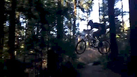
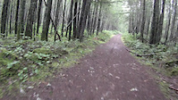
Photos of Westwood Mountain Bike
Videos of Westwood Mountain Bike
trail: Upper Pink Unicorn
0:14 |
158 |
May 10, 2020
trail: Upper Pink Unicorn
4:27 |
220 |
Aug 17, 2019
trail: Sempiternal
0:03 |
843 |
May 24, 2016
trail: Lower Binx
7:21 |
382 |
Jan 5, 2016

trail: Westwood Ridge
2:58 |
11587 |
Jun 11, 2015
trail: Westwood Ridge
0:09 |
61 |
Mar 5, 2015
trail: Westwood Ridge
0:40 |
69 |
Jan 5, 2015

trail: Westwood Ridge
6:06 |
4 |
May 24, 2013
Current Trail Warnings
| status | trail | date | condition | user | info |
|---|---|---|---|---|---|
| GiGi | Jun 5, 2026 @ 2:17pm (America/Vancouver) Jun 5, 2026 | Dry | RoadRog | Trees down across Basket Case at Gigi... |
Recent Trail Reports
| status | trail | date | condition | info | user |
|---|---|---|---|---|---|
| Basket Case | Jun 6, 2026 @ 7:26pm (America/Vancouver) Jun 6, 2026 | Dry | Edwinthebaker | ||
| The Saddle | May 30, 2026 @ 10:57am (America/Vancouver) May 30, 2026 | Ideal | scottylitts6071 | ||
| Pink Unicorn | May 24, 2026 @ 2:31pm (America/Vancouver) May 24, 2026 | Dry | Justinperkins | ||
| Upper Pink Unicorn | May 24, 2026 @ 2:31pm (America/Vancouver) May 24, 2026 | Very Dry | Justinperkins | ||
| Binx | Apr 30, 2026 @ 11:42am (America/Vancouver) Apr 30, 2026 | Ideal | Stasher CTSS | ||
| Loki | Apr 30, 2026 @ 11:42am (America/Vancouver) Apr 30, 2026 | Dry | Stasher CTSS | ||
| The Saddle | Apr 30, 2026 @ 11:42am (America/Vancouver) Apr 30, 2026 | Ideal | Stasher CTSS | ||
| Brothers 5 | Apr 30, 2026 @ 11:42am (America/Vancouver) Apr 30, 2026 | Ideal | Stasher CTSS | ||
| Exit Stage Right 1 | Apr 30, 2026 @ 11:42am (America/Vancouver) Apr 30, 2026 | Ideal | Stasher CTSS | ||
| Lower Binx | Apr 30, 2026 @ 11:42am (America/Vancouver) Apr 30, 2026 | Ideal | Stasher CTSS |
Activity Feed
| username | action | type | title | date |
|---|---|---|---|---|
| dwhalley | ridden | trail | activity #97510321 | Jun 21, 2026 @ 12:26pm 17 hours |
| afletch | ridden | trail | activity #97193490 | Jun 17, 2026 @ 10:19am Jun 17, 2026 |
| olivedarby | ridden | trail | activity #96848273 and 2 more | Jun 12, 2026 @ 9:46pm Jun 12, 2026 |
| agnostic | add | photo | activity #96575344 and 2 more | Jun 8, 2026 @ 5:36pm Jun 8, 2026 |
| Ebluhm | wishlist | trail | activity #96513669 | Jun 7, 2026 @ 6:26pm Jun 7, 2026 |
Recent Comments
| username | type | title | comment | date |
|---|---|---|---|---|
| trail | Correction to my post below: I had ridden K2... | Jun 5, 2026 @ 7:00pm Jun 5, 2026 | ||
| trail | How to access this trail from its top?!!??... | Jun 5, 2026 @ 6:55pm Jun 5, 2026 | ||
| trail | Still excellent with a Single Crown, watch... | May 22, 2026 @ 9:02pm May 22, 2026 | ||
| trail | Any plans to clean this trail up? It's such a... | May 8, 2026 @ 10:00pm May 8, 2026 | ||
| trail | Warning! Fallen tree across the track, about... | Mar 7, 2026 @ 8:17pm Mar 7, 2026 |
Nearby Areas
| name | distance | ||||
|---|---|---|---|---|---|
| Water District Lands | 4 | 13 | 2.3 km | ||
| South Benson / Wolf Mountain | 2 | 8 | 30 | 8 | 2.4 km |
| North Benson / Jameson | 1 | 6 | 1 | 2.5 km | |
| Diver Lake | 5 | 1 | 2.9 km | ||
| The Abyss / Extension Ridge | 6 | 59 | 3 | 3.7 km |
Local Badges
-

Completionist0 awarded
Activity Type Stats
| activitytype | trails | distance | descent | descent distance | total vertical | rating | global rank | state rank | photos | reports | routes | ridelogs |
|---|---|---|---|---|---|---|---|---|---|---|---|---|
| Mountain Bike | 71 | 36 miles | 6,932 ft | 17 miles | 1,909 ft | #152 | #22 | 382 | 3,374 | 9 | 33,386 | |
| E-Bike | 29 | 15 miles | 2,710 ft | 6 miles | 1,844 ft | #1,239 | #54 | 15 | 2,930 | 2 | 1,965 | |
| Horse | 1 | 476 ft | 49 ft | 387 ft | 49 ft | 796 | 1 | |||||
| Hike | 67 | 35 miles | 5,863 ft | 15 miles | 1,909 ft | #3,126 | #143 | 6 | 3,307 | 1 | 2,103 | |
| Trail Running | 67 | 35 miles | 5,863 ft | 15 miles | 1,909 ft | #590 | #30 | 3,306 | 1 | 10,343 | ||
| Dirtbike/Moto | 8 | 6 miles | 404 ft | 2 miles | 1,768 ft | #178 | #36 | 3 | 805 | 113 | ||
| Observed Trials | 1 | 4 miles | 112 ft | 2,710 ft | 1,713 ft | 7 | 9 | |||||
| ATV/ORV/OHV | 7 | 5 miles | 266 ft | 1 mile | 1,768 ft | #152 | #19 | 801 | 3 |
Frequently Asked Questions About Westwood
▼
What are the highest rated mountain biking trails in Westwood?
The highest rated mountain biking trails in Westwood are:
- Sempiternal (4.5/5)
- Binx (4.4/5)
- The Sneaky Weasel (4.4/5)
- Luke's Chute (4.4/5)
- Lower Panoraimo (4.4/5)
▼
What is the best time of the year to ride in Westwood?
Based on ride log data, the most popular months to ride in Westwood are:
- July (534 activities)
- August (454 activities)
- September (409 activities)
▼
Where can I park to ride in Westwood?
There are 3 parking locations listed in Westwood. The most popular parking spots are: View all parking and trailhead locations on the map to plan your visit.
▼
What is the longest trail in Westwood?
The longest trail in Westwood is Westwood Lake Trail at 2.9 miles. View all trails sorted by distance.
Activities
Trails
- By dubelyew
 & contributors
 - Admins: NMBC, NMBC
- #10001 - 42,760 views
- westwood activity log | embed map of Westwood mountain bike trails | westwood mountain biking points of interest polygons
Downloading of trail gps tracks in kml & gpx formats is enabled for Westwood.
You must login to download files.