close
-
Layers w
- Weather Layers
- Pro
- Pro
- Pro
- Pro
- Pro
- Pro
- More Layers
- Pro
- Pro
- Pro
- Pro
-
Upgrade to

3D
Trail Conditions
- Unknown
- Snow Groomed
- Snow Packed
- Snow Covered
- Snow Cover Partial
- Freeze/thaw Cycle
- Icy
- Prevalent Mud
- Wet
- Variable
- Ideal
- Dry
- Very Dry
Trail Flow (Ridden Direction)
Trailforks scans users ridelogs to determine the most popular direction each trail is ridden. A good flowing trail network will have most trails flowing in a single direction according to their intension.
The colour categories are based on what percentage of riders are riding a trail in its intended direction.
The colour categories are based on what percentage of riders are riding a trail in its intended direction.
- > 96%
- > 90%
- > 80%
- > 70%
- > 50%
- < 50%
- bi-directional trail
- no data
Trail Last Ridden
Trailforks scans ridelogs to determine the last time a trail was ridden.
- < 2 days
- < 1 week
- < 2 weeks
- < 1 month
- < 6 months
- > 6 months
Trail Ridden Direction
The intended direction a trail should be ridden.
- Downhill Only
- Downhill Primary
- Both Directions
- Uphill Primary
- Uphill Only
- One Direction
Contribute Details
Colors indicate trail is missing specified detail.
- Description
- Photos
- Description & Photos
- Videos
Trail Popularity ?
Trailforks scans ridelogs to determine which trails are ridden the most in the last 9 months.
Trails are compared with nearby trails in the same city region with a possible 25 colour shades.
Think of this as a heatmap, more rides = more kinetic energy = warmer colors.
- most popular
- popular
- less popular
- not popular
ATV/ORV/OHV Filter
Max Vehicle Width
inches
US Cell Coverage
Legend

Radar Time
Activity Recordings
Trailforks uses anonymized public activity data.
?
Activity Recordings
Trailforks uses anonymized public activity data.
?
Personal Heatmap
▶
Activity Types
all
/
none
▶
Options
2
Date range
month
–
Winter Trails
Warning
A routing network for winter maps does not exist. Selecting trails using the winter trails layer has been disabled.
Missing Trails
Most Popular
Least Popular
Trails are colored based on popularity. The more popular a trail is, the more red. Less popular trails trend towards green.
Jump Magnitude Heatmap
Heatmap of where riders jump on trails. Zoom in to see individual jumps, click circles to view jump details.
BC Backroad Status
![map legend]()
Service Road Atlas is a free to use, community-driven service for viewing and creating reports on the numerous back-country service roads around B.C. and Alberta.

Slope Aspect
Direction the slope faces
Trails Deemphasized
Trails are shown in grey.
Only show trails with no bike usage.
Suggested Layers
Based on selected activity type
Save the current map location and zoom level as your default home location whenever this page is loaded.
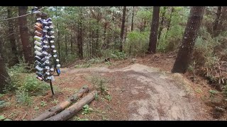
SaveThe trail starts around the Laings road gate, off Whare Flat Road (on way up to the Bullpen) on the left. Look out for the there's a notice board with map and other information there to help with navigation.
Primary Trail Type: All-Mountain & Downhill
Land Status: City Managed
 google parking directions
 Access Info:
Laings Road gate, off Whare Flat Road.
Links
Activities Click to view
- Mountain Bike
91 trails
- E-Bike
76 trails
- Gravel Bike
10 trails
- Hike
64 trails
- Trail Running
64 trails
Region Details
- 14
- 14
- 16
- 25
- 6
Region Status
Open as of Jun 13, 2026Stats
- Avg Trail Rating
- Trails (view details)
- 83
- Trails Mountain Bike
- 91
- Trails E-Bike
- 76
- Trails Gravel Bike
- 10
- Trails Hike
- 64
- Trails Trail Running
- 64
- Total Distance
- 51 miles
- Total Descent
- 18,871 ft
- Total Vertical
- 2,069 ft
- Highest Trailhead
- 2,370 ft
- Reports
- 421
- Photos
- 168
- Ridden Counter
- 11,857
Popular Whare Flat Mountain Biking Trails
• 90 ★ 3.6 • 1 mile • 339 ft • 324 •
Easy Uphill track to avoid riding on the road to get to the bullpen car park.
• 75 ★ 2.6 • 1,568 ft • 120 ft • 287 •
Wide singletrack trail with moto ruts to keep things interesting and a rock garden about two-thirds of the way down to keep the stoke factor high. A challenging climb if you're keen. Beware of motorbikes.
• 40 ★ 4.0 • 2,192 ft • 0 ft • 226 •
The sister track to . A natural trail that runs along the hillside above Berma Rd with a wee bit of off camber riding. Can be lapped by using the back to Middle Rd, or join and head downhill to CF trail and South Rd
• 80 ★ 3.8 • 2,861 ft • 6 ft • 216 •
Reinstated track linking the Bull Ring to Lucy's Run. Can be ridden in both directions.
• 60 ★ 3.4 • 2,449 ft • 35 ft • 196 •
TRACK CLOSED DURING THE WEEK FOR FORESTRY WORK DO NOT RIDE THROUGH THE WEEK ONLY RIDE ON THE WEEKENDS A twisty track that mostly descends. Has some drops, small jumps and pleanty of berms. When the track is wet it is very slippery, is a...
• 85 ★ 4.3 • 2,169 ft • 0 ft • 194 •
Try and hold your speed through some flat turns on a reasonably shallow grade. A great flowing trail as an easier addition to Whare Flat
• 90 ★ 4.2 • 2,001 ft • 0 ft • 186 •
Pump through some natural features and try to hold your speed on this mellow trail. A few rock features to keep you on your toes and a couple of pinches to get you pedalling
Whare Flat Mountain Bike Routes
9 miles • 1,911 ft • 0 • Loop •
Park at the Bull Ring Car Park Descend on Whare Flat gravel Road Climb on the access gravel track to the...
10 miles • 2,695 ft • 11 • Point to Point • Race •
Enter here https://www.webscorer.com/register?pid=1&raceid=300289 Hone in your skills for The...
13 miles • 3,628 ft • 18 • Race •
3 Peaks 2023 2 days of racing in Dunedin. This year racing will occur over the hill at Whare Flat on...
14 miles • 3,987 ft • 14 • Loop • Race •
2023 Emerson's 3 Peaks Enduro Day 1 Whare Flat Course Map.
14 miles • 3,968 ft • 18 • Loop • Race •
2023 Emerson's 3 Peaks Enduro Day 1 Whare Flat course
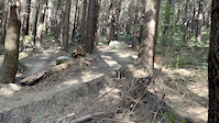
Photos of Whare Flat Mountain Bike
Videos of Whare Flat Mountain Bike
trail: Boomer Remover
0:56 |
|
Dec 18, 2020
trail: Boomer Remover
0:59 |
|
Dec 18, 2020
trail: Coronation Street
0:21 |
367 |
May 4, 2020
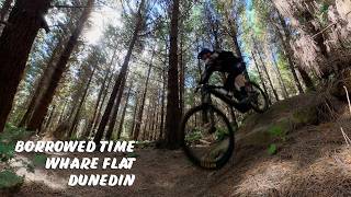
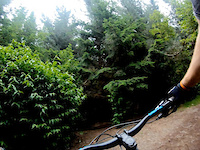
trail: Borrowed Time
0:34 |
26 |
Mar 22, 2026 , Dunedin
trail: Obelix
6:39 |
336 |
Apr 3, 2023 , Dunedin
youtuber
![Little Surprises @ Whare Flat. Dunedin]()

trail: Little Surprises
3:28 |
358 |
Nov 30, 2021 , Dunedin

youtuber
![Shenanigans-Evil Shenanigans @ Whare Flat....]()

trail: Shenanigans
3:49 |
460 |
Nov 23, 2021 , Dunedin
Recent Trail Reports
Activity Feed
| username | action | type | title | date |
|---|---|---|---|---|
| rattyboy | vote | trail | activity #96941577 | Jun 14, 2026 @ 12:00am Jun 14, 2026 |
| rattyboy | add | report | activity #96941465 | Jun 13, 2026 @ 11:56pm Jun 13, 2026 |
| D1rtys0uth | add | report | activity #96939061 | Jun 13, 2026 @ 10:05pm Jun 13, 2026 |
| rattyboy | vote | trail | activity #96928709 and 1 more | Jun 13, 2026 @ 5:29pm Jun 13, 2026 |
| mjaldridge7 | ridden | trail | activity #96791114 and 1 more | Jun 12, 2026 @ 2:40am Jun 12, 2026 |
Recent Comments
| username | type | title | comment | date |
|---|---|---|---|---|
| trail | Blocked by gorse at SE end. Avoid… | Mar 29, 2026 @ 10:18am Mar 29, 2026 | ||
| trail | Use caution on exit ramp as some clown looks... | Apr 12, 2025 @ 5:54pm Apr 12, 2025 | ||
| report | Now clear | Jan 23, 2025 @ 4:06pm Jan 23, 2025 | ||
| trail | Unreal! | Dec 6, 2024 @ 12:11am Dec 6, 2024 | ||
| trail | Short, steep and fun alternative exit to... | May 2, 2024 @ 1:45am May 2, 2024 |
Nearby Areas
| name | distance | ||||
|---|---|---|---|---|---|
| Redwoods/Wakari Creek | 8 | 6 | 1 | 2.3 km | |
| Leith Valley | 1 | 3 km | |||
| Jubilee Park | 2 | 3.4 km | |||
| Signal Hill | 3 | 4 | 12 | 8 | 5.2 km |
| Bethunes Gully/Forrester Park | 5 | 6 | 2 | 5.6 km |
Local Badges
-

Completionist0 awarded
Activity Type Stats
| activitytype | trails | distance | descent | descent distance | total vertical | rating | global rank | state rank | photos | reports | routes | ridelogs |
|---|---|---|---|---|---|---|---|---|---|---|---|---|
| Mountain Bike | 91 | 49 miles | 18,776 ft | 31 miles | 2,070 ft | #619 | #23 | 164 | 420 | 7 | 7,115 | |
| E-Bike | 76 | 45 miles | 16,243 ft | 27 miles | 2,070 ft | #853 | #33 | 4 | 371 | 2 | 1,620 | |
| Gravel Bike | 10 | 10 miles | 909 ft | 3 miles | 1,854 ft | #36 | #3 | 42 | 11 | |||
| Hike | 64 | 42 miles | 12,575 ft | 23 miles | 2,070 ft | #2,449 | #39 | 351 | 93 | |||
| Trail Running | 64 | 42 miles | 12,575 ft | 23 miles | 2,070 ft | #1,858 | #24 | 351 | 236 |
Frequently Asked Questions About Whare Flat
▼
What are the highest rated mountain biking trails in Whare Flat?
The highest rated mountain biking trails in Whare Flat are:
- Lucy's Run (4.4/5)
- Instant Classic! (4.4/5)
- Double Dutch (4.3/5)
- Peeled Cheese (4.2/5)
- Slippery Penguin (4.2/5)
▼
What is the best time of the year to ride in Whare Flat?
Based on ride log data, the most popular months to ride in Whare Flat are:
- February (55 activities)
- August (52 activities)
- November (52 activities)
▼
Where can I park to ride in Whare Flat?
There are 3 parking locations listed in Whare Flat. The most popular parking spots are: View all parking and trailhead locations on the map to plan your visit.
▼
What is the longest trail in Whare Flat?
The longest trail in Whare Flat is Raceman's Track at 6.2 km. View all trails sorted by distance.
Activities
Trails
Points of Interest
- By ceeceeemmjay & contributors
- Admins: MBO
- #4470 - 31,464 views
- whare flat activity log | embed map of Whare Flat mountain bike trails | whare flat mountain biking points of interest
Downloading of trail gps tracks in kml & gpx formats is enabled for Whare Flat.
You must login to download files.