close
-
Layers w
- Weather Layers
- Pro
- Pro
- Pro
- Pro
- Pro
- Pro
- More Layers
- Pro
- Pro
- Pro
- Pro
-
Upgrade to

3D
Trail Conditions
- Unknown
- Snow Groomed
- Snow Packed
- Snow Covered
- Snow Cover Partial
- Freeze/thaw Cycle
- Icy
- Prevalent Mud
- Wet
- Variable
- Ideal
- Dry
- Very Dry
Trail Flow (Ridden Direction)
Trailforks scans users ridelogs to determine the most popular direction each trail is ridden. A good flowing trail network will have most trails flowing in a single direction according to their intension.
The colour categories are based on what percentage of riders are riding a trail in its intended direction.
The colour categories are based on what percentage of riders are riding a trail in its intended direction.
- > 96%
- > 90%
- > 80%
- > 70%
- > 50%
- < 50%
- bi-directional trail
- no data
Trail Last Ridden
Trailforks scans ridelogs to determine the last time a trail was ridden.
- < 2 days
- < 1 week
- < 2 weeks
- < 1 month
- < 6 months
- > 6 months
Trail Ridden Direction
The intended direction a trail should be ridden.
- Downhill Only
- Downhill Primary
- Both Directions
- Uphill Primary
- Uphill Only
- One Direction
Contribute Details
Colors indicate trail is missing specified detail.
- Description
- Photos
- Description & Photos
- Videos
Trail Popularity ?
Trailforks scans ridelogs to determine which trails are ridden the most in the last 9 months.
Trails are compared with nearby trails in the same city region with a possible 25 colour shades.
Think of this as a heatmap, more rides = more kinetic energy = warmer colors.
- most popular
- popular
- less popular
- not popular
ATV/ORV/OHV Filter
Max Vehicle Width
inches
US Cell Coverage
Legend

Radar Time
Activity Recordings
Trailforks uses anonymized public activity data.
?
Activity Recordings
Trailforks uses anonymized public activity data.
?
Personal Heatmap
▶
Activity Types
all
/
none
▶
Options
2
Date range
month
–
Winter Trails
Warning
A routing network for winter maps does not exist. Selecting trails using the winter trails layer has been disabled.
Missing Trails
Most Popular
Least Popular
Trails are colored based on popularity. The more popular a trail is, the more red. Less popular trails trend towards green.
Jump Magnitude Heatmap
Heatmap of where riders jump on trails. Zoom in to see individual jumps, click circles to view jump details.
BC Backroad Status
![map legend]()
Service Road Atlas is a free to use, community-driven service for viewing and creating reports on the numerous back-country service roads around B.C. and Alberta.

Slope Aspect
Direction the slope faces
Trails Deemphasized
Trails are shown in grey.
Only show trails with no bike usage.
Suggested Layers
Based on selected activity type
Save the current map location and zoom level as your default home location whenever this page is loaded.
SaveAlso known as Batsto, the Wharton stacked loop trail system offers you a variety of options to choose from.
Primary Trail Type: Cross-Country
eBikes Allowed:
No
AKA: Batsto
Land Status: State Forest
 google parking directions
 Access Info:
Batsto Village Parking Lot
MTB trailheads at northwest corner of lot. Hiking trailheads at northeast corner of lot.
MTB trailheads at northwest corner of lot. Hiking trailheads at northeast corner of lot.
Links
Activities Click to view
- Mountain Bike
16 trails
- E-Bike
0 trails
- Horse
1 trails
- Hike
47 trails
- Trail Running
47 trails
Region Details
- 1
- 7
- 2
Region Status
Caution as of Jun 6, 2026Local Trail Association
Stats
- Avg Trail Rating
- Trails (view details)
- 36
- Trails Mountain Bike
- 16
- Trails Horse
- 1
- Trails Hike
- 47
- Trails Trail Running
- 47
- Total Distance
- 68 miles
- Total Descent Distance
- 14 miles
- Total Descent
- 1,075 ft
- Total Vertical
- 181 ft
- Highest Trailhead
- 192 ft
- Reports
- 171
- Photos
- 63
- Ridden Counter
- 2,213
Popular Wharton State Forest Mountain Biking Trails
• 100 ★ 4.3 • 18 miles • 364 ft • 332 •
19 mile loop that has a lot of twisty sections. Be sure to bring tools should you get a flat, bug repellent in the spring/summer for ticks and chiggers (late Aug).
• 80 ★ 3.0 • 3 miles • 58 ft • 248 •
This is the that is apart of one of the 10-ish mile loops posted on the kiosk at the trail head. Wharton has a stacked loop trail system that is well marked. If you follow the blue dots from the trail head you will find yourself on this...
• 60 ★ 4.0 • 1 mile • 61 ft • 127 •
This trail is off of the green loop and is tagged with white dots. This section connects the green at two points.
• 70 ★ 2.0 • 2 miles • 39 ft • 94 •
Popular green difficulty doubletrack. This mountain bike primary trail and has a easy overall physical rating with a 39 ft green climb. On average it takes 13 minutes to complete this trail.
• 45 ★ 4.0 • 4,573 ft • 8 ft • 87 •
Fun flowy-twisty trail.
• 25 ★ 3.5 • 3,806 ft • 5 ft • 62 •
Red trail connects the white trail and the . It's the typical twisty single track found in Wharton. Use this to mix up your rides a bit!
• 90 ★ 0.0 • 535 ft • 0 ft • 33 •
Popular green difficulty singletrack. This multi-use trail can be used both directions and has a easy overall physical rating with a 0 ft green climb. Trail visibility is always easy to follow.
• 35 ★ 0.0 • 3,927 ft • 3 ft • 2 • • hike
Less popular blue difficulty singletrack. This hike primary trail can be used both directions and has a moderate overall physical rating with a 3 ft blue climb. Trail visibility is always easy to follow.
Wharton State Forest Mountain Bike Routes
★ 2.4 • 17 miles • 244 ft • 4 • Loop •
Follow the Green to the blue/orange and follow orange dots back to blue to green for what is measured 19mi...
15 miles • 302 ft • 3 • Out & Back •
Back and forth on the lower loops of the trail network at Batsto / Wharton State Forest
5 miles • 127 ft • 3 • Loop •
6.1 mile loop that has some twisty sections. Can be sandy in some spots. Very little roots and rocks.
7 miles • 159 ft • 7 •
6.8 mile loop that has some twisty sections. Can be sandy in some spots.
8 miles • 152 ft • 6 • Loop •
9.6 mile trail with some twisty sections. Can be sandy in some areas.
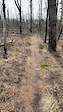
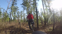
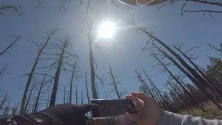
Photos of Wharton State Forest Mountain Bike
Videos of Wharton State Forest Mountain Bike
0:16 |
95 |
Apr 11, 2023
4:32 |
566 |
Apr 29, 2018

0:00 |
399 |
Dec 26, 2021 , Washington Township
1:53:12 |
717 |
May 31, 2021 , Washington Township
Recent Trail Reports
Activity Feed
| username | action | type | title | date |
|---|---|---|---|---|
| Sky2Adam | add | report | activity #96363461 | Jun 6, 2026 @ 6:28am Jun 6, 2026 |
| AlexandergheBlU | wishlist | trail | activity #96075745 | Jun 2, 2026 @ 5:07am Jun 2, 2026 |
| AlexandergheBlU | wishlist | trail | activity #96041827 | Jun 1, 2026 @ 2:43pm Jun 1, 2026 |
| mamilne | wishlist | trail | activity #95854737 | May 30, 2026 @ 8:24am May 30, 2026 |
| ttavaresbruno | wishlist | route | activity #95820928 | May 29, 2026 @ 8:18pm May 29, 2026 |
Recent Comments
| username | type | title | comment | date |
|---|---|---|---|---|
| trail | A really fun twisty and turn filled trail... | Jul 28, 2024 @ 7:20am Jul 28, 2024 | ||
| trail | First time riding in this area, a very... | Nov 2, 2021 @ 10:04am Nov 2, 2021 | ||
| trail | All clear on 10/31/21. First time on Orange... | Oct 31, 2021 @ 11:17am Oct 31, 2021 | ||
| trail | Trail received maintenance last week by JORBA.... | Aug 21, 2021 @ 3:41am Aug 21, 2021 | ||
| trail | The lower half of White is ridden more than... | Aug 21, 2021 @ 3:38am Aug 21, 2021 |
Nearby Areas
| name | distance | ||||
|---|---|---|---|---|---|
| WSF - Equestrian Trails | 10 | 10.7 km | |||
| Franklin Parker Preserve | 13 | 1 | 11.1 km | ||
| Bog Trails | 20 | 11.5 km | |||
| Pomona Trails | 1 | 11.6 km | |||
| Port Trails | 8 | 11.6 km |
Local Badges
-

Completionist0 awarded
Activity Type Stats
| activitytype | trails | distance | descent | descent distance | total vertical | rating | global rank | state rank | photos | reports | routes | ridelogs |
|---|---|---|---|---|---|---|---|---|---|---|---|---|
| Mountain Bike | 16 | 26 miles | 453 ft | 4 miles | 52 ft | #6,967 | #2,664 | 66 | 170 | 5 | 3,518 | |
| Horse | 1 | #3,472 | #2,084 | 50 | ||||||||
| Hike | 47 | 50 miles | 764 ft | 11 miles | 180 ft | #3,730 | #1,305 | 161 | 3 | 104 | ||
| Trail Running | 47 | 50 miles | 764 ft | 11 miles | 180 ft | #3,854 | #1,075 | 161 | 3 | 155 |
Frequently Asked Questions About Wharton State Forest
▼
What are the highest rated mountain biking trails in Wharton State Forest?
The highest rated mountain biking trails in Wharton State Forest are:
- Batsto Penn Branch Trail (Orange) (4.1/5)
- Batsto Oak Hill Trail-Southern Half (White) (4/5)
- Batsto Oak Hill Trail-Northern Half (White) (4/5)
- Batsto Teaberry Trail (Red) (3.9/5)
- Batsto Huckleberry Trail (Blue) (3.8/5)
▼
What is the best time of the year to ride in Wharton State Forest?
Based on ride log data, the most popular months to ride in Wharton State Forest are:
- November (61 activities)
- October (56 activities)
- May (55 activities)
▼
Where can I park to ride in Wharton State Forest?
There are 6 parking locations listed in Wharton State Forest. The most popular parking spots are: View all parking and trailhead locations on the map to plan your visit.
▼
What is the longest trail in Wharton State Forest?
The longest trail in Wharton State Forest is Batsto Penn Branch Trail (Orange) at 18.2 miles. View all trails sorted by distance.
Activities
Trails
- Hard trails in Wharton State Forest
- Easy trails in Wharton State Forest
- Favorite trails in Wharton State Forest
- Most ridden trails in Wharton State Forest
- Singletrack in Wharton State Forest
- Viewpoint trails in Wharton State Forest
- Trails with technical features in Wharton State Forest
- Race routes in Wharton State Forest
Points of Interest
- By brenthillier
 NSMBA TRAILFORKS & contributors
 - Admins: JORBA, JORBA Wharton, JORBA Atlantic
- #3614 - 18,424 views
- wharton state forest activity log | embed map of Wharton State Forest mountain bike trails | wharton state forest mountain biking points of interest
Downloading of trail gps tracks in kml & gpx formats is enabled for Wharton State Forest.
You must login to download files.