close
-
Layers w
- Weather Layers
- Pro
- Pro
- Pro
- Pro
- Pro
- Pro
- More Layers
- Pro
- Pro
- Pro
- Pro
-
Upgrade to

3D
Trail Conditions
- Unknown
- Snow Groomed
- Snow Packed
- Snow Covered
- Snow Cover Partial
- Freeze/thaw Cycle
- Icy
- Prevalent Mud
- Wet
- Variable
- Ideal
- Dry
- Very Dry
Trail Flow (Ridden Direction)
Trailforks scans users ridelogs to determine the most popular direction each trail is ridden. A good flowing trail network will have most trails flowing in a single direction according to their intension.
The colour categories are based on what percentage of riders are riding a trail in its intended direction.
The colour categories are based on what percentage of riders are riding a trail in its intended direction.
- > 96%
- > 90%
- > 80%
- > 70%
- > 50%
- < 50%
- bi-directional trail
- no data
Trail Last Ridden
Trailforks scans ridelogs to determine the last time a trail was ridden.
- < 2 days
- < 1 week
- < 2 weeks
- < 1 month
- < 6 months
- > 6 months
Trail Ridden Direction
The intended direction a trail should be ridden.
- Downhill Only
- Downhill Primary
- Both Directions
- Uphill Primary
- Uphill Only
- One Direction
Contribute Details
Colors indicate trail is missing specified detail.
- Description
- Photos
- Description & Photos
- Videos
Trail Popularity ?
Trailforks scans ridelogs to determine which trails are ridden the most in the last 9 months.
Trails are compared with nearby trails in the same city region with a possible 25 colour shades.
Think of this as a heatmap, more rides = more kinetic energy = warmer colors.
- most popular
- popular
- less popular
- not popular
ATV/ORV/OHV Filter
Max Vehicle Width
inches
US Cell Coverage
Legend

Radar Time
Activity Recordings
Trailforks uses anonymized public activity data.
?
Activity Recordings
Trailforks uses anonymized public activity data.
?
Personal Heatmap
▶
Activity Types
all
/
none
▶
Options
2
Date range
month
–
Winter Trails
Warning
A routing network for winter maps does not exist. Selecting trails using the winter trails layer has been disabled.
Missing Trails
Most Popular
Least Popular
Trails are colored based on popularity. The more popular a trail is, the more red. Less popular trails trend towards green.
Jump Magnitude Heatmap
Heatmap of where riders jump on trails. Zoom in to see individual jumps, click circles to view jump details.
BC Backroad Status
![map legend]()
Service Road Atlas is a free to use, community-driven service for viewing and creating reports on the numerous back-country service roads around B.C. and Alberta.

Slope Aspect
Direction the slope faces
Trails Deemphasized
Trails are shown in grey.
Only show trails with no bike usage.
Suggested Layers
Based on selected activity type
Save the current map location and zoom level as your default home location whenever this page is loaded.
SavePopular Trail Networks
view all areas »
No description for Whatcom County has been added yet!
Login or register to submit one.
Activities Click to view
- Mountain Bike
597 trails
- E-Bike
322 trails
- Horse
112 trails
- Hike
872 trails
- Trail Running
855 trails
- Dirtbike/Moto
20 trails
- Observed Trials
10 trails
- ATV/ORV/OHV
11 trails
- Snowmobile
1 trails
- Snowshoe
93 trails
- Downhill Ski
69 trails
- Backcountry Ski
94 trails
- Nordic Ski
7 trails
Stats
- Avg Trail Rating
- Trails (view details)
- 1,010
- Trails Mountain Bike
- 606
- Trails E-Bike
- 322
- Trails Gravel Bike
- 7
- Trails Adaptive Bike
- 5
- Trails Horse
- 112
- Trails Hike
- 872
- Trails Trail Running
- 855
- Trails Dirtbike/Moto
- 20
- Trails Observed Trials
- 10
- Trails ATV/ORV/OHV
- 11
- Trails Snowmobile
- 1
- Trails Snowshoe
- 93
- Trails Downhill Ski
- 79
- Trails Backcountry Ski
- 94
- Trails Nordic Ski
- 7
- Total Distance
- 1,133 miles
- Total Descent
- 234,935 ft
- Total Vertical
- 10,747 ft
- Highest Trailhead
- 10,747 ft
- Reports
- 23,400
- Photos
- 6,721
- Ridden Counter
- 574,966
Articles
2026 Northwest Tune-Up: More Demos, New FMB Events, & Souls of Mischief
May 5, 2026 from pinkbike.com
Dropping into downtown Bellingham for its 5th year, NW Tune-Up expands its reach with a new Trailforks challenge and the FMB Bronze-Level...
Video & Photo Highlights: Woolley Fest 2025
Sep 4, 2025 from pinkbike.com
Woolley Fest 2025 proved that FEST is alive and thriving in the Pacific Northwest.
The Fest Series Returns to North America for Woolley Fest 2025
Aug 6, 2025 from pinkbike.com
A rider-built freeride throwdown lands near Bellingham this August.
Sub Regions
- Bellingham (487)
- 100 Acre Woods (38)
- Blanchard Mountain (25)
- Chuckanut Mountain (46)
- Cordata Park (6)
- Galbraith (200)
- Hog's Pond (4)
- Lake Padden (12)
- Lake Whatcom Park (14)
- Lookout Mountain Forest Preserve (46)
- Northridge Park (0)
- Olsen Creek State Forest (13)
- Samish Crest Open Space (38)
- Samish Park (0)
- Whatcom Falls Park (11)
- Birch Bay (2)
- Ferndale (7)
- Glacier (29)
- Lynden (26)
- Maple Falls (18)
- Maple Creek Park (4)
- Silver Lake Park (6)
- Nooksack (0)
Popular Whatcom County Mountain Biking Trails
• 100 ★ 4.6 • 4,078 ft • 0 ft • 9,021 •
One of Galbraith's premiere trails, is a machine built intermediate/advanced jump trail. Large park berms and over forty jumps make this an exhilarating ride. This trail features doubles, booters, and tables showcasing the dedication...
• 100 ★ 3.4 • 2,756 ft • 73 ft • 7,910 •
Popular green difficulty singletrack. This mountain bike primary trail can be used both directions and has a easy overall physical rating with a 73 ft green climb. It features bridge and skinny. Trail visibility is always easy to follow. On average it takes 5 minutes to complete this trail.
• 95 ★ 4.7 • 2,231 ft • 0 ft • 7,051 •
lution (or ) dishes up a sophisticated blend of jumps, ladders, and drops during the half mile between the summit and RD 3000. kicks things off with a series of doubles before winding towards a long log ride feature called the Stinger...
• 100 ★ 4.3 • 2,438 ft • 85 ft • 7,033 •
is a great way to transition from to all the trails on the Southside of Galbraith. The primary feature of note is a bridge crossing - the bridge is plenty wide but does require a little caution when wet. This trail is shaded by trees...
• 100 ★ 4.5 • 4,154 ft • 0 ft • 6,439 •
Fun, fast, flowy trail with jumps that can be rolled and optional gaps. Nothing overly dangerous for people who don't want to hit big jumps. Easy access off of . On your left as you climb up . One of the best at Galby.
• 100 ★ 3.8 • 1,568 ft • 3 ft • 6,254 •
As the name says it is the last trail out from the pipe line after . Fun fast little trail with a couple MMFs and god dirt. Great beginner trail.
• 100 ★ 4.6 • 2,976 ft • 0 ft • 6,020 •
A super fun old school downhill with a couple of rollaable features. Technical is a few spots, but one of my favorites. Good in any weather.
Whatcom County Mountain Bike Routes
★ 3.6 • 83 miles • 13,789 ft • 474 • Loop •
Should be a monster! This route covers every trail on Galbraith at least once. Some uphill trails are...
★ 4.2 • 12 miles • 2,289 ft • 13 •
The Cascadia Dirt Cup is proud to once again partner with the NW Tune up to bring the Galbraith Mountain...
★ 4.7 • 16 miles • 3,324 ft • 20 •
A route from the North side (Birch St) to get all of the raw and natural trails like Space Wolf, Dad Bod,...
★ 5.0 • 6 miles • 867 ft • 4 • Loop •
Unemployment line, AKA U-Line, is one of the signature trails at Galbraith Mountain. Starting at the end...
★ 4.0 • 7 miles • 1,084 ft • 5 •
riding from the lot up the road, heading through dog patch to pony express, up both pigs, huff and puff to...
★ 5.0 • 6 miles • 1,131 ft • 19 • Loop •
from birch street entrance up the cedardust to the wall wall to el pollo el pollo to grass hopper grass...
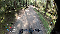
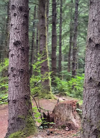
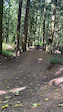
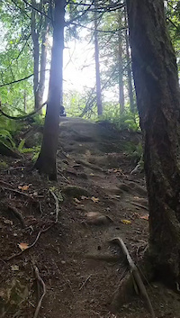
Photos of Whatcom County Mountain Bike
Videos of Whatcom County Mountain Bike
trail: Rank Advancement
0:24 |
51 |
Mar 31, 2026
trail: Irish Death
0:08 |
41 |
Oct 23, 2025
trail: Boot Dryer
0:07 |
61 |
Oct 23, 2025
trail: Boot Dryer
0:10 |
62 |
Oct 23, 2025
trail: Mabel's Monkey-Wrench
0:11 |
63 |
Oct 23, 2025

trail: Hidden Valley
2:22 |
185 |
May 7, 2025
trail: Cedar Dust Black Jump Line
0:46 |
120 |
Apr 7, 2025

trail: Powerline
5:35 |
157 |
Mar 4, 2025
Current Trail Warnings
| status | trail | date | condition | user | info |
|---|---|---|---|---|---|
| The Wall - Road 2400 Galbraith | Jun 15, 2026 @ 8:22pm (America/Los_Angeles) 2 days | Dry | Tf-es WMBC Admin | Closed until further notice for maintenance | |
| Devilcross Galbraith | Jun 13, 2026 @ 4:37pm (America/Los_Angeles) Jun 13, 2026 | Ideal | AJMIAC | Logs are blocking all exits of this... | |
| Quick Way Out Galbraith | Jun 12, 2026 @ 4:00pm (America/Los_Angeles) Jun 12, 2026 | Unknown | cywhitling | Hella brushy! |
Recent Trail Reports
Activity Feed
| username | action | type | title | date |
|---|---|---|---|---|
| Kevinf0cGTs | wishlist | route | activity #97203974 | Jun 17, 2026 @ 12:44pm 1 hours |
| firstbestdan | comment | trail | activity #97200846 | Jun 17, 2026 @ 11:57am 2 hours |
| jamesmilesmtb | add | video | activity #97192065 | Jun 17, 2026 @ 10:00am 4 hours |
| Annie97ONMM | wishlist | route | activity #97182573 and 1 more | Jun 17, 2026 @ 7:37am 6 hours |
| DanLeaverton | wishlist | route | activity #97164303 | Jun 16, 2026 @ 11:03pm 15 hours |
Recent Comments
| username | type | title | comment | date |
|---|---|---|---|---|
| trail | not exactly a 'Green' climbing trail... | Jun 17, 2026 @ 11:57am 2 hours | ||
| trail | It’s truly a beautiful climb trail; even the... | Jun 16, 2026 @ 4:34pm 21 hours | ||
| trail | Visiting from Alberta; no one talked about... | Jun 16, 2026 @ 4:29pm 21 hours | ||
| trail | Logging seems to have taken out this trail... | Jun 15, 2026 @ 2:06pm 2 days | ||
| trail | LOVED this trail! | Jun 14, 2026 @ 4:29pm 3 days |
Local Badges
-

Mountain Biking 100k Badge0 awarded -

Descent 10k Badge4 awarded -

Epic Ride Descent 2k0 awarded -
Epic Ride Descent 2k0 awarded -
Epic Ride Descent 2k8 awarded -

Climbing 10k Badge0 awarded
Bike & Skill Parks
| name | type | city | rating |
|---|---|---|---|
| Whatcom Falls Pump Track | skill park | Bellingham | |
| Cedar Dust Jump Lines | skill park | Bellingham | |
| Bellingham Waterfront Bike Park | skill park | Bellingham | |
| Bellingham Dirt Jump Park | skill park | Bellingham | |
| Galbraith Dirt Jumps | skill park | Bellingham |
Upcoming Local Events
-
-
-
Local Products
Local Products
Activity Type Stats
| activitytype | trails | distance | descent | descent distance | total vertical | rating | global rank | state rank | photos | reports | routes | ridelogs |
|---|---|---|---|---|---|---|---|---|---|---|---|---|
| Mountain Bike | 597 | 520 miles | 111,191 ft | 210 miles | 5,584 ft | 6,483 | 23,310 | 240 | 309,504 | |||
| E-Bike | 322 | 309 miles | 51,962 ft | 118 miles | 5,581 ft | 22 | 20,129 | 27 | 23,436 | |||
| Gravel Bike | 7 | 6 | 466 | 11 | 1,005 | |||||||
| Adaptive Bike | 5 | 28 | 10 | |||||||||
| Horse | 112 | 285 miles | 37,904 ft | 87 miles | 7,884 ft | 5,236 | 1 | 35 | ||||
| Hike | 872 | 1,056 miles | 184,672 ft | 361 miles | 10,748 ft | 131 | 21,374 | 51 | 23,521 | |||
| Trail Running | 855 | 1,022 miles | 183,635 ft | 357 miles | 10,748 ft | 42 | 21,424 | 42 | 34,575 | |||
| Dirtbike/Moto | 20 | 61 miles | 10,784 ft | 24 miles | 4,744 ft | 4,937 | 345 | |||||
| Observed Trials | 10 | 43 miles | 8,074 ft | 17 miles | 4,744 ft | 4 | 271 | 49 | ||||
| ATV/ORV/OHV | 11 | 34 miles | 6,385 ft | 15 miles | 3,967 ft | 6 | 4,925 | 54 | ||||
| Snowmobile | 1 | 6 miles | 420 ft | 2 miles | 1,611 ft | 8 | 27 | |||||
| Snowshoe | 93 | 184 miles | 32,549 ft | 50 miles | 10,417 ft | 7 | 157 | |||||
| Downhill Ski | 69 | 29 miles | 24,199 ft | 23 miles | 3,514 ft | 3 | 7 | 5,458 | ||||
| Backcountry Ski | 94 | 162 miles | 35,449 ft | 49 miles | 10,135 ft | 7 | 2,516 | |||||
| Nordic Ski | 7 | 2 miles | 184 ft | 2 miles | 164 ft | 8 | 366 |
Frequently Asked Questions About Whatcom County
▼
What are the best places to ride in Whatcom County?
Whatcom County has 38 areas to explore for mountain biking. The top rated areas are:
▼
What are the highest rated mountain biking trails in Whatcom County?
The highest rated mountain biking trails in Whatcom County are:
- The Horn (4.8/5)
- Mohawk (4.7/5)
- Double Down (4.7/5)
- SST - Lower (4.7/5)
- Double Black Diamond (4.7/5)
▼
What is the best time of the year to ride in Whatcom County?
Based on ride log data, the most popular months to ride in Whatcom County are:
- July (2,752 activities)
- August (1,676 activities)
- June (1,547 activities)
▼
What is the longest trail in Whatcom County?
The longest trail in Whatcom County is Canyon Ridge Trail at 10.7 miles. View all trails sorted by distance.
Activities
- Whatcom County Mountain Biking Trails
- Whatcom County E-Biking Trails
- Whatcom County Horseback Trails
- Whatcom County Hiking Trails
- Whatcom County Trail Running Trails
- Whatcom County Dirtbiking Trails
- Whatcom County Observed Trials Trails
- Whatcom County ATVing/Offroading Trails
- Whatcom County Snowshoeing Trails
- Whatcom County Skiing Trails
- Whatcom County Backcountry Skiing Trails
- Whatcom County Nordic Skiing Trails
Trails
Points of Interest
- By flowmotiontrailtours & contributors
- Admins: NMA, EMBA-Staff, EMBA-BOD, sanfret, LoriTaylor, WMBC Admin
- #17591 - 14,501 views
- whatcom county activity log | embed map of Whatcom County mountain bike trails | whatcom county mountain biking points of interest polygons
Downloading of trail gps tracks in kml & gpx formats is enabled for Whatcom County.
You must login to download files.