close
-
Layers w
- Weather Layers
- Pro
- Pro
- Pro
- Pro
- Pro
- Pro
- More Layers
- Pro
- Pro
- Pro
- Pro
-
Upgrade to

3D
Trail Conditions
- Unknown
- Snow Groomed
- Snow Packed
- Snow Covered
- Snow Cover Partial
- Freeze/thaw Cycle
- Icy
- Prevalent Mud
- Wet
- Variable
- Ideal
- Dry
- Very Dry
Trail Flow (Ridden Direction)
Trailforks scans users ridelogs to determine the most popular direction each trail is ridden. A good flowing trail network will have most trails flowing in a single direction according to their intension.
The colour categories are based on what percentage of riders are riding a trail in its intended direction.
The colour categories are based on what percentage of riders are riding a trail in its intended direction.
- > 96%
- > 90%
- > 80%
- > 70%
- > 50%
- < 50%
- bi-directional trail
- no data
Trail Last Ridden
Trailforks scans ridelogs to determine the last time a trail was ridden.
- < 2 days
- < 1 week
- < 2 weeks
- < 1 month
- < 6 months
- > 6 months
Trail Ridden Direction
The intended direction a trail should be ridden.
- Downhill Only
- Downhill Primary
- Both Directions
- Uphill Primary
- Uphill Only
- One Direction
Contribute Details
Colors indicate trail is missing specified detail.
- Description
- Photos
- Description & Photos
- Videos
Trail Popularity ?
Trailforks scans ridelogs to determine which trails are ridden the most in the last 9 months.
Trails are compared with nearby trails in the same city region with a possible 25 colour shades.
Think of this as a heatmap, more rides = more kinetic energy = warmer colors.
- most popular
- popular
- less popular
- not popular
ATV/ORV/OHV Filter
Max Vehicle Width
inches
US Cell Coverage
Legend

Radar Time
Activity Recordings
Trailforks uses anonymized public activity data.
?
Activity Recordings
Trailforks uses anonymized public activity data.
?
Personal Heatmap
▶
Activity Types
all
/
none
▶
Options
2
Date range
month
–
Winter Trails
Warning
A routing network for winter maps does not exist. Selecting trails using the winter trails layer has been disabled.
Missing Trails
Most Popular
Least Popular
Trails are colored based on popularity. The more popular a trail is, the more red. Less popular trails trend towards green.
Jump Magnitude Heatmap
Heatmap of where riders jump on trails. Zoom in to see individual jumps, click circles to view jump details.
BC Backroad Status
![map legend]()
Service Road Atlas is a free to use, community-driven service for viewing and creating reports on the numerous back-country service roads around B.C. and Alberta.

Slope Aspect
Direction the slope faces
Trails Deemphasized
Trails are shown in grey.
Only show trails with no bike usage.
Suggested Layers
Based on selected activity type
Save the current map location and zoom level as your default home location whenever this page is loaded.
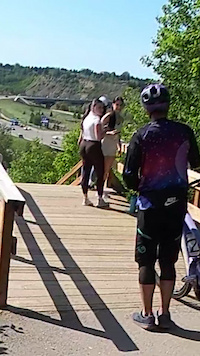
SaveAn up and coming riding area just north of the Whitemud Drive overpass over Whitemud Creek. The valley is shared by Snow Valley Ski Area
Primary Trail Type: Cross-Country
Land Status: City Managed
Activities Click to view
- Mountain Bike
32 trails
- E-Bike
3 trails
- Hike
35 trails
- Trail Running
35 trails
Region Details
- 10
- 2
- 9
- 4
- 7
Region Status
Open as of Jun 16, 2026Stats
- Avg Trail Rating
- Trails (view details)
- 33
- Trails Mountain Bike
- 32
- Trails E-Bike
- 3
- Trails Hike
- 35
- Trails Trail Running
- 35
- Trails Snowshoe
- 2
- Total Distance
- 19 miles
- Total Descent
- 2,032 ft
- Total Vertical
- 265 ft
- Highest Trailhead
- 2,290 ft
- Reports
- 850
- Photos
- 108
- Ridden Counter
- 11,981
Popular Whitemud Mountain Biking Trails
• 80 ★ 3.0 • 3,264 ft • 36 ft • 551 •
Excellent gravel multi use with undulating and curvy terrain. Going down slope is a hoot but watch for pedestrians and trail courtesy will you serve you well in this area as there's some unrest with some of the neighbors regarding bike...
• 70 ★ 3.8 • 4,918 ft • 121 ft • 512 •
from the north side, coming from , joins the this trail, as the trail goes deeper in the slopes and wooded areas, roots are on the trail, tight switchbacks and punchy climbs and nice downslopes, steeper descent separate Foreplay and...
• 75 ★ 4.5 • 978 ft • 27 ft • 469 •
Flows nice northbound. Connects with The Farmers Daughter on the north side. Slightly easier than .
• 60 ★ 4.0 • 2,185 ft • 66 ft • 443 •
Fun section of gravel multi use. Watch for stairs near the top, can be bypassed on the up-slope side.
• 75 ★ 4.4 • 1,952 ft • 7 ft • 442 •
Most trails require a little blood, sweat, and tears; but sometimes, they are more than that.
• 50 ★ 4.0 • 2,490 ft • 80 ft • 391 •
connection from asphalt to pet cemetery and The Farmers Daugther
• 50 ★ 2.0 • 1,270 ft • 58 ft • 279 •
Peel off the paved multi with this bolt-on when you're finished/or starting in the Rainbow Valley area. Smooth track that weaves through the trees and rubs up along the Snow Valley fence (in spots).
Whitemud Mountain Bike Routes
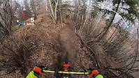
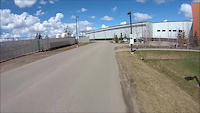
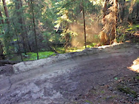
Videos of Whitemud Mountain Bike
trail: The Farmer's Daughter
0:37 |
45 |
Apr 2, 2026
trail: Ass Over Tea Kettle
0:21 |
120 |
Apr 29, 2024

trail: Grandview Drive Access
0:06 |
39 |
Oct 16, 2022

9:24 |
|
May 25, 2022
trail: The Farmer's Daughter
46:30 |
671 |
May 14, 2017

trail: Hope
0:15 |
32 |
Feb 1, 2017

trail: Hope
0:00 |
567 |
Sep 13, 2013
trail: Hope
3:05 |
429 |
Aug 30, 2013
Recent Trail Reports
Activity Feed
| username | action | type | title | date |
|---|---|---|---|---|
| SerenaVRxpzC | wishlist | route | activity #97220703 | Jun 17, 2026 @ 5:36pm Jun 17, 2026 |
| yamhab | add | report | activity #97158960 | Jun 16, 2026 @ 8:07pm Jun 16, 2026 |
| yamhab | wishlist | region | activity #97157944 | Jun 16, 2026 @ 7:47pm Jun 16, 2026 |
| sum333 | add | report | activity #97066921 | Jun 15, 2026 @ 2:51pm Jun 15, 2026 |
| PeggyqsVAxJ | add | report | activity #96810651 | Jun 12, 2026 @ 9:36am Jun 12, 2026 |
Recent Comments
| username | type | title | comment | date |
|---|---|---|---|---|
| report | Can get through, but gravelly on asphalt in... | Oct 6, 2024 @ 7:26pm Oct 6, 2024 | ||
| trail | The consistent ups and downs make for a... | Aug 29, 2024 @ 9:10pm Aug 29, 2024 | ||
| trail | The consistent up and downs make for a... | Aug 29, 2024 @ 9:02pm Aug 29, 2024 | ||
| report | Sorry wrong report, should state: caution!... | Aug 24, 2024 @ 2:49pm Aug 24, 2024 | ||
| trail | So how come were adding Organ Donor but not... | Apr 27, 2024 @ 5:31pm Apr 27, 2024 |
Nearby Areas
| name | distance | ||||
|---|---|---|---|---|---|
| Bulyea Trails | 4 | 4 | 0.7 km | ||
| Terwillegar | 51 | 40 | 13 | 1.9 km | |
| Keillor | 11 | 13 | 12 | 2.3 km | |
| Buena Vista | 4 | 4 | 2 | 2.9 km | |
| Westpointe Ravine | 8 | 12 | 1 | 2.9 km |
Local Badges
-

Completionist0 awarded
Activity Type Stats
| activitytype | trails | distance | descent | descent distance | total vertical | rating | global rank | state rank | photos | reports | routes | ridelogs |
|---|---|---|---|---|---|---|---|---|---|---|---|---|
| Mountain Bike | 32 | 18 miles | 1,542 ft | 6 miles | 253 ft | #2,421 | #34 | 104 | 847 | 2 | 2,632 | |
| E-Bike | 3 | 1 mile | 213 ft | 3,297 ft | 167 ft | #9,521 | #110 | 684 | 34 | |||
| Hike | 35 | 19 miles | 2,031 ft | 7 miles | 266 ft | #6,807 | #58 | 847 | 346 | |||
| Trail Running | 35 | 19 miles | 2,031 ft | 7 miles | 266 ft | #546 | #9 | 3 | 847 | 2 | 1,214 | |
| Snowshoe | 2 | 3,235 ft | 23 ft | 548 ft | 75 ft | 23 | 8 |
Frequently Asked Questions About Whitemud
▼
What are the highest rated mountain biking trails in Whitemud?
The highest rated mountain biking trails in Whitemud are:
- Organ Donor (4.2/5)
- Snow Sally (4.2/5)
- Patty Climb (4.1/5)
- LansDOWN (4/5)
- Grandview Drive Access (4/5)
▼
What is the best time of the year to ride in Whitemud?
Based on ride log data, the most popular months to ride in Whitemud are:
- July (49 activities)
- June (45 activities)
- May (41 activities)
▼
Where can I park to ride in Whitemud?
Check the Whitemud trail map for trailhead and parking information. Community members regularly update access and parking details for trails in the area.
▼
What is the longest trail in Whitemud?
The longest trail in Whitemud is The Farmer's Daughter at 1.5 km. View all trails sorted by distance.
- By nofunstravaguy
 & contributors
 - Admins: EMBA, EdmontonMountainBikeAlliance, jdd4, yegmtb1
- #24774 - 7,981 views
- whitemud activity log | embed map of Whitemud mountain bike trails | whitemud mountain biking points of interest
Downloading of trail gps tracks in kml & gpx formats is enabled for Whitemud.
You must login to download files.