close
-
Layers w
- Weather Layers
- Pro
- Pro
- Pro
- Pro
- Pro
- Pro
- More Layers
- Pro
- Pro
- Pro
- Pro
-
Upgrade to

3D
Trail Conditions
- Unknown
- Snow Groomed
- Snow Packed
- Snow Covered
- Snow Cover Partial
- Freeze/thaw Cycle
- Icy
- Prevalent Mud
- Wet
- Variable
- Ideal
- Dry
- Very Dry
Trail Flow (Ridden Direction)
Trailforks scans users ridelogs to determine the most popular direction each trail is ridden. A good flowing trail network will have most trails flowing in a single direction according to their intension.
The colour categories are based on what percentage of riders are riding a trail in its intended direction.
The colour categories are based on what percentage of riders are riding a trail in its intended direction.
- > 96%
- > 90%
- > 80%
- > 70%
- > 50%
- < 50%
- bi-directional trail
- no data
Trail Last Ridden
Trailforks scans ridelogs to determine the last time a trail was ridden.
- < 2 days
- < 1 week
- < 2 weeks
- < 1 month
- < 6 months
- > 6 months
Trail Ridden Direction
The intended direction a trail should be ridden.
- Downhill Only
- Downhill Primary
- Both Directions
- Uphill Primary
- Uphill Only
- One Direction
Contribute Details
Colors indicate trail is missing specified detail.
- Description
- Photos
- Description & Photos
- Videos
Trail Popularity ?
Trailforks scans ridelogs to determine which trails are ridden the most in the last 9 months.
Trails are compared with nearby trails in the same city region with a possible 25 colour shades.
Think of this as a heatmap, more rides = more kinetic energy = warmer colors.
- most popular
- popular
- less popular
- not popular
ATV/ORV/OHV Filter
Max Vehicle Width
inches
US Cell Coverage
Legend

Radar Time
Activity Recordings
Trailforks uses anonymized public activity data.
?
Activity Recordings
Trailforks uses anonymized public activity data.
?
Personal Heatmap
▶
Activity Types
all
/
none
▶
Options
2
Date range
month
–
Winter Trails
Warning
A routing network for winter maps does not exist. Selecting trails using the winter trails layer has been disabled.
Missing Trails
Most Popular
Least Popular
Trails are colored based on popularity. The more popular a trail is, the more red. Less popular trails trend towards green.
Jump Magnitude Heatmap
Heatmap of where riders jump on trails. Zoom in to see individual jumps, click circles to view jump details.
BC Backroad Status
![map legend]()
Service Road Atlas is a free to use, community-driven service for viewing and creating reports on the numerous back-country service roads around B.C. and Alberta.

Slope Aspect
Direction the slope faces
Trails Deemphasized
Trails are shown in grey.
Only show trails with no bike usage.
Suggested Layers
Based on selected activity type
Save the current map location and zoom level as your default home location whenever this page is loaded.
Save
No description for Whittier has been added yet!
Login or register to submit one.
Activities Click to view
- Mountain Bike
38 trails
- Gravel Bike
0 trails
- Adaptive Bike
0 trails
- Winter Fat Bike
0 trails
- Hike
42 trails
- Trail Running
42 trails
Region Details
- 4
- 1
- 16
- 7
- 2
Region Status
Open as of Apr 3, 2026Stats
- Avg Trail Rating
- Trails (view details)
- 31
- Trails Mountain Bike
- 39
- Trails E-Bike
- 3
- Trails Hike
- 42
- Trails Trail Running
- 42
- Total Distance
- 63 miles
- Total Descent
- 7,124 ft
- Total Vertical
- 1,348 ft
- Highest Trailhead
- 1,350 ft
- Reports
- 253
- Photos
- 49
- Ridden Counter
- 3,070
Sub Regions
-
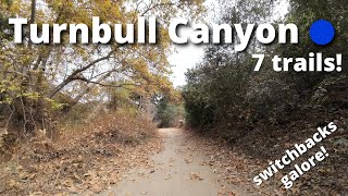
Turnbull Canyon
- 1
- 13
- 7
- 2
Popular Whittier Mountain Biking Trails
• 90 ★ 4.8 • 2 miles • 536 ft • 276 •
Accessed from the Rose Hills Fire road, through a gate in a chain fence. When you pass through the fence, there will be a 3-way fork. Take the center trail, this is the start of the Ahwinga trail witch will take you to . The forks off...
• 100 ★ 3.0 • 3,770 ft • 307 ft • 268 •
Popular green difficulty doubletrack. This mountain bike primary trail can be used both directions. On average it takes 10 minutes to complete this trail.
• 95 ★ 4.5 • 3,638 ft • 63 ft • 266 •
A Turnbull classic\! It's a fun blue/black descent filled with sweeping switchbacks, tight chutes, and natural jumps with a short easy climb at the end. Once you reach the end head right to hit freeway ( ), or left to climb up towards road.
• 90 ★ 4.4 • 2 miles • 165 ft • 265 •
Pure, sweet, singletrack along a ridge. Fun beginner singletrack trail. The only thing wrong with it is that it isn't longer! Try to ride it without grinning ear to ear.
• 100 ★ 2.0 • 623 ft • 17 ft • 161 •
Popular green difficulty singletrack. This mountain bike primary trail can be used both directions. On average it takes minutes to complete this trail.
• 70 ★ 5.0 • 2,615 ft • 0 ft • 114 •
A short exit trail off of cow trail. The start of this trail is very steep and last for about a few hundred yards. After the steep section it flattens out and exits into a suburban neighborhood.
• 50 ★ 2.5 • 1 mile • 23 ft • 92 •
Fairly steep climb but not impossible. Take the right at the fork by the trees at the top to drop into the or continue straight to head directly to the side of the mountain.
Whittier Mountain Bike Routes
Photos of Whittier Mountain Bike
Videos of Whittier Mountain Bike

trail: Rattlesnake
0:25 |
211 |
Sep 9, 2016

trail: Rattlesnake
46:50 |
118 |
Dec 13, 2024 , Whittier

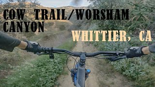
trail: Worsham Canyon Trail
46:50 |
161 |
Dec 13, 2024 , Whittier

trail: Sumac
46:50 |
66 |
Dec 13, 2024 , Whittier

trail: Cow Trail
46:50 |
163 |
Dec 13, 2024 , Whittier
trail: Native Oak Trail
46:50 |
96 |
Dec 13, 2024 , Whittier

trail: Ahwingna
46:50 |
76 |
Dec 13, 2024 , Whittier
trail: Cow Trail
6:41 |
1243 |
Feb 29, 2020 , Whittier
Recent Trail Reports
| status | trail | date | condition | info | user |
|---|---|---|---|---|---|
| Turnbull Canyon Trail | Apr 3, 2026 @ 3:45pm (America/Los_Angeles) Apr 3, 2026 | Ideal | elijah4 | ||
| Powerlines | Feb 5, 2026 @ 8:58pm (America/Los_Angeles) Feb 5, 2026 | Dry | AmybkbAI8 | ||
| Rattlesnake | Jan 15, 2026 @ 6:46pm (America/Los_Angeles) Jan 15, 2026 | Variable | AmybkbAI8 | ||
| Native Oak Trail | Jan 14, 2026 @ 4:10pm (America/Los_Angeles) Jan 14, 2026 | Variable | BlindJoeDeath | ||
| North Shore Peninsula | Jan 12, 2026 @ 3:35pm (America/Los_Angeles) Jan 12, 2026 | Variable | Gdeyarmond | ||
| Cow Trail | Sep 27, 2025 @ 5:02pm (America/Los_Angeles) Sep 27, 2025 | Dry | AmybkbAI8 | ||
| Sumac | Sep 12, 2025 @ 9:08am (America/Los_Angeles) Sep 12, 2025 | Ideal | lashaloft | ||
| Sycamore Canyon Trail | Dec 30, 2024 @ 2:10pm Dec 30, 2024 | Very Dry | DavidBrooks | ||
| Workman Ridge | Dec 26, 2024 @ 11:39am Dec 26, 2024 | Dry | f125gpracr | ||
| Arroyo San Miguel Trail | Sep 2, 2024 @ 8:02am Sep 2, 2024 | Dry | bngo21 |
Activity Feed
| username | action | type | title | date |
|---|---|---|---|---|
| jbloss | vote | poi | activity #97332874 | Jun 19, 2026 @ 11:29am Jun 19, 2026 |
| offroadmanuel | wishlist | region | activity #96577196 | Jun 8, 2026 @ 6:08pm Jun 8, 2026 |
| EthanFOBKBE | add | trail | activity #95060957 | May 19, 2026 @ 12:51pm May 19, 2026 |
| cluelesscruising | wishlist | trail | activity #93717054 | Apr 30, 2026 @ 9:12am Apr 30, 2026 |
| Bran01 | wishlist | trail | activity #93063811 | Apr 20, 2026 @ 11:46pm Apr 20, 2026 |
Recent Comments
| username | type | title | comment | date |
|---|---|---|---|---|
| trail | Rideable but overgrown with lots of bushes... | Apr 12, 2026 @ 10:11pm Apr 12, 2026 | ||
| trail | I’m a confident blue rider and this felt... | Jan 14, 2026 @ 4:08pm Jan 14, 2026 | ||
| trail | Pretty overgrown but rideable. Short socks... | Jan 14, 2026 @ 4:05pm Jan 14, 2026 | ||
| trail | Really fun. Few steep sections | Jan 14, 2026 @ 4:04pm Jan 14, 2026 | ||
| trail | There is a huge 10 foot jump, berms, drops,... | Dec 9, 2025 @ 9:45am Dec 9, 2025 |
Local Badges
-

Epic Mountain Bike Climb 2k18 awarded -

Climbing 10k Badge36 awarded -

Mountain Biking 100k Badge3 awarded -

Epic Ride Descent 2k18 awarded -

Descent 10k Badge34 awarded -

Descent 100k Badge3 awarded
Activity Type Stats
| activitytype | trails | distance | descent | descent distance | total vertical | rating | global rank | state rank | photos | reports | routes | ridelogs |
|---|---|---|---|---|---|---|---|---|---|---|---|---|
| Mountain Bike | 38 | 62 miles | 7,119 ft | 28 miles | 1,348 ft | #3,805 | #1,285 | 49 | 255 | 1 | 9,804 | |
| E-Bike | 3 | 31 miles | 371 ft | 14 miles | 282 ft | 199 | 362 | |||||
| Hike | 42 | 63 miles | 7,123 ft | 28 miles | 1,348 ft | #4,307 | #1,514 | 255 | 497 | |||
| Trail Running | 42 | 63 miles | 7,123 ft | 28 miles | 1,348 ft | #3,894 | #1,165 | 255 | 169 |
Frequently Asked Questions About Whittier
▼
What are the best places to ride in Whittier?
Whittier has 1 areas to explore for mountain biking. The top rated areas are:
▼
What are the highest rated mountain biking trails in Whittier?
The highest rated mountain biking trails in Whittier are:
- Worsham Canyon Trail (4.2/5)
- Rattlesnake (4.2/5)
- Native Oak Trail (4.2/5)
- Cow Trail (4.2/5)
- Powerlines (4/5)
▼
What is the best time of the year to ride in Whittier?
Based on ride log data, the most popular months to ride in Whittier are:
- March (30 activities)
- February (29 activities)
- October (23 activities)
▼
Where can I park to ride in Whittier?
There are 4 parking locations listed in Whittier. The most popular parking spots are: View all parking and trailhead locations on the map to plan your visit.
- By dylanbesnilian & contributors
- Admins: CORBA
- #9165 - 4,241 views
- whittier activity log | embed map of Whittier mountain bike trails | whittier mountain biking points of interest
Downloading of trail gps tracks in kml & gpx formats is enabled for Whittier.
You must login to download files.