close
-
Layers w
- Weather Layers
- Pro
- Pro
- Pro
- Pro
- Pro
- Pro
- More Layers
- Pro
- Pro
- Pro
- Pro
-
Upgrade to

3D
Trail Conditions
- Unknown
- Snow Groomed
- Snow Packed
- Snow Covered
- Snow Cover Partial
- Freeze/thaw Cycle
- Icy
- Prevalent Mud
- Wet
- Variable
- Ideal
- Dry
- Very Dry
Trail Flow (Ridden Direction)
Trailforks scans users ridelogs to determine the most popular direction each trail is ridden. A good flowing trail network will have most trails flowing in a single direction according to their intension.
The colour categories are based on what percentage of riders are riding a trail in its intended direction.
The colour categories are based on what percentage of riders are riding a trail in its intended direction.
- > 96%
- > 90%
- > 80%
- > 70%
- > 50%
- < 50%
- bi-directional trail
- no data
Trail Last Ridden
Trailforks scans ridelogs to determine the last time a trail was ridden.
- < 2 days
- < 1 week
- < 2 weeks
- < 1 month
- < 6 months
- > 6 months
Trail Ridden Direction
The intended direction a trail should be ridden.
- Downhill Only
- Downhill Primary
- Both Directions
- Uphill Primary
- Uphill Only
- One Direction
Contribute Details
Colors indicate trail is missing specified detail.
- Description
- Photos
- Description & Photos
- Videos
Trail Popularity ?
Trailforks scans ridelogs to determine which trails are ridden the most in the last 9 months.
Trails are compared with nearby trails in the same city region with a possible 25 colour shades.
Think of this as a heatmap, more rides = more kinetic energy = warmer colors.
- most popular
- popular
- less popular
- not popular
ATV/ORV/OHV Filter
Max Vehicle Width
inches
US Cell Coverage
Legend

Radar Time
Activity Recordings
Trailforks uses anonymized public activity data.
?
Activity Recordings
Trailforks uses anonymized public activity data.
?
Personal Heatmap
▶
Activity Types
all
/
none
▶
Options
2
Date range
month
–
Winter Trails
Warning
A routing network for winter maps does not exist. Selecting trails using the winter trails layer has been disabled.
Missing Trails
Most Popular
Least Popular
Trails are colored based on popularity. The more popular a trail is, the more red. Less popular trails trend towards green.
Jump Magnitude Heatmap
Heatmap of where riders jump on trails. Zoom in to see individual jumps, click circles to view jump details.
BC Backroad Status
![map legend]()
Service Road Atlas is a free to use, community-driven service for viewing and creating reports on the numerous back-country service roads around B.C. and Alberta.

Slope Aspect
Direction the slope faces
Trails Deemphasized
Trails are shown in grey.
Only show trails with no bike usage.
Suggested Layers
Based on selected activity type
Save the current map location and zoom level as your default home location whenever this page is loaded.
Save
No description for Świdnica has been added yet!
Login or register to submit one.
This region uses the Uk/Euro style trail grading system.
Activities Click to view
- Mountain Bike
64 trails
- E-Bike
64 trails
- Adaptive Bike
0 trails
- Horse
3 trails
- Hike
24 trails
- Trail Running
24 trails
Region Details
- 40
- 6
- 12
- 3
- 3
Region Status
Open as of May 25, 2026Stats
- Avg Trail Rating
- Trails (view details)
- 64
- Trails Mountain Bike
- 64
- Trails E-Bike
- 64
- Trails Horse
- 3
- Trails Hike
- 24
- Trails Trail Running
- 24
- Total Distance
- 54 miles
- Total Descent Distance
- 25 miles
- Total Descent
- 9,698 ft
- Total Vertical
- 1,114 ft
- Highest Trailhead
- 1,843 ft
- Reports
- 438
- Photos
- 196
- Ridden Counter
- 1,825
Sub Regions
-
Bystrzyca Trails
- 2
-
Bystrzyckie Singletracki
- 2
- 2
-
Rowerowy Park Umiejętności w Świdnicy
- 2
- 1
- 1
Popular Świdnica Mountain Biking Trails
• 90 ★ 5.0 • 2 miles • 303 ft • 89 •
Jedna z trzech tras Bystrzyckich Singletracków, najdłuższa i średnia, jeśli chodzi o trudność. Dobrze wyprofilowane bandy i kilka mostków.
• 100 ★ 5.0 • 600 ft • 43 ft • 82 •
Agrafkowy podjazd do Pętli Srebrnej Bystrzyckich Singletracków.
• 100 ★ 5.0 • 3,881 ft • 108 ft • 73 •
Teoretycznie najtrudniejszych z trzech bystrzyckich singli, oznaczony kolorem czerwonym. Kilka miejsc gdzie można się nieco wybić, stolik, bandy.
• 90 ★ 4.0 • 1,562 ft • 38 ft • 66 •
Jedna z trzech ścieżek Bystrzyckich Singletracków. Zdecydowanie najłatwiejsza i najkrótsza. Bez większych trudności technicznych.
• 95 ★ 0.0 • 860 ft • 31 ft • 44 •
Singiel podjazdowy, po drodze poprzeczne belki i mały rock garden.
• 100 ★ 4.0 • 502 ft • 0 ft • 43 •
Popular red difficulty machine groomed. This mountain bike primary trail can be used one direction. It features jump. Adaptive MTB rating: amtb black. Trail visibility is always easy to follow.
• 80 ★ 0.0 • 1,138 ft • 18 ft • 39 •
Szybka, łatwa sekcja z bandami, czasem trzeba wrzucić jakąś lekką korbę.
Świdnica Mountain Bike Routes
19 miles • 2,444 ft • 0 • Loop •
Niebieska Świdnica Strefy MTB Sudety jest idealną propozycją na lekką przejażdżkę MTB na początek...
21 miles • 2,888 ft • 0 • Loop •
To już prawdziwa górska trasa w Gminie Świdnica a początek swój ma razem z Niebieską Świdnica,ale...
15 miles • 1,522 ft • 0 • Loop •
Łatwa trasa w sam raz na krótki trening. Fajne widoki w gratisie ;-)
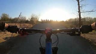
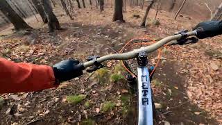
Videos of Świdnica Mountain Bike
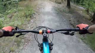
trail: Pętla Srebrna
3:22 |
18 |
May 28, 2026 , Świdnica
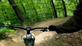
trail: Pętla Srebrna
3:12 |
62 |
May 30, 2025 , Świdnica

trail: Pętla Ołowiana
3:12 |
63 |
May 30, 2025 , Świdnica

15:22 |
41 |
Apr 6, 2025
trail: Singletrail Czerwony
15:22 |
114 |
Apr 6, 2025 , Świdnica

trail: Sekcja Skoków
15:22 |
51 |
Apr 6, 2025 , Świdnica
trail: Lisek
2:53 |
124 |
Jan 2, 2025 , Świdnica
trail: Poligon
0:11 |
122 |
Oct 23, 2011
Recent Trail Reports
Activity Feed
| username | action | type | title | date |
|---|---|---|---|---|
| KrisTar | difficultyvote | trail | activity #96970139 | Jun 14, 2026 @ 8:10am Jun 14, 2026 |
| PiotrE0WDx8 | wishlist | trail | activity #96349888 | Jun 6, 2026 @ 2:28am Jun 6, 2026 |
| FTUoW | wishlist | trail | activity #96155159 and 1 more | Jun 3, 2026 @ 7:49am Jun 3, 2026 |
| r85 | add | photo | activity #95879496 and 6 more | May 30, 2026 @ 12:47pm May 30, 2026 |
| r85 | add | poi | activity #95875431 and 2 more | May 30, 2026 @ 12:01pm May 30, 2026 |
Recent Comments
| username | type | title | comment | date |
|---|---|---|---|---|
| report | odkurzone, zlikwidowane 2 cheat line | Jul 18, 2025 @ 1:49am Jul 18, 2025 | ||
| trail | Niebieska trasa flowz kilkoma trudniejszymi... | Mar 27, 2025 @ 5:23am Mar 27, 2025 | ||
| trail | trasa przejedna, wszystko ok. | Jan 26, 2025 @ 7:13am Jan 26, 2025 | ||
| trail | Piękna trasa, ścianki nie takie straszne,... | Jan 26, 2025 @ 6:04am Jan 26, 2025 | ||
| trail | Fajna, szybka, niebanaln! | Sep 30, 2024 @ 7:18am Sep 30, 2024 |
Local Badges
-

Epic Mountain Bike Climb 2k5 awarded -

Climbing 10k Badge11 awarded -

Mountain Biking 100k Badge0 awarded -

Epic Ride Descent 2k5 awarded -

Descent 10k Badge11 awarded -

Descent 100k Badge0 awarded
Bike & Skill Parks
| name | type | city | rating |
|---|---|---|---|
| Rowerowy Park Umiejętności Lubachów | skill park | Świdnica | |
| Pumptrack Świdnica | skill park | Świdnica | |
| Dolnośląski Park Umiejętności w Świdnicy | skill park | Świdnica |
Activity Type Stats
| activitytype | trails | distance | descent | descent distance | total vertical | rating | global rank | state rank | photos | reports | routes | ridelogs |
|---|---|---|---|---|---|---|---|---|---|---|---|---|
| Mountain Bike | 64 | 54 miles | 9,698 ft | 25 miles | 1,115 ft | #1,935 | #31 | 194 | 438 | 4 | 2,708 | |
| E-Bike | 64 | 54 miles | 9,698 ft | 25 miles | 1,115 ft | #1,544 | #278 | 427 | 2 | 274 | ||
| Horse | 3 | 4 miles | 1,299 ft | 3 miles | 892 ft | #404 | #253 | 7 | ||||
| Hike | 24 | 20 miles | 4,462 ft | 11 miles | 1,093 ft | #4,174 | #75 | 369 | 267 | |||
| Trail Running | 24 | 18 miles | 3,950 ft | 10 miles | 938 ft | #3,738 | #64 | 365 | 115 |
Frequently Asked Questions About Świdnica
▼
What are the best places to ride in Świdnica?
Świdnica has 3 areas to explore for mountain biking. The top rated areas are:
▼
What are the highest rated mountain biking trails in Świdnica?
The highest rated mountain biking trails in Świdnica are:
- Pętla Srebrna (4.4/5)
- Redline (4.4/5)
- Pętla Ołowiana (4.3/5)
- Justynka (4.2/5)
- Pętla Srebrna - podjazd (4.2/5)
▼
What is the best time of the year to ride in Świdnica?
Based on ride log data, the most popular months to ride in Świdnica are:
- September (12 activities)
- April (8 activities)
- August (7 activities)
▼
Where can I park to ride in Świdnica?
There are 8 parking locations listed in Świdnica. The most popular parking spots are: View all parking and trailhead locations on the map to plan your visit.
Activities
Trails
- By w-piotrek & contributors
- Admins: xaoo
- #18371 - 6,216 views
- Świdnica activity log | embed map of Świdnica mountain bike trails | Świdnica mountain biking points of interest
Downloading of trail gps tracks in kml & gpx formats is enabled for Świdnica.
You must login to download files.