close
-
Layers w
- Weather Layers
- Pro
- Pro
- Pro
- Pro
- Pro
- Pro
- More Layers
- Pro
- Pro
- Pro
- Pro
-
Upgrade to

3D
Trail Conditions
- Unknown
- Snow Groomed
- Snow Packed
- Snow Covered
- Snow Cover Partial
- Freeze/thaw Cycle
- Icy
- Prevalent Mud
- Wet
- Variable
- Ideal
- Dry
- Very Dry
Trail Flow (Ridden Direction)
Trailforks scans users ridelogs to determine the most popular direction each trail is ridden. A good flowing trail network will have most trails flowing in a single direction according to their intension.
The colour categories are based on what percentage of riders are riding a trail in its intended direction.
The colour categories are based on what percentage of riders are riding a trail in its intended direction.
- > 96%
- > 90%
- > 80%
- > 70%
- > 50%
- < 50%
- bi-directional trail
- no data
Trail Last Ridden
Trailforks scans ridelogs to determine the last time a trail was ridden.
- < 2 days
- < 1 week
- < 2 weeks
- < 1 month
- < 6 months
- > 6 months
Trail Ridden Direction
The intended direction a trail should be ridden.
- Downhill Only
- Downhill Primary
- Both Directions
- Uphill Primary
- Uphill Only
- One Direction
Contribute Details
Colors indicate trail is missing specified detail.
- Description
- Photos
- Description & Photos
- Videos
Trail Popularity ?
Trailforks scans ridelogs to determine which trails are ridden the most in the last 9 months.
Trails are compared with nearby trails in the same city region with a possible 25 colour shades.
Think of this as a heatmap, more rides = more kinetic energy = warmer colors.
- most popular
- popular
- less popular
- not popular
ATV/ORV/OHV Filter
Max Vehicle Width
inches
US Cell Coverage
Legend

Radar Time
Activity Recordings
Trailforks uses anonymized public activity data.
?
Activity Recordings
Trailforks uses anonymized public activity data.
?
Personal Heatmap
▶
Activity Types
all
/
none
▶
Options
2
Date range
month
–
Winter Trails
Warning
A routing network for winter maps does not exist. Selecting trails using the winter trails layer has been disabled.
Missing Trails
Most Popular
Least Popular
Trails are colored based on popularity. The more popular a trail is, the more red. Less popular trails trend towards green.
Jump Magnitude Heatmap
Heatmap of where riders jump on trails. Zoom in to see individual jumps, click circles to view jump details.
BC Backroad Status
![map legend]()
Service Road Atlas is a free to use, community-driven service for viewing and creating reports on the numerous back-country service roads around B.C. and Alberta.

Slope Aspect
Direction the slope faces
Trails Deemphasized
Trails are shown in grey.
Only show trails with no bike usage.
Suggested Layers
Based on selected activity type
Save the current map location and zoom level as your default home location whenever this page is loaded.
Save
No description for Wieliczka has been added yet!
Login or register to submit one.
This region uses the Uk/Euro style trail grading system.
Activities Click to view
- Mountain Bike
105 trails
- E-Bike
40 trails
- Adaptive Bike
0 trails
- Winter Fat Bike
0 trails
- Horse
1 trails
- Hike
90 trails
- Trail Running
89 trails
- Observed Trials
0 trails
- Snowshoe
1 trails
- Downhill Ski
0 trails
- Backcountry Ski
0 trails
- Nordic Ski
0 trails
Region Details
- 40
- 20
- 26
- 16
- 1
Region Status
Caution as of 5 hoursStats
- Avg Trail Rating
- Trails (view details)
- 104
- Trails Mountain Bike
- 108
- Trails E-Bike
- 40
- Trails Horse
- 1
- Trails Hike
- 90
- Trails Trail Running
- 89
- Trails Dirtbike/Moto
- 3
- Trails ATV/ORV/OHV
- 3
- Trails Snowshoe
- 1
- Total Distance
- 30 miles
- Total Descent
- 7,236 ft
- Total Vertical
- 696 ft
- Highest Trailhead
- 1,390 ft
- Reports
- 326
- Photos
- 1,375
- Ridden Counter
- 1,637
Sub Regions
-
Amun Trails Gąsiory
- 6
- 3
- 3
- 1
-
Chorągwica
-
Trupi Las
- 1
- 1
- 3
Popular Wieliczka Mountain Biking Trails
• 100 ★ 0.0 • 808 ft • 0 ft • 63 •
Popular blue difficulty singletrack. This mountain bike primary trail can be used downhill primary and has a easy overall physical rating with a 0 ft blue climb. It features gap jump. Trail visibility is sometimes hard to follow. On average it takes 1 minutes to complete this trail.
• 100 ★ 4.3 • 1,407 ft • 0 ft • 59 •
This trail is more simple than Respirator. We can find there small drops(0,5 m high), two gap jumps (3 m long) and a lot of wallrides. It's a very good trail for intermediete riders.
• 100 ★ 3.0 • 3,502 ft • 165 ft • 50 •
Popular green difficulty family friendly doubletrack. This mountain bike primary trail can be used both directions and has a easy overall physical rating with a 165 ft green climb. Trail visibility is always easy to follow. On average it takes 4 minutes to complete this trail.
• 100 ★ 0.0 • 712 ft • 11 ft • 46 •
Popular red difficulty singletrack. This mountain bike primary trail can be used both directions. It features gap jump, roller coaster and wallride. On average it takes 2 minutes to complete this trail.
• 100 ★ 4.0 • 1,100 ft • 2 ft • 36 •
Popular blue difficulty singletrack. This mountain bike primary trail can be used both directions and has a easy overall physical rating with a 2 ft green climb. It features jump. Trail visibility is no clear path. On average it takes 1 minutes to complete this trail.
• 90 ★ 2.0 • 1,029 ft • 0 ft • 33 •
Popular red difficulty singletrack. This mountain bike primary trail can be used both directions. It features drop, jump and gap jump. On average it takes 2 minutes to complete this trail.
• 95 ★ 5.0 • 1,214 ft • 3 ft • 32 •
Trawers wzdluz potoku Malinowka - naturalne przedluzenie zjazdu na Slonecznym Stoku.
Wieliczka Mountain Bike Routes
8 miles • 752 ft • 0 • Point to Point •
na znakach są czerwone strzałki które wskazują tą drogę
2 miles • 572 ft • 0 • Point to Point •
podjazd na górę chorągwica z wieliczki wysokość bezwględna to 420, która kojarzy się z godziną...
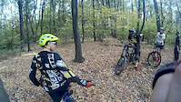
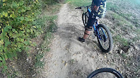
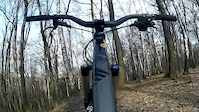
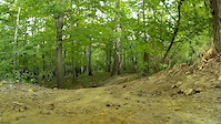
Photos of Wieliczka Mountain Bike
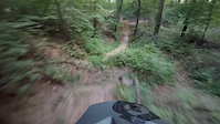
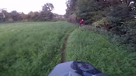
Videos of Wieliczka Mountain Bike
trail: Wyciskacz Łez
0:35 |
227 |
Oct 19, 2019
trail: Trupi
0:21 |
338 |
Oct 19, 2019
trail: Wyciskacz Łez
0:07 |
143 |
Oct 13, 2019
trail: Snakes BGC
0:15 |
123 |
Sep 11, 2019
trail: Trupi Węże
0:35 |
297 |
Nov 30, 2018

trail: Snakes BGC
0:28 |
118 |
Oct 25, 2018
trail: Snakes BGC
0:21 |
207 |
Sep 12, 2018
trail: Snakes BGC
0:47 |
130 |
Sep 12, 2018
Recent Trail Reports
| status | trail | date | condition | info | user |
|---|---|---|---|---|---|
| Herbatka | Jun 20, 2026 @ 3:27pm (Europe/Warsaw) 5 hours | Wet | sebasg3r | ||
| Zielona dzięcioł | May 9, 2026 @ 10:34am (Europe/Warsaw) May 9, 2026 | Dry | amun AT | ||
| Wilga | Apr 28, 2026 @ 11:24am (Europe/Warsaw) Apr 28, 2026 | Ideal | ZielonyNiebieski | ||
| Niebieska Sójka | Apr 16, 2026 @ 5:58pm (Europe/Warsaw) Apr 16, 2026 | Dry | amun AT | ||
| Puszczyk | Apr 16, 2026 @ 5:58pm (Europe/Warsaw) Apr 16, 2026 | Dry | amun AT | ||
| Kruk | Apr 16, 2026 @ 5:58pm (Europe/Warsaw) Apr 16, 2026 | Dry | amun AT | ||
| Powrót | Apr 16, 2026 @ 5:58pm (Europe/Warsaw) Apr 16, 2026 | Dry | amun AT | ||
| Krzyszkowicki Dół | Apr 9, 2026 @ 7:03pm (Europe/Warsaw) Apr 9, 2026 | Variable | sebasg3r | ||
| Wyciskacz Łez | Apr 9, 2026 @ 7:02pm (Europe/Warsaw) Apr 9, 2026 | Dry | sebasg3r | ||
| Trupi | Apr 9, 2026 @ 7:02pm (Europe/Warsaw) Apr 9, 2026 | Dry | sebasg3r |
Activity Feed
| username | action | type | title | date |
|---|---|---|---|---|
| sebasg3r | add | report | activity #97388141 | Jun 20, 2026 @ 6:27am 5 hours |
| Autovetus | comment | trail | activity #97194303 | Jun 17, 2026 @ 10:30am Jun 17, 2026 |
| sebasg3r | add | report | activity #96823727 | Jun 12, 2026 @ 1:05pm Jun 12, 2026 |
| sebasg3r | add | report | activity #96736181 | Jun 11, 2026 @ 7:29am Jun 11, 2026 |
| sebasg3r | add | report | activity #96156192 and 1 more | Jun 3, 2026 @ 8:06am Jun 3, 2026 |
Recent Comments
| username | type | title | comment | date |
|---|---|---|---|---|
| trail | zarośnięte , przeorabe pole 👎 | Jun 17, 2026 @ 10:30am Jun 17, 2026 | ||
| trail | Lepsze niż Łopata DH w Wolskim czy nie do... | May 6, 2026 @ 8:05am May 6, 2026 | ||
| trail | Trasa nieprzejezdna - zarośnięta | Sep 18, 2025 @ 11:11am Sep 18, 2025 | ||
| trail | Ta ścieżka nie istnieje, a jeśli istnieje,... | May 22, 2023 @ 12:14am May 22, 2023 | ||
| trail | Ta ścieżka nie istnieje, a jeśli istnieje,... | May 22, 2023 @ 12:14am May 22, 2023 |
Local Badges
-

Epic Ride Climb 2k8 awarded -

Climbing 10k Badge30 awarded -

Climbing 100k Badge2 awarded -

Epic Ride Descent 2k8 awarded -

Descent 10k Badge31 awarded -

Descent 100k Badge2 awarded
Bike & Skill Parks
| name | type | city | rating |
|---|---|---|---|
| BGC Spot | skill park | Wieliczka | |
| Skatepark Wieliczka | skill park | Wieliczka | |
| Skatepark Gdów | skill park | Wieliczka | |
| Kamieniec | skill park | Wieliczka | |
| Plac Targowy | skill park | Wieliczka |
Activity Type Stats
| activitytype | trails | distance | descent | descent distance | total vertical | rating | global rank | state rank | photos | reports | routes | ridelogs |
|---|---|---|---|---|---|---|---|---|---|---|---|---|
| Mountain Bike | 105 | 30 miles | 7,208 ft | 17 miles | 696 ft | #1,868 | #28 | 1,375 | 330 | 4 | 8,517 | |
| E-Bike | 40 | 11 miles | 2,113 ft | 6 miles | 554 ft | #2,293 | #287 | 182 | 2 | 246 | ||
| Horse | 1 | 889 ft | 52 ft | 889 ft | 52 ft | #307 | #250 | 17 | ||||
| Hike | 90 | 23 miles | 5,262 ft | 13 miles | 696 ft | #2,850 | #57 | 300 | 189 | |||
| Trail Running | 89 | 25 miles | 5,823 ft | 15 miles | 696 ft | #2,250 | #44 | 303 | 426 | |||
| Dirtbike/Moto | 3 | 3 miles | 456 ft | 1 mile | 308 ft | 20 | ||||||
| ATV/ORV/OHV | 3 | 4,226 ft | 144 ft | 2,887 ft | 253 ft | 18 | ||||||
| Snowshoe | 1 | 390 ft | 7 ft | 161 ft | 7 ft | #105 | #20 |
Frequently Asked Questions About Wieliczka
▼
What are the best places to ride in Wieliczka?
Wieliczka has 3 areas to explore for mountain biking. The top rated areas are:
▼
What are the highest rated mountain biking trails in Wieliczka?
The highest rated mountain biking trails in Wieliczka are:
- Zielona dzięcioł (4.1/5)
- Krucze Agrafki (4.1/5)
- Trupi (4.1/5)
- Malinowy (4.1/5)
- Puszczyk (4.1/5)
▼
What is the best time of the year to ride in Wieliczka?
Based on ride log data, the most popular months to ride in Wieliczka are:
- May (73 activities)
- July (69 activities)
- June (56 activities)
▼
Where can I park to ride in Wieliczka?
There are 10 parking locations listed in Wieliczka. The most popular parking spots are: View all parking and trailhead locations on the map to plan your visit.
Activities
Trails
Points of Interest
- By Berian78 & contributors
- Admins: apply
- #18447 - 5,438 views
- wieliczka activity log | embed map of Wieliczka mountain bike trails | wieliczka mountain biking points of interest
Downloading of trail gps tracks in kml & gpx formats is enabled for Wieliczka.
You must login to download files.