close
-
Layers w
- Weather Layers
- Pro
- Pro
- Pro
- Pro
- Pro
- Pro
- More Layers
- Pro
- Pro
- Pro
- Pro
-
Upgrade to

3D
Trail Conditions
- Unknown
- Snow Groomed
- Snow Packed
- Snow Covered
- Snow Cover Partial
- Freeze/thaw Cycle
- Icy
- Prevalent Mud
- Wet
- Variable
- Ideal
- Dry
- Very Dry
Trail Flow (Ridden Direction)
Trailforks scans users ridelogs to determine the most popular direction each trail is ridden. A good flowing trail network will have most trails flowing in a single direction according to their intension.
The colour categories are based on what percentage of riders are riding a trail in its intended direction.
The colour categories are based on what percentage of riders are riding a trail in its intended direction.
- > 96%
- > 90%
- > 80%
- > 70%
- > 50%
- < 50%
- bi-directional trail
- no data
Trail Last Ridden
Trailforks scans ridelogs to determine the last time a trail was ridden.
- < 2 days
- < 1 week
- < 2 weeks
- < 1 month
- < 6 months
- > 6 months
Trail Ridden Direction
The intended direction a trail should be ridden.
- Downhill Only
- Downhill Primary
- Both Directions
- Uphill Primary
- Uphill Only
- One Direction
Contribute Details
Colors indicate trail is missing specified detail.
- Description
- Photos
- Description & Photos
- Videos
Trail Popularity ?
Trailforks scans ridelogs to determine which trails are ridden the most in the last 9 months.
Trails are compared with nearby trails in the same city region with a possible 25 colour shades.
Think of this as a heatmap, more rides = more kinetic energy = warmer colors.
- most popular
- popular
- less popular
- not popular
ATV/ORV/OHV Filter
Max Vehicle Width
inches
US Cell Coverage
Legend

Radar Time
Activity Recordings
Trailforks uses anonymized public activity data.
?
Activity Recordings
Trailforks uses anonymized public activity data.
?
Personal Heatmap
▶
Activity Types
all
/
none
▶
Options
2
Date range
month
–
Winter Trails
Warning
A routing network for winter maps does not exist. Selecting trails using the winter trails layer has been disabled.
Missing Trails
Most Popular
Least Popular
Trails are colored based on popularity. The more popular a trail is, the more red. Less popular trails trend towards green.
Jump Magnitude Heatmap
Heatmap of where riders jump on trails. Zoom in to see individual jumps, click circles to view jump details.
BC Backroad Status
![map legend]()
Service Road Atlas is a free to use, community-driven service for viewing and creating reports on the numerous back-country service roads around B.C. and Alberta.

Slope Aspect
Direction the slope faces
Trails Deemphasized
Trails are shown in grey.
Only show trails with no bike usage.
Suggested Layers
Based on selected activity type
Save the current map location and zoom level as your default home location whenever this page is loaded.
Save
No description for Wilbraham has been added yet!
Login or register to submit one.
Activities Click to view
- Mountain Bike
70 trails
- E-Bike
41 trails
- Adaptive Bike
0 trails
- Winter Fat Bike
0 trails
- Hike
70 trails
- Trail Running
70 trails
Region Details
- 10
- 3
- 36
- 19
- 2
Region Status
Open as of Sep 6, 2025Stats
- Avg Trail Rating
- Trails (view details)
- 70
- Trails Mountain Bike
- 70
- Trails E-Bike
- 41
- Trails Hike
- 70
- Trails Trail Running
- 70
- Total Distance
- 12 miles
- Total Descent
- 1,304 ft
- Total Vertical
- 660 ft
- Highest Trailhead
- 908 ft
- Reports
- 72
- Photos
- 23
- Ridden Counter
- 2,493
Sub Regions
-
Cedar Swamp
- 3
- 32
- 6
-
Frye MTB & BMX Trails
-
Sunset Ridge Trail Network
- 12
- 2
Popular Wilbraham Mountain Biking Trails
• 60 ★ 5.0 • 2,635 ft • 12 ft • 115 •
Moderately popular black diamond difficulty singletrack. This mountain bike primary trail can be used downhill primary and has a moderate overall physical rating. On average it takes 4 minutes to complete this trail.
• 70 ★ 4.0 • 2,206 ft • 104 ft • 94 •
Popular black diamond difficulty singletrack. This mountain bike primary trail can be used both directions and has a moderate overall physical rating with a 104 ft blue climb. On average it takes 10 minutes to complete this trail.
• 60 ★ 0.0 • 1,242 ft • 3 ft • 91 •
Moderately popular blue difficulty singletrack. This mountain bike primary trail can be used both directions and has a moderate overall physical rating with a 3 ft blue climb. Trail visibility is always easy to follow. On average it takes 2 minutes to complete this trail.
• 65 ★ 5.0 • 1 mile • 380 ft • 85 •
Climbing starts right away, making this a challenging start to a ride.
• 70 ★ 0.0 • 3,016 ft • 97 ft • 84 •
Popular blue difficulty singletrack. This mountain bike primary trail can be used both directions and has a moderate overall physical rating with a 97 ft blue climb. Trail visibility is always easy to follow. On average it takes 6 minutes to complete this trail.
• 90 ★ 0.0 • 758 ft • 2 ft • 78 •
Popular blue difficulty singletrack. This mountain bike primary trail can be used both directions and has a moderate overall physical rating with a 2 ft blue climb. Trail visibility is always easy to follow. On average it takes 1 minutes to complete this trail.
• 85 ★ 0.0 • 901 ft • 22 ft • 73 •
Popular blue difficulty singletrack. This mountain bike primary trail can be used both directions and has a moderate overall physical rating with a 22 ft blue climb. Trail visibility is always easy to follow. On average it takes 2 minutes to complete this trail.
• 30 ★ 0.0 • 1,620 ft • 59 ft • 65 •
Less popular blue difficulty singletrack. This mountain bike primary trail can be used both directions and has a moderate overall physical rating with a 59 ft blue climb. Trail visibility is always easy to follow. On average it takes 3 minutes to complete this trail.
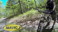
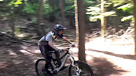
Videos of Wilbraham Mountain Bike
trail: Exit DH
0:09 |
344 |
Oct 16, 2019
trail: Mile 76 Loop
0:08 |
218 |
May 13, 2019

trail: Exit DH
0:11 |
272 |
May 9, 2019
trail: The Gnar
0:46 |
218 |
Jan 15, 2017

trail: The Gnar
2:18 |
327 |
Sep 4, 2014
trail: The Gnar
4:21 |
378 |
Sep 4, 2014

trail: Trail F
7:52 |
184 |
Aug 18, 2013
trail: Trail I
4:26 |
1426 |
Jun 9, 2013
Recent Trail Reports
| status | trail | date | condition | info | user |
|---|---|---|---|---|---|
| McDonald Parking Doubletrack | Sep 6, 2025 @ 9:02am Sep 6, 2025 | Ideal | GhostMTBWMA | ||
| Double Track 2 | Sep 6, 2025 @ 9:02am Sep 6, 2025 | Dry | GhostMTBWMA | ||
| Gravel 1 | Sep 6, 2025 @ 9:02am Sep 6, 2025 | Dry | GhostMTBWMA | ||
| Lake to Washington Connector | Sep 6, 2025 @ 9:02am Sep 6, 2025 | Ideal | GhostMTBWMA | ||
| Wagon Dr Climb | Aug 5, 2025 @ 1:20pm Aug 5, 2025 | Dry | sunsetslowly WRD | ||
| Exit DH | Apr 11, 2025 @ 1:33pm Apr 11, 2025 | Prevalent Mud | Palinferno | ||
| The Gnar | Mar 18, 2025 @ 10:11am Mar 18, 2025 | Variable | Palinferno | ||
| Trail D | Mar 13, 2025 @ 7:31am Mar 13, 2025 | Variable | Palinferno | ||
| Loop A | Mar 11, 2025 @ 7:39am Mar 11, 2025 | Variable | Palinferno | ||
| Trail G | Mar 11, 2025 @ 7:39am Mar 11, 2025 | Ideal | Palinferno |
Activity Feed
| username | action | type | title | date |
|---|---|---|---|---|
| Bill69 | wishlist | region | activity #94442898 | May 10, 2026 @ 10:57am May 10, 2026 |
| OrionSumire | ridden | trail | activity #89378104 | Feb 22, 2026 @ 1:06pm Feb 22, 2026 |
| Rheeshags | ridden | trail | activity #86695280 and 3 more | Jan 5, 2026 @ 8:18am Jan 5, 2026 |
| Erikiexlvr | wishlist | region | activity #82197843 | Oct 12, 2025 @ 5:06am Oct 12, 2025 |
| GhostMTBWMA | add | report | activity #79748111 and 3 more | Sep 6, 2025 @ 6:48am Sep 6, 2025 |
Recent Comments
| username | type | title | comment | date |
|---|---|---|---|---|
| report | Sounds good, thanks for clearing. Great trails! | Apr 7, 2025 @ 10:55am Apr 7, 2025 | ||
| report | There is a small group of locals who regularly... | Apr 7, 2025 @ 9:47am Apr 7, 2025 | ||
| report | Thanks for the report! Do you know if it its... | Mar 28, 2025 @ 8:33am Mar 28, 2025 |
Local Badges
-

10 Blue Trails42 awarded -

Epic Ride Climb 2k0 awarded -

Climbing 10k Badge15 awarded -

Climbing 100k Badge1 awarded -

Epic Ride Descent 2k0 awarded -

Descent 10k Badge15 awarded
Activity Type Stats
| activitytype | trails | distance | descent | descent distance | total vertical | rating | global rank | state rank | photos | reports | routes | ridelogs |
|---|---|---|---|---|---|---|---|---|---|---|---|---|
| Mountain Bike | 70 | 12 miles | 1,302 ft | 4 miles | 659 ft | #4,713 | #1,583 | 24 | 72 | 5,260 | ||
| E-Bike | 41 | #7,347 | #2,216 | 52 | 147 | |||||||
| Hike | 70 | 12 miles | 1,302 ft | 4 miles | 659 ft | #7,101 | #2,520 | 72 | 163 | |||
| Trail Running | 70 | 12 miles | 1,302 ft | 4 miles | 659 ft | #6,949 | #2,286 | 72 | 22 |
Frequently Asked Questions About Wilbraham
▼
What are the best places to ride in Wilbraham?
Wilbraham has 4 areas to explore for mountain biking. The top rated areas are:
▼
What are the highest rated mountain biking trails in Wilbraham?
The highest rated mountain biking trails in Wilbraham are:
- Wagon Dr Climb (4.2/5)
- Flip Chip (4.1/5)
- To Twisted Sister (4.1/5)
- Twisted Sister (4.1/5)
- Flipchip Connector (4.1/5)
▼
What is the best time of the year to ride in Wilbraham?
Based on ride log data, the most popular months to ride in Wilbraham are:
- June (72 activities)
- May (61 activities)
- August (61 activities)
▼
Where can I park to ride in Wilbraham?
There are 3 parking locations listed in Wilbraham. The most popular parking spots are: View all parking and trailhead locations on the map to plan your visit.
Activities
Trails
Points of Interest
- By Schmittr86 & contributors
- Admins: WMass NEMBA, PVH, WRD
- #19326 - 5,364 views
- wilbraham activity log | embed map of Wilbraham mountain bike trails | wilbraham mountain biking points of interest
Downloading of trail gps tracks in kml & gpx formats is enabled for Wilbraham.
You must login to download files.