close
-
Layers w
- Weather Layers
- Pro
- Pro
- Pro
- Pro
- Pro
- Pro
- More Layers
- Pro
- Pro
- Pro
- Pro
-
Upgrade to

3D
Trail Conditions
- Unknown
- Snow Groomed
- Snow Packed
- Snow Covered
- Snow Cover Partial
- Freeze/thaw Cycle
- Icy
- Prevalent Mud
- Wet
- Variable
- Ideal
- Dry
- Very Dry
Trail Flow (Ridden Direction)
Trailforks scans users ridelogs to determine the most popular direction each trail is ridden. A good flowing trail network will have most trails flowing in a single direction according to their intension.
The colour categories are based on what percentage of riders are riding a trail in its intended direction.
The colour categories are based on what percentage of riders are riding a trail in its intended direction.
- > 96%
- > 90%
- > 80%
- > 70%
- > 50%
- < 50%
- bi-directional trail
- no data
Trail Last Ridden
Trailforks scans ridelogs to determine the last time a trail was ridden.
- < 2 days
- < 1 week
- < 2 weeks
- < 1 month
- < 6 months
- > 6 months
Trail Ridden Direction
The intended direction a trail should be ridden.
- Downhill Only
- Downhill Primary
- Both Directions
- Uphill Primary
- Uphill Only
- One Direction
Contribute Details
Colors indicate trail is missing specified detail.
- Description
- Photos
- Description & Photos
- Videos
Trail Popularity ?
Trailforks scans ridelogs to determine which trails are ridden the most in the last 9 months.
Trails are compared with nearby trails in the same city region with a possible 25 colour shades.
Think of this as a heatmap, more rides = more kinetic energy = warmer colors.
- most popular
- popular
- less popular
- not popular
ATV/ORV/OHV Filter
Max Vehicle Width
inches
US Cell Coverage
Legend

Radar Time
Activity Recordings
Trailforks uses anonymized public activity data.
?
Activity Recordings
Trailforks uses anonymized public activity data.
?
Personal Heatmap
▶
Activity Types
all
/
none
▶
Options
2
Date range
month
–
Winter Trails
Warning
A routing network for winter maps does not exist. Selecting trails using the winter trails layer has been disabled.
Missing Trails
Most Popular
Least Popular
Trails are colored based on popularity. The more popular a trail is, the more red. Less popular trails trend towards green.
Jump Magnitude Heatmap
Heatmap of where riders jump on trails. Zoom in to see individual jumps, click circles to view jump details.
BC Backroad Status
![map legend]()
Service Road Atlas is a free to use, community-driven service for viewing and creating reports on the numerous back-country service roads around B.C. and Alberta.

Slope Aspect
Direction the slope faces
Trails Deemphasized
Trails are shown in grey.
Only show trails with no bike usage.
Suggested Layers
Based on selected activity type
Save the current map location and zoom level as your default home location whenever this page is loaded.
SaveThis region is Unsanctioned, Ride at your own Risk!
Wild Park is Brighton & Hove's largest Local Nature Reserve (LNR) and has extensive woodland walks and spectacular views over the city.
The South Downs National Park extends right in to the city here and important species-rich chalk grassland survive on south and north-facing slopes surrounding the recreation ground and on the roughs of Hollingbury Park golf course. There are also large patches of chalk scrub, grazing fields (popular with seed-eating birds) and a dew pond.
The South Downs National Park extends right in to the city here and important species-rich chalk grassland survive on south and north-facing slopes surrounding the recreation ground and on the roughs of Hollingbury Park golf course. There are also large patches of chalk scrub, grazing fields (popular with seed-eating birds) and a dew pond.
source: Wild Park
Primary Trail Type: All-Mountain & Downhill
eBikes Allowed:
Yes
Land Status: Conservation Reserve
 google parking directions
This region uses the Uk/Euro style trail grading system.
Activities Click to view
- Mountain Bike
7 trails
- E-Bike
7 trails
- Hike
1 trails
- Trail Running
1 trails
Region Details
- 1
- 1
- 5
Region Status
Caution as of Jun 30, 2025Stats
- Avg Trail Rating
- Trails (view details)
- 7
- Trails Mountain Bike
- 7
- Trails E-Bike
- 7
- Trails Hike
- 1
- Trails Trail Running
- 1
- Total Distance
- 2 miles
- Total Descent
- 1,348 ft
- Total Vertical
- 306 ft
- Highest Trailhead
- 494 ft
- Reports
- 67
- Photos
- 59
- Ridden Counter
- 465
Popular Wild Park Mountain Biking Trails
• 15 ★ 4.4 • 2,047 ft • 0 ft • 86 •
A feature packed fun line from top to bottom. Start with some singletrack, hit the jumps then gun it for the drop. Not for the faint hearted. Watch out for caravans at the bottom.
• 30 ★ 4.0 • 1,214 ft • 0 ft • 73 •
The newest trail built here, built early 2016. Fun tight single track up top leads in to a mini roller coaster of squashes. with berms jumps and off camber sections. nice and tricky to get a smooth run. makes it fun to go fast to see...
• 30 ★ 5.0 • 1,217 ft • 0 ft • 69 •
Rail the corner and pop the double, use the pallet extension to g-out in the berm then crank it into the drop. A few nice features, a descent bit of gradient leading into some ok singletrack. This trail has a lot to offer... if you can...
• 10 ★ 5.0 • 994 ft • 0 ft • 63 •
A twisty descent filled with . Can you make it down in one piece?
• 15 ★ 4.0 • 3,328 ft • 3 ft • 32 •
A long flat-out singletrack descent, watch out for dog walkers. Finish by hucking the stair sets like its 1999.
• 5 ★ 0.0 • 1,932 ft • 13 ft • 26 •
Dodge, duck, dip, dive and dodge as you take The Long Way Round.
Wild Park Mountain Bike Routes
36 miles • 4,773 ft • 1 • Loop •
Testing South Downs Loop with lots of climbing +1600m. Downhill sections could be improved on. Single...
• 6 miles • 336 ft • 0 •
• 9 miles • 506 ft • 0 •
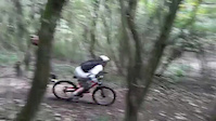
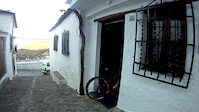
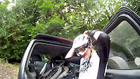
Photos of Wild Park Mountain Bike
Videos of Wild Park Mountain Bike
trail: RH line
0:10 |
1961 |
Oct 9, 2017

trail: Huck the pain away
0:22 |
1363 |
Oct 24, 2016

trail: Switchbacks
2:01 |
1304 |
Jul 1, 2014
trail: Switchbacks
5:58 |
305 |
Oct 28, 2013

trail: EP
2:19 |
30146 |
Apr 17, 2013

trail: EP
4:44 |
344 |
Jul 9, 2012

trail: EP
3:00 |
414 |
Jul 1, 2012
trail: EP
0:31 |
233 |
Jun 23, 2012
Recent Trail Reports
| status | trail | date | condition | info | user |
|---|---|---|---|---|---|
| Switchbacks | Mar 31, 2025 @ 1:24am Mar 31, 2025 | Ideal | Mucker69 | ||
| RH line | Jul 29, 2024 @ 4:17pm Jul 29, 2024 | Variable | Aylay | ||
| Chicken Sticks | Jun 28, 2024 @ 4:20pm Jun 28, 2024 | Dry | Aylay | ||
| The Long Way Round | Apr 26, 2021 @ 9:57am Apr 26, 2021 | Very Dry | nsimmonds9 | ||
| EP | Apr 1, 2021 @ 1:08am Apr 1, 2021 | Dry | RichDuf | ||
| Curley Wurley | Jun 14, 2020 @ 9:51am Jun 14, 2020 | Dry | nsimmonds9 |
Activity Feed
| username | action | type | title | date |
|---|---|---|---|---|
| Andrew7PxNbk | ridden | trail | activity #95864538 | May 30, 2026 @ 10:03am May 30, 2026 |
| pete-af | wishlist | region | activity #95400878 | May 24, 2026 @ 5:52am May 24, 2026 |
| pete-af | ridden | trail | activity #94739553 | May 15, 2026 @ 3:23am May 15, 2026 |
| trailforks | add | video | activity #89397562 | Feb 22, 2026 @ 8:05pm Feb 22, 2026 |
| trailforks | add | video | activity #88693525 | Feb 10, 2026 @ 2:00pm Feb 10, 2026 |
Recent Comments
| username | type | title | comment | date |
|---|---|---|---|---|
| trail | Overgrown | Jul 8, 2025 @ 10:44am Jul 8, 2025 | ||
| trail | Still in great condition. Added a small... | Sep 9, 2024 @ 2:13am Sep 9, 2024 | ||
| trail | Looks like the start of this trail has moved... | Feb 21, 2021 @ 10:06am Feb 21, 2021 | ||
| trail | Excellent condition today | Feb 23, 2018 @ 9:51am Feb 23, 2018 | ||
| report | Thanks for taking care. I wasn't able to take... | Sep 25, 2016 @ 1:26pm Sep 25, 2016 |
Nearby Areas
| name | distance | ||||
|---|---|---|---|---|---|
| Stanmer Park | 1 | 37 | 1.5 km | ||
| Blackcap | 2 | 3.3 km | |||
| Friston Forest | 13 | 14.2 km | |||
| Highdown Hill | 5 | 2 | 14.8 km | ||
| St Leonards Forest | 9 | 10 | 16 km |
Activity Type Stats
| activitytype | trails | distance | descent | descent distance | total vertical | rating | global rank | state rank | photos | reports | routes | ridelogs |
|---|---|---|---|---|---|---|---|---|---|---|---|---|
| Mountain Bike | 7 | 2 miles | 1,348 ft | 2 miles | 305 ft | #5,376 | #161 | 59 | 67 | 1 | 9,043 | |
| E-Bike | 7 | 2 miles | 1,348 ft | 2 miles | 305 ft | #5,826 | #271 | 64 | 1 | 1,088 | ||
| Hike | 1 | 3,327 ft | 308 ft | 3,196 ft | 305 ft | #12,735 | #367 | 53 | 1 | 546 | ||
| Trail Running | 1 | 3,327 ft | 308 ft | 3,196 ft | 305 ft | #12,095 | #357 | 53 | 1 | 21 |
Frequently Asked Questions About Wild Park
▼
What are the highest rated mountain biking trails in Wild Park?
The highest rated mountain biking trails in Wild Park are:
- Switchbacks (4.2/5)
- Curley Wurley (4.1/5)
- Huck the pain away (4.1/5)
- RH line (4/5)
- Chicken Sticks (4/5)
▼
What is the best time of the year to ride in Wild Park?
Based on ride log data, the most popular months to ride in Wild Park are:
- July (19 activities)
- May (13 activities)
- June (12 activities)
▼
Where can I park to ride in Wild Park?
There are 1 parking locations listed in Wild Park. The most popular parking spots are:
▼
What is the longest trail in Wild Park?
The longest trail in Wild Park is EP at 3,328 ft. View all trails sorted by distance.
Trails
- By smatkins1 & contributors
- Admins: apply
- #7262 - 13,917 views
- wild park activity log | embed map of Wild Park mountain bike trails | wild park mountain biking points of interest
Downloading of trail gps tracks in kml & gpx formats is enabled for Wild Park.
You must login to download files.