close
-
Layers w
- Weather Layers
- Pro
- Pro
- Pro
- Pro
- Pro
- Pro
- More Layers
- Pro
- Pro
- Pro
- Pro
-
Upgrade to

3D
Trail Conditions
- Unknown
- Snow Groomed
- Snow Packed
- Snow Covered
- Snow Cover Partial
- Freeze/thaw Cycle
- Icy
- Prevalent Mud
- Wet
- Variable
- Ideal
- Dry
- Very Dry
Trail Flow (Ridden Direction)
Trailforks scans users ridelogs to determine the most popular direction each trail is ridden. A good flowing trail network will have most trails flowing in a single direction according to their intension.
The colour categories are based on what percentage of riders are riding a trail in its intended direction.
The colour categories are based on what percentage of riders are riding a trail in its intended direction.
- > 96%
- > 90%
- > 80%
- > 70%
- > 50%
- < 50%
- bi-directional trail
- no data
Trail Last Ridden
Trailforks scans ridelogs to determine the last time a trail was ridden.
- < 2 days
- < 1 week
- < 2 weeks
- < 1 month
- < 6 months
- > 6 months
Trail Ridden Direction
The intended direction a trail should be ridden.
- Downhill Only
- Downhill Primary
- Both Directions
- Uphill Primary
- Uphill Only
- One Direction
Contribute Details
Colors indicate trail is missing specified detail.
- Description
- Photos
- Description & Photos
- Videos
Trail Popularity ?
Trailforks scans ridelogs to determine which trails are ridden the most in the last 9 months.
Trails are compared with nearby trails in the same city region with a possible 25 colour shades.
Think of this as a heatmap, more rides = more kinetic energy = warmer colors.
- most popular
- popular
- less popular
- not popular
ATV/ORV/OHV Filter
Max Vehicle Width
inches
US Cell Coverage
Legend

Radar Time
Activity Recordings
Trailforks uses anonymized public activity data.
?
Activity Recordings
Trailforks uses anonymized public activity data.
?
Personal Heatmap
▶
Activity Types
all
/
none
▶
Options
2
Date range
month
–
Winter Trails
Warning
A routing network for winter maps does not exist. Selecting trails using the winter trails layer has been disabled.
Missing Trails
Most Popular
Least Popular
Trails are colored based on popularity. The more popular a trail is, the more red. Less popular trails trend towards green.
Jump Magnitude Heatmap
Heatmap of where riders jump on trails. Zoom in to see individual jumps, click circles to view jump details.
BC Backroad Status
![map legend]()
Service Road Atlas is a free to use, community-driven service for viewing and creating reports on the numerous back-country service roads around B.C. and Alberta.

Slope Aspect
Direction the slope faces
Trails Deemphasized
Trails are shown in grey.
Only show trails with no bike usage.
Suggested Layers
Based on selected activity type
Save the current map location and zoom level as your default home location whenever this page is loaded.
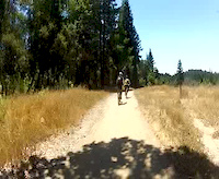
SaveThe park has 34 miles of hiking, biking and equestrian trails winding through coastal terraces and valleys. Several restored buildings once belonging to the Wilder family are preserved. The park has tours and living history demonstrations to help visitors explore the history of early ranchers and farmers along the Central Coast.
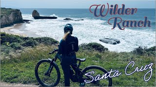
This is the goto place when you first come to explore the trails of Santa Cruz county. It offers some nice redwood forested single track and gorgeous ocean views of Monterey Bay and the Pacific Ocean.
This is the goto place when you first come to explore the trails of Santa Cruz county. It offers some nice redwood forested single track and gorgeous ocean views of Monterey Bay and the Pacific Ocean.
source: Wilder Ranch State Park
Primary Trail Type: Cross-Country
Land Status: State Park
Land Manager: California State Parks
 google parking directions
 Activities Click to view
- Mountain Bike
45 trails
- E-Bike
27 trails
- Horse
41 trails
- Hike
45 trails
- Trail Running
45 trails
Region Details
- 11
- 2
- 8
- 12
- 1
Region Status
Open as of Jun 3, 2026Stats
- Avg Trail Rating
- Trails (view details)
- 34
- Trails Mountain Bike
- 46
- Trails E-Bike
- 27
- Trails Gravel Bike
- 1
- Trails Adaptive Bike
- 1
- Trails Horse
- 41
- Trails Hike
- 45
- Trails Trail Running
- 45
- Total Distance
- 41 miles
- Total Descent
- 5,728 ft
- Total Vertical
- 1,107 ft
- Highest Trailhead
- 1,132 ft
- Reports
- 1,697
- Photos
- 353
- Ridden Counter
- 66,286
Popular Wilder Ranch Mountain Biking Trails
• 100 ★ 3.8 • 4,390 ft • 6 ft • 3,598 •
Popular green difficulty family friendly singletrack. This multi-use trail can be used both directions and has a easy overall physical rating with a 6 ft green climb. Trail visibility is always easy to follow. On average it takes 4 minutes to complete this trail.
• 100 ★ 4.3 • 1 mile • 0 ft • 3,163 •
New Singletrack Reroute of Trail - built by MBOSC and State Parks and opened in May 2019. Trail climbs at a gentle grade up the sides of the old marine terrace. This is a busy two-way trail with lots of hikers and equestrians. Take 'er...
• 90 ★ 4.1 • 5,052 ft • 176 ft • 2,990 •
Highly rated popular blue difficulty singletrack. This multi-use trail can be used downhill primary. On average it takes 11 minutes to complete this trail.
• 80 ★ 4.4 • 1 mile • 272 ft • 2,427 •
Ride Clockwise for a fun, root strewn descent (drop in on the southern end, closer to the coast) Plenty of opportunities to boost over roots, but you can roll them too. Watch for the drop-off/switchback. Climb out was rerouted in 2016...
• 75 ★ 3.7 • 4,393 ft • 107 ft • 2,353 •
Fun single track through redwood trees. There are a couple of breakaway bridge crossings and the approaches and climbs out of the creeks are the most technically challenging on this trail.
• 80 ★ 3.8 • 2,612 ft • 22 ft • 2,111 •
Popular blue difficulty singletrack. This multi-use trail can be used downhill primary. On average it takes 4 minutes to complete this trail.
• 70 ★ 4.0 • 1 mile • 38 ft • 1,518 •
Highly rated popular green difficulty singletrack. This multi-use trail can be used downhill primary. On average it takes 5 minutes to complete this trail.
• 55 ★ 3.7 • 4,688 ft • 34 ft • 1,399 •
This trail includes technical rocky terrain! Great fun!
Wilder Ranch Mountain Bike Routes
★ 3.9 • 10 miles • 1,234 ft • 8 •
Update loop with new Englseman trail (thanks MBoSC!)
★ 5.0 • 21 miles • 1,943 ft • 12 •
This loop incorporates the best of . The only thing to note is the is ridden clockwise NOT...
11 miles • 1,399 ft • 6 • Loop •
A Wilder Classic with a bit of redwood and excellent ocean views. The more technical descent of can be...
11 miles • 1,299 ft • 5 •
An 11 mile loop for a good ride.
★ 3.5 • 14 miles • 1,861 ft • 18 •
With the Cowboy Loop at the south end and the at the north end interconnected with other fun trails, this...
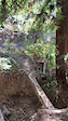
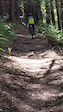
Photos of Wilder Ranch Mountain Bike
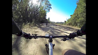
Videos of Wilder Ranch Mountain Bike
trail: Rodrigo
0:12 |
7 |
Feb 2, 2026
trail: Old Cabin
0:18 |
214 |
May 29, 2019
trail: Ohlone Bluff Trail
0:25 |
319 |
May 29, 2019

trail: Wilder Ranch
9:13 |
264 |
Jan 26, 2014
trail: Wilder Ranch
0:48 |
61 |
Dec 1, 2013

trail: Wilder Ranch
5:57 |
261 |
Dec 9, 2012
trail: Wilder Ranch
2:31 |
215 |
Jul 7, 2012
trail: Enchanted Loop
14:25 |
175 |
Aug 5, 2025 , Santa Cruz
Recent Trail Reports
| status | trail | date | condition | info | user |
|---|---|---|---|---|---|
| Highway 1 Bike Path | Jun 3, 2026 @ 12:12pm (America/Los_Angeles) Jun 3, 2026 | Unknown | scottchapin SCMTS Reporter | ||
| Cowboy Loop Trail | May 7, 2026 @ 5:42pm (America/Los_Angeles) May 7, 2026 | Unknown | matibenzoni SCMTS Staff | ||
| Eagle Cutoff | May 1, 2026 @ 11:42am (America/Los_Angeles) May 1, 2026 | Unknown | matibenzoni SCMTS Staff | ||
| Baldwin Loop | May 1, 2026 @ 11:42am (America/Los_Angeles) May 1, 2026 | Variable | matibenzoni SCMTS Staff | ||
| Rodrigo | Apr 3, 2026 @ 6:53am (America/Los_Angeles) Apr 3, 2026 | Ideal | Jonsanders SCMTS Sage | ||
| Old Cabin | Apr 3, 2026 @ 6:52am (America/Los_Angeles) Apr 3, 2026 | Ideal | Jonsanders SCMTS Sage | ||
| Enchanted Loop | Mar 17, 2026 @ 2:33pm (America/Los_Angeles) Mar 17, 2026 | Dry | matibenzoni SCMTS Staff | ||
| Wilder Ridge Loop | Mar 7, 2026 @ 1:29pm (America/Los_Angeles) Mar 7, 2026 | Variable | wmichul | ||
| Zane Gray Cutoff | Mar 7, 2026 @ 10:38am (America/Los_Angeles) Mar 7, 2026 | Wet | wmichul | ||
| Twin Oaks | Feb 5, 2026 @ 9:20am (America/Los_Angeles) Feb 5, 2026 | Dry | RocklinDave |
Activity Feed
| username | action | type | title | date |
|---|---|---|---|---|
| jonaslea | wishlist | route | activity #97215288 | Jun 17, 2026 @ 4:12pm 2 days |
| lKox | wishlist | trail | activity #97162989 | Jun 16, 2026 @ 10:15pm 3 days |
| 5B4oU | wishlist | route | activity #97024045 and 1 more | Jun 14, 2026 @ 10:46pm Jun 14, 2026 |
| ashleybuckle | wishlist | route | activity #96908343 | Jun 13, 2026 @ 12:55pm Jun 13, 2026 |
| Stomper777 | wishlist | route | activity #96895264 and 1 more | Jun 13, 2026 @ 10:44am Jun 13, 2026 |
Recent Comments
| username | type | title | comment | date |
|---|---|---|---|---|
| report | Cowboy Loop has been completely brushed back... | May 14, 2026 @ 4:34pm May 14, 2026 | ||
| report | Awesome! | May 4, 2026 @ 12:01pm May 4, 2026 | ||
| report | The entire lower portion of West Baldwin and... | May 2, 2026 @ 4:38pm May 2, 2026 | ||
| report | Thanks Rick! SCMTS cleared this yesterday! | Mar 25, 2026 @ 2:48pm Mar 25, 2026 | ||
| report | This tree was removed about a month ago. | Mar 14, 2026 @ 5:01pm Mar 14, 2026 |
Nearby Areas
| name | distance | ||||
|---|---|---|---|---|---|
| UCSC | 2 | 13 | 2.3 km | ||
| Pogonip Open Space | 1 | 2 | 2.8 km | ||
| Henry Cowell Redwoods State Park | 2 | 12 | 8 | 4 km | |
| Bear Mountain | 4 km | ||||
| DeLaveaga Park | 2 | 4 | 5 km |
Local Badges
-

Completionist0 awarded
Bike & Skill Parks
| name | type | city | rating |
|---|---|---|---|
| San Lorenzo Park Pumptrack | skill park | Santa Cruz |
Activity Type Stats
| activitytype | trails | distance | descent | descent distance | total vertical | rating | global rank | state rank | photos | reports | routes | ridelogs |
|---|---|---|---|---|---|---|---|---|---|---|---|---|
| Mountain Bike | 45 | 41 miles | 5,728 ft | 21 miles | 1,106 ft | #269 | #96 | 303 | 1,696 | 8 | 35,840 | |
| E-Bike | 27 | 23 miles | 4,675 ft | 15 miles | 1,083 ft | #905 | #642 | 31 | 1,534 | 3 | 5,125 | |
| Gravel Bike | 1 | #339 | #161 | 11 | 57 | |||||||
| Adaptive Bike | 1 | #339 | #161 | 13 | ||||||||
| Horse | 41 | 38 miles | 5,512 ft | 20 miles | 1,106 ft | #736 | #385 | 536 | 9 | |||
| Hike | 45 | 41 miles | 5,728 ft | 21 miles | 1,106 ft | #1,888 | #794 | 53 | 1,688 | 1 | 871 | |
| Trail Running | 45 | 41 miles | 5,728 ft | 21 miles | 1,106 ft | #3,220 | #858 | 1,688 | 940 |
Frequently Asked Questions About Wilder Ranch
▼
What are the highest rated mountain biking trails in Wilder Ranch?
The highest rated mountain biking trails in Wilder Ranch are:
- Enchanted Loop (4.3/5)
- West Engelsman Reroute (new) (4.2/5)
- Twin Oaks (4.1/5)
- Enchanted Loop Cutoff (4.1/5)
- Old Cabin (4.1/5)
▼
What is the best time of the year to ride in Wilder Ranch?
Based on ride log data, the most popular months to ride in Wilder Ranch are:
- July (300 activities)
- October (221 activities)
- August (212 activities)
▼
Where can I park to ride in Wilder Ranch?
There are 3 parking locations listed in Wilder Ranch. The most popular parking spots are: View all parking and trailhead locations on the map to plan your visit.
▼
What is the longest trail in Wilder Ranch?
The longest trail in Wilder Ranch is Ohlone Bluff Trail at 4.7 miles. View all trails sorted by distance.
Activities
- By brenthillier
 NSMBA TRAILFORKS & contributors
 - Admins: apply
- #3592 - 66,668 views
- wilder ranch activity log | embed map of Wilder Ranch mountain bike trails | wilder ranch mountain biking points of interest
Downloading of trail gps tracks in kml & gpx formats is enabled for Wilder Ranch.
You must login to download files.