close
-
Layers w
- Weather Layers
- Pro
- Pro
- Pro
- Pro
- Pro
- Pro
- More Layers
- Pro
- Pro
- Pro
- Pro
-
Upgrade to

3D
Trail Conditions
- Unknown
- Snow Groomed
- Snow Packed
- Snow Covered
- Snow Cover Partial
- Freeze/thaw Cycle
- Icy
- Prevalent Mud
- Wet
- Variable
- Ideal
- Dry
- Very Dry
Trail Flow (Ridden Direction)
Trailforks scans users ridelogs to determine the most popular direction each trail is ridden. A good flowing trail network will have most trails flowing in a single direction according to their intension.
The colour categories are based on what percentage of riders are riding a trail in its intended direction.
The colour categories are based on what percentage of riders are riding a trail in its intended direction.
- > 96%
- > 90%
- > 80%
- > 70%
- > 50%
- < 50%
- bi-directional trail
- no data
Trail Last Ridden
Trailforks scans ridelogs to determine the last time a trail was ridden.
- < 2 days
- < 1 week
- < 2 weeks
- < 1 month
- < 6 months
- > 6 months
Trail Ridden Direction
The intended direction a trail should be ridden.
- Downhill Only
- Downhill Primary
- Both Directions
- Uphill Primary
- Uphill Only
- One Direction
Contribute Details
Colors indicate trail is missing specified detail.
- Description
- Photos
- Description & Photos
- Videos
Trail Popularity ?
Trailforks scans ridelogs to determine which trails are ridden the most in the last 9 months.
Trails are compared with nearby trails in the same city region with a possible 25 colour shades.
Think of this as a heatmap, more rides = more kinetic energy = warmer colors.
- most popular
- popular
- less popular
- not popular
ATV/ORV/OHV Filter
Max Vehicle Width
inches
US Cell Coverage
Legend

Radar Time
Activity Recordings
Trailforks uses anonymized public activity data.
?
Activity Recordings
Trailforks uses anonymized public activity data.
?
Personal Heatmap
▶
Activity Types
all
/
none
▶
Options
2
Date range
month
–
Winter Trails
Warning
A routing network for winter maps does not exist. Selecting trails using the winter trails layer has been disabled.
Missing Trails
Most Popular
Least Popular
Trails are colored based on popularity. The more popular a trail is, the more red. Less popular trails trend towards green.
Jump Magnitude Heatmap
Heatmap of where riders jump on trails. Zoom in to see individual jumps, click circles to view jump details.
BC Backroad Status
![map legend]()
Service Road Atlas is a free to use, community-driven service for viewing and creating reports on the numerous back-country service roads around B.C. and Alberta.

Slope Aspect
Direction the slope faces
Trails Deemphasized
Trails are shown in grey.
Only show trails with no bike usage.
Suggested Layers
Based on selected activity type
Save the current map location and zoom level as your default home location whenever this page is loaded.
SavePopular Trail Networks
view all areas »
No description for Will County has been added yet!
Login or register to submit one.
Activities Click to view
- Mountain Bike
1,478 trails
- E-Bike
1,221 trails
- Horse
123 trails
- Hike
1,687 trails
- Trail Running
1,624 trails
- Snowmobile
7 trails
- Snowshoe
753 trails
- Nordic Ski
781 trails
Stats
- Trails (view details)
- 1,679
- Trails Mountain Bike
- 1,479
- Trails E-Bike
- 1,221
- Trails Horse
- 123
- Trails Hike
- 1,688
- Trails Trail Running
- 1,624
- Trails Snowmobile
- 7
- Trails Snowshoe
- 753
- Trails Nordic Ski
- 781
- Total Distance
- 517 miles
- Total Descent Distance
- 137 miles
- Total Descent
- 8,192 ft
- Total Vertical
- 285 ft
- Highest Trailhead
- 789 ft
- Reports
- 119
- Photos
- 24
- Ridden Counter
- 4,114
Sub Regions
- Bolingbrook (146)
- Balstrode - Volunteer - Poplar Parks (6)
- Bulldog Park (5)
- Central Park (5)
- Gateway Wetlands (9)
- Hidden Oaks Preserve (13)
- Indian Boundary Park (7)
- Indian Chase Meadows Park (7)
- Johanson Farm Park (3)
- Knights of Columbus Park (5)
- Lily Cache Greenway Park (25)
- Meyer Park - Bolingbrook Village Trails (15)
- Prairie Trails Park (5)
- Whalon Lake (20)
- Winston Woods (8)
- Channahon (121)
- Crest Hill (34)
- Brent Hassert Park (29)
- Crete (26)
- Elwood (54)
- Frankfort (34)
- Homer Glen (27)
- Messenger Marsh (18)
- Joliet (160)
- Lockport (19)
- manhattan (26)
- Mokena (54)
- Monee (16)
- Monee Reservoir (4)
- Naperville Will County (210)
- Brook Crossings - Brook Prairie (7)
- Commissioners Park (23)
- DuPage River Park (19)
- Frontier - Ashbury - Rose Hill Farms Parks (9)
- Kingsley Prairie (3)
- Knoch Knolls Park (42)
- Riverview Farmstead Preserve (9)
- Riverwoods Park (5)
- Springbrook Parkway (10)
- Tall Grass Lakes Park (6)
- Vermont Cemetery Preserve (8)
- Walnut Ridge Woods (4)
- Wolf Creek Preserve (1)
- Wolf's Crossing Community Park (21)
- New Lenox (23)
- Peotone (6)
- Plainfield (244)
- Caton Ridge Park (9)
- Eaton Preserve (13)
- Electric Park (12)
- Four Seasons West / Avery Preserve (13)
- Gregory B Bott Park (10)
- Lake Renwick Preserve (16)
- Liberty Grove (13)
- Mather Woods (10)
- Norman Greenway (6)
- Olde Renwick Trail Park (5)
- Riverside Parkway Park (3)
- Riverview Park (3)
- Settlers' Park (18)
- Tamarack Settlement Park (9)
- Van Horn Woods East (9)
- Van Horn Woods West (11)
- Wheatland Park (2)
- Romeoville (131)
- Isle a la Cache (16)
- Veterans Woods (7)
- Village - Conservation Park (48)
- Shorewood (87)
- Cene's Four Seasons Park (6)
- Hammel Woods (33)
- Symerton (3)
- University Park (0)
- Wheatland (34)
- Wheatland Skate Park (11)
- Wilmington (20)
Popular Will County Mountain Biking Trails
• 100 ★ 0.0 • 846 ft • 5 ft • 53 •
Popular green difficulty doubletrack. This multi-use trail can be used both directions and has a easy overall physical rating with a 5 ft green climb. Trail visibility is always easy to follow. On average it takes minutes to complete this trail.
• 100 ★ 0.0 • 909 ft • 2 ft • 40 •
Popular green difficulty singletrack. This multi-use trail can be used both directions and has a easy overall physical rating with a 2 ft green climb. Trail visibility is always easy to follow. On average it takes minutes to complete this trail.
• 95 ★ 0.0 • 492 ft • 0 ft • 32 •
Popular green difficulty doubletrack. This multi-use trail can be used both directions and has a easy overall physical rating with a 0 ft green climb. Trail visibility is always easy to follow. On average it takes minutes to complete this trail.
• 95 ★ 0.0 • 1,844 ft • 29 ft • 24 •
Popular blue difficulty singletrack. This multi-use trail can be used both directions and has a easy overall physical rating with a 29 ft green climb. Trail visibility is always easy to follow. On average it takes 2 minutes to complete this trail.
• 100 ★ 0.0 • 4,121 ft • 39 ft • 24 •
Popular blue difficulty singletrack. This multi-use trail can be used both directions and has a easy overall physical rating with a 39 ft green climb. Trail visibility is always easy to follow. On average it takes 6 minutes to complete this trail.
• 95 ★ 0.0 • 925 ft • 0 ft • 23 •
Popular green difficulty singletrack. This multi-use trail can be used both directions and has a easy overall physical rating with a 0 ft green climb. Trail visibility is always easy to follow. On average it takes 1 minutes to complete this trail.
• 100 ★ 0.0 • 1 mile • 35 ft • 23 •
Popular green difficulty singletrack. This multi-use trail can be used both directions and has a easy overall physical rating with a 35 ft green climb. Trail visibility is always easy to follow. On average it takes 10 minutes to complete this trail.
• 95 ★ 0.0 • 4,209 ft • 14 ft • 15 •
Popular blue difficulty singletrack. This multi-use trail can be used both directions and has a easy overall physical rating with a 14 ft green climb. Trail visibility is always easy to follow. On average it takes 8 minutes to complete this trail.
Photos of Will County Mountain Bike
Videos of Will County Mountain Bike
youtuber
![Frankfort Pump Track - How well will my 29er...]()
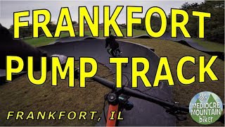
trail: Old Plank Road Trail
6:33 |
301 |
Oct 15, 2023 , Mokena
Recent Trail Reports
| status | trail | date | condition | info | user |
|---|---|---|---|---|---|
| Prairie Loop Trail McKinley Woods | May 12, 2025 @ 3:56pm May 12, 2025 | Very Dry | lilpurpjumper | ||
| Kerry Sheridan Grove Parking Loop McKinley Woods | May 12, 2025 @ 3:56pm May 12, 2025 | Very Dry | lilpurpjumper | ||
| Four Rivers Trail McKinley Woods | May 12, 2025 @ 3:56pm May 12, 2025 | Very Dry | lilpurpjumper | ||
| I&M Parking Road Channahon | May 12, 2025 @ 3:56pm May 12, 2025 | Very Dry | lilpurpjumper | ||
| Frontier Park Trail Frontier - Ashbury - Rose Hill Farms Parks | Sep 7, 2024 @ 9:12am Sep 7, 2024 | Unknown | PPMTBiker | ||
| Sidewalk Knoch Knolls Park | Sep 7, 2024 @ 9:12am Sep 7, 2024 | Unknown | PPMTBiker | ||
| Dorothea Weigand Riverfront Park Road Naperville Will County | Sep 7, 2024 @ 9:12am Sep 7, 2024 | Unknown | PPMTBiker | ||
| Connector Trail Naperville Will County | Sep 7, 2024 @ 9:12am Sep 7, 2024 | Unknown | PPMTBiker | ||
| Weigand Mowed Path Naperville Will County | Sep 7, 2024 @ 9:12am Sep 7, 2024 | Unknown | PPMTBiker | ||
| DuPage River Trail Naperville Will County | Sep 7, 2024 @ 9:12am Sep 7, 2024 | Unknown | PPMTBiker |
Activity Feed
| username | action | type | title | date |
|---|---|---|---|---|
| gkusch99 | wishlist | trail | activity #94629419 | May 13, 2026 @ 8:34am May 13, 2026 |
| jyQAvq | wishlist | region | activity #93822781 | May 1, 2026 @ 5:38pm May 1, 2026 |
| tmullen | wishlist | region | activity #84015954 | Nov 12, 2025 @ 5:34am Nov 12, 2025 |
| dococ04 | wishlist | trail | activity #83166622 | Oct 28, 2025 @ 9:27am Oct 28, 2025 |
| HaroldasIcAp7u | ridden | trail | activity #78587777 | Aug 20, 2025 @ 8:15pm Aug 20, 2025 |
Recent Comments
| username | type | title | comment | date |
|---|---|---|---|---|
| trail | The first five miles, from the southern tip,... | May 1, 2022 @ 4:00pm May 1, 2022 |
Local Badges
-

Descent 10k Badge0 awarded -

Descent 100k Badge0 awarded -
Descent 100k Badge0 awarded -
Descent 100k Badge0 awarded -
Descent 100k Badge0 awarded -
Descent 10k Badge0 awarded
Activity Type Stats
| activitytype | trails | distance | descent | descent distance | total vertical | rating | global rank | state rank | photos | reports | routes | ridelogs |
|---|---|---|---|---|---|---|---|---|---|---|---|---|
| Mountain Bike | 1,478 | 472 miles | 6,906 ft | 128 miles | 285 ft | 24 | 119 | 4,239 | ||||
| E-Bike | 1,221 | 371 miles | 5,535 ft | 98 miles | 285 ft | 90 | 70 | |||||
| Horse | 123 | 39 miles | 702 ft | 11 miles | 200 ft | 11 | ||||||
| Hike | 1,687 | 517 miles | 8,192 ft | 137 miles | 285 ft | 119 | 232 | |||||
| Trail Running | 1,624 | 512 miles | 7,913 ft | 136 miles | 285 ft | 119 | 351 | |||||
| Snowmobile | 7 | 13 miles | 43 ft | 3 miles | 26 ft | |||||||
| Snowshoe | 753 | 172 miles | 3,278 ft | 40 miles | 262 ft | 2 | ||||||
| Nordic Ski | 781 | 176 miles | 3,304 ft | 41 miles | 285 ft | 11 |
Frequently Asked Questions About Will County
▼
What are the best places to ride in Will County?
Will County has 96 areas to explore for mountain biking. The top rated areas are:
▼
What are the highest rated mountain biking trails in Will County?
The highest rated mountain biking trails in Will County are:
- Michael C Oliveri Memorial Trail - connect (0/5)
- Michael C Oliveri Memorial Trail - connecto (0/5)
- I&M Dellwood Connector (0/5)
- Hickory Creek Junction Nature Trail (0/5)
- Cleveland Road Access (0/5)
▼
What is the best time of the year to ride in Will County?
Based on ride log data, the most popular months to ride in Will County are:
- August (13 activities)
- September (9 activities)
- July (5 activities)
▼
What is the longest trail in Will County?
The longest trail in Will County is Trail at 1.3 miles. View all trails sorted by distance.
Activities
Trails
- By WillieJacobsz
 Trailforks SBP SWW & contributors
 - Admins: PlumbBobM, CAMBR
- #54950 - 2,518 views
- will county activity log | embed map of Will County mountain bike trails | will county mountain biking points of interest polygons
Downloading of trail gps tracks in kml & gpx formats is enabled for Will County.
You must login to download files.