close
-
Layers w
- Weather Layers
- Pro
- Pro
- Pro
- Pro
- Pro
- Pro
- More Layers
- Pro
- Pro
- Pro
- Pro
-
Upgrade to

3D
Trail Conditions
- Unknown
- Snow Groomed
- Snow Packed
- Snow Covered
- Snow Cover Partial
- Freeze/thaw Cycle
- Icy
- Prevalent Mud
- Wet
- Variable
- Ideal
- Dry
- Very Dry
Trail Flow (Ridden Direction)
Trailforks scans users ridelogs to determine the most popular direction each trail is ridden. A good flowing trail network will have most trails flowing in a single direction according to their intension.
The colour categories are based on what percentage of riders are riding a trail in its intended direction.
The colour categories are based on what percentage of riders are riding a trail in its intended direction.
- > 96%
- > 90%
- > 80%
- > 70%
- > 50%
- < 50%
- bi-directional trail
- no data
Trail Last Ridden
Trailforks scans ridelogs to determine the last time a trail was ridden.
- < 2 days
- < 1 week
- < 2 weeks
- < 1 month
- < 6 months
- > 6 months
Trail Ridden Direction
The intended direction a trail should be ridden.
- Downhill Only
- Downhill Primary
- Both Directions
- Uphill Primary
- Uphill Only
- One Direction
Contribute Details
Colors indicate trail is missing specified detail.
- Description
- Photos
- Description & Photos
- Videos
Trail Popularity ?
Trailforks scans ridelogs to determine which trails are ridden the most in the last 9 months.
Trails are compared with nearby trails in the same city region with a possible 25 colour shades.
Think of this as a heatmap, more rides = more kinetic energy = warmer colors.
- most popular
- popular
- less popular
- not popular
ATV/ORV/OHV Filter
Max Vehicle Width
inches
US Cell Coverage
Legend

Radar Time
Activity Recordings
Trailforks uses anonymized public activity data.
?
Activity Recordings
Trailforks uses anonymized public activity data.
?
Personal Heatmap
▶
Activity Types
all
/
none
▶
Options
2
Date range
month
–
Winter Trails
Warning
A routing network for winter maps does not exist. Selecting trails using the winter trails layer has been disabled.
Missing Trails
Most Popular
Least Popular
Trails are colored based on popularity. The more popular a trail is, the more red. Less popular trails trend towards green.
Jump Magnitude Heatmap
Heatmap of where riders jump on trails. Zoom in to see individual jumps, click circles to view jump details.
BC Backroad Status
![map legend]()
Service Road Atlas is a free to use, community-driven service for viewing and creating reports on the numerous back-country service roads around B.C. and Alberta.

Slope Aspect
Direction the slope faces
Trails Deemphasized
Trails are shown in grey.
Only show trails with no bike usage.
Suggested Layers
Based on selected activity type
Save the current map location and zoom level as your default home location whenever this page is loaded.
Save
No description for Willemstad has been added yet!
Login or register to submit one.
Activities Click to view
- Mountain Bike
99 trails
- E-Bike
81 trails
- Adaptive Bike
0 trails
- Winter Fat Bike
0 trails
- Horse
5 trails
- Hike
98 trails
- Trail Running
98 trails
Region Details
- 5
- 4
- 50
- 38
- 1
Region Status
Open as of Mar 16, 2026Stats
- Avg Trail Rating
- Trails (view details)
- 98
- Trails Mountain Bike
- 99
- Trails E-Bike
- 81
- Trails Horse
- 5
- Trails Hike
- 98
- Trails Trail Running
- 98
- Total Distance
- 56 miles
- Total Descent
- 4,036 ft
- Total Vertical
- 373 ft
- Highest Trailhead
- 377 ft
- Reports
- 81
- Photos
- 50
- Ridden Counter
- 1,191
Sub Regions
-
Boca sami
- 6
- 6
-
Hato vlakte
- 1
- 2
-
Porto Mari
-
St. Joris
- 2
- 4
- 1
Popular Willemstad Mountain Biking Trails
• 85 ★ 4.5 • 3,560 ft • 87 ft • 35 •
Popular blue difficulty singletrack. This mountain bike primary trail can be used both directions and has a moderate overall physical rating with a 87 ft blue climb. It features rock garden. On average it takes 7 minutes to complete this trail.
• 100 ★ 0.0 • 793 ft • 0 ft • 31 •
Popular blue difficulty singletrack. This mountain bike primary trail can be used both directions and has a easy overall physical rating with a 0 ft blue climb. It features drop and rock garden. Trail visibility is always easy to follow. On average it takes 1 minutes to complete this trail.
• 95 ★ 5.0 • 2,130 ft • 44 ft • 28 •
Popular green difficulty singletrack. This mountain bike primary trail can be used both directions and has a easy overall physical rating with a 44 ft green climb. It features berm and roller coaster. Trail visibility is always easy to follow. On average it takes 3 minutes to complete this trail.
• 80 ★ 0.0 • 2,334 ft • 49 ft • 26 •
Popular blue difficulty singletrack. This mountain bike primary trail can be used both directions and has a moderate overall physical rating with a 49 ft blue climb. It features drop, rock face, rock garden and roller coaster. Trail visibility is sometimes hard to follow. On average it takes 3 minutes to complete this trail.
• 100 ★ 0.0 • 1,393 ft • 47 ft • 24 •
Popular green difficulty doubletrack. This mountain bike primary trail can be used both directions and has a easy overall physical rating with a 47 ft green climb. It features rock face. Trail visibility is always easy to follow. On average it takes 1 minutes to complete this trail.
• 95 ★ 5.0 • 1,601 ft • 18 ft • 23 •
Popular green difficulty singletrack. This mountain bike primary trail can be used both directions and has a moderate overall physical rating with a 18 ft blue climb. It features drop, rock garden and roller coaster. Trail visibility is always easy to follow. On average it takes 2 minutes to complete this trail.
• 55 ★ 5.0 • 2,447 ft • 68 ft • 21 •
Moderately popular green difficulty singletrack. This mountain bike primary trail can be used both directions and has a moderate overall physical rating with a 68 ft blue climb. It features rock face and rock garden. Trail visibility is always easy to follow. On average it takes 3 minutes to complete this trail.
Willemstad Mountain Bike Routes
25 miles • 1,134 ft • 1 •
Hilly partly dirt (60%) partly asphalt (40%)
31 miles • 1,724 ft • 2 • Loop •
this is the 2018 short Duo extreme route, part of the Curacao Cycling week
7 miles • 532 ft • 6 • Out & Back •
A fun and scenic route along a nature reserve and going into a hilly route
Photos of Willemstad Mountain Bike
Videos of Willemstad Mountain Bike
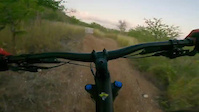
trail: The Darkside
0:21 |
8 |
Mar 20, 2026
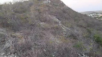
trail: The Darkside
0:38 |
9 |
Mar 20, 2026
Recent Trail Reports
| status | trail | date | condition | info | user |
|---|---|---|---|---|---|
| The Darkside | Mar 16, 2026 @ 4:41pm (America/Curacao) Mar 16, 2026 | Dry | AJshred | ||
| Sint Michiel Berg West | Mar 16, 2026 @ 4:41pm (America/Curacao) Mar 16, 2026 | Dry | AJshred | ||
| Secret Ottevanger | Jun 24, 2024 @ 9:25am Jun 24, 2024 | Dry | Evogreen | ||
| Endless Summer Trail | Jun 24, 2024 @ 9:22am Jun 24, 2024 | Dry | Evogreen | ||
| Kop van Koraal Tabak | Jun 23, 2024 @ 8:38am Jun 23, 2024 | Dry | Evogreen | ||
| Drag Strip Climb | Jun 23, 2024 @ 8:36am Jun 23, 2024 | Dry | Evogreen | ||
| St. Joris Trail Down | Jun 23, 2024 @ 8:34am Jun 23, 2024 | Dry | Evogreen | ||
| Jungle trail | Jun 8, 2024 @ 9:30am Jun 8, 2024 | Dry | Evogreen | ||
| Kalebas | Jun 8, 2024 @ 9:29am Jun 8, 2024 | Dry | Evogreen | ||
| Rocky trail south WC route | Jun 8, 2024 @ 9:28am Jun 8, 2024 | Dry | Evogreen |
Activity Feed
| username | action | type | title | date |
|---|---|---|---|---|
| AJshred | add | photo | activity #90962921 | Mar 20, 2026 @ 10:04pm Mar 20, 2026 |
| AJshred | add | photo | activity #90723251 and 2 more | Mar 16, 2026 @ 8:57pm Mar 16, 2026 |
| AJshred | add | report | activity #90723196 and 1 more | Mar 16, 2026 @ 8:53pm Mar 16, 2026 |
| Curacao-Cycling-Events | add | directory | activity #86800387 | Jan 7, 2026 @ 8:59am Jan 7, 2026 |
| evandwc2012 | ridden | trail | activity #78452960 | Aug 18, 2025 @ 8:16pm Aug 18, 2025 |
Recent Comments
| username | type | title | comment | date |
|---|---|---|---|---|
| trail | Not maintained, completely overgrown | Jul 15, 2025 @ 4:10am Jul 15, 2025 | ||
| trail | Overgrown with cactus and thorny bushes | Feb 28, 2023 @ 6:33am Feb 28, 2023 | ||
| trail | DH; some switchbacks, more speed and a... | Oct 9, 2022 @ 12:22pm Oct 9, 2022 | ||
| trail | Fun trail, with lots of grass, pretty uncommon... | Oct 9, 2022 @ 12:16pm Oct 9, 2022 | ||
| trail | Not a real trail, would like to suggest this... | Oct 9, 2022 @ 12:14pm Oct 9, 2022 |
Local Badges
-

10 Blue Trails15 awarded -

Epic Ride Climb 2k2 awarded -

Climbing 10k Badge8 awarded -

Climbing 100k Badge0 awarded -

Epic Ride Descent 2k2 awarded -

Descent 10k Badge8 awarded
Bike & Skill Parks
| name | type | city | rating |
|---|---|---|---|
| Curacao BMX track | skill park | Willemstad | |
| Flipside Skate&BMX park | skill park | Willemstad | |
| Asiento BMX track | skill park | Willemstad |
Activity Type Stats
| activitytype | trails | distance | descent | descent distance | total vertical | rating | global rank | state rank | photos | reports | routes | ridelogs |
|---|---|---|---|---|---|---|---|---|---|---|---|---|
| Mountain Bike | 99 | 56 miles | 4,035 ft | 22 miles | 374 ft | #1,049 | #1 | 48 | 81 | 14 | 1,467 | |
| E-Bike | 81 | 44 miles | 3,307 ft | 18 miles | 374 ft | #906 | #1 | 79 | 4 | 14 | ||
| Horse | 5 | 3 miles | 180 ft | 1 mile | 89 ft | #415 | #1 | 20 | ||||
| Hike | 98 | 55 miles | 3,888 ft | 21 miles | 374 ft | #1,303 | #1 | 2 | 81 | 1 | 200 | |
| Trail Running | 98 | 55 miles | 3,888 ft | 21 miles | 374 ft | #944 | #1 | 81 | 1 | 269 |
Frequently Asked Questions About Willemstad
▼
What are the best places to ride in Willemstad?
Willemstad has 4 areas to explore for mountain biking. The top rated areas are:
▼
What are the highest rated mountain biking trails in Willemstad?
The highest rated mountain biking trails in Willemstad are:
- St. Joris Trail Down (4.2/5)
- Jan Thiel Drop (4.1/5)
- Endless Summer Trail (4.1/5)
- Jungle trail (4.1/5)
- Last Bit WC route (4.1/5)
▼
What is the best time of the year to ride in Willemstad?
Based on ride log data, the most popular months to ride in Willemstad are:
- December (16 activities)
- July (11 activities)
- September (10 activities)
▼
Where can I park to ride in Willemstad?
There are 4 parking locations listed in Willemstad. The most popular parking spots are: View all parking and trailhead locations on the map to plan your visit.
Activities
Trails
Points of Interest
- By basvdl
 & contributors
 - Admins: apply
- #27925 - 2,674 views
- willemstad activity log | embed map of Willemstad mountain bike trails | willemstad mountain biking points of interest
Downloading of trail gps tracks in kml & gpx formats is enabled for Willemstad.
You must login to download files.