close
-
Layers w
- Weather Layers
- Pro
- Pro
- Pro
- Pro
- Pro
- Pro
- More Layers
- Pro
- Pro
- Pro
- Pro
-
Upgrade to

3D
Trail Conditions
- Unknown
- Snow Groomed
- Snow Packed
- Snow Covered
- Snow Cover Partial
- Freeze/thaw Cycle
- Icy
- Prevalent Mud
- Wet
- Variable
- Ideal
- Dry
- Very Dry
Trail Flow (Ridden Direction)
Trailforks scans users ridelogs to determine the most popular direction each trail is ridden. A good flowing trail network will have most trails flowing in a single direction according to their intension.
The colour categories are based on what percentage of riders are riding a trail in its intended direction.
The colour categories are based on what percentage of riders are riding a trail in its intended direction.
- > 96%
- > 90%
- > 80%
- > 70%
- > 50%
- < 50%
- bi-directional trail
- no data
Trail Last Ridden
Trailforks scans ridelogs to determine the last time a trail was ridden.
- < 2 days
- < 1 week
- < 2 weeks
- < 1 month
- < 6 months
- > 6 months
Trail Ridden Direction
The intended direction a trail should be ridden.
- Downhill Only
- Downhill Primary
- Both Directions
- Uphill Primary
- Uphill Only
- One Direction
Contribute Details
Colors indicate trail is missing specified detail.
- Description
- Photos
- Description & Photos
- Videos
Trail Popularity ?
Trailforks scans ridelogs to determine which trails are ridden the most in the last 9 months.
Trails are compared with nearby trails in the same city region with a possible 25 colour shades.
Think of this as a heatmap, more rides = more kinetic energy = warmer colors.
- most popular
- popular
- less popular
- not popular
ATV/ORV/OHV Filter
Max Vehicle Width
inches
US Cell Coverage
Legend

Radar Time
Activity Recordings
Trailforks uses anonymized public activity data.
?
Activity Recordings
Trailforks uses anonymized public activity data.
?
Personal Heatmap
▶
Activity Types
all
/
none
▶
Options
2
Date range
month
–
Winter Trails
Warning
A routing network for winter maps does not exist. Selecting trails using the winter trails layer has been disabled.
Missing Trails
Most Popular
Least Popular
Trails are colored based on popularity. The more popular a trail is, the more red. Less popular trails trend towards green.
Jump Magnitude Heatmap
Heatmap of where riders jump on trails. Zoom in to see individual jumps, click circles to view jump details.
BC Backroad Status
![map legend]()
Service Road Atlas is a free to use, community-driven service for viewing and creating reports on the numerous back-country service roads around B.C. and Alberta.

Slope Aspect
Direction the slope faces
Trails Deemphasized
Trails are shown in grey.
Only show trails with no bike usage.
Suggested Layers
Based on selected activity type
Save the current map location and zoom level as your default home location whenever this page is loaded.
Save
No description for Williamsburg has been added yet!
Login or register to submit one.
Activities Click to view
- Mountain Bike
45 trails
- E-Bike
8 trails
- Gravel Bike
0 trails
- Adaptive Bike
0 trails
- Winter Fat Bike
0 trails
- Hike
62 trails
- Trail Running
60 trails
Region Details
- 9
- 4
- 18
- 11
- 2
- 1
Region Status
Open as of 2 daysStats
- Avg Trail Rating
- Trails (view details)
- 62
- Trails Mountain Bike
- 45
- Trails E-Bike
- 8
- Trails Hike
- 62
- Trails Trail Running
- 60
- Total Distance
- 56 miles
- Total Descent
- 3,472 ft
- Total Vertical
- 145 ft
- Highest Trailhead
- 148 ft
- Reports
- 239
- Photos
- 123
- Ridden Counter
- 7,768
Sub Regions
-
College Woods
- 8
- 5
-
Freedom Park
- 3
- 5
- 5
- 1
- 1
-
New Quarter Park
- 19
- 1
- 1
-
Waller Mill Reservoir
- 1
Popular Williamsburg Mountain Biking Trails
• 100 ★ 4.2 • 3 miles • 273 ft • 451 •
This is another great trail built and maintained by the Eastern Virginia Mountainbike Association (www.evma.org). Part of the Confederate Defensive Line was on this property and there are three Civil War dugouts clearly visible in the...
• 90 ★ 5.0 • 709 ft • 0 ft • 298 •
Optional line with a skinny, that is a bit wide for a skinny, but it rolls over a bit of a high area followed by a drop off the end.
Williamsburg Mountain Bike Routes
★ 1.0 • 9 miles • 539 ft • 10 • Loop •
Flowing intermediate loop with some optional technical trail features on C loop
16 miles • 1,129 ft • 15 • Loop •
Long loop that includes all of the primary trails at Freedom Park
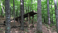
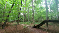
Photos of Williamsburg Mountain Bike
Videos of Williamsburg Mountain Bike
trail: The Big Easy
0:12 |
407 |
Nov 18, 2021
trail: Long Skinny Drop
0:09 |
521 |
Jun 27, 2020

trail: The Big Easy
0:10 |
370 |
Jun 27, 2020

trail: Multiuse Trail
0:44 |
141 |
Nov 22, 2017

trail: Multiuse Trail
2:51 |
69 |
Feb 9, 2017

trail: Multiuse Trail
5:27 |
119 |
Feb 9, 2017

trail: The Big Easy
0:28 |
1741 |
Jul 1, 2013

trail: The Big Easy
0:36 |
1954 |
May 29, 2012
Recent Trail Reports
| status | trail | date | condition | info | user |
|---|---|---|---|---|---|
| Loop A | Jun 25, 2026 @ 7:47am (America/New_York) 2 days | Variable | jbailey3238 | ||
| Loop D | Dec 24, 2025 @ 10:34am (America/New_York) Dec 24, 2025 | Ideal | Chipper-Ripper | ||
| Loop E | Dec 24, 2025 @ 10:34am (America/New_York) Dec 24, 2025 | Ideal | Chipper-Ripper | ||
| Matoaka Lake (East) | Nov 20, 2025 @ 2:29pm (America/New_York) Nov 20, 2025 | Dry | coachbobo | ||
| Matoaka Woods Trail | Nov 20, 2025 @ 2:29pm (America/New_York) Nov 20, 2025 | Variable | coachbobo | ||
| Peninsula | Oct 12, 2025 @ 12:51pm (America/New_York) Oct 12, 2025 | Wet | PrknRde | ||
| Connector | Oct 5, 2025 @ 2:19pm (America/New_York) Oct 5, 2025 | Ideal | Bear1977 MAH | ||
| Redoubt Run Mountain Bike Trail | Oct 5, 2025 @ 2:17pm (America/New_York) Oct 5, 2025 | Ideal | Bear1977 MAH | ||
| Virginia Capital Trail | Sep 19, 2025 @ 9:06am (America/New_York) Sep 19, 2025 | Dry | saberhawk65 | ||
| Loop C | Sep 20, 2025 @ 8:47am (America/New_York) Sep 20, 2025 | Variable | JosephkJwQOu |
Activity Feed
| username | action | type | title | date |
|---|---|---|---|---|
| jbailey3238 | add | report | activity #97763274 | Jun 25, 2026 @ 6:15am 2 days |
| airtym | wishlist | route | activity #97706663 and 1 more | Jun 24, 2026 @ 10:11am 3 days |
| airtym | wishlist | trail | activity #97706466 | Jun 24, 2026 @ 10:08am 3 days |
| jreyes8373 | ridden | trail | activity #96478529 | Jun 7, 2026 @ 10:52am Jun 7, 2026 |
| Jhrowe | add | photo | activity #96091364 | Jun 2, 2026 @ 9:50am Jun 2, 2026 |
Recent Comments
| username | type | title | comment | date |
|---|---|---|---|---|
| report | V | Apr 19, 2026 @ 7:33am Apr 19, 2026 | ||
| report | oeio933 was oo | Apr 7, 2026 @ 10:50am Apr 7, 2026 | ||
| trail | The C Loop is my favorite trail in the park... | Jan 22, 2026 @ 5:48am Jan 22, 2026 | ||
| trail | The E Loop is a nice ride. The direction of... | Jan 22, 2026 @ 5:16am Jan 22, 2026 | ||
| trail | Every time I ride the D Loop, I ask myself,... | Jan 22, 2026 @ 5:10am Jan 22, 2026 |
Local Badges
-

10 Green Trails61 awarded -

10 Blue Trails114 awarded -

Epic Ride Climb 2k1 awarded -

Climbing 10k Badge36 awarded -

Climbing 100k Badge2 awarded -

Epic Ride Descent 2k1 awarded
Local Mountain Biking Directory
-
Bikebeat - WilliamsburgBike Shop
-
BikebeatBike Shop
-
Conte's Of WilliamsburgBike Shop
-
Red Barn BicyclesBike Shop
Activity Type Stats
| activitytype | trails | distance | descent | descent distance | total vertical | rating | global rank | state rank | photos | reports | routes | ridelogs |
|---|---|---|---|---|---|---|---|---|---|---|---|---|
| Mountain Bike | 45 | 49 miles | 3,212 ft | 19 miles | 144 ft | #3,262 | #1,123 | 107 | 239 | 2 | 10,924 | |
| E-Bike | 8 | 6 miles | 509 ft | 3 miles | 62 ft | #7,880 | #2,379 | 3 | 187 | 87 | ||
| Hike | 62 | 49 miles | 2,949 ft | 18 miles | 144 ft | #4,151 | #1,466 | 8 | 234 | 626 | ||
| Trail Running | 60 | 48 miles | 2,894 ft | 18 miles | 144 ft | #4,297 | #1,314 | 1 | 234 | 503 |
Frequently Asked Questions About Williamsburg
▼
What are the best places to ride in Williamsburg?
Williamsburg has 4 areas to explore for mountain biking. The top rated areas are:
▼
What are the highest rated mountain biking trails in Williamsburg?
The highest rated mountain biking trails in Williamsburg are:
- Loop C (4.5/5)
- The Big Easy (4.4/5)
- Long Skinny Drop (4.3/5)
- Loop D (4.2/5)
- Redoubt Run Mountain Bike Trail (4.1/5)
▼
What is the best time of the year to ride in Williamsburg?
Based on ride log data, the most popular months to ride in Williamsburg are:
- July (112 activities)
- December (99 activities)
- May (84 activities)
▼
Where can I park to ride in Williamsburg?
Activities
Trails
- By brenthillier
 NSMBA TRAILFORKS & contributors
 - Admins: MAH, More - Master
- #14732 - 6,690 views
- williamsburg activity log | embed map of Williamsburg mountain bike trails | williamsburg mountain biking points of interest
Downloading of trail gps tracks in kml & gpx formats is enabled for Williamsburg.
You must login to download files.