close
-
Layers w
- Weather Layers
- Pro
- Pro
- Pro
- Pro
- Pro
- Pro
- More Layers
- Pro
- Pro
- Pro
- Pro
-
Upgrade to

3D
Trail Conditions
- Unknown
- Snow Groomed
- Snow Packed
- Snow Covered
- Snow Cover Partial
- Freeze/thaw Cycle
- Icy
- Prevalent Mud
- Wet
- Variable
- Ideal
- Dry
- Very Dry
Trail Flow (Ridden Direction)
Trailforks scans users ridelogs to determine the most popular direction each trail is ridden. A good flowing trail network will have most trails flowing in a single direction according to their intension.
The colour categories are based on what percentage of riders are riding a trail in its intended direction.
The colour categories are based on what percentage of riders are riding a trail in its intended direction.
- > 96%
- > 90%
- > 80%
- > 70%
- > 50%
- < 50%
- bi-directional trail
- no data
Trail Last Ridden
Trailforks scans ridelogs to determine the last time a trail was ridden.
- < 2 days
- < 1 week
- < 2 weeks
- < 1 month
- < 6 months
- > 6 months
Trail Ridden Direction
The intended direction a trail should be ridden.
- Downhill Only
- Downhill Primary
- Both Directions
- Uphill Primary
- Uphill Only
- One Direction
Contribute Details
Colors indicate trail is missing specified detail.
- Description
- Photos
- Description & Photos
- Videos
Trail Popularity ?
Trailforks scans ridelogs to determine which trails are ridden the most in the last 9 months.
Trails are compared with nearby trails in the same city region with a possible 25 colour shades.
Think of this as a heatmap, more rides = more kinetic energy = warmer colors.
- most popular
- popular
- less popular
- not popular
ATV/ORV/OHV Filter
Max Vehicle Width
inches
US Cell Coverage
Legend

Radar Time
Activity Recordings
Trailforks uses anonymized public activity data.
?
Activity Recordings
Trailforks uses anonymized public activity data.
?
Personal Heatmap
▶
Activity Types
all
/
none
▶
Options
2
Date range
month
–
Winter Trails
Warning
A routing network for winter maps does not exist. Selecting trails using the winter trails layer has been disabled.
Missing Trails
Most Popular
Least Popular
Trails are colored based on popularity. The more popular a trail is, the more red. Less popular trails trend towards green.
Jump Magnitude Heatmap
Heatmap of where riders jump on trails. Zoom in to see individual jumps, click circles to view jump details.
BC Backroad Status
![map legend]()
Service Road Atlas is a free to use, community-driven service for viewing and creating reports on the numerous back-country service roads around B.C. and Alberta.

Slope Aspect
Direction the slope faces
Trails Deemphasized
Trails are shown in grey.
Only show trails with no bike usage.
Suggested Layers
Based on selected activity type
Save the current map location and zoom level as your default home location whenever this page is loaded.
Save
No description for Wilmington has been added yet!
Login or register to submit one.
Activities Click to view
- Mountain Bike
33 trails
- E-Bike
8 trails
- Hike
34 trails
- Trail Running
33 trails
Region Details
- 3
- 9
- 14
- 7
Region Status
Caution as of Jun 10, 2026Stats
- Avg Trail Rating
- Trails (view details)
- 34
- Trails Mountain Bike
- 33
- Trails E-Bike
- 8
- Trails Hike
- 34
- Trails Trail Running
- 33
- Total Distance
- 33 miles
- Total Descent
- 501 ft
- Total Vertical
- 54 ft
- Highest Trailhead
- 59 ft
- Reports
- 221
- Photos
- 17
- Ridden Counter
- 3,337
Sub Regions
-
Abbey Nature Preserve
- 1
- 9
-
Blue Clay Bike Park
- 1
- 7
-
Greenfield Park
- 1
-
Halyburton Park
- 1
-
Smith Creek Park
- 3
Popular Wilmington Mountain Biking Trails
• 100 ★ 3.7 • 4,583 ft • 67 ft • 302 •
Popular blue difficulty singletrack. This mountain bike primary trail can be used one direction. On average it takes 5 minutes to complete this trail.
• 95 ★ 3.7 • 4,161 ft • 54 ft • 302 •
Popular blue difficulty singletrack. This mountain bike primary trail can be used one direction. On average it takes 4 minutes to complete this trail.
• 100 ★ 4.0 • 4,204 ft • 85 ft • 300 •
Popular blue difficulty singletrack. This mountain bike primary trail can be used one direction. On average it takes 4 minutes to complete this trail.
• 95 ★ 3.0 • 4,245 ft • 51 ft • 297 •
Popular blue difficulty singletrack. This mountain bike primary trail can be used one direction. On average it takes 4 minutes to complete this trail.
• 85 ★ 5.0 • 2,307 ft • 2 ft • 291 •
Popular blue difficulty singletrack. This mountain bike primary trail can be used one direction. On average it takes 1 minutes to complete this trail.
• 85 ★ 4.0 • 1 mile • 19 ft • 258 •
Popular green difficulty singletrack. This mountain bike primary trail can be used both directions. It features bridge. On average it takes 6 minutes to complete this trail.
• 90 ★ 4.0 • 5,117 ft • 9 ft • 235 •
Popular blue difficulty singletrack. This mountain bike primary trail can be used one direction. On average it takes 5 minutes to complete this trail.
• 80 ★ 5.0 • 1,957 ft • 11 ft • 192 •
Popular blue difficulty singletrack. This mountain bike primary trail can be used both directions. On average it takes 1 minutes to complete this trail.
Wilmington Mountain Bike Routes
★ 4.0 • 6 miles • 80 ft • 6 •
Connecting all trails in the park in a CCW loop.
Videos of Wilmington Mountain Bike
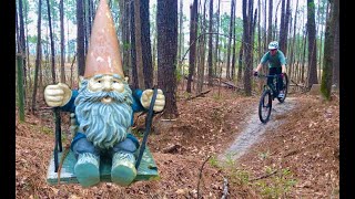
trail: Intermediate Loop TH - #1
4:44 |
2173 |
Mar 31, 2021 , Wilmington
20:15 |
244 |
Mar 13, 2024
Recent Trail Reports
Activity Feed
| username | action | type | title | date |
|---|---|---|---|---|
| Reedreynolds10 | add | report | activity #96713059 and 6 more | Jun 10, 2026 @ 7:24pm Jun 10, 2026 |
| jpivi | add | report | activity #95005270 | May 18, 2026 @ 3:48pm May 18, 2026 |
| ncsaltwater | add | report | activity #94839466 and 3 more | May 16, 2026 @ 11:57am May 16, 2026 |
| ncsaltwater | add | report | activity #91322807 and 6 more | Mar 26, 2026 @ 8:40am Mar 26, 2026 |
| ncsaltwater | add | report | activity #90139592 and 2 more | Mar 7, 2026 @ 10:53am Mar 7, 2026 |
Recent Comments
| username | type | title | comment | date |
|---|---|---|---|---|
| trail | Rode the whole trail system today from end to... | Jul 29, 2019 @ 6:08am Jul 29, 2019 |
Local Badges
-

Epic Ride Climb 2k0 awarded -

Climbing 10k Badge12 awarded -

Climbing 100k Badge0 awarded -

Epic Ride Descent 2k0 awarded -

Descent 10k Badge12 awarded -

Descent 100k Badge0 awarded
Activity Type Stats
| activitytype | trails | distance | descent | descent distance | total vertical | rating | global rank | state rank | photos | reports | routes | ridelogs |
|---|---|---|---|---|---|---|---|---|---|---|---|---|
| Mountain Bike | 33 | 33 miles | 502 ft | 8 miles | 56 ft | #5,153 | #1,738 | 3 | 221 | 1 | 11,631 | |
| E-Bike | 8 | 21 miles | 171 ft | 5 miles | 56 ft | #5,438 | #1,689 | 194 | 509 | |||
| Hike | 34 | 33 miles | 502 ft | 8 miles | 56 ft | #5,865 | #2,057 | 3 | 221 | 255 | ||
| Trail Running | 33 | 33 miles | 502 ft | 8 miles | 56 ft | #5,759 | #1,835 | 221 | 409 |
Frequently Asked Questions About Wilmington
▼
What are the best places to ride in Wilmington?
Wilmington has 5 areas to explore for mountain biking. The top rated areas are:
▼
What are the highest rated mountain biking trails in Wilmington?
The highest rated mountain biking trails in Wilmington are:
- Intermediate Loop TH - #1 (4.1/5)
- Intermediate Loop Alternate (4.1/5)
- Beginner Loop (4/5)
- Intermediate Loop #2 - #3 (4/5)
- Intermediate Loop #1 - #2 (4/5)
▼
What is the best time of the year to ride in Wilmington?
Based on ride log data, the most popular months to ride in Wilmington are:
- July (79 activities)
- April (35 activities)
- May (28 activities)
▼
Where can I park to ride in Wilmington?
There are 4 parking locations listed in Wilmington. The most popular parking spots are: View all parking and trailhead locations on the map to plan your visit.
Activities
Trails
Points of Interest
- By brenthillier
 NSMBA TRAILFORKS & contributors
 - Admins: apply
- #3773 - 13,620 views
- wilmington activity log | embed map of Wilmington mountain bike trails | wilmington mountain biking points of interest
Downloading of trail gps tracks in kml & gpx formats is enabled for Wilmington.
You must login to download files.