close
-
Layers w
- Weather Layers
- Pro
- Pro
- Pro
- Pro
- Pro
- Pro
- More Layers
- Pro
- Pro
- Pro
- Pro
-
Upgrade to

3D
Trail Conditions
- Unknown
- Snow Groomed
- Snow Packed
- Snow Covered
- Snow Cover Partial
- Freeze/thaw Cycle
- Icy
- Prevalent Mud
- Wet
- Variable
- Ideal
- Dry
- Very Dry
Trail Flow (Ridden Direction)
Trailforks scans users ridelogs to determine the most popular direction each trail is ridden. A good flowing trail network will have most trails flowing in a single direction according to their intension.
The colour categories are based on what percentage of riders are riding a trail in its intended direction.
The colour categories are based on what percentage of riders are riding a trail in its intended direction.
- > 96%
- > 90%
- > 80%
- > 70%
- > 50%
- < 50%
- bi-directional trail
- no data
Trail Last Ridden
Trailforks scans ridelogs to determine the last time a trail was ridden.
- < 2 days
- < 1 week
- < 2 weeks
- < 1 month
- < 6 months
- > 6 months
Trail Ridden Direction
The intended direction a trail should be ridden.
- Downhill Only
- Downhill Primary
- Both Directions
- Uphill Primary
- Uphill Only
- One Direction
Contribute Details
Colors indicate trail is missing specified detail.
- Description
- Photos
- Description & Photos
- Videos
Trail Popularity ?
Trailforks scans ridelogs to determine which trails are ridden the most in the last 9 months.
Trails are compared with nearby trails in the same city region with a possible 25 colour shades.
Think of this as a heatmap, more rides = more kinetic energy = warmer colors.
- most popular
- popular
- less popular
- not popular
ATV/ORV/OHV Filter
Max Vehicle Width
inches
US Cell Coverage
Legend

Radar Time
Activity Recordings
Trailforks uses anonymized public activity data.
?
Activity Recordings
Trailforks uses anonymized public activity data.
?
Personal Heatmap
▶
Activity Types
all
/
none
▶
Options
2
Date range
month
–
Winter Trails
Warning
A routing network for winter maps does not exist. Selecting trails using the winter trails layer has been disabled.
Missing Trails
Most Popular
Least Popular
Trails are colored based on popularity. The more popular a trail is, the more red. Less popular trails trend towards green.
Jump Magnitude Heatmap
Heatmap of where riders jump on trails. Zoom in to see individual jumps, click circles to view jump details.
BC Backroad Status
![map legend]()
Service Road Atlas is a free to use, community-driven service for viewing and creating reports on the numerous back-country service roads around B.C. and Alberta.

Slope Aspect
Direction the slope faces
Trails Deemphasized
Trails are shown in grey.
Only show trails with no bike usage.
Suggested Layers
Based on selected activity type
Save the current map location and zoom level as your default home location whenever this page is loaded.
Save
No description for Winchester has been added yet!
Login or register to submit one.
Activities Click to view
- Mountain Bike
231 trails
- Gravel Bike
0 trails
- Adaptive Bike
0 trails
- Winter Fat Bike
0 trails
- Hike
269 trails
- Trail Running
268 trails
- Snowshoe
23 trails
Region Details
- 89
- 3
- 35
- 89
- 14
Region Status
Open as of Apr 8, 2026Stats
- Avg Trail Rating
- Trails (view details)
- 269
- Trails Mountain Bike
- 231
- Trails E-Bike
- 1
- Trails Horse
- 3
- Trails Hike
- 269
- Trails Trail Running
- 268
- Trails Snowshoe
- 23
- Trails Backcountry Ski
- 1
- Trails Nordic Ski
- 1
- Total Distance
- 76 miles
- Total Descent
- 8,606 ft
- Total Vertical
- 328 ft
- Highest Trailhead
- 367 ft
- Reports
- 2,071
- Photos
- 113
- Ridden Counter
- 93,574
Sub Regions
-
Fells
-
Middlesex Fells Reservation
- 3
- 26
- 75
- 9
-
Whipple Hill
- 6
- 14
- 5
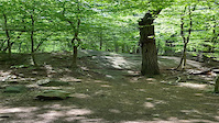
Popular Winchester Mountain Biking Trails
• 95 ★ 0.0 • 4,006 ft • 82 ft • 2,981 •
Popular blue difficulty mixed. This multi-use trail can be used both directions and has a moderate overall physical rating with a 82 ft black diamond climb. Trail visibility is always easy to follow. On average it takes 7 minutes to complete this trail.
• 100 ★ 4.0 • 797 ft • 36 ft • 1,511 •
Popular blue difficulty singletrack. This multi-use trail can be used both directions and has a moderate overall physical rating with a 36 ft blue climb. Trail visibility is always easy to follow. On average it takes 1 minutes to complete this trail.
• 100 ★ 5.0 • 3,150 ft • 100 ft • 1,298 •
This section of trail is shared by the Skyline Trail, the as well as the Green Mountain bike Trail. Please be careful and give right of way to all pedestrians.
• 100 ★ 5.0 • 1,962 ft • 20 ft • 1,269 •
Popular blue difficulty singletrack. This multi-use trail can be used both directions and has a moderate overall physical rating with a 20 ft blue climb. Trail visibility is always easy to follow. On average it takes 3 minutes to complete this trail.
• 100 ★ 4.4 • 4,846 ft • 49 ft • 1,130 •
Section exits Sheepfold near Sheepfold parking area then follows Chandler Rd for a brief piece before heading left (south) off Chandler Rd. Good ups and downs with some steep technical bony sections. Meets at and S. Dam Rd. intersection.
• 95 ★ 4.0 • 1 mile • 128 ft • 1,115 •
Many technical sections along this part of , a lot of small rock as well as rock face rollers. This is where you will find Orange Steps Rock Garden
• 95 ★ 4.0 • 322 ft • 0 ft • 1,041 •
Popular blue difficulty singletrack. This multi-use trail can be used both directions and has a moderate overall physical rating with a 0 ft green climb. It features bridge. On average it takes minutes to complete this trail.
• 95 ★ 5.0 • 4,131 ft • 100 ft • 1,010 •
Great section of (orange trail on DCR map). Starts at N. Border Rd., near Fallon Rd parking area. Loose gravel climb up , then flattens out. Drops right before trail hits Rd (main trail down from water tower) for good flowy downhill...
Winchester Mountain Bike Routes
★ 3.9 • 6 miles • 445 ft • 21 • Loop •
This route starts from the Bear Hill Parking Area at 100 Fallon Rd, Stoneham, MA (off exit 35 Route 93)....
★ 5.0 • 9 miles • 601 ft • 18 •
Greater Boston chapter of New England Mountain Biking Association route for our Fells season opener event....
★ 4.0 • 7 miles • 524 ft • 36 • Loop •
The Green Mountain Bike Route (Green Blazes) is a relatively easy 6.4 mile loop around the North, Middle...
★ 1.0 • 11 miles • 770 ft • 22 • Loop •
Greater Boston chapter of New England Mountain Biking Association route for our Fells season opener event....
★ 4.0 • 9 miles • 649 ft • 53 •
2019 Fells MBAS event white arrowed course, organized by GBNEMBA
5 miles • 202 ft • 7 •
Greater Boston chapter of New England Mountain Biking Association route for our Fells season opener event....
Photos of Winchester Mountain Bike
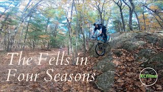
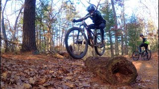
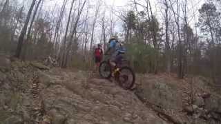
Videos of Winchester Mountain Bike

trail: Fallon To Hillcrest Road
0:11 |
253 |
May 26, 2021
trail: Fallon To Hillcrest Road
0:12 |
|
May 26, 2021
18:57 |
69 |
Jul 3, 2025
youtuber
![Singlespeeding The Fells with Sousa - The...]()
11:25 |
670 |
Feb 13, 2020
youtuber
![Kona Bicycles MTB Adventure Series at the...]()

2:04 |
428 |
Sep 7, 2019
youtuber
![NEMBA Wednesday Fells Ride]()
2:04 |
567 |
Sep 7, 2019

4:37 |
935 |
Aug 28, 2018
Recent Trail Reports
Activity Feed
| username | action | type | title | date |
|---|---|---|---|---|
| KfyZZ7 | wishlist | region | activity #97632253 | Jun 23, 2026 @ 9:21am 1 day |
| JakeHonig7 | wishlist | route | activity #96934315 and 1 more | Jun 13, 2026 @ 7:25pm Jun 13, 2026 |
| BXIzDT | wishlist | route | activity #96772980 | Jun 11, 2026 @ 5:43pm Jun 11, 2026 |
| SteveCC5Hju | wishlist | trail | activity #96754624 | Jun 11, 2026 @ 12:15pm Jun 11, 2026 |
| jjkato | checkin | route | activity #96453934 | Jun 7, 2026 @ 6:26am Jun 7, 2026 |
Recent Comments
| username | type | title | comment | date |
|---|---|---|---|---|
| trail | Per DCR, isn’t no mountain biking allowed... | May 28, 2026 @ 12:22pm May 28, 2026 | ||
| trail | Looped clockwise so fun! Finally completed... | Sep 2, 2025 @ 1:41pm Sep 2, 2025 | ||
| trail | Sketchy enterance off the street but levels out | Mar 16, 2025 @ 3:02pm Mar 16, 2025 | ||
| trail | Chunky downhill from the east or technical... | Mar 8, 2024 @ 12:30pm Mar 8, 2024 | ||
| trail | Fun rock roll down red to green (NE->SW) | Mar 8, 2024 @ 12:24pm Mar 8, 2024 |
Local Badges
-

10 Green Trails394 awarded -

10 Blue Trails1,023 awarded -

Epic Ride Climb 2k5 awarded -

Climbing 10k Badge169 awarded -

Climbing 100k Badge6 awarded -

Epic Ride Descent 2k4 awarded
Activity Type Stats
| activitytype | trails | distance | descent | descent distance | total vertical | rating | global rank | state rank | photos | reports | routes | ridelogs |
|---|---|---|---|---|---|---|---|---|---|---|---|---|
| Mountain Bike | 231 | 68 miles | 7,001 ft | 27 miles | 328 ft | #223 | #83 | 110 | 2,071 | 9 | 49,273 | |
| E-Bike | 1 | 974 ft | 3 ft | 315 ft | 3 ft | 1,682 | 215 | |||||
| Horse | 3 | 2 miles | 177 ft | 4,075 ft | 105 ft | 690 | 3 | |||||
| Hike | 269 | 76 miles | 8,589 ft | 30 miles | 328 ft | #1,295 | #594 | 3 | 2,071 | 2 | 2,773 | |
| Trail Running | 268 | 76 miles | 8,570 ft | 30 miles | 328 ft | #893 | #336 | 2,071 | 2 | 3,773 | ||
| Snowshoe | 23 | 4 miles | 364 ft | 2 miles | 249 ft | #1,070 | #541 | 10 | 1 | 28 | ||
| Backcountry Ski | 1 | 974 ft | 3 ft | 315 ft | 3 ft | 22 | ||||||
| Nordic Ski | 1 | 974 ft | 3 ft | 315 ft | 3 ft | 76 |
Frequently Asked Questions About Winchester
▼
What are the best places to ride in Winchester?
Winchester has 3 areas to explore for mountain biking. The top rated areas are:
▼
What are the highest rated mountain biking trails in Winchester?
The highest rated mountain biking trails in Winchester are:
- Reservoir Trail Money Hill section (4.3/5)
- Whipped Climb (4.2/5)
- Main Shared Trail (4.1/5)
- Reservoir Trail (Dike Road to Sheepfold) (4.1/5)
- Bear Hill DH 2 (4.1/5)
▼
What is the best time of the year to ride in Winchester?
Based on ride log data, the most popular months to ride in Winchester are:
- July (918 activities)
- August (726 activities)
- June (724 activities)
▼
Where can I park to ride in Winchester?
There are 9 parking locations listed in Winchester. The most popular parking spots are:
- Parking
- Bear Hill Parking lot (100 Fallon Rd, Stoneham, MA, off Exit 35 Rt. 93)
- Parking lot on S.Border Rd., near S. Dam Rd.,
- Lynn Woods - Jeep Kelly Parking
- Whipple Hill Parking Lot
Activities
Trails
- By peloquin & contributors
- Admins: GB NEMBA, BCT
- #5535 - 5,592 views
- winchester activity log | embed map of Winchester mountain bike trails | winchester mountain biking points of interest polygons
Downloading of trail gps tracks in kml & gpx formats is enabled for Winchester.
You must login to download files.