close
-
Layers w
- Weather Layers
- Pro
- Pro
- Pro
- Pro
- Pro
- Pro
- More Layers
- Pro
- Pro
- Pro
- Pro
-
Upgrade to

3D
Trail Conditions
- Unknown
- Snow Groomed
- Snow Packed
- Snow Covered
- Snow Cover Partial
- Freeze/thaw Cycle
- Icy
- Prevalent Mud
- Wet
- Variable
- Ideal
- Dry
- Very Dry
Trail Flow (Ridden Direction)
Trailforks scans users ridelogs to determine the most popular direction each trail is ridden. A good flowing trail network will have most trails flowing in a single direction according to their intension.
The colour categories are based on what percentage of riders are riding a trail in its intended direction.
The colour categories are based on what percentage of riders are riding a trail in its intended direction.
- > 96%
- > 90%
- > 80%
- > 70%
- > 50%
- < 50%
- bi-directional trail
- no data
Trail Last Ridden
Trailforks scans ridelogs to determine the last time a trail was ridden.
- < 2 days
- < 1 week
- < 2 weeks
- < 1 month
- < 6 months
- > 6 months
Trail Ridden Direction
The intended direction a trail should be ridden.
- Downhill Only
- Downhill Primary
- Both Directions
- Uphill Primary
- Uphill Only
- One Direction
Contribute Details
Colors indicate trail is missing specified detail.
- Description
- Photos
- Description & Photos
- Videos
Trail Popularity ?
Trailforks scans ridelogs to determine which trails are ridden the most in the last 9 months.
Trails are compared with nearby trails in the same city region with a possible 25 colour shades.
Think of this as a heatmap, more rides = more kinetic energy = warmer colors.
- most popular
- popular
- less popular
- not popular
ATV/ORV/OHV Filter
Max Vehicle Width
inches
US Cell Coverage
Legend

Radar Time
Activity Recordings
Trailforks uses anonymized public activity data.
?
Activity Recordings
Trailforks uses anonymized public activity data.
?
Personal Heatmap
▶
Activity Types
all
/
none
▶
Options
2
Date range
month
–
Winter Trails
Warning
A routing network for winter maps does not exist. Selecting trails using the winter trails layer has been disabled.
Missing Trails
Most Popular
Least Popular
Trails are colored based on popularity. The more popular a trail is, the more red. Less popular trails trend towards green.
Jump Magnitude Heatmap
Heatmap of where riders jump on trails. Zoom in to see individual jumps, click circles to view jump details.
BC Backroad Status
![map legend]()
Service Road Atlas is a free to use, community-driven service for viewing and creating reports on the numerous back-country service roads around B.C. and Alberta.

Slope Aspect
Direction the slope faces
Trails Deemphasized
Trails are shown in grey.
Only show trails with no bike usage.
Suggested Layers
Based on selected activity type
Save the current map location and zoom level as your default home location whenever this page is loaded.
SavePopular Trail Networks
view all areas »
No description for Windham County has been added yet!
Login or register to submit one.
Links
Stats
- Avg Trail Rating
- Trails (view details)
- 733
- Trails Mountain Bike
- 290
- Trails E-Bike
- 66
- Trails Hike
- 268
- Trails Trail Running
- 262
- Trails Dirtbike/Moto
- 1
- Trails ATV/ORV/OHV
- 1
- Trails Snowmobile
- 23
- Trails Snowshoe
- 185
- Trails Downhill Ski
- 363
- Trails Backcountry Ski
- 13
- Trails Nordic Ski
- 85
- Total Distance
- 391 miles
- Total Descent
- 140,702 ft
- Total Vertical
- 3,716 ft
- Highest Trailhead
- 3,940 ft
- Reports
- 1,118
- Photos
- 311
- Ridden Counter
- 55,106
Sub Regions
- Brattleboro (32)
- Retreat Farm (29)
- brookline (1)
- Dover (42)
- Crosstown Trail Network (20)
- Horace Hill (8)
- Mount Snow (12)
- Grafton (82)
- Jamaica (6)
- Londonderry (34)
- Marlboro (17)
- Newfane (0)
- Putney (1)
- Rockingham (20)
- Stratton (23)
- Townshend (0)
- Westminster (22)
- Wilmington (10)
- TVES Trails (5)
- Windham (1)
- Windham Trails (1)
- West River Trail (3)
Popular Windham County Mountain Biking Trails
• 80 ★ 5.0 • 1,598 ft • 0 ft • 378 •
Popular blue difficulty singletrack. This mountain bike primary trail can be used downhill only and has a moderate overall physical rating. Trail visibility is always easy to follow. On average it takes 1 minutes to complete this trail.
• 95 ★ 4.2 • 1 mile • 0 ft • 376 •
Highly rated popular blue difficulty singletrack. This mountain bike primary trail can be used downhill only. On average it takes 5 minutes to complete this trail.
• 65 ★ 4.0 • 1,004 ft • 0 ft • 353 •
Moderately popular green difficulty singletrack. This mountain bike primary trail can be used downhill only and has a easy overall physical rating. Trail visibility is always easy to follow. On average it takes minutes to complete this trail.
• 60 ★ 4.4 • 1,965 ft • 0 ft • 330 •
Moderately popular blue difficulty singletrack. This mountain bike primary trail can be used downhill only and has a moderate overall physical rating. Trail visibility is always easy to follow. On average it takes 2 minutes to complete this trail.
• 75 ★ 4.8 • 2,680 ft • 0 ft • 321 •
Mostly flowy with some light tech thrown in, this is a fan favorite.
• 90 ★ 5.0 • 955 ft • 0 ft • 290 •
Entry level mini terrain park with berms, mini-rock garden, and rollers serviced by a carpet lift.
• 45 ★ 3.5 • 3,077 ft • 0 ft • 280 •
Moderately popular green difficulty singletrack. This mountain bike primary trail can be used downhill only and has a easy overall physical rating. Trail visibility is always easy to follow. On average it takes 1 minutes to complete this trail.
Windham County Mountain Bike Routes
2 miles • 230 ft • 3 • Loop •
A great route for a quick lap that includes some of the best downhill sections of trail in the northern...
5 miles • 408 ft • 4 • Loop •
The original airport loop starting from Country Club Road. Alternative loops include > Sherwood Wetland...
8 miles • 782 ft • 35 • Loop •
Hitting as much of the stuff as possible in one loop without too much doubling up
15 miles • 1,383 ft • 0 • Loop •
West Hill Bike shop tamer loop modified for extra couple miles.
★ 1.0 • 7 miles • 1,290 ft • 7 • Loop •
Mount Snow's XC Trails - base loop first, then the south loop.
5 miles • 441 ft • 0 • Loop •
Easy ride good for all levels of riders. A good route for those looking to get into mountain biking. We...
Photos of Windham County Mountain Bike
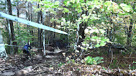
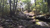
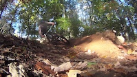
Videos of Windham County Mountain Bike

trail: Mount Snow
3:37 |
764 |
Oct 16, 2018
trail: Mount Snow
0:26 |
681 |
Oct 15, 2018

trail: Mount Snow
3:26 |
1637 |
Oct 17, 2017

trail: Mount Snow
3:12 |
963 |
Jul 11, 2016
trail: Arcadia
0:28 |
208 |
Oct 2, 2015

trail: Mount Snow
5:33 |
92 |
Aug 7, 2015
trail: Just For Fun
0:28 |
546 |
Oct 5, 2014

trail: Mount Snow
2:53 |
226 |
Aug 6, 2014
Current Trail Warnings
| status | trail | date | condition | user | info |
|---|---|---|---|---|---|
| Sherwood Forest: Wetland Gap Crosstown Trail Network | Jun 19, 2026 @ 9:22am (America/New_York) 1 day | Unknown | Mudseason |
Recent Trail Reports
Activity Feed
| username | action | type | title | date |
|---|---|---|---|---|
| Mudseason | add | report | activity #97312196 | Jun 19, 2026 @ 6:22am 1 day |
| pigpenms | add | report | activity #96688880 | Jun 10, 2026 @ 12:10pm Jun 10, 2026 |
| mappermook | add | report | activity #96424211 and 9 more | Jun 6, 2026 @ 7:14pm Jun 6, 2026 |
| mappermook | add | report | activity #96334164 and 1 more | Jun 5, 2026 @ 6:00pm Jun 5, 2026 |
| update | event | activity #96223763 | Jun 4, 2026 @ 6:51am Jun 4, 2026 |
Recent Comments
| username | type | title | comment | date |
|---|---|---|---|---|
| report | Clear | Jun 25, 2025 @ 1:47pm Jun 25, 2025 | ||
| report | Clear | Jun 25, 2025 @ 1:47pm Jun 25, 2025 | ||
| trail | There are actually quite a few unmarked single... | Aug 3, 2024 @ 2:37pm Aug 3, 2024 | ||
| trail | Flowy downhill, well designed | Jul 5, 2024 @ 6:00am Jul 5, 2024 | ||
| trail | This is the service road. A bit of a slog to... | Jun 6, 2024 @ 1:46pm Jun 6, 2024 |
Local Badges
-

Epic Ride 50k40 awarded -

Descent 100k Badge0 awarded -
Descent 100k Badge1 awarded -

Big Ride 30k80 awarded -
Big Ride 30k80 awarded -

Completionist0 awarded
Bike & Skill Parks
| name | type | city | rating |
|---|---|---|---|
| Mount Snow | bike park | Dover | |
| Stratton Mountain Resort Bike Park | bike park | Stratton | |
| Magic Mountain Ski Area | bike park | Londonderry | |
| Stratton Mountain Resort | bike park | Stratton | |
| Mount Snow Ski Resort | bike park | Dover |
Upcoming Local Events
-
-
-
-
Local Trail Supporters
![]()
- Hoot, Toot, and Whistle Bike Club
Local Trail Supporters
![]()
- Hoot, Toot, and Whistle Bike Club
Activity Type Stats
| activitytype | trails | distance | descent | descent distance | total vertical | rating | global rank | state rank | photos | reports | routes | ridelogs |
|---|---|---|---|---|---|---|---|---|---|---|---|---|
| Mountain Bike | 290 | 211 miles | 27,648 ft | 72 miles | 3,343 ft | 293 | 1,000 | 7 | 14,136 | |||
| E-Bike | 66 | 41 miles | 6,831 ft | 19 miles | 2,398 ft | 1 | 842 | 4 | 362 | |||
| Hike | 268 | 222 miles | 23,510 ft | 66 miles | 3,717 ft | 3 | 870 | 4 | 2,414 | |||
| Trail Running | 262 | 214 miles | 22,100 ft | 62 miles | 3,717 ft | 862 | 4 | 391 | ||||
| Dirtbike/Moto | 1 | 4,567 ft | 161 ft | 3,425 ft | 154 ft | 122 | 7 | |||||
| ATV/ORV/OHV | 1 | 4,567 ft | 161 ft | 3,425 ft | 154 ft | 122 | 2 | |||||
| Snowmobile | 23 | 17 miles | 2,484 ft | 8 miles | 1,047 ft | 185 | 4 | |||||
| Snowshoe | 185 | 132 miles | 9,816 ft | 31 miles | 3,717 ft | 3 | 243 | 1 | 210 | |||
| Downhill Ski | 363 | 118 miles | 105,098 ft | 112 miles | 2,454 ft | 1 | 123 | 9,483 | ||||
| Backcountry Ski | 13 | 6 miles | 1,145 ft | 2 miles | 938 ft | 122 | 2,138 | |||||
| Nordic Ski | 85 | 43 miles | 4,665 ft | 18 miles | 2,178 ft | 3 | 172 | 1 | 1,037 |
Activities
- Windham County Mountain Biking Trails
- Windham County E-Biking Trails
- Windham County Hiking Trails
- Windham County Trail Running Trails
- Windham County Snowmobiling Trails
- Windham County Snowshoeing Trails
- Windham County Skiing Trails
- Windham County Backcountry Skiing Trails
- Windham County Nordic Skiing Trails
Trails
Points of Interest
- Horace Hill Summit
- Mt Olga Lookout Tower Viewpoint
- Hogsback Mountain Summit
- Mount Olga Summit
- Haystack Mountain Summit
- Hamilton Falls Sight
- Jamaica State Park Campground Camping
- Ski Patrol Hut Cabin
- Bald Mountain Summit
- Black Mountain Summit
- Mount Snow (3,583 ft)
- Haystack Mountain (3,425 ft)
- Glebe Mountain (2,923 ft)
- By WillieJacobsz
 Trailforks SBP SWW & contributors
 - Admins: VMBA, Velomont, Jwduston, WCoTA, NATSVMBA
- #31240 - 3,730 views
- windham county activity log | embed map of Windham County mountain bike trails | windham county mountain biking points of interest polygons
Downloading of trail gps tracks in kml & gpx formats is enabled for Windham County.
You must login to download files.