close
-
Layers w
- Weather Layers
- Pro
- Pro
- Pro
- Pro
- Pro
- Pro
- More Layers
- Pro
- Pro
- Pro
- Pro
-
Upgrade to

3D
Trail Conditions
- Unknown
- Snow Groomed
- Snow Packed
- Snow Covered
- Snow Cover Partial
- Freeze/thaw Cycle
- Icy
- Prevalent Mud
- Wet
- Variable
- Ideal
- Dry
- Very Dry
Trail Flow (Ridden Direction)
Trailforks scans users ridelogs to determine the most popular direction each trail is ridden. A good flowing trail network will have most trails flowing in a single direction according to their intension.
The colour categories are based on what percentage of riders are riding a trail in its intended direction.
The colour categories are based on what percentage of riders are riding a trail in its intended direction.
- > 96%
- > 90%
- > 80%
- > 70%
- > 50%
- < 50%
- bi-directional trail
- no data
Trail Last Ridden
Trailforks scans ridelogs to determine the last time a trail was ridden.
- < 2 days
- < 1 week
- < 2 weeks
- < 1 month
- < 6 months
- > 6 months
Trail Ridden Direction
The intended direction a trail should be ridden.
- Downhill Only
- Downhill Primary
- Both Directions
- Uphill Primary
- Uphill Only
- One Direction
Contribute Details
Colors indicate trail is missing specified detail.
- Description
- Photos
- Description & Photos
- Videos
Trail Popularity ?
Trailforks scans ridelogs to determine which trails are ridden the most in the last 9 months.
Trails are compared with nearby trails in the same city region with a possible 25 colour shades.
Think of this as a heatmap, more rides = more kinetic energy = warmer colors.
- most popular
- popular
- less popular
- not popular
ATV/ORV/OHV Filter
Max Vehicle Width
inches
US Cell Coverage
Legend

Radar Time
Activity Recordings
Trailforks uses anonymized public activity data.
?
Activity Recordings
Trailforks uses anonymized public activity data.
?
Personal Heatmap
▶
Activity Types
all
/
none
▶
Options
2
Date range
month
–
Winter Trails
Warning
A routing network for winter maps does not exist. Selecting trails using the winter trails layer has been disabled.
Missing Trails
Most Popular
Least Popular
Trails are colored based on popularity. The more popular a trail is, the more red. Less popular trails trend towards green.
Jump Magnitude Heatmap
Heatmap of where riders jump on trails. Zoom in to see individual jumps, click circles to view jump details.
BC Backroad Status
![map legend]()
Service Road Atlas is a free to use, community-driven service for viewing and creating reports on the numerous back-country service roads around B.C. and Alberta.

Slope Aspect
Direction the slope faces
Trails Deemphasized
Trails are shown in grey.
Only show trails with no bike usage.
Suggested Layers
Based on selected activity type
Save the current map location and zoom level as your default home location whenever this page is loaded.
SaveActivities Click to view
- Mountain Bike
219 trails
- E-Bike
138 trails
- Gravel Bike
0 trails
- Adaptive Bike
0 trails
- Winter Fat Bike
0 trails
- Horse
16 trails
- Hike
226 trails
- Trail Running
225 trails
- Snowshoe
46 trails
- Downhill Ski
0 trails
- Nordic Ski
148 trails
Region Details
- 48
- 53
- 77
- 32
- 8
- 1
Region Status
Open as of Jun 9, 2026Local Trail Association
Stats
- Avg Trail Rating
- Trails (view details)
- 341
- Trails Mountain Bike
- 219
- Trails E-Bike
- 138
- Trails Horse
- 16
- Trails Hike
- 226
- Trails Trail Running
- 225
- Trails Snowmobile
- 1
- Trails Snowshoe
- 46
- Trails Nordic Ski
- 148
- Total Distance
- 303 miles
- Total Descent
- 2,917 ft
- Total Vertical
- 159 ft
- Highest Trailhead
- 892 ft
- Reports
- 2,691
- Photos
- 615
- Ridden Counter
- 24,450
Sub Regions
-
Assiniboine Forest
- 14
-
Assiniboine Park
- 10
- 5
-
Birds Hill Provincial Park
- 2
- 4
- 1
- 2
-
Bison Butte Recreational Trails
- 6
- 10
- 3
-
Bourkevale Community Centre
-
Capasso Pump Track in Sage Creek
- 1
- 1
-
Kildonan Park
- 1
-
Kings Park
- 1
-
La Barriere Park
- 4
-
Lagimodière-Gaboury Park
-
Oak Ridge
- 2
- 4
- 1
- 1
-
Riverview / Churchill Drive Parkway
- 1
-
St Norbert Community Centre
-
St. Norbert Heritage Trails
- 1
-
St. Norbert Provincial Heritage Park
- 1
-
Transcona Community Bioreserve
- 1
- 2
-
University of Manitoba
- 2
-
WestView Park
- 1
- 4
- 2
-
Winnipeg - Central
- 14
- 13
-
Winnipeg - NorthEast
- 2
- 2
-
Winnipeg - Northwest
- 4
- 2
-
Winnipeg - Southeast
- 3
- 10
- 4
-
Winnipeg - Southwest
- 12
- 4
-
Winnipeg River Trails
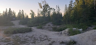
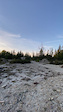
Popular Winnipeg Mountain Biking Trails
• 100 ★ 4.0 • 3 miles • 41 ft • 477 •
7 km loop. Dedicated mountain bike trail in the South West section of Birds Hill Provincial Park. Single track. Very minor elevation changes. Many sections are built on deer trails and have extremely tight corners and very narrow...
• 100 ★ 4.5 • 1,191 ft • 0 ft • 421 •
Wide and smooth switch back climb. Turns get tighter and steeper as you climb. Takes you to the top of the hill where you have many descent choices from easy to an advanced mandatory drop.
• 100 ★ 3.7 • 1,073 ft • 0 ft • 421 •
Nice flowy bermed descent with table tops between some berms. Final rocky drop before finishing with three large table tops. Ride around option for rocky drop. Three new large jumps under construction.
• 100 ★ 3.4 • 1,873 ft • 9 ft • 399 •
Rooty descent, mildly downhill, mildly rooty climb back to the main loop. Similar to , but no run-up.
• 100 ★ 4.0 • 2,146 ft • 0 ft • 377 •
Starts with big S turn berms, singletrack to a steep rock roll down, rock garden, then singletrack finish with mild climb. Ride around option for roll down. " " is also a classic Manitoba MTB race near Morden MB, with the sweetest...
• 95 ★ 3.7 • 3,714 ft • 8 ft • 350 •
Start with a long grassy run-up, and then a couple sections of rooty rattlers slightly downhill combined with small switchback mildly rooty climbs. Important to note that theres a section halfway through where you can skip a small...
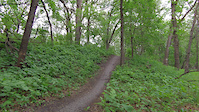
• 90 ★ 4.3 • 1,309 ft • 0 ft • 336 •
Short descent with berms, continuing through forested single track, finishing with a very technical rocky climb that will challenge your skill, and your lungs!
Winnipeg Mountain Bike Routes
★ 5.0 • 2 miles • 28 ft • 7 •
Hike or ride around the historic Forks and St. Boniface areas
4,659 ft • 3 ft • 1 • Out & Back •
Walk from The Forks west along the Assiniboine River towards the Legislative Building. Be aware the often...
18 miles • 204 ft • 12 • Loop •
Starting at the Forks, head to via the . After riding the Greenway head to the and then the . Down Scotia...
2 miles • 28 ft • 7 •
Hike or ride around the historic Forks and St. Boniface areas
18 miles • 28 ft • 8 •
This route shows the summer route for Southern Comfort and Amisk. Along the river between the two trails...
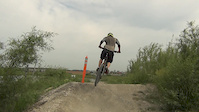
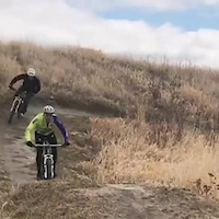
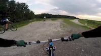
Photos of Winnipeg Mountain Bike
Videos of Winnipeg Mountain Bike
trail: Nimowin Self-guiding Trail
0:10 |
79 |
Aug 3, 2023
trail: Wrath of Man
0:28 |
|
Apr 8, 2022
trail: Nimowin Self-guiding Trail
0:12 |
141 |
Oct 8, 2021
0:32 |
184 |
Jun 25, 2021
trail: Happy Ending
0:47 |
550 |
Jan 23, 2020

trail: Wayne's World
0:10 |
534 |
May 14, 2018
trail: Goose it
0:10 |
628 |
Apr 28, 2018
trail: Cris's Corner
0:41 |
618 |
Apr 28, 2018
Recent Trail Reports
Activity Feed
| username | action | type | title | date |
|---|---|---|---|---|
| gmclaren6 | comment | trail | activity #96777384 | Jun 11, 2026 @ 6:58pm Jun 11, 2026 |
| kevbikemad | add | report | activity #96622610 | Jun 9, 2026 @ 12:18pm Jun 9, 2026 |
| kevbikemad | add | report | activity #96622609 | Jun 9, 2026 @ 12:18pm Jun 9, 2026 |
| azim3136 | add | report | activity #96500841 and 1 more | Jun 7, 2026 @ 3:09pm Jun 7, 2026 |
| azim3136 | add | report | activity #95986521 and 1 more | May 31, 2026 @ 4:30pm May 31, 2026 |
Recent Comments
| username | type | title | comment | date |
|---|---|---|---|---|
| trail | Trail under construction till further notice | Jun 11, 2026 @ 6:58pm Jun 11, 2026 | ||
| trail | Gravel bike too | May 9, 2026 @ 6:37am May 9, 2026 | ||
| report | Groomed and firm | Mar 16, 2026 @ 5:15pm Mar 16, 2026 | ||
| trail | Awesome conditions today, snow is firm. | Mar 14, 2026 @ 1:01pm Mar 14, 2026 | ||
| report | Trail groomed March 13 and in good winter... | Mar 13, 2026 @ 4:50pm Mar 13, 2026 |
Local Badges
-

10 Green Trails204 awarded -

10 Blue Trails238 awarded -

Epic Ride Climb 2k4 awarded -

Climbing 10k Badge39 awarded -

Climbing 100k Badge0 awarded -

Epic Ride Descent 2k5 awarded
Activity Type Stats
| activitytype | trails | distance | descent | descent distance | total vertical | rating | global rank | state rank | photos | reports | routes | ridelogs |
|---|---|---|---|---|---|---|---|---|---|---|---|---|
| Mountain Bike | 219 | 177 miles | 1,621 ft | 29 miles | 161 ft | #430 | #1 | 381 | 2,108 | 16 | 66,524 | |
| E-Bike | 138 | 124 miles | 512 ft | 20 miles | 161 ft | #1,007 | #5 | 1 | 1,731 | 8 | 470 | |
| Horse | 16 | 34 miles | 620 ft | 13 miles | 131 ft | #863 | #2 | 3 | 353 | 1 | 8 | |
| Hike | 226 | 211 miles | 2,375 ft | 43 miles | 161 ft | #594 | #1 | 181 | 2,025 | 7 | 2,135 | |
| Trail Running | 225 | 206 miles | 2,313 ft | 43 miles | 161 ft | #464 | #1 | 2,025 | 7 | 5,384 | ||
| Snowmobile | 1 | 8 miles | 115 ft | 2 miles | 121 ft | #2 | 82 | 1 | 2 | |||
| Snowshoe | 46 | 33 miles | 338 ft | 5 miles | 157 ft | #383 | #3 | 182 | 3 | 187 | ||
| Nordic Ski | 148 | 118 miles | 741 ft | 16 miles | 161 ft | #43 | #1 | 32 | 690 | 3 | 2,302 |
Frequently Asked Questions About Winnipeg
▼
What are the best places to ride in Winnipeg?
Winnipeg has 28 areas to explore for mountain biking. The top rated areas are:
▼
What are the highest rated mountain biking trails in Winnipeg?
The highest rated mountain biking trails in Winnipeg are:
- 2 Switchbacks (4.2/5)
- John Bruce - Bois-des-espirit (4.2/5)
- Trail (4.1/5)
- Advanced Pump Track (4.1/5)
- Beginner Pump Track (4.1/5)
▼
What is the best time of the year to ride in Winnipeg?
Based on ride log data, the most popular months to ride in Winnipeg are:
- July (406 activities)
- August (381 activities)
- June (359 activities)
▼
Where can I park to ride in Winnipeg?
There are 73 parking locations listed in Winnipeg. The most popular parking spots are:
- South Marquette Trailhead
- East Entrance Parking
- La Honda Drive Parking
- North of the Pavilion Parking
- Parking lot for Oak Ridge MTB trail and Bur Oak multi-use path
Activities
Trails
Points of Interest
- Ski Trail Access Point Other
- Kilter Brewing Co. [Tap Room] Other
- Sunrise Lookout and Rest Area Viewpoint
- Duck Pond [Warm up Shelter] Other
- Griffiths Hill Warming Shelter Cabin
- Griffiths Hill Lookout Tower Sight
- The Leaf Other
- Ski trail access point Other
- Plain Bicycle Ski Shack Other
- Kildonan Park Pegius Pavilion Lodge
- By canadaka
 Trailforks & contributors
 - Admins: MPP, MB, crislabossiere, WpgT
- #3321 - 45,957 views
- winnipeg activity log | embed map of Winnipeg mountain bike trails | winnipeg mountain biking points of interest polygons
Downloading of trail gps tracks in kml & gpx formats is enabled for Winnipeg.
You must login to download files.