close
-
Layers w
- Weather Layers
- Pro
- Pro
- Pro
- Pro
- Pro
- Pro
- More Layers
- Pro
- Pro
- Pro
- Pro
-
Upgrade to

3D
Trail Conditions
- Unknown
- Snow Groomed
- Snow Packed
- Snow Covered
- Snow Cover Partial
- Freeze/thaw Cycle
- Icy
- Prevalent Mud
- Wet
- Variable
- Ideal
- Dry
- Very Dry
Trail Flow (Ridden Direction)
Trailforks scans users ridelogs to determine the most popular direction each trail is ridden. A good flowing trail network will have most trails flowing in a single direction according to their intension.
The colour categories are based on what percentage of riders are riding a trail in its intended direction.
The colour categories are based on what percentage of riders are riding a trail in its intended direction.
- > 96%
- > 90%
- > 80%
- > 70%
- > 50%
- < 50%
- bi-directional trail
- no data
Trail Last Ridden
Trailforks scans ridelogs to determine the last time a trail was ridden.
- < 2 days
- < 1 week
- < 2 weeks
- < 1 month
- < 6 months
- > 6 months
Trail Ridden Direction
The intended direction a trail should be ridden.
- Downhill Only
- Downhill Primary
- Both Directions
- Uphill Primary
- Uphill Only
- One Direction
Contribute Details
Colors indicate trail is missing specified detail.
- Description
- Photos
- Description & Photos
- Videos
Trail Popularity ?
Trailforks scans ridelogs to determine which trails are ridden the most in the last 9 months.
Trails are compared with nearby trails in the same city region with a possible 25 colour shades.
Think of this as a heatmap, more rides = more kinetic energy = warmer colors.
- most popular
- popular
- less popular
- not popular
ATV/ORV/OHV Filter
Max Vehicle Width
inches
US Cell Coverage
Legend

Radar Time
Activity Recordings
Trailforks uses anonymized public activity data.
?
Activity Recordings
Trailforks uses anonymized public activity data.
?
Personal Heatmap
▶
Activity Types
all
/
none
▶
Options
2
Date range
month
–
Winter Trails
Warning
A routing network for winter maps does not exist. Selecting trails using the winter trails layer has been disabled.
Missing Trails
Most Popular
Least Popular
Trails are colored based on popularity. The more popular a trail is, the more red. Less popular trails trend towards green.
Jump Magnitude Heatmap
Heatmap of where riders jump on trails. Zoom in to see individual jumps, click circles to view jump details.
BC Backroad Status
![map legend]()
Service Road Atlas is a free to use, community-driven service for viewing and creating reports on the numerous back-country service roads around B.C. and Alberta.

Slope Aspect
Direction the slope faces
Trails Deemphasized
Trails are shown in grey.
Only show trails with no bike usage.
Suggested Layers
Based on selected activity type
Save the current map location and zoom level as your default home location whenever this page is loaded.
Save
No description for Winona has been added yet!
Login or register to submit one.
Activities Click to view
- Mountain Bike
38 trails
- E-Bike
12 trails
- Adaptive Bike
0 trails
- Hike
44 trails
- Trail Running
44 trails
- Snowshoe
9 trails
- Nordic Ski
32 trails
Region Details
- 2
- 3
- 16
- 13
- 3
Region Status
Open as of May 25, 2025Stats
- Avg Trail Rating
- Trails (view details)
- 42
- Trails Mountain Bike
- 38
- Trails E-Bike
- 12
- Trails Hike
- 44
- Trails Trail Running
- 44
- Trails Snowshoe
- 9
- Trails Nordic Ski
- 33
- Total Distance
- 39 miles
- Total Descent Distance
- 13 miles
- Total Descent
- 4,660 ft
- Total Vertical
- 564 ft
- Highest Trailhead
- 1,211 ft
- Reports
- 209
- Photos
- 78
- Ridden Counter
- 1,898
Sub Regions
-
Bluffside Park
- 1
- 14
- 8
- 3
-
Cherry Hill
- 2
- 4
-
Lake Park
- 1
Popular Winona Mountain Biking Trails
• 100 ★ 0.0 • 449 ft • 10 ft • 112 •
Popular green difficulty singletrack. This multi-use trail can be used both directions and has a easy overall physical rating with a 10 ft green climb. Trail visibility is always easy to follow. On average it takes 1 minutes to complete this trail.
• 95 ★ 5.0 • 2 miles • 469 ft • 109 •
Popular green difficulty singletrack. This multi-use trail can be used both directions and has a easy overall physical rating with a 469 ft green climb. Trail visibility is always easy to follow. On average it takes 22 minutes to complete this trail.
• 80 ★ 0.0 • 2 miles • 258 ft • 108 •
Popular green difficulty singletrack. This multi-use trail can be used one direction and has a easy overall physical rating with a 258 ft green climb. Trail visibility is always easy to follow. On average it takes 11 minutes to complete this trail.
• 95 ★ 2.7 • 5,272 ft • 94 ft • 105 •
Popular green difficulty singletrack. This multi-use trail can be used both directions and has a easy overall physical rating with a 94 ft green climb. Trail visibility is always easy to follow. On average it takes 49 minutes to complete this trail.
• 85 ★ 4.0 • 5,226 ft • 29 ft • 92 •
Popular blue difficulty singletrack. This multi-use trail can be used one direction and has a moderate overall physical rating. Trail visibility is always easy to follow. On average it takes 15 minutes to complete this trail.
• 75 ★ 4.0 • 2,067 ft • 32 ft • 73 •
Popular blue difficulty singletrack. This multi-use trail can be used both directions and has a moderate overall physical rating with a 32 ft black diamond climb. Trail visibility is sometimes hard to follow. On average it takes 3 minutes to complete this trail.
• 75 ★ 5.0 • 1 mile • 135 ft • 70 •
Popular blue difficulty singletrack. This multi-use trail can be used one direction and has a moderate overall physical rating with a 135 ft blue climb. Trail visibility is always easy to follow. On average it takes 12 minutes to complete this trail.
• 100 ★ 5.0 • 2 miles • 89 ft • 64 •
Popular green difficulty singletrack. This multi-use trail can be used both directions and has a easy overall physical rating with a 89 ft green climb. Trail visibility is always easy to follow. On average it takes 9 minutes to complete this trail.
Videos of Winona Mountain Bike
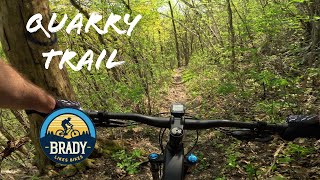
trail: Quarry
14:30 |
109 |
Aug 9, 2025 , Winona

trail: Danger Noodle
4:55 |
75 |
Aug 9, 2025 , Winona

trail: Danger Noodle
18:54 |
172 |
Nov 21, 2024 , Winona
youtuber
![This could be the start of something great! ...]()

27:56 |
149 |
May 9, 2024
youtuber
![Trail Champions: The Bluffs Traverse | Winona,...]()

3:10 |
161 |
Jan 19, 2024
Recent Trail Reports
| status | trail | date | condition | info | user |
|---|---|---|---|---|---|
| Lower Connector | May 25, 2025 @ 7:56am May 25, 2025 | Dry | trailforks Trailforks | ||
| Wildwood West | Aug 18, 2024 @ 8:56am Aug 18, 2024 | Ideal | trailforks Trailforks | ||
| Chickadee Circuit | Aug 18, 2024 @ 8:56am Aug 18, 2024 | Ideal | trailforks Trailforks | ||
| Wildwood east | Aug 18, 2024 @ 8:56am Aug 18, 2024 | Ideal | trailforks Trailforks | ||
| Wildwood North | Jun 30, 2024 @ 8:02am Jun 30, 2024 | Ideal | trailforks Trailforks | ||
| Cistern | Jun 30, 2024 @ 8:02am Jun 30, 2024 | Ideal | trailforks Trailforks | ||
| Rollers | Jun 30, 2024 @ 8:02am Jun 30, 2024 | Ideal | trailforks Trailforks | ||
| Low Rollers | Jun 30, 2024 @ 8:02am Jun 30, 2024 | Ideal | trailforks Trailforks | ||
| Danger Noodle | Jun 30, 2024 @ 8:02am Jun 30, 2024 | Dry | trailforks Trailforks | ||
| Chickadee Circuit Access | Jun 30, 2024 @ 8:02am Jun 30, 2024 | Ideal | trailforks Trailforks |
Activity Feed
| username | action | type | title | date |
|---|---|---|---|---|
| Ianthabear | comment | trail | activity #96341025 | Jun 5, 2026 @ 8:53pm Jun 5, 2026 |
| TheuPs8mY | vote | trail | activity #95785299 | May 29, 2026 @ 9:58am May 29, 2026 |
| Mtunn080 | ridden | trail | activity #84283237 and 1 more | Nov 16, 2025 @ 7:15pm Nov 16, 2025 |
| Mtunn080 | vote | trail | activity #84283185 and 1 more | Nov 16, 2025 @ 7:12pm Nov 16, 2025 |
| Mtunn080 | add | karma | activity #83195039 | Oct 28, 2025 @ 6:24pm Oct 28, 2025 |
Recent Comments
| username | type | title | comment | date |
|---|---|---|---|---|
| trail | Hiking trail only, no MTB | Jun 5, 2026 @ 8:53pm Jun 5, 2026 | ||
| trail | Super nice for small riders that do not like... | Aug 6, 2025 @ 6:41am Aug 6, 2025 | ||
| trail | Feels more like a strenuous green with blue... | Sep 3, 2024 @ 6:56am Sep 3, 2024 | ||
| trail | Forsure black diamond. Super fun if you like... | Apr 8, 2024 @ 8:17pm Apr 8, 2024 | ||
| trail | Didn't realize I signed up for all these... | Nov 9, 2023 @ 3:22pm Nov 9, 2023 |
Local Badges
-

Epic Ride Descent 2k2 awarded -

Descent 10k Badge7 awarded -

Descent 100k Badge0 awarded -

Completionist0 awarded -

10 Blue Trails2 awarded -

Epic Mountain Bike Climb 2k0 awarded
Activity Type Stats
| activitytype | trails | distance | descent | descent distance | total vertical | rating | global rank | state rank | photos | reports | routes | ridelogs |
|---|---|---|---|---|---|---|---|---|---|---|---|---|
| Mountain Bike | 38 | 37 miles | 4,587 ft | 13 miles | 564 ft | #4,020 | #1,351 | 78 | 209 | 4,284 | ||
| E-Bike | 12 | 20 miles | 1,368 ft | 6 miles | 551 ft | #5,611 | #1,732 | 61 | 58 | |||
| Hike | 44 | 39 miles | 4,659 ft | 13 miles | 564 ft | #5,601 | #1,968 | 209 | 876 | |||
| Trail Running | 44 | 39 miles | 4,659 ft | 13 miles | 564 ft | #4,934 | #1,538 | 209 | 284 | |||
| Snowshoe | 9 | 11 miles | 1,148 ft | 5 miles | 472 ft | #1,173 | #617 | 51 | ||||
| Nordic Ski | 32 | 12 miles | 1,161 ft | 5 miles | 472 ft | #776 | #299 | 179 |
Frequently Asked Questions About Winona
▼
What are the best places to ride in Winona?
Winona has 5 areas to explore for mountain biking. The top rated areas are:
▼
What are the highest rated mountain biking trails in Winona?
The highest rated mountain biking trails in Winona are:
- Outside Loop - West (4.2/5)
- Chickadee Circuit (4.1/5)
- OPE! (4.1/5)
- Zinger (4.1/5)
- Danger Noodle (4/5)
▼
What is the best time of the year to ride in Winona?
Based on ride log data, the most popular months to ride in Winona are:
- July (32 activities)
- May (14 activities)
- June (11 activities)
▼
Where can I park to ride in Winona?
There are 9 parking locations listed in Winona. The most popular parking spots are:
- Holzinger Lodge Parking Area & Trailhead
- West Lake Blvd Parking
- Parking
- Trailhead Parking
- Roadside Parking
Activities
Trails
Points of Interest
- By brenthillier
 NSMBA TRAILFORKS & contributors
 - Admins: apply
- #10305 - 9,246 views
- winona activity log | embed map of Winona mountain bike trails | winona mountain biking points of interest
Downloading of trail gps tracks in kml & gpx formats is enabled for Winona.
You must login to download files.