close
-
Layers w
- Weather Layers
- Pro
- Pro
- Pro
- Pro
- Pro
- Pro
- More Layers
- Pro
- Pro
- Pro
- Pro
-
Upgrade to

3D
Trail Conditions
- Unknown
- Snow Groomed
- Snow Packed
- Snow Covered
- Snow Cover Partial
- Freeze/thaw Cycle
- Icy
- Prevalent Mud
- Wet
- Variable
- Ideal
- Dry
- Very Dry
Trail Flow (Ridden Direction)
Trailforks scans users ridelogs to determine the most popular direction each trail is ridden. A good flowing trail network will have most trails flowing in a single direction according to their intension.
The colour categories are based on what percentage of riders are riding a trail in its intended direction.
The colour categories are based on what percentage of riders are riding a trail in its intended direction.
- > 96%
- > 90%
- > 80%
- > 70%
- > 50%
- < 50%
- bi-directional trail
- no data
Trail Last Ridden
Trailforks scans ridelogs to determine the last time a trail was ridden.
- < 2 days
- < 1 week
- < 2 weeks
- < 1 month
- < 6 months
- > 6 months
Trail Ridden Direction
The intended direction a trail should be ridden.
- Downhill Only
- Downhill Primary
- Both Directions
- Uphill Primary
- Uphill Only
- One Direction
Contribute Details
Colors indicate trail is missing specified detail.
- Description
- Photos
- Description & Photos
- Videos
Trail Popularity ?
Trailforks scans ridelogs to determine which trails are ridden the most in the last 9 months.
Trails are compared with nearby trails in the same city region with a possible 25 colour shades.
Think of this as a heatmap, more rides = more kinetic energy = warmer colors.
- most popular
- popular
- less popular
- not popular
ATV/ORV/OHV Filter
Max Vehicle Width
inches
US Cell Coverage
Legend

Radar Time
Activity Recordings
Trailforks uses anonymized public activity data.
?
Activity Recordings
Trailforks uses anonymized public activity data.
?
Personal Heatmap
▶
Activity Types
all
/
none
▶
Options
2
Date range
month
–
Winter Trails
Warning
A routing network for winter maps does not exist. Selecting trails using the winter trails layer has been disabled.
Missing Trails
Most Popular
Least Popular
Trails are colored based on popularity. The more popular a trail is, the more red. Less popular trails trend towards green.
Jump Magnitude Heatmap
Heatmap of where riders jump on trails. Zoom in to see individual jumps, click circles to view jump details.
BC Backroad Status
![map legend]()
Service Road Atlas is a free to use, community-driven service for viewing and creating reports on the numerous back-country service roads around B.C. and Alberta.

Slope Aspect
Direction the slope faces
Trails Deemphasized
Trails are shown in grey.
Only show trails with no bike usage.
Suggested Layers
Based on selected activity type
Save the current map location and zoom level as your default home location whenever this page is loaded.
Save
No description for Winston-Salem has been added yet!
Login or register to submit one.
Activities Click to view
- Mountain Bike
19 trails
- E-Bike
13 trails
- Adaptive Bike
0 trails
- Horse
1 trails
- Hike
16 trails
- Trail Running
17 trails
Region Details
- 2
- 6
- 5
- 5
- 1
Region Status
Caution as of Jun 3, 2026Stats
- Avg Trail Rating
- Trails (view details)
- 19
- Trails Mountain Bike
- 19
- Trails E-Bike
- 13
- Trails Horse
- 1
- Trails Hike
- 16
- Trails Trail Running
- 17
- Total Distance
- 28 miles
- Total Descent Distance
- 8 miles
- Total Descent
- 1,537 ft
- Total Vertical
- 228 ft
- Highest Trailhead
- 941 ft
- Reports
- 324
- Photos
- 150
- Ridden Counter
- 2,727
Sub Regions
-
Hobby Park
- 1
- 2
-
Horizons Park
- 1
- 1
-
Salem Lake
- 3
- 2
Popular Winston-Salem Mountain Biking Trails
• 90 ★ 4.6 • 5 miles • 538 ft • 612 •
Main loop at the park,but you can take a bunch of other loop options to make different ride combinations. Some technical sections with difficult climbs. Trail has some fast flow in sections, with some roots and little spots to air out a...
• 100 ★ 4.3 • 7 miles • 143 ft • 268 •
This trail is a great 7-mile gravel grinder path that wraps around Salem Lake. The trail is nice and wide with a few moderate climbs, but watch for runners, walkers, and the occasional equestrians.
• 100 ★ 4.4 • 666 ft • 6 ft • 229 •
This trail loop is about half single track and half rocks, making it feel like it was taken straight from Western North Carolina. includes several stream crossings, a few rock gardens, and a 20-foot, semi-stable curving rock bridge....
• 95 ★ 5.0 • 784 ft • 0 ft • 167 •
The closest thing to a terrain park in Winston-Salem! This unofficial downhill trail begins with a fast section where riders can choose from several lines to send a variety of jumps, drops, and gap jumps before hucking a big dirt jump...
• 30 ★ 2.7 • 3 miles • 272 ft • 124 •
Formerly comprised of multiple smaller segments, this trail is now the main contiguous loop at Horizons Park. It is accessed via taking a left turn off of the gravel that leads in from the parking lot. Riders wishing to bypass the first...
• 75 ★ 3.5 • 5 miles • 53 ft • 90 •
Popular white difficulty paved path. This mountain bike primary trail can be used both directions and has a easy overall physical rating with a 53 ft green climb. On average it takes 23 minutes to complete this trail.
• 55 ★ 2.5 • 3,875 ft • 77 ft • 68 •
This is a 0.6-mile paved multi-use path connects the Waughtown Connector to the . The path begins by splitting from the main greenway just before the Reynolds Park Road bridge, runs along the sidewalk of Peachtree Street, then...
• 65 ★ 4.0 • 2 miles • 69 ft • 51 •
This 1.61-mile (mostly) paved multi-use path runs past the Quarry Park and connects the Waughtown neighborhood to the Peachtree Greenway, which in turn connects to the . The connector begins at Marble Street near Waughtown, connects to...
Photos of Winston-Salem Mountain Bike
Videos of Winston-Salem Mountain Bike

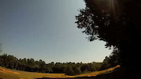
trail: Hobby Park
0:59 |
1287 |
Dec 27, 2014

trail: Hobby Park
7:39 |
211 |
Jun 4, 2012
trail: Hobby Park
3:32 |
225 |
Sep 4, 2011
trail: Hobby Park
4:09 |
293 |
Aug 23, 2011
Recent Trail Reports
| status | trail | date | condition | info | user |
|---|---|---|---|---|---|
| Horizons Park Loop | Jun 3, 2026 @ 5:28pm (America/New_York) Jun 3, 2026 | Dry | mtoTD4 | ||
| Run(a)way | May 31, 2026 @ 8:15am (America/Kentucky/Monticello) May 31, 2026 | Ideal | pillen140 | ||
| Little Pisgah | May 31, 2026 @ 8:15am (America/Kentucky/Monticello) May 31, 2026 | Ideal | pillen140 | ||
| Hobby Park | May 31, 2026 @ 8:15am (America/Kentucky/Monticello) May 31, 2026 | Ideal | pillen140 | ||
| Long Branch Trail | May 3, 2026 @ 2:37pm (America/New_York) May 3, 2026 | Dry | btag | ||
| Salem Lake Trail | Mar 25, 2026 @ 5:00pm (America/New_York) Mar 25, 2026 | Unknown | larelear | ||
| Waughtown Connector | Feb 22, 2026 @ 9:20am (America/New_York) Feb 22, 2026 | Variable | kennync | ||
| New Greensboro Connector | Feb 6, 2026 @ 1:58pm (America/New_York) Feb 6, 2026 | Snow Covered | oldguy53 | ||
| Salem Creek Greenway | May 22, 2025 @ 12:27pm May 22, 2025 | Dry | btag | ||
| Peachtree Greenway | May 7, 2025 @ 4:53pm May 7, 2025 | Very Dry | btag |
Activity Feed
| username | action | type | title | date |
|---|---|---|---|---|
| mtoTD4 | wishlist | trail | activity #97283501 | Jun 18, 2026 @ 4:50pm 20 hours |
| FORBA | add | poi | activity #97111713 | Jun 16, 2026 @ 8:16am Jun 16, 2026 |
| FORBA | update | trail | activity #97106822 and 1 more | Jun 16, 2026 @ 6:58am Jun 16, 2026 |
| FORBA | add | photo | activity #97103780 and 1 more | Jun 16, 2026 @ 6:02am Jun 16, 2026 |
| FORBA | add | trail | activity #97102849 and 5 more | Jun 16, 2026 @ 5:43am Jun 16, 2026 |
Recent Comments
| username | type | title | comment | date |
|---|---|---|---|---|
| trail | Couple of trees down since the most recent... | Jun 3, 2026 @ 2:28pm Jun 3, 2026 | ||
| trail | If you’re looking for a shorter distance... | May 13, 2026 @ 5:58am May 13, 2026 | ||
| report | This is amazing to hear! Thank you. | May 7, 2026 @ 11:52am May 7, 2026 | ||
| report | Cleared | Nov 22, 2024 @ 9:23am Nov 22, 2024 | ||
| trail | Desperate need of proper signs | Oct 20, 2024 @ 10:32am Oct 20, 2024 |
Local Badges
-

Epic Ride Climb 2k2 awarded -

Climbing 10k Badge41 awarded -

Climbing 100k Badge1 awarded -

Epic Ride Descent 2k2 awarded -

Descent 10k Badge41 awarded -

Descent 100k Badge1 awarded
Local Mountain Biking Directory
-
Forsyth Off Road Bicycle Association
![Forsyth Off Road Bicycle Association]()
-
CycletherapyBike Shop
-
Ken's Bike ShopBike Shop
-
Paul's Schwinn CyclingBike Shop
Activity Type Stats
| activitytype | trails | distance | descent | descent distance | total vertical | rating | global rank | state rank | photos | reports | routes | ridelogs |
|---|---|---|---|---|---|---|---|---|---|---|---|---|
| Mountain Bike | 19 | 28 miles | 1,535 ft | 8 miles | 226 ft | #4,116 | #1,388 | 141 | 324 | 10,730 | ||
| E-Bike | 13 | 15 miles | 650 ft | 5 miles | 220 ft | #5,978 | #1,824 | 193 | 890 | |||
| Horse | 1 | 7 miles | 138 ft | 2 miles | 59 ft | #2,880 | #1,610 | 49 | ||||
| Hike | 16 | 27 miles | 1,470 ft | 8 miles | 226 ft | #7,325 | #2,594 | 7 | 319 | 525 | ||
| Trail Running | 17 | 27 miles | 1,512 ft | 8 miles | 226 ft | #6,812 | #2,231 | 319 | 291 |
Frequently Asked Questions About Winston-Salem
▼
What are the best places to ride in Winston-Salem?
Winston-Salem has 3 areas to explore for mountain biking. The top rated areas are:
▼
What are the highest rated mountain biking trails in Winston-Salem?
The highest rated mountain biking trails in Winston-Salem are:
- Hobby Park (4.4/5)
- Run(a)way (4.1/5)
- Little Pisgah (4.1/5)
- Salem Lake Trail (4.1/5)
- Long Branch Trail (4/5)
▼
What is the best time of the year to ride in Winston-Salem?
Based on ride log data, the most popular months to ride in Winston-Salem are:
- July (87 activities)
- August (62 activities)
- May (60 activities)
▼
Where can I park to ride in Winston-Salem?
There are 14 parking locations listed in Winston-Salem. The most popular parking spots are:
- Linville Road Parking Lot
- The Point Parking Lot
- Parking
- Salem Lake Marina Parking Lot
- Fourth and Patterson Parking
Activities
Trails
- By manglermixer
 & contributors
 - Admins: FritzNeal, FORBA
- #7968 - 10,247 views
- winston-salem activity log | embed map of Winston-Salem mountain bike trails | winston-salem mountain biking points of interest
Downloading of trail gps tracks in kml & gpx formats is enabled for Winston-Salem.
You must login to download files.