close
-
Layers w
- Weather Layers
- Pro
- Pro
- Pro
- Pro
- Pro
- Pro
- More Layers
- Pro
- Pro
- Pro
- Pro
-
Upgrade to

3D
Trail Conditions
- Unknown
- Snow Groomed
- Snow Packed
- Snow Covered
- Snow Cover Partial
- Freeze/thaw Cycle
- Icy
- Prevalent Mud
- Wet
- Variable
- Ideal
- Dry
- Very Dry
Trail Flow (Ridden Direction)
Trailforks scans users ridelogs to determine the most popular direction each trail is ridden. A good flowing trail network will have most trails flowing in a single direction according to their intension.
The colour categories are based on what percentage of riders are riding a trail in its intended direction.
The colour categories are based on what percentage of riders are riding a trail in its intended direction.
- > 96%
- > 90%
- > 80%
- > 70%
- > 50%
- < 50%
- bi-directional trail
- no data
Trail Last Ridden
Trailforks scans ridelogs to determine the last time a trail was ridden.
- < 2 days
- < 1 week
- < 2 weeks
- < 1 month
- < 6 months
- > 6 months
Trail Ridden Direction
The intended direction a trail should be ridden.
- Downhill Only
- Downhill Primary
- Both Directions
- Uphill Primary
- Uphill Only
- One Direction
Contribute Details
Colors indicate trail is missing specified detail.
- Description
- Photos
- Description & Photos
- Videos
Trail Popularity ?
Trailforks scans ridelogs to determine which trails are ridden the most in the last 9 months.
Trails are compared with nearby trails in the same city region with a possible 25 colour shades.
Think of this as a heatmap, more rides = more kinetic energy = warmer colors.
- most popular
- popular
- less popular
- not popular
ATV/ORV/OHV Filter
Max Vehicle Width
inches
US Cell Coverage
Legend

Radar Time
Activity Recordings
Trailforks uses anonymized public activity data.
?
Activity Recordings
Trailforks uses anonymized public activity data.
?
Personal Heatmap
▶
Activity Types
all
/
none
▶
Options
2
Date range
month
–
Winter Trails
Warning
A routing network for winter maps does not exist. Selecting trails using the winter trails layer has been disabled.
Missing Trails
Most Popular
Least Popular
Trails are colored based on popularity. The more popular a trail is, the more red. Less popular trails trend towards green.
Jump Magnitude Heatmap
Heatmap of where riders jump on trails. Zoom in to see individual jumps, click circles to view jump details.
BC Backroad Status
![map legend]()
Service Road Atlas is a free to use, community-driven service for viewing and creating reports on the numerous back-country service roads around B.C. and Alberta.

Slope Aspect
Direction the slope faces
Trails Deemphasized
Trails are shown in grey.
Only show trails with no bike usage.
Suggested Layers
Based on selected activity type
Save the current map location and zoom level as your default home location whenever this page is loaded.
Save
No description for Winterberg has been added yet!
Login or register to submit one.
This region uses the Uk/Euro style trail grading system.
Activities Click to view
- Mountain Bike
74 trails
- E-Bike
74 trails
- Gravel Bike
0 trails
- Adaptive Bike
0 trails
- Winter Fat Bike
0 trails
- Hike
26 trails
- Trail Running
25 trails
Region Details
- 1
- 20
- 25
- 8
- 3
Region Status
Caution as of Jun 1, 2026Stats
- Avg Trail Rating
- Trails (view details)
- 58
- Trails Mountain Bike
- 74
- Trails E-Bike
- 74
- Trails Hike
- 26
- Trails Trail Running
- 25
- Trails Nordic Ski
- 2
- Total Distance
- 22 miles
- Total Descent
- 11,331 ft
- Total Vertical
- 814 ft
- Highest Trailhead
- 2,661 ft
- Reports
- 926
- Photos
- 225
- Ridden Counter
- 27,049
Articles

Video: Highlights from iXS Dirt Masters Festival 2023
Jun 15, 2023 from pinkbike.com
Four incredible days filled with action on and off the tracks.
Video: Propain's Kids' Team Shreds Bikepark Winterberg
Nov 29, 2019 from pinkbike.com
The Propain Talent Factory is packed with riders to watch in the future.
Sub Regions
-
Bikepark Winterberg
- 7
- 4
- 5
- 3
-
Trailpark Winterberg
- 5
- 13
Popular Winterberg Mountain Biking Trails
• 95 ★ 4.4 • 1 mile • 10 ft • 1,447 •
A 1.6 km long flow trail with adjoining curves and tables for freeride beginners. But even experienced bikers can build up speed and rip properly.
• 90 ★ 3.3 • 636 ft • 17 ft • 1,418 •
Popular green difficulty doubletrack. This mountain bike primary trail can be used both directions. On average it takes 1 minutes to complete this trail.
• 70 ★ 4.0 • 2,339 ft • 11 ft • 1,387 •
Einsteiger wagen die ersten Sprünge, Fortgeschrittene den Griff in die Trickkiste. Eine schöne, griffige Strecke mit Anliegern, Tables, Doubles und Corner Jumps. Auch für weniger geübte Biker geeignet.
• 90 ★ 4.2 • 3,806 ft • 2 ft • 1,268 •
Flowiger Trail mit Step Downs, Anliegerkurven und Hip Jump.
• 60 ★ 4.3 • 2,444 ft • 0 ft • 1,254 •
Ein überwiegend naturbelassener mit allerlei Extras gespickter Kurs wartet auf euch. Rasante Turns über Stock und Stein, mit schnellen Anliegern und kniffeligen Abschnitten. Wurzelpassagen, Steinfelder, Sprünge und eine Monster...
• 50 ★ 4.3 • 2,119 ft • 0 ft • 1,132 •
Naturbelassener, schmaler, flowiger Trail mit kleinen und großen Wurzeln, engen Kurven und Stufen. Genau das richtige Terrain für erfahrene Enduro- und Freeridebiker.
• 45 ★ 4.0 • 2,989 ft • 14 ft • 1,123 •
34 flowige Anliegerkurevn mit vielen Sprüngen und Tables sorgen für den richtigen Fahrspaß.
• 85 ★ 3.7 • 1,119 ft • 11 ft • 1,022 •
Schnewittchen / Fairy Trail middle section Can be used to access the lower section of Schnewittchen / Fairy Tail and the Schnewittchen lift. Machine groomed Highway ;)
Winterberg Mountain Bike Routes
8 miles • 1,448 ft • 8 • Loop •
Starts and ends at Hotel Brabander or P1. First Poppenberg Trails -> follows or -> and . Next stop...
4 miles • 665 ft • 0 • Point to Point •
Der Poppenberg Pro "PP" ist ein roter (anspruchsvoller) Loop der über 6 km durch den Trailpark führt....
• 28 miles • 9,111 ft • 76 •
• 13 miles • 5,465 ft • 57 •
• 19 miles • 6,165 ft • 43 •
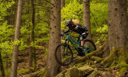
Photos of Winterberg Mountain Bike
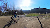
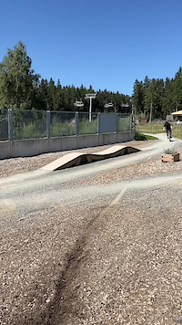
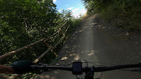
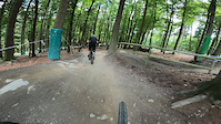
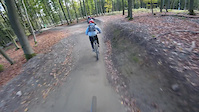
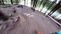
Videos of Winterberg Mountain Bike

trail: Schneewittchen Upper Section
0:05 |
12 |
May 9, 2026
trail: Schneewittchen Lower Section
0:25 |
22 |
Nov 5, 2024
0:11 |
32 |
Oct 26, 2023
trail: Schwalbe Loose Lee (Pinball)
0:10 |
101 |
Jul 28, 2022
trail: IXS Downhill
0:11 |
|
Jul 7, 2021
trail: SRAM Flow Country
0:07 |
66 |
Nov 1, 2020

trail: Biggesteig-Downhill
0:58 |
224 |
Sep 10, 2020
trail: Black Line 1.0
3:02 |
69 |
Feb 27, 2020
Current Trail Warnings
| status | trail | date | condition | user | info |
|---|---|---|---|---|---|
| Bremberg Blues | May 25, 2026 @ 12:15am (Europe/Berlin) May 24, 2026 | Ideal | Einfach | Der Trail ist gesperrt und nicht mehr da. | |
| Fairy Trail Upper Section | May 24, 2026 @ 5:38pm (Europe/Berlin) May 24, 2026 | Ideal | Einfach | Wegen Trailpflege gesperrt. |
Recent Trail Reports
| status | trail | date | condition | info | user |
|---|---|---|---|---|---|
| Bremberg Flow | Jun 1, 2026 @ 10:27pm (Europe/Berlin) Jun 1, 2026 | Unknown | HAL2000 | ||
| Black Line 1.0 | May 28, 2026 @ 11:26pm (Europe/Berlin) May 28, 2026 | Dry | Einfach | ||
| Forrest Stump | May 28, 2026 @ 11:10pm (Europe/Berlin) May 28, 2026 | Dry | Einfach | ||
| SRAM Flow Country | May 28, 2026 @ 10:55pm (Europe/Berlin) May 28, 2026 | Dry | Einfach | ||
| Snake the lake | May 25, 2026 @ 1:23pm (Europe/Berlin) May 25, 2026 | Wet | Doerch | ||
| Popp Top Track | May 25, 2026 @ 1:23pm (Europe/Berlin) May 25, 2026 | Variable | Doerch | ||
| Little Fluff | May 25, 2026 @ 1:23pm (Europe/Berlin) May 25, 2026 | Variable | Doerch | ||
| Poppenberg Peak | May 25, 2026 @ 1:23pm (Europe/Berlin) May 25, 2026 | Ideal | Doerch | ||
| Landal Enduro Stage | May 25, 2026 @ 1:23pm (Europe/Berlin) May 25, 2026 | Variable | Doerch | ||
| Sürenberg Sause | May 25, 2026 @ 1:23pm (Europe/Berlin) May 25, 2026 | Variable | Doerch |
Activity Feed
| username | action | type | title | date |
|---|---|---|---|---|
| HAL2000 | add | report | activity #96037680 | Jun 1, 2026 @ 1:27pm Jun 1, 2026 |
| Einfach | ridden | trail | activity #96030756 | Jun 1, 2026 @ 11:28am Jun 1, 2026 |
| Einfach | vote | trail | activity #96030749 | Jun 1, 2026 @ 11:28am Jun 1, 2026 |
| pauwa1 | wishlist | region | activity #96021854 | Jun 1, 2026 @ 9:12am Jun 1, 2026 |
| cdVQXn | wishlist | region | activity #96014881 | Jun 1, 2026 @ 7:04am Jun 1, 2026 |
Recent Comments
| username | type | title | comment | date |
|---|---|---|---|---|
| trail | Very fun trail, a nice mix of flow and some... | Oct 2, 2024 @ 5:28am Oct 2, 2024 | ||
| trail | When wet, the last part is extremely slippery... | Oct 2, 2024 @ 5:26am Oct 2, 2024 | ||
| trail | Mastercully shaped natural flow trail | Jun 30, 2024 @ 11:37am Jun 30, 2024 | ||
| trail | Thoughest trail in the park! Thanks to the... | Sep 10, 2020 @ 2:36pm Sep 10, 2020 | ||
| trail | Heute abgefahren, Zustand sehr gut :) | May 9, 2020 @ 12:06pm May 9, 2020 |
Local Badges
-

Epic Ride Climb 2k883 awarded -

Climbing 10k Badge107 awarded -

Climbing 100k Badge1 awarded -

Epic Ride Descent 2k884 awarded -

Descent 10k Badge173 awarded -

Descent 100k Badge1 awarded
Bike & Skill Parks
| name | type | city | rating |
|---|---|---|---|
| Bikepark Winterberg | bike park | Winterberg | |
| Rockshox Slopestyle | skill park | Winterberg | |
| Commencal Beginner & Kids Parcours | skill park | Winterberg |
Activity Type Stats
| activitytype | trails | distance | descent | descent distance | total vertical | rating | global rank | state rank | photos | reports | routes | ridelogs |
|---|---|---|---|---|---|---|---|---|---|---|---|---|
| Mountain Bike | 74 | 22 miles | 11,332 ft | 16 miles | 814 ft | #638 | #3 | 225 | 926 | 3 | 8,195 | |
| E-Bike | 74 | 22 miles | 11,332 ft | 16 miles | 814 ft | #235 | #8 | 870 | 2 | 889 | ||
| Hike | 26 | 8 miles | 4,085 ft | 6 miles | 814 ft | #3,466 | #27 | 833 | 185 | |||
| Trail Running | 25 | 7 miles | 3,258 ft | 5 miles | 794 ft | #3,007 | #25 | 830 | 61 | |||
| Nordic Ski | 2 | 38 |
Frequently Asked Questions About Winterberg
▼
What are the best places to ride in Winterberg?
Winterberg has 2 areas to explore for mountain biking. The top rated areas are:
▼
What are the highest rated mountain biking trails in Winterberg?
The highest rated mountain biking trails in Winterberg are:
- Enduro-Line (4.4/5)
- Shreddy Mörphy (4.3/5)
- SRAM Flow Country (4.3/5)
- North Shore (4.3/5)
- Black Line 1.0 (4.2/5)
▼
What is the best time of the year to ride in Winterberg?
Based on ride log data, the most popular months to ride in Winterberg are:
- May (99 activities)
- July (94 activities)
- September (87 activities)
▼
Where can I park to ride in Winterberg?
There are 1 parking locations listed in Winterberg. The most popular parking spots are:
Activities
Trails
- By NsBiker63 & contributors
- Admins: apply
- #5055 - 15,602 views
- winterberg activity log | embed map of Winterberg mountain bike trails | winterberg mountain biking points of interest polygons
Downloading of trail gps tracks in kml & gpx formats is enabled for Winterberg.
You must login to download files.