close
-
Layers w
- Weather Layers
- Pro
- Pro
- Pro
- Pro
- Pro
- Pro
- More Layers
- Pro
- Pro
- Pro
- Pro
-
Upgrade to

3D
Trail Conditions
- Unknown
- Snow Groomed
- Snow Packed
- Snow Covered
- Snow Cover Partial
- Freeze/thaw Cycle
- Icy
- Prevalent Mud
- Wet
- Variable
- Ideal
- Dry
- Very Dry
Trail Flow (Ridden Direction)
Trailforks scans users ridelogs to determine the most popular direction each trail is ridden. A good flowing trail network will have most trails flowing in a single direction according to their intension.
The colour categories are based on what percentage of riders are riding a trail in its intended direction.
The colour categories are based on what percentage of riders are riding a trail in its intended direction.
- > 96%
- > 90%
- > 80%
- > 70%
- > 50%
- < 50%
- bi-directional trail
- no data
Trail Last Ridden
Trailforks scans ridelogs to determine the last time a trail was ridden.
- < 2 days
- < 1 week
- < 2 weeks
- < 1 month
- < 6 months
- > 6 months
Trail Ridden Direction
The intended direction a trail should be ridden.
- Downhill Only
- Downhill Primary
- Both Directions
- Uphill Primary
- Uphill Only
- One Direction
Contribute Details
Colors indicate trail is missing specified detail.
- Description
- Photos
- Description & Photos
- Videos
Trail Popularity ?
Trailforks scans ridelogs to determine which trails are ridden the most in the last 9 months.
Trails are compared with nearby trails in the same city region with a possible 25 colour shades.
Think of this as a heatmap, more rides = more kinetic energy = warmer colors.
- most popular
- popular
- less popular
- not popular
ATV/ORV/OHV Filter
Max Vehicle Width
inches
US Cell Coverage
Legend

Radar Time
Activity Recordings
Trailforks uses anonymized public activity data.
?
Activity Recordings
Trailforks uses anonymized public activity data.
?
Personal Heatmap
▶
Activity Types
all
/
none
▶
Options
2
Date range
month
–
Winter Trails
Warning
A routing network for winter maps does not exist. Selecting trails using the winter trails layer has been disabled.
Missing Trails
Most Popular
Least Popular
Trails are colored based on popularity. The more popular a trail is, the more red. Less popular trails trend towards green.
Jump Magnitude Heatmap
Heatmap of where riders jump on trails. Zoom in to see individual jumps, click circles to view jump details.
BC Backroad Status
![map legend]()
Service Road Atlas is a free to use, community-driven service for viewing and creating reports on the numerous back-country service roads around B.C. and Alberta.

Slope Aspect
Direction the slope faces
Trails Deemphasized
Trails are shown in grey.
Only show trails with no bike usage.
Suggested Layers
Based on selected activity type
Save the current map location and zoom level as your default home location whenever this page is loaded.
Save
No description for Wood County has been added yet!
Login or register to submit one.
Activities Click to view
- Mountain Bike
114 trails
- E-Bike
65 trails
- Horse
1 trails
- Hike
107 trails
- Trail Running
108 trails
- Dirtbike/Moto
0 trails
- ATV/ORV/OHV
0 trails
- Snowmobile
4 trails
- Snowshoe
36 trails
- Downhill Ski
3 trails
- Backcountry Ski
0 trails
- Nordic Ski
28 trails
Region Details
- 33
- 21
- 21
- 27
- 12
Stats
- Avg Trail Rating
- Trails (view details)
- 140
- Trails Mountain Bike
- 114
- Trails E-Bike
- 65
- Trails Gravel Bike
- 17
- Trails Adaptive Bike
- 28
- Trails Winter Fat Bike
- 44
- Trails Horse
- 1
- Trails Hike
- 107
- Trails Trail Running
- 108
- Trails Snowmobile
- 4
- Trails Snowshoe
- 36
- Trails Downhill Ski
- 3
- Trails Nordic Ski
- 28
- Total Distance
- 74 miles
- Total Descent Distance
- 24 miles
- Total Descent
- 3,113 ft
- Total Vertical
- 481 ft
- Highest Trailhead
- 1,451 ft
- Reports
- 531
- Photos
- 91
- Ridden Counter
- 1,063
Sub Regions
- Arpin (34)
- Babcock (13)
- South Bluff (13)
- Marshfield (60)
- Wisconsin Rapids (4)
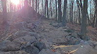
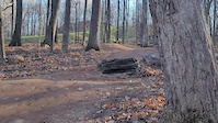
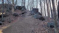
Popular Wood County Mountain Biking Trails
• 100 ★ 0.0 • 1,749 ft • 25 ft • 26 •
Popular blue difficulty singletrack. This mountain bike primary trail can be used both directions and has a moderate overall physical rating with a 25 ft blue climb. On average it takes 2 minutes to complete this trail.
• 80 ★ 0.0 • 4,590 ft • 14 ft • 23 •
Popular blue difficulty singletrack. This mountain bike primary trail can be used both directions and has a moderate overall physical rating with a 14 ft green climb. On average it takes 8 minutes to complete this trail.
• 95 ★ 0.0 • 1,079 ft • 15 ft • 22 •
Popular blue difficulty singletrack. This mountain bike primary trail can be used both directions and has a moderate overall physical rating with a 15 ft blue climb. On average it takes 1 minutes to complete this trail.
• 75 ★ 0.0 • 1,634 ft • 10 ft • 15 •
Popular blue difficulty singletrack. This mountain bike primary trail can be used both directions and has a moderate overall physical rating with a 10 ft blue climb. Trail visibility is sometimes hard to follow. On average it takes 2 minutes to complete this trail.
Wood County Mountain Bike Routes
2 miles • 95 ft • 2 •
If you'd like a smoother trail riding experience, this route might be for you. Using a combination of...
6 miles • 388 ft • 14 • Race •
Photos of Wood County Mountain Bike
Videos of Wood County Mountain Bike
trail: Gnarpin
0:08 |
67 |
Aug 25, 2024
trail: Gnarpin
0:19 |
38 |
Aug 25, 2024
trail: Gnarpin
0:32 |
92 |
Nov 25, 2023
trail: Hike up your Kilt
10:35 |
179 |
Aug 14, 2024 , Babcock

trail: East Loop
26:14 |
976 |
Feb 4, 2018 , Wisconsin Rapids
Recent Trail Reports
Activity Feed
| username | action | type | title | date |
|---|---|---|---|---|
| 3b3nn | update | trail | activity #97365753 and 1 more | Jun 19, 2026 @ 9:35pm 6 hours |
| 3b3nn | update | trail | activity #97348139 | Jun 19, 2026 @ 3:19pm 12 hours |
| brooks4adventures | add | route | activity #96241506 | Jun 4, 2026 @ 11:22am Jun 4, 2026 |
| JamesonxzV36u | checkin | trail | activity #94512099 | May 11, 2026 @ 12:49pm May 11, 2026 |
| JamesonxzV36u | ridden | trail | activity #94512031 | May 11, 2026 @ 12:48pm May 11, 2026 |
Recent Comments
| username | type | title | comment | date |
|---|---|---|---|---|
| report | New construction on south bluff can’t wait... | Apr 12, 2022 @ 5:45am Apr 12, 2022 | ||
| trail | Freshly groomed for winter activity | Feb 12, 2020 @ 7:11am Feb 12, 2020 | ||
| trail | Mostly easy flowy trail, with a few steep... | Aug 20, 2017 @ 6:08pm Aug 20, 2017 |
Local Badges
-

Epic Ride Descent 2k0 awarded -

Descent 10k Badge0 awarded -
Descent 10k Badge0 awarded -
Epic Ride Descent 2k0 awarded -

Descent 100k Badge0 awarded -

Mountain Biking 100k Badge0 awarded
Bike & Skill Parks
| name | type | city | rating |
|---|---|---|---|
| Central Wisconsin BMX | skill park | Wisconsin Rapids |
Activity Type Stats
| activitytype | trails | distance | descent | descent distance | total vertical | rating | global rank | state rank | photos | reports | routes | ridelogs |
|---|---|---|---|---|---|---|---|---|---|---|---|---|
| Mountain Bike | 114 | 62 miles | 2,513 ft | 20 miles | 472 ft | 83 | 531 | 4 | 2,169 | |||
| E-Bike | 65 | 36 miles | 1,411 ft | 11 miles | 466 ft | 140 | 13 | |||||
| Gravel Bike | 17 | 16 miles | 285 ft | 6 miles | 230 ft | |||||||
| Adaptive Bike | 28 | 21 miles | 397 ft | 7 miles | 262 ft | 27 | ||||||
| Winter Fat Bike | 44 | 19 miles | 692 ft | 5 miles | 285 ft | 1 | 314 | |||||
| Horse | 1 | 1 mile | 39 ft | 3,330 ft | 33 ft | |||||||
| Hike | 107 | 64 miles | 2,408 ft | 20 miles | 482 ft | 496 | 100 | |||||
| Trail Running | 108 | 64 miles | 2,408 ft | 20 miles | 482 ft | 496 | 14 | |||||
| Snowmobile | 4 | 2 miles | 157 ft | 1 mile | 194 ft | 368 | ||||||
| Snowshoe | 36 | 16 miles | 781 ft | 4 miles | 482 ft | 398 | 2 | |||||
| Downhill Ski | 3 | 3,015 ft | 190 ft | 3,015 ft | 102 ft | |||||||
| Nordic Ski | 28 | 12 miles | 358 ft | 4 miles | 308 ft | 438 | 20 |
Frequently Asked Questions About Wood County
▼
What are the best places to ride in Wood County?
Wood County has 9 areas to explore for mountain biking. The top rated areas are:
▼
What are the highest rated mountain biking trails in Wood County?
The highest rated mountain biking trails in Wood County are:
- Descension (4.1/5)
- Slinger (4.1/5)
- Creekside (4.1/5)
- Gnarpin (4.1/5)
- Pucker Factor (4.1/5)
▼
What is the best time of the year to ride in Wood County?
Based on ride log data, the most popular months to ride in Wood County are:
- July (57 activities)
- September (5 activities)
- August (5 activities)
▼
What is the longest trail in Wood County?
The longest trail in Wood County is Lake Wazeecha Recreation Trail at 4.1 miles. View all trails sorted by distance.
Activities
Trails
- By brenthillier
 NSMBA TRAILFORKS & contributors
 - Admins: MW HIKING, feardabeast, CWOCC, 3b3nn
- #11011 - 4,045 views
- wood county activity log | embed map of Wood County mountain bike trails | wood county mountain biking points of interest
Downloading of trail gps tracks in kml & gpx formats is enabled for Wood County.
You must login to download files.