close
-
Layers w
- Weather Layers
- Pro
- Pro
- Pro
- Pro
- Pro
- Pro
- More Layers
- Pro
- Pro
- Pro
- Pro
-
Upgrade to

3D
Trail Conditions
- Unknown
- Snow Groomed
- Snow Packed
- Snow Covered
- Snow Cover Partial
- Freeze/thaw Cycle
- Icy
- Prevalent Mud
- Wet
- Variable
- Ideal
- Dry
- Very Dry
Trail Flow (Ridden Direction)
Trailforks scans users ridelogs to determine the most popular direction each trail is ridden. A good flowing trail network will have most trails flowing in a single direction according to their intension.
The colour categories are based on what percentage of riders are riding a trail in its intended direction.
The colour categories are based on what percentage of riders are riding a trail in its intended direction.
- > 96%
- > 90%
- > 80%
- > 70%
- > 50%
- < 50%
- bi-directional trail
- no data
Trail Last Ridden
Trailforks scans ridelogs to determine the last time a trail was ridden.
- < 2 days
- < 1 week
- < 2 weeks
- < 1 month
- < 6 months
- > 6 months
Trail Ridden Direction
The intended direction a trail should be ridden.
- Downhill Only
- Downhill Primary
- Both Directions
- Uphill Primary
- Uphill Only
- One Direction
Contribute Details
Colors indicate trail is missing specified detail.
- Description
- Photos
- Description & Photos
- Videos
Trail Popularity ?
Trailforks scans ridelogs to determine which trails are ridden the most in the last 9 months.
Trails are compared with nearby trails in the same city region with a possible 25 colour shades.
Think of this as a heatmap, more rides = more kinetic energy = warmer colors.
- most popular
- popular
- less popular
- not popular
ATV/ORV/OHV Filter
Max Vehicle Width
inches
US Cell Coverage
Legend

Radar Time
Activity Recordings
Trailforks uses anonymized public activity data.
?
Activity Recordings
Trailforks uses anonymized public activity data.
?
Personal Heatmap
▶
Activity Types
all
/
none
▶
Options
2
Date range
month
–
Winter Trails
Warning
A routing network for winter maps does not exist. Selecting trails using the winter trails layer has been disabled.
Missing Trails
Most Popular
Least Popular
Trails are colored based on popularity. The more popular a trail is, the more red. Less popular trails trend towards green.
Jump Magnitude Heatmap
Heatmap of where riders jump on trails. Zoom in to see individual jumps, click circles to view jump details.
BC Backroad Status
![map legend]()
Service Road Atlas is a free to use, community-driven service for viewing and creating reports on the numerous back-country service roads around B.C. and Alberta.

Slope Aspect
Direction the slope faces
Trails Deemphasized
Trails are shown in grey.
Only show trails with no bike usage.
Suggested Layers
Based on selected activity type
Save the current map location and zoom level as your default home location whenever this page is loaded.
Save
No description for Worcester has been added yet!
Login or register to submit one.
Links
Activities Click to view
- Mountain Bike
98 trails
- E-Bike
19 trails
- Adaptive Bike
0 trails
- Hike
110 trails
- Trail Running
110 trails
- Snowshoe
79 trails
- Backcountry Ski
4 trails
- Nordic Ski
76 trails
Region Details
- 20
- 18
- 46
- 12
- 1
Region Status
Open as of Oct 24, 2025Stats
- Avg Trail Rating
- Trails (view details)
- 109
- Trails Mountain Bike
- 98
- Trails E-Bike
- 19
- Trails Hike
- 110
- Trails Trail Running
- 110
- Trails Snowshoe
- 79
- Trails Backcountry Ski
- 4
- Trails Nordic Ski
- 76
- Total Distance
- 45 miles
- Total Descent
- 5,083 ft
- Total Vertical
- 1,007 ft
- Highest Trailhead
- 1,374 ft
- Reports
- 200
- Photos
- 37
- Ridden Counter
- 2,240
Sub Regions
-
Broad Meadow Brook Wildlife Sanctuary
- 5
-
Cascades
- 7
- 4
-
Cook's Pond
- 2
- 1
-
Cookson Park
- 2
-
Donker Farm
- 1
- 5
-
God's Acre / Tetasset Ridge
- 5
- 3
- 1
-
Green Hill Park
- 8
- 5
- 1
-
Holbrook Forest
- 4
- 5
- 1
-
Kinneywoods & Cooks Brook
- 5
- 2
-
Parson’s Cider Mill & Marois 28
- 1
- 7
- 1
Popular Worcester Mountain Biking Trails
• 100 ★ 0.0 • 1,838 ft • 6 ft • 62 •
Popular blue difficulty singletrack. This multi-use trail can be used both directions and has a easy overall physical rating with a 6 ft blue climb. On average it takes 2 minutes to complete this trail.
• 95 ★ 4.0 • 2,854 ft • 3 ft • 58 •
Popular black diamond difficulty singletrack. This multi-use trail can be used downhill primary and has a hard overall physical rating with a 3 ft double black diamond climb. It features drop and rock garden. On average it takes 5 minutes to complete this trail.
• 90 ★ 0.0 • 3,118 ft • 185 ft • 56 •
Popular black diamond difficulty singletrack. This multi-use trail can be used both directions and has a hard overall physical rating with a 185 ft black diamond climb. It features rock garden. On average it takes 11 minutes to complete this trail.
• 85 ★ 3.0 • 2,952 ft • 15 ft • 54 •
Popular blue difficulty singletrack. This multi-use trail can be used both directions and has a moderate overall physical rating with a 15 ft black diamond climb. It features rock garden. On average it takes 4 minutes to complete this trail.
• 100 ★ 0.0 • 557 ft • 0 ft • 46 •
Popular blue difficulty family friendly singletrack. This multi-use trail can be used both directions and has a easy overall physical rating with a 0 ft blue climb. It features rock garden. On average it takes 1 minutes to complete this trail.
• 70 ★ 0.0 • 1,705 ft • 130 ft • 41 •
Popular blue difficulty singletrack. This multi-use trail can be used both directions and has a moderate overall physical rating with a 130 ft blue climb. On average it takes 4 minutes to complete this trail.
• 90 ★ 4.0 • 1,250 ft • 0 ft • 39 •
Popular black diamond difficulty singletrack. This multi-use trail can be used downhill primary and has a moderate overall physical rating with a 0 ft double black diamond climb. It features drop and rock garden. On average it takes 2 minutes to complete this trail.
• 75 ★ 4.0 • 4,470 ft • 12 ft • 37 •
Popular black diamond difficulty singletrack. This multi-use trail can be used downhill primary and has a hard overall physical rating with a 12 ft double black diamond climb. It features drop and rock garden. On average it takes 6 minutes to complete this trail.
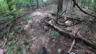
Photos of Worcester Mountain Bike
Videos of Worcester Mountain Bike

trail: Asylum
4:06 |
311 |
Feb 11, 2012
trail: Daredevils Descent
3:49 |
716 |
Sep 2, 2020 , Worcester
Recent Trail Reports
| status | trail | date | condition | info | user |
|---|---|---|---|---|---|
| The Stairmaster | Oct 24, 2025 @ 7:53pm (America/New_York) Oct 24, 2025 | Ideal | mappermook TRAILFORKS | ||
| East West Trail | Sep 18, 2025 @ 9:01am (America/New_York) Sep 18, 2025 | Unknown | massrider636 | ||
| El Jardin | Sep 22, 2024 @ 4:07pm Sep 22, 2024 | Ideal | SemperGumby | ||
| El Jardinero | Sep 22, 2024 @ 4:07pm Sep 22, 2024 | Ideal | SemperGumby | ||
| Memorials | Sep 22, 2024 @ 4:07pm Sep 22, 2024 | Ideal | SemperGumby | ||
| Parson's Cider Mill Trail | Aug 3, 2024 @ 7:09am Aug 3, 2024 | Variable | EvilCowDog | ||
| Circle the Drain | Aug 3, 2024 @ 7:09am Aug 3, 2024 | Unknown | EvilCowDog | ||
| DH to Drain | Aug 3, 2024 @ 7:09am Aug 3, 2024 | Wet | EvilCowDog | ||
| Dresser Loop | Aug 3, 2024 @ 7:09am Aug 3, 2024 | Variable | EvilCowDog | ||
| Blackstone River Bikeway | Jul 5, 2024 @ 7:17am Jul 5, 2024 | Variable | ncyr555 |
Activity Feed
| username | action | type | title | date |
|---|---|---|---|---|
| Bamitsmanny | wishlist | trail | activity #85737114 | Dec 19, 2025 @ 7:55am Dec 19, 2025 |
| WillieJacobsz | add | poi | activity #85649395 and 1 more | Dec 17, 2025 @ 6:13am Dec 17, 2025 |
| WillieJacobsz | update | trail | activity #85649272 | Dec 17, 2025 @ 6:10am Dec 17, 2025 |
| WillieJacobsz | update | polygon | activity #85649224 | Dec 17, 2025 @ 6:09am Dec 17, 2025 |
| mappermook | update | trail | activity #82961242 | Oct 24, 2025 @ 10:02pm Oct 24, 2025 |
Recent Comments
| username | type | title | comment | date |
|---|---|---|---|---|
| trail | Fun one! Short but it has some proper New... | Mar 29, 2025 @ 9:27am Mar 29, 2025 | ||
| trail | We climbed up Silver Spring Road and down this... | Jul 24, 2024 @ 3:15pm Jul 24, 2024 | ||
| trail | Nice climb up. Simple road, gravel & dirt. | Jul 24, 2024 @ 2:44pm Jul 24, 2024 | ||
| trail | I was excited to ride this trail after seeing... | Jul 24, 2024 @ 2:37pm Jul 24, 2024 | ||
| trail | Fun, simple trail. Nothing too... | Jul 24, 2024 @ 2:21pm Jul 24, 2024 |
Local Badges
-

10 Blue Trails27 awarded -

Epic Ride Climb 2k2 awarded -

Climbing 10k Badge12 awarded -

Climbing 100k Badge0 awarded -

Epic Ride Descent 2k2 awarded -

Descent 10k Badge12 awarded
Bike & Skill Parks
| name | type | city | rating |
|---|---|---|---|
| Greenhill Skatepark | skill park | Worcester |
Activity Type Stats
| activitytype | trails | distance | descent | descent distance | total vertical | rating | global rank | state rank | photos | reports | routes | ridelogs |
|---|---|---|---|---|---|---|---|---|---|---|---|---|
| Mountain Bike | 98 | 40 miles | 4,764 ft | 18 miles | 1,007 ft | #4,394 | #1,485 | 35 | 201 | 3,374 | ||
| E-Bike | 19 | 10 miles | 538 ft | 4 miles | 397 ft | #5,796 | #1,793 | 165 | 121 | |||
| Hike | 110 | 45 miles | 5,082 ft | 19 miles | 1,007 ft | #3,676 | 4 | 201 | 1 | 568 | ||
| Trail Running | 110 | 45 miles | 5,082 ft | 19 miles | 1,007 ft | #3,511 | #1,046 | 201 | 1 | 379 | ||
| Snowshoe | 79 | 29 miles | 4,272 ft | 13 miles | 1,007 ft | #495 | #172 | 34 | 23 | |||
| Backcountry Ski | 4 | 1,112 ft | 138 ft | 978 ft | 138 ft | #599 | #201 | 5 | 39 | |||
| Nordic Ski | 76 | 27 miles | 4,101 ft | 13 miles | 961 ft | #590 | #197 | 33 | 73 |
Frequently Asked Questions About Worcester
▼
What are the best places to ride in Worcester?
Worcester has 10 areas to explore for mountain biking. The top rated areas are:
▼
What are the highest rated mountain biking trails in Worcester?
The highest rated mountain biking trails in Worcester are:
- Asylum (4.1/5)
- Asnebumskit Ridge Trail (4.1/5)
- East West Trail (4.1/5)
- El Jardin (4.1/5)
- Asnebumskit Ridge Trail (4/5)
▼
What is the best time of the year to ride in Worcester?
Based on ride log data, the most popular months to ride in Worcester are:
- May (44 activities)
- October (35 activities)
- July (35 activities)
▼
Where can I park to ride in Worcester?
There are 20 parking locations listed in Worcester. The most popular parking spots are: View all parking and trailhead locations on the map to plan your visit.
Activities
Trails
- By WillieJacobsz
 Trailforks SBP SWW & contributors
 - Admins: BVNEMBA WORCTR, BVNEMBA Region, BVNEMBA Admins
- #14152 - 9,719 views
- worcester activity log | embed map of Worcester mountain bike trails | worcester mountain biking points of interest polygons
Downloading of trail gps tracks in kml & gpx formats is enabled for Worcester.
You must login to download files.