close
-
Layers w
- Weather Layers
- Pro
- Pro
- Pro
- Pro
- Pro
- Pro
- More Layers
- Pro
- Pro
- Pro
- Pro
-
Upgrade to

3D
Trail Conditions
- Unknown
- Snow Groomed
- Snow Packed
- Snow Covered
- Snow Cover Partial
- Freeze/thaw Cycle
- Icy
- Prevalent Mud
- Wet
- Variable
- Ideal
- Dry
- Very Dry
Trail Flow (Ridden Direction)
Trailforks scans users ridelogs to determine the most popular direction each trail is ridden. A good flowing trail network will have most trails flowing in a single direction according to their intension.
The colour categories are based on what percentage of riders are riding a trail in its intended direction.
The colour categories are based on what percentage of riders are riding a trail in its intended direction.
- > 96%
- > 90%
- > 80%
- > 70%
- > 50%
- < 50%
- bi-directional trail
- no data
Trail Last Ridden
Trailforks scans ridelogs to determine the last time a trail was ridden.
- < 2 days
- < 1 week
- < 2 weeks
- < 1 month
- < 6 months
- > 6 months
Trail Ridden Direction
The intended direction a trail should be ridden.
- Downhill Only
- Downhill Primary
- Both Directions
- Uphill Primary
- Uphill Only
- One Direction
Contribute Details
Colors indicate trail is missing specified detail.
- Description
- Photos
- Description & Photos
- Videos
Trail Popularity ?
Trailforks scans ridelogs to determine which trails are ridden the most in the last 9 months.
Trails are compared with nearby trails in the same city region with a possible 25 colour shades.
Think of this as a heatmap, more rides = more kinetic energy = warmer colors.
- most popular
- popular
- less popular
- not popular
ATV/ORV/OHV Filter
Max Vehicle Width
inches
US Cell Coverage
Legend

Radar Time
Activity Recordings
Trailforks uses anonymized public activity data.
?
Activity Recordings
Trailforks uses anonymized public activity data.
?
Personal Heatmap
▶
Activity Types
all
/
none
▶
Options
2
Date range
month
–
Winter Trails
Warning
A routing network for winter maps does not exist. Selecting trails using the winter trails layer has been disabled.
Missing Trails
Most Popular
Least Popular
Trails are colored based on popularity. The more popular a trail is, the more red. Less popular trails trend towards green.
Jump Magnitude Heatmap
Heatmap of where riders jump on trails. Zoom in to see individual jumps, click circles to view jump details.
BC Backroad Status
![map legend]()
Service Road Atlas is a free to use, community-driven service for viewing and creating reports on the numerous back-country service roads around B.C. and Alberta.

Slope Aspect
Direction the slope faces
Trails Deemphasized
Trails are shown in grey.
Only show trails with no bike usage.
Suggested Layers
Based on selected activity type
Save the current map location and zoom level as your default home location whenever this page is loaded.
Save
No description for Woronora has been added yet!
Login or register to submit one.
 google parking directions
Primary Trail Type: Cross-Country
eBikes Allowed:
No
AKA: West Loftus
google parking directions Activities Click to view
- Mountain Bike
63 trails
- E-Bike
31 trails
- Hike
49 trails
- Trail Running
49 trails
Region Details
- 15
- 7
- 25
- 14
- 2
Region Status
Caution as of Jun 7, 2026Stats
- Avg Trail Rating
- Trails (view details)
- 63
- Trails Mountain Bike
- 63
- Trails E-Bike
- 31
- Trails Hike
- 49
- Trails Trail Running
- 49
- Total Distance
- 30 miles
- Total Descent
- 7,351 ft
- Total Vertical
- 684 ft
- Highest Trailhead
- 708 ft
- Reports
- 324
- Photos
- 131
- Ridden Counter
- 4,108
Popular Woronora Mountain Biking Trails
• 75 ★ 4.0 • 1,152 ft • 0 ft • 139 •
A super fun trail, with some steep rolls, technical rock gardens, berms, a fun medium-sized drop, a gap jump, a sketchy but fun ladder bridge roll and finishes off with a super fun flowly section. Entrance is along the fire road that...
• 65 ★ 4.5 • 1,286 ft • 0 ft • 132 •
This trail is tons of fun. Short and steep, with a lots of fast flowly section, a perfect drop, a huge gap jump (avoidable) into a steep technical section with a sketchy rock drop that surprises me everytime. Entrance is in woronora...
• 55 ★ 0.0 • 2,818 ft • 50 ft • 111 •
Following the Caspian Trail, this rewards you with a lookout over the town and river Woronora
• 65 ★ 4.5 • 1,227 ft • 0 ft • 107 •
A north shore inspired trail with a significant rock roll feature. Steep and off camber sections and some technical rock gardens.
• 50 ★ 3.0 • 3,122 ft • 50 ft • 106 •
Moderately popular black diamond difficulty singletrack. This mountain bike primary trail can be used downhill only and has a moderate overall physical rating. It features berm, drop, jump, gap jump and rock garden. Trail visibility is always easy to follow. On average it takes 8 minutes to complete this trail.
• 60 ★ 0.0 • 1,306 ft • 0 ft • 95 •
Moderately popular blue difficulty singletrack. This mountain bike primary trail can be used downhill only. On average it takes 3 minutes to complete this trail.
• 30 ★ 0.0 • 1,512 ft • 0 ft • 94 •
White knuckled descent that will quickly see you from the Caspian trail to the Woronora Heights service road
Woronora Mountain Bike Routes
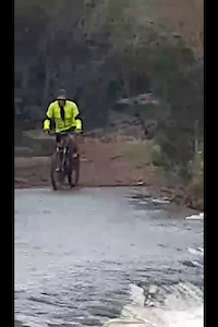
Photos of Woronora Mountain Bike
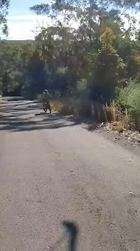
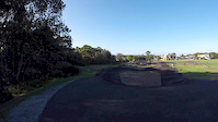
Videos of Woronora Mountain Bike
trail: Old Illawarra Road
0:26 |
29 |
Aug 9, 2023
trail: Engadine Waterboard Road
0:26 |
18 |
Aug 9, 2023

trail: Deepwater Dh
0:00 |
408 |
Jan 18, 2021
trail: Sneaky
0:18 |
182 |
Feb 18, 2020

trail: In Deep
0:40 |
2207 |
Aug 23, 2016

trail: Sneaky
0:48 |
372 |
Jun 13, 2016

trail: Jans
0:36 |
191 |
Oct 22, 2015

trail: Jans
0:10 |
455 |
Aug 9, 2014
Current Trail Warnings
| status | trail | date | condition | user | info |
|---|---|---|---|---|---|
| Powerful Owl | Jun 5, 2026 @ 3:44pm (Australia/Sydney) Jun 4, 2026 | Unknown | MenaiMountainBiker | Way overgrown |
Recent Trail Reports
| status | trail | date | condition | info | user |
|---|---|---|---|---|---|
| Redbellied Surprise | Jun 8, 2026 @ 11:20am (Australia/Sydney) Jun 7, 2026 | Ideal | RomanMark | ||
| Lower trail | May 9, 2026 @ 1:01pm (Australia/Sydney) May 8, 2026 | Ideal | StrongFlatWhite | ||
| Cliff Track | May 9, 2026 @ 1:01pm (Australia/Sydney) May 8, 2026 | Ideal | StrongFlatWhite | ||
| Waterfall | May 9, 2026 @ 1:01pm (Australia/Sydney) May 8, 2026 | Ideal | StrongFlatWhite | ||
| Double Cross | Apr 28, 2026 @ 1:22pm (Australia/Sydney) Apr 27, 2026 | Ideal | Goonduro | ||
| In Deep | Apr 28, 2026 @ 1:22pm (Australia/Sydney) Apr 27, 2026 | Ideal | Goonduro | ||
| Raw Dawg | Apr 28, 2026 @ 1:22pm (Australia/Sydney) Apr 27, 2026 | Dry | Goonduro | ||
| Cemetery Downhill | Apr 28, 2026 @ 1:22pm (Australia/Sydney) Apr 27, 2026 | Ideal | Goonduro | ||
| Sloppy Seconds | Apr 26, 2026 @ 9:45am (Australia/Sydney) Apr 25, 2026 | Dry | gpmcg | ||
| F-Blasting | Apr 26, 2026 @ 9:45am (Australia/Sydney) Apr 25, 2026 | Dry | gpmcg |
Activity Feed
| username | action | type | title | date |
|---|---|---|---|---|
| RomanMark | add | report | activity #96579068 | Jun 8, 2026 @ 6:46pm Jun 8, 2026 |
| MenaiMountainBiker | add | report | activity #96277640 | Jun 4, 2026 @ 10:44pm Jun 4, 2026 |
| peter80 | wishlist | trail | activity #96005487 | Jun 1, 2026 @ 2:46am Jun 1, 2026 |
| StrongFlatWhite | add | report | activity #94461729 and 2 more | May 10, 2026 @ 2:54pm May 10, 2026 |
| Pulv73 | ridden | trail | activity #93831716 | May 1, 2026 @ 9:14pm May 1, 2026 |
Recent Comments
| username | type | title | comment | date |
|---|---|---|---|---|
| trail | DO NOT RIDE NOT WORTH THE CLIMB VERY TIGHT TRAIL | Dec 19, 2025 @ 1:11am Dec 19, 2025 | ||
| trail | Beautiful steep rocky chonks with tight turns.... | Nov 6, 2025 @ 1:09am Nov 6, 2025 | ||
| trail | Oh | Sep 26, 2025 @ 3:50am Sep 26, 2025 | ||
| trail | Running very well | Jul 28, 2025 @ 10:16pm Jul 28, 2025 | ||
| trail | Last 3/4 raked and cleaned up. I’ll be back... | Feb 10, 2025 @ 6:10pm Feb 10, 2025 |
Nearby Areas
| name | distance | ||||
|---|---|---|---|---|---|
| Yarrawarrah Valley | 1.3 km | ||||
| Loftus/Yarrawarrah | 19 | 6 | 10 | 1 | 1.7 km |
| Royal NP - Temptation Creek | 33 | 17 | 5 | 1 | 1.7 km |
| Engadine | 2 | 1.8 km | |||
| Royal NP - East Heathcote | 8 | 8 | 3.1 km |
Local Badges
-

Completionist0 awarded
Activity Type Stats
| activitytype | trails | distance | descent | descent distance | total vertical | rating | global rank | state rank | photos | reports | routes | ridelogs |
|---|---|---|---|---|---|---|---|---|---|---|---|---|
| Mountain Bike | 63 | 30 miles | 7,349 ft | 17 miles | 686 ft | #2,716 | #136 | 129 | 324 | 1 | 6,463 | |
| E-Bike | 31 | 19 miles | 3,589 ft | 10 miles | 676 ft | #3,902 | #189 | 262 | 910 | |||
| Hike | 49 | 27 miles | 5,220 ft | 15 miles | 686 ft | #5,608 | #164 | 2 | 290 | 629 | ||
| Trail Running | 49 | 27 miles | 5,220 ft | 15 miles | 686 ft | #4,621 | #135 | 290 | 897 |
Frequently Asked Questions About Woronora
▼
What are the highest rated mountain biking trails in Woronora?
The highest rated mountain biking trails in Woronora are:
- Upper Forbes Creek (4.2/5)
- Nang Banger (4.1/5)
- Redbellied Surprise (4.1/5)
- Cliff Track (4.1/5)
- Jans (4.1/5)
▼
What is the best time of the year to ride in Woronora?
Based on ride log data, the most popular months to ride in Woronora are:
- July (51 activities)
- April (49 activities)
- August (48 activities)
▼
Where can I park to ride in Woronora?
There are 1 parking locations listed in Woronora. The most popular parking spots are:
▼
What is the longest trail in Woronora?
The longest trail in Woronora is RT Forbes Creek Singletrack at 2.6 km. View all trails sorted by distance.
Activities
Trails
Points of Interest
- By sendinit & contributors
- Admins: TrailCare, MCTA
- #29248 - 11,295 views
- woronora activity log | embed map of Woronora mountain bike trails | woronora mountain biking points of interest
Downloading of trail gps tracks in kml & gpx formats is enabled for Woronora.
You must login to download files.