close
-
Layers w
- Weather Layers
- Pro
- Pro
- Pro
- Pro
- Pro
- Pro
- More Layers
- Pro
- Pro
- Pro
- Pro
-
Upgrade to

3D
Trail Conditions
- Unknown
- Snow Groomed
- Snow Packed
- Snow Covered
- Snow Cover Partial
- Freeze/thaw Cycle
- Icy
- Prevalent Mud
- Wet
- Variable
- Ideal
- Dry
- Very Dry
Trail Flow (Ridden Direction)
Trailforks scans users ridelogs to determine the most popular direction each trail is ridden. A good flowing trail network will have most trails flowing in a single direction according to their intension.
The colour categories are based on what percentage of riders are riding a trail in its intended direction.
The colour categories are based on what percentage of riders are riding a trail in its intended direction.
- > 96%
- > 90%
- > 80%
- > 70%
- > 50%
- < 50%
- bi-directional trail
- no data
Trail Last Ridden
Trailforks scans ridelogs to determine the last time a trail was ridden.
- < 2 days
- < 1 week
- < 2 weeks
- < 1 month
- < 6 months
- > 6 months
Trail Ridden Direction
The intended direction a trail should be ridden.
- Downhill Only
- Downhill Primary
- Both Directions
- Uphill Primary
- Uphill Only
- One Direction
Contribute Details
Colors indicate trail is missing specified detail.
- Description
- Photos
- Description & Photos
- Videos
Trail Popularity ?
Trailforks scans ridelogs to determine which trails are ridden the most in the last 9 months.
Trails are compared with nearby trails in the same city region with a possible 25 colour shades.
Think of this as a heatmap, more rides = more kinetic energy = warmer colors.
- most popular
- popular
- less popular
- not popular
ATV/ORV/OHV Filter
Max Vehicle Width
inches
US Cell Coverage
Legend

Radar Time
Activity Recordings
Trailforks uses anonymized public activity data.
?
Activity Recordings
Trailforks uses anonymized public activity data.
?
Personal Heatmap
▶
Activity Types
all
/
none
▶
Options
2
Date range
month
–
Winter Trails
Warning
A routing network for winter maps does not exist. Selecting trails using the winter trails layer has been disabled.
Missing Trails
Most Popular
Least Popular
Trails are colored based on popularity. The more popular a trail is, the more red. Less popular trails trend towards green.
Jump Magnitude Heatmap
Heatmap of where riders jump on trails. Zoom in to see individual jumps, click circles to view jump details.
BC Backroad Status
![map legend]()
Service Road Atlas is a free to use, community-driven service for viewing and creating reports on the numerous back-country service roads around B.C. and Alberta.

Slope Aspect
Direction the slope faces
Trails Deemphasized
Trails are shown in grey.
Only show trails with no bike usage.
Suggested Layers
Based on selected activity type
Save the current map location and zoom level as your default home location whenever this page is loaded.
Save
No description for Wrexham County has been added yet!
Login or register to submit one.
This region uses the Uk/Euro style trail grading system.
Activities Click to view
- Mountain Bike
18 trails
- E-Bike
10 trails
- Hike
14 trails
- Trail Running
14 trails
Region Details
- 2
- 2
- 2
- 3
- 7
Stats
- Avg Trail Rating
- Trails (view details)
- 17
- Trails Mountain Bike
- 18
- Trails E-Bike
- 10
- Trails Horse
- 1
- Trails Hike
- 14
- Trails Trail Running
- 14
- Total Distance
- 27 miles
- Total Descent
- 5,126 ft
- Total Vertical
- 835 ft
- Highest Trailhead
- 1,704 ft
- Reports
- 297
- Photos
- 253
- Ridden Counter
- 5,260
Sub Regions
- llangollen (4)
- Wrexham (16)
- Llandegla (16)
- Llandegla Forest (5)
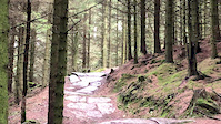
Popular Wrexham County Mountain Biking Trails
• 100 ★ 3.5 • 1 mile • 230 ft • 1,785 •
Popular black difficulty singletrack. This mountain bike primary trail can be used one direction. On average it takes 10 minutes to complete this trail.
• 60 ★ 4.8 • 2 miles • 370 ft • 1,612 •
See notice boards and Oneplanetadventure for more details
• 95 ★ 4.5 • 9 miles • 1,165 ft • 1,417 •
Highly rated popular red difficulty singletrack. This mountain bike primary trail can be used one direction and has a moderate overall physical rating with a 1,165 ft black diamond climb. It features bridge, drop, jump, roller coaster and skinny. On average it takes 56 minutes to complete this trail.
• 30 ★ 4.0 • 1,715 ft • 116 ft • 1,358 •
Less popular black difficulty singletrack. This mountain bike primary trail can be used one direction. On average it takes 4 minutes to complete this trail.
• 75 ★ 4.0 • 4,728 ft • 41 ft • 1,286 •
Popular black difficulty singletrack. This mountain bike primary trail can be used one direction and has a hard overall physical rating. On average it takes 5 minutes to complete this trail.
• 70 ★ 3.7 • 2,815 ft • 65 ft • 1,102 •
Part of Coed Llandegla Forest Trails, See notice at trail start and OnePlanetAdventure for more details.
• 40 ★ 4.3 • 4 miles • 136 ft • 714 •
12 km/7.5 miles A great route to try before embarking on the longer ‘Intermediate’ Route.
Wrexham County Mountain Bike Routes
★ 4.7 • 15 miles • 2,515 ft • 15 • Loop •
The red and black trail loop at llandegla forest park bike trails centre
• 11 miles • 1,778 ft • 3 •
• 17 miles • 2,890 ft • 6 •
• 13 miles • 1,943 ft • 3 •
• 18 miles • 3,235 ft • 7 •
• 13 miles • 2,040 ft • 5 •
Photos of Wrexham County Mountain Bike
Videos of Wrexham County Mountain Bike

10:11 |
15 |
Oct 31, 2021

3:11 |
12 |
Jun 18, 2021
trail: Parallel Universe
0:10 |
251 |
Feb 10, 2019

0:44 |
438 |
Oct 1, 2018

trail: Parallel Universe
5:55 |
289 |
Jul 25, 2018

trail: Llandegla Red
16:07 |
391 |
Jul 14, 2018

trail: Llandegla Red
9:43 |
93 |
Apr 28, 2018

10:31 |
59 |
Nov 24, 2017
Recent Trail Reports
| status | trail | date | condition | info | user |
|---|---|---|---|---|---|
| Back to the Red Llandegla | Apr 25, 2026 @ 11:02am (Europe/London) Apr 25, 2026 | Dry | benusher1 | ||
| Black Trail 4 (JJs Jumps and B-Line) Llandegla | Apr 25, 2026 @ 11:02am (Europe/London) Apr 25, 2026 | Dry | benusher1 | ||
| From Dusk Till Dawn Llandegla | Apr 25, 2026 @ 11:02am (Europe/London) Apr 25, 2026 | Dry | benusher1 | ||
| Dave The Fox Llandegla | Nov 10, 2025 @ 9:25am (Europe/London) Nov 10, 2025 | Wet | Vimto-North | ||
| Natural selection Llandegla | Nov 10, 2025 @ 9:25am (Europe/London) Nov 10, 2025 | Wet | Vimto-North | ||
| Llandegla Red Llandegla | Jun 4, 2025 @ 9:45am Jun 4, 2025 | Ideal | EdReynolds | ||
| Big Jims Llandegla | May 19, 2025 @ 1:22pm May 19, 2025 | Very Dry | BartK | ||
| Black Trail 3 Llandegla Forest | May 19, 2025 @ 1:22pm May 19, 2025 | Very Dry | BartK | ||
| Parallel Universe Llandegla | Apr 12, 2025 @ 10:03am Apr 12, 2025 | Dry | Paul3Lyle9 | ||
| Red route Llandegla | May 19, 2024 @ 2:41am May 19, 2024 | Dry | PembsBiker |
Activity Feed
| username | action | type | title | date |
|---|---|---|---|---|
| SBolton | wishlist | trail | activity #97267885 | Jun 18, 2026 @ 12:01pm 2 days |
| Cedkins | wishlist | route | activity #94739503 | May 15, 2026 @ 3:21am May 15, 2026 |
| Charlie12artpro | add | photo | activity #94231345 | May 7, 2026 @ 11:35am May 7, 2026 |
| DennyuVYUvV | wishlist | trail | activity #93934927 | May 3, 2026 @ 4:51am May 3, 2026 |
| benusher1 | add | report | activity #93351720 and 1 more | Apr 25, 2026 @ 7:02am Apr 25, 2026 |
Recent Comments
| username | type | title | comment | date |
|---|---|---|---|---|
| trail | Weird switchbacks and quite pedally, with lots... | Jun 7, 2024 @ 6:04am Jun 7, 2024 | ||
| trail | Rode with uni mates. Big Jim’s was faster... | Jun 7, 2024 @ 6:03am Jun 7, 2024 | ||
| trail | This section is called Big Jims | Mar 10, 2023 @ 10:05am Mar 10, 2023 | ||
| trail | Awesome trail. Bring £8 for parking (2020)... | Jul 14, 2020 @ 1:03pm Jul 14, 2020 | ||
| trail | Car park just gone up to a fiver and some... | Mar 13, 2020 @ 2:24pm Mar 13, 2020 |
Local Badges
-

Epic Mountain Bike Climb 2k44 awarded -

Climbing 10k Badge24 awarded -

Mountain Biking 100k Badge1 awarded -

Epic Ride Descent 2k44 awarded -

Descent 10k Badge24 awarded -

Descent 100k Badge1 awarded
Bike & Skill Parks
| name | type | city | rating |
|---|---|---|---|
| One Giant Leap DH MTB uplift venue | skill park | llangollen | |
| Treuddyn Pumptrack | skill park | Mynydd Du | |
| Ponciaui Banks Pumptrack | skill park | Wrexham |
Activity Type Stats
| activitytype | trails | distance | descent | descent distance | total vertical | rating | global rank | state rank | photos | reports | routes | ridelogs |
|---|---|---|---|---|---|---|---|---|---|---|---|---|
| Mountain Bike | 18 | 26 miles | 4,948 ft | 13 miles | 837 ft | 252 | 297 | 1 | 17,964 | |||
| E-Bike | 10 | 7 miles | 1,690 ft | 5 miles | 548 ft | 1 | 261 | 3,898 | ||||
| Horse | 1 | 93 | ||||||||||
| Hike | 14 | 13 miles | 3,005 ft | 7 miles | 758 ft | 280 | 177 | |||||
| Trail Running | 14 | 13 miles | 3,005 ft | 7 miles | 758 ft | 280 | 83 |
Frequently Asked Questions About Wrexham County
▼
What are the best places to ride in Wrexham County?
Wrexham County has 2 areas to explore for mountain biking. The top rated areas are:
▼
What are the highest rated mountain biking trails in Wrexham County?
The highest rated mountain biking trails in Wrexham County are:
- Llandegla Red (4.3/5)
- Black Trail 4 (JJs Jumps and B-Line) (4.3/5)
- Blue Route (4.1/5)
- Red route (4.1/5)
- Old Blue Trail (4.1/5)
▼
What is the best time of the year to ride in Wrexham County?
Based on ride log data, the most popular months to ride in Wrexham County are:
- August (66 activities)
- July (63 activities)
- September (55 activities)
▼
What is the longest trail in Wrexham County?
The longest trail in Wrexham County is Llandegla Red at 9.3 miles. View all trails sorted by distance.
Activities
Trails
Points of Interest
- By brenthillier
 NSMBA TRAILFORKS & contributors
 - Admins: UKTP, 20twenty-p, TCNW
- #6987 - 6,049 views
- wrexham county activity log | embed map of Wrexham County mountain bike trails | wrexham county mountain biking points of interest
Downloading of trail gps tracks in kml & gpx formats is enabled for Wrexham County.
You must login to download files.