close
-
Layers w
- Weather Layers
- Pro
- Pro
- Pro
- Pro
- Pro
- Pro
- More Layers
- Pro
- Pro
- Pro
- Pro
-
Upgrade to

3D
Trail Conditions
- Unknown
- Snow Groomed
- Snow Packed
- Snow Covered
- Snow Cover Partial
- Freeze/thaw Cycle
- Icy
- Prevalent Mud
- Wet
- Variable
- Ideal
- Dry
- Very Dry
Trail Flow (Ridden Direction)
Trailforks scans users ridelogs to determine the most popular direction each trail is ridden. A good flowing trail network will have most trails flowing in a single direction according to their intension.
The colour categories are based on what percentage of riders are riding a trail in its intended direction.
The colour categories are based on what percentage of riders are riding a trail in its intended direction.
- > 96%
- > 90%
- > 80%
- > 70%
- > 50%
- < 50%
- bi-directional trail
- no data
Trail Last Ridden
Trailforks scans ridelogs to determine the last time a trail was ridden.
- < 2 days
- < 1 week
- < 2 weeks
- < 1 month
- < 6 months
- > 6 months
Trail Ridden Direction
The intended direction a trail should be ridden.
- Downhill Only
- Downhill Primary
- Both Directions
- Uphill Primary
- Uphill Only
- One Direction
Contribute Details
Colors indicate trail is missing specified detail.
- Description
- Photos
- Description & Photos
- Videos
Trail Popularity ?
Trailforks scans ridelogs to determine which trails are ridden the most in the last 9 months.
Trails are compared with nearby trails in the same city region with a possible 25 colour shades.
Think of this as a heatmap, more rides = more kinetic energy = warmer colors.
- most popular
- popular
- less popular
- not popular
ATV/ORV/OHV Filter
Max Vehicle Width
inches
US Cell Coverage
Legend

Radar Time
Activity Recordings
Trailforks uses anonymized public activity data.
?
Activity Recordings
Trailforks uses anonymized public activity data.
?
Personal Heatmap
▶
Activity Types
all
/
none
▶
Options
2
Date range
month
–
Winter Trails
Warning
A routing network for winter maps does not exist. Selecting trails using the winter trails layer has been disabled.
Missing Trails
Most Popular
Least Popular
Trails are colored based on popularity. The more popular a trail is, the more red. Less popular trails trend towards green.
Jump Magnitude Heatmap
Heatmap of where riders jump on trails. Zoom in to see individual jumps, click circles to view jump details.
BC Backroad Status
![map legend]()
Service Road Atlas is a free to use, community-driven service for viewing and creating reports on the numerous back-country service roads around B.C. and Alberta.

Slope Aspect
Direction the slope faces
Trails Deemphasized
Trails are shown in grey.
Only show trails with no bike usage.
Suggested Layers
Based on selected activity type
Save the current map location and zoom level as your default home location whenever this page is loaded.
SaveActivities Click to view
- Mountain Bike
202 trails
- E-Bike
204 trails
- Gravel Bike
82 trails
- Adaptive Bike
20 trails
- Hike
160 trails
- Trail Running
160 trails
Region Details
- 159
- 32
- 8
- 2
Region Status
Open as of Jun 8, 2026Stats
- Avg Trail Rating
- Trails (view details)
- 203
- Trails Mountain Bike
- 203
- Trails E-Bike
- 204
- Trails Gravel Bike
- 82
- Trails Adaptive Bike
- 20
- Trails Hike
- 160
- Trails Trail Running
- 160
- Trails Nordic Ski
- 1
- Total Distance
- 193 miles
- Total Descent
- 5,324 ft
- Total Vertical
- 168 ft
- Highest Trailhead
- 512 ft
- Reports
- 1,790
- Photos
- 113
- Ridden Counter
- 22,029
Sub Regions
-
Górka Skarbowców
- 3
-
Las Osobowicki
- 6
- 4
- 1
-
Las Strachociński
- 3
Popular Wrocław Mountain Biking Trails
• 95 ★ 4.5 • 476 ft • 0 ft • 227 •
Popular green difficulty singletrack. This mountain bike primary trail can be used downhill primary. On average it takes 2 minutes to complete this trail.
• 85 ★ 3.7 • 551 ft • 0 ft • 216 •
Popular blue difficulty singletrack. This mountain bike primary trail can be used downhill primary. On average it takes 1 minutes to complete this trail.
• 100 ★ 4.7 • 561 ft • 0 ft • 201 •
Popular blue difficulty singletrack. This mountain bike primary trail can be used one direction and has a easy overall physical rating with a 0 ft green climb. On average it takes 2 minutes to complete this trail.
• 90 ★ 5.0 • 623 ft • 0 ft • 154 •
Popular green difficulty singletrack. This mountain bike primary trail can be used downhill only. It features berm and jump. On average it takes 2 minutes to complete this trail.
• 75 ★ 0.0 • 873 ft • 15 ft • 152 •
Popular red difficulty mixed. This mountain bike primary trail can be used downhill only and has a easy overall physical rating with a 15 ft green climb. It features berm, drop, jump, gap jump and pump track. On average it takes 12 minutes to complete this trail.
Wrocław Mountain Bike Routes
27 miles • 572 ft • 17 • Loop •
Szlak Rowerowy Odry i Widawy - trasa biegnie głównie po wałach z dala od głównych ulic, dzięki czemu...
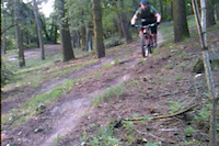
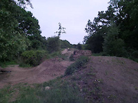
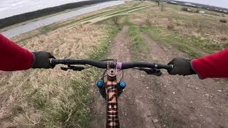
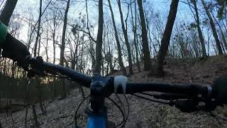
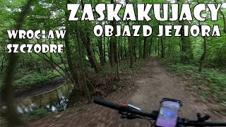
Photos of Wrocław Mountain Bike
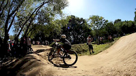
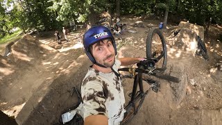
Videos of Wrocław Mountain Bike
trail: Trawers Prawo
0:05 |
658 |
Jul 23, 2015
trail: Kili / K2
4:20 |
1972 |
Aug 22, 2012
10:22 |
7 |
Apr 28, 2026
trail: Kili / K2
0:31 |
355 |
May 17, 2011
trail: Wzgórze Maślickie
0:36 |
154 |
Mar 9, 2024 , Wrocław

trail: DdR: Aleja Wielkiej Wyspy
5:47 |
139 |
Mar 4, 2024 , Wrocław
trail: Ejlajn
8:54 |
261 |
Feb 17, 2024 , Wrocław
37:10 |
126 |
Nov 24, 2023 , Wrocław
Recent Trail Reports
| status | trail | date | condition | info | user |
|---|---|---|---|---|---|
| Ścieżka Międzyrzecka | Jun 8, 2026 @ 10:39am (Pacific/Midway) Jun 8, 2026 | Ideal | gdzietatrasa | ||
| Most Rakowiecki - Krzywa Grobla | Jun 8, 2026 @ 10:39am (Pacific/Midway) Jun 8, 2026 | Ideal | gdzietatrasa | ||
| Most Zwierzyniecki - Jaz Opatowicki | May 31, 2026 @ 12:48pm (Pacific/Midway) May 31, 2026 | Ideal | gdzietatrasa | ||
| Aleja Dębowa 2 | May 31, 2026 @ 12:48pm (Pacific/Midway) May 31, 2026 | Ideal | gdzietatrasa | ||
| Pod Mostem Strachocińskim Zachód | May 31, 2026 @ 12:48pm (Pacific/Midway) May 31, 2026 | Ideal | gdzietatrasa | ||
| Pod Mostem Strachocińskim Wschód | May 31, 2026 @ 12:48pm (Pacific/Midway) May 31, 2026 | Ideal | gdzietatrasa | ||
| Grobla Łanieska | May 31, 2026 @ 12:48pm (Pacific/Midway) May 31, 2026 | Ideal | gdzietatrasa | ||
| Łącznik Dwukierunkowy | May 31, 2026 @ 12:48pm (Pacific/Midway) May 31, 2026 | Ideal | gdzietatrasa | ||
| Kładka Zwierzyniecka | May 31, 2026 @ 12:48pm (Pacific/Midway) May 31, 2026 | Ideal | gdzietatrasa | ||
| Mosty Jagiellońskie - Most Bartoszowicki | Jun 6, 2026 @ 10:07am (Europe/Prague) Jun 6, 2026 | Ideal | Powsinoga |
Activity Feed
| username | action | type | title | date |
|---|---|---|---|---|
| gdzietatrasa | add | report | activity #96589278 and 1 more | Jun 9, 2026 @ 12:40am Jun 9, 2026 |
| gdzietatrasa | add | report | activity #96539505 and 6 more | Jun 8, 2026 @ 7:53am Jun 8, 2026 |
| Powsinoga | add | report | activity #96392748 and 7 more | Jun 6, 2026 @ 11:43am Jun 6, 2026 |
| Tommi999 | add | report | activity #96392493 | Jun 6, 2026 @ 11:40am Jun 6, 2026 |
| Tommi999 | add | report | activity #96392488 and 5 more | Jun 6, 2026 @ 11:40am Jun 6, 2026 |
Recent Comments
| username | type | title | comment | date |
|---|---|---|---|---|
| trail | Tam jest teraz tak: kończy się wał, dalej... | Aug 17, 2025 @ 12:24pm Aug 17, 2025 | ||
| trail | Może tę drogę do AOW trzeba jakoś udrożnić? | Aug 17, 2025 @ 7:33am Aug 17, 2025 | ||
| trail | To kiedyś pewnie był fajny singiel, ale... | Jul 27, 2025 @ 2:10am Jul 27, 2025 | ||
| trail | W dzień sporo pieszych. Fajnie jest się... | Jul 27, 2025 @ 2:08am Jul 27, 2025 | ||
| trail | Dla spargnionych szutru i mniejszych... | Jul 27, 2025 @ 2:02am Jul 27, 2025 |
Local Badges
-

Epic Ride Climb 2k22 awarded -

Climbing 10k Badge192 awarded -

Climbing 100k Badge13 awarded -

Epic Ride Descent 2k24 awarded -

Descent 10k Badge192 awarded -

Descent 100k Badge13 awarded
Bike & Skill Parks
| name | type | city | rating |
|---|---|---|---|
| Pumptrack Kuźniki | skill park | Wrocław | |
| Pumptrack Wrocław | skill park | Wrocław | |
| Dirt Kosmos | skill park | Wrocław | |
| Pumptrack Wrocław Królewiecka | skill park | Wrocław | |
| Pumptrack Zakrzów | skill park | Wrocław |
Activity Type Stats
| activitytype | trails | distance | descent | descent distance | total vertical | rating | global rank | state rank | photos | reports | routes | ridelogs |
|---|---|---|---|---|---|---|---|---|---|---|---|---|
| Mountain Bike | 202 | 192 miles | 5,318 ft | 71 miles | 167 ft | #335 | #7 | 96 | 1,790 | 2 | 90,861 | |
| E-Bike | 204 | 192 miles | 5,318 ft | 71 miles | 167 ft | #278 | #260 | 1,772 | 2 | 1,426 | ||
| Gravel Bike | 82 | 103 miles | 2,054 ft | 38 miles | 102 ft | #7 | #25 | 15 | 97 | 2 | 1,807 | |
| Adaptive Bike | 20 | 15 miles | 433 ft | 5 miles | 85 ft | #67 | #79 | 201 | 1 | |||
| Hike | 160 | 136 miles | 4,203 ft | 51 miles | 167 ft | #334 | #24 | 2 | 1,783 | 2,712 | ||
| Trail Running | 160 | 136 miles | 4,203 ft | 51 miles | 167 ft | #415 | #22 | 1,783 | 1 | 5,370 | ||
| Nordic Ski | 1 | 1,191 ft | 7 ft | 436 ft | 10 ft | #1,166 | 30 |
Frequently Asked Questions About Wrocław
▼
What are the best places to ride in Wrocław?
Wrocław has 3 areas to explore for mountain biking. The top rated areas are:
▼
What are the highest rated mountain biking trails in Wrocław?
The highest rated mountain biking trails in Wrocław are:
- Sośnik (4.2/5)
- Szwedzki Szaniec 2 (4.2/5)
- Szwedzki Szaniec 1 (4.2/5)
- Środkowa (4.1/5)
- Trawers Lewo (4.1/5)
▼
What is the best time of the year to ride in Wrocław?
Based on ride log data, the most popular months to ride in Wrocław are:
- May (269 activities)
- July (253 activities)
- June (233 activities)
▼
Where can I park to ride in Wrocław?
There are 5 parking locations listed in Wrocław. The most popular parking spots are: View all parking and trailhead locations on the map to plan your visit.
Activities
Trails
- By szusz & contributors
- Admins: xaoo, xaoo
- #9357 - 19,389 views
- wrocław activity log | embed map of Wrocław mountain bike trails | wrocław mountain biking points of interest
Downloading of trail gps tracks in kml & gpx formats is enabled for Wrocław.
You must login to download files.