close
-
Layers w
- Weather Layers
- Pro
- Pro
- Pro
- Pro
- Pro
- Pro
- More Layers
- Pro
- Pro
- Pro
- Pro
-
Upgrade to

3D
Trail Conditions
- Unknown
- Snow Groomed
- Snow Packed
- Snow Covered
- Snow Cover Partial
- Freeze/thaw Cycle
- Icy
- Prevalent Mud
- Wet
- Variable
- Ideal
- Dry
- Very Dry
Trail Flow (Ridden Direction)
Trailforks scans users ridelogs to determine the most popular direction each trail is ridden. A good flowing trail network will have most trails flowing in a single direction according to their intension.
The colour categories are based on what percentage of riders are riding a trail in its intended direction.
The colour categories are based on what percentage of riders are riding a trail in its intended direction.
- > 96%
- > 90%
- > 80%
- > 70%
- > 50%
- < 50%
- bi-directional trail
- no data
Trail Last Ridden
Trailforks scans ridelogs to determine the last time a trail was ridden.
- < 2 days
- < 1 week
- < 2 weeks
- < 1 month
- < 6 months
- > 6 months
Trail Ridden Direction
The intended direction a trail should be ridden.
- Downhill Only
- Downhill Primary
- Both Directions
- Uphill Primary
- Uphill Only
- One Direction
Contribute Details
Colors indicate trail is missing specified detail.
- Description
- Photos
- Description & Photos
- Videos
Trail Popularity ?
Trailforks scans ridelogs to determine which trails are ridden the most in the last 9 months.
Trails are compared with nearby trails in the same city region with a possible 25 colour shades.
Think of this as a heatmap, more rides = more kinetic energy = warmer colors.
- most popular
- popular
- less popular
- not popular
ATV/ORV/OHV Filter
Max Vehicle Width
inches
US Cell Coverage
Legend

Radar Time
Activity Recordings
Trailforks uses anonymized public activity data.
?
Activity Recordings
Trailforks uses anonymized public activity data.
?
Personal Heatmap
▶
Activity Types
all
/
none
▶
Options
2
Date range
month
–
Winter Trails
Warning
A routing network for winter maps does not exist. Selecting trails using the winter trails layer has been disabled.
Missing Trails
Most Popular
Least Popular
Trails are colored based on popularity. The more popular a trail is, the more red. Less popular trails trend towards green.
Jump Magnitude Heatmap
Heatmap of where riders jump on trails. Zoom in to see individual jumps, click circles to view jump details.
BC Backroad Status
![map legend]()
Service Road Atlas is a free to use, community-driven service for viewing and creating reports on the numerous back-country service roads around B.C. and Alberta.

Slope Aspect
Direction the slope faces
Trails Deemphasized
Trails are shown in grey.
Only show trails with no bike usage.
Suggested Layers
Based on selected activity type
Save the current map location and zoom level as your default home location whenever this page is loaded.
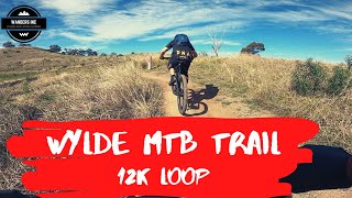
SaveWylde in Western Sydney Parklands is the largest combined mountain biking and BMX hub in Australia, featuring more than 15km of purpose-built mountain bike trails, a BMX racetrack and the largest pump track in the Southern Hemisphere.
Located on Range Road, off Elizabeth Drive in Cecil Park, Wylde caters for beginner, intermediate, competent, and advanced riders.
Located on Range Road, off Elizabeth Drive in Cecil Park, Wylde caters for beginner, intermediate, competent, and advanced riders.
source: ...
 google parking directions
Links
Activities Click to view
- Mountain Bike
21 trails
- E-Bike
12 trails
- Hike
5 trails
- Trail Running
5 trails
Region Details
- 3
- 1
- 7
- 9
- 1
Region Status
Open as of Jun 4, 2026Stats
- Avg Trail Rating
- Trails (view details)
- 21
- Trails Mountain Bike
- 21
- Trails E-Bike
- 12
- Trails Hike
- 5
- Trails Trail Running
- 5
- Total Distance
- 8 miles
- Total Descent Distance
- 4 miles
- Total Descent
- 852 ft
- Total Vertical
- 319 ft
- Highest Trailhead
- 460 ft
- Reports
- 527
- Photos
- 97
- Ridden Counter
- 13,600
Popular Wylde MTB Mountain Biking Trails
• 100 ★ 4.0 • 679 ft • 2 ft • 860 •
Popular green difficulty singletrack. This mountain bike primary trail can be used downhill only. It features berm and drop. Trail visibility is always easy to follow. On average it takes 1 minutes to complete this trail.
• 100 ★ 3.0 • 1,145 ft • 0 ft • 776 •
Popular black diamond difficulty singletrack. This mountain bike primary trail can be used downhill only. It features berm, drop, gap jump and ladder bridge. Trail visibility is always easy to follow. On average it takes 2 minutes to complete this trail.
• 100 ★ 4.4 • 1,991 ft • 12 ft • 775 •
Popular green difficulty singletrack. This mountain bike primary trail can be used downhill only. Trail visibility is always easy to follow. On average it takes 2 minutes to complete this trail.
• 80 ★ 0.0 • 738 ft • 0 ft • 741 •
Popular blue difficulty singletrack. This mountain bike primary trail can be used downhill only. It features berm and jump. Trail visibility is always easy to follow. On average it takes minutes to complete this trail.
• 60 ★ 3.4 • 1 mile • 81 ft • 662 •
Moderately popular blue difficulty singletrack. This mountain bike primary trail can be used downhill only and has a moderate overall physical rating with a 81 ft green climb. It features berm, drop, jump, gap jump and rock face. Trail visibility is always easy to follow. On average it takes 8 minutes to complete this trail.
Photos of Wylde MTB Mountain Bike
Videos of Wylde MTB Mountain Bike
trail: Roly Poly Valley
7:28 |
4407 |
Apr 13, 2021 , Parramatta
Recent Trail Reports
| status | trail | date | condition | info | user |
|---|---|---|---|---|---|
| V-Twin Left | Jun 5, 2026 @ 3:47pm (Australia/Sydney) Jun 4, 2026 | Very Dry | RyanCroft | ||
| Home Trail | Apr 27, 2026 @ 7:55am (Australia/Sydney) Apr 26, 2026 | Very Dry | MacroTiara | ||
| Home Run | Apr 27, 2026 @ 7:55am (Australia/Sydney) Apr 26, 2026 | Very Dry | MacroTiara | ||
| Lower Link | Apr 27, 2026 @ 7:55am (Australia/Sydney) Apr 26, 2026 | Very Dry | MacroTiara | ||
| Roly Poly Valley | Apr 27, 2026 @ 7:55am (Australia/Sydney) Apr 26, 2026 | Very Dry | MacroTiara | ||
| Smiles for Miles | Apr 27, 2026 @ 7:55am (Australia/Sydney) Apr 26, 2026 | Ideal | MacroTiara | ||
| Smiles Link | Apr 27, 2026 @ 7:55am (Australia/Sydney) Apr 26, 2026 | Very Dry | MacroTiara | ||
| Exile | Apr 27, 2026 @ 7:55am (Australia/Sydney) Apr 26, 2026 | Very Dry | MacroTiara | ||
| Hidden Valley | Apr 27, 2026 @ 7:55am (Australia/Sydney) Apr 26, 2026 | Very Dry | MacroTiara | ||
| Exile | Apr 27, 2026 @ 7:55am (Australia/Sydney) Apr 26, 2026 | Very Dry | MacroTiara |
Activity Feed
| username | action | type | title | date |
|---|---|---|---|---|
| RyanCroft | add | report | activity #96281376 | Jun 5, 2026 @ 1:22am Jun 5, 2026 |
| MacroTiara | add | report | activity #93493641 and 13 more | Apr 26, 2026 @ 6:37pm Apr 26, 2026 |
| DevKKh9XF | wishlist | trail | activity #92845764 | Apr 18, 2026 @ 4:16am Apr 18, 2026 |
| Welshie5 | wishlist | region | activity #91870250 | Apr 3, 2026 @ 10:01pm Apr 3, 2026 |
| TraceyM6zRhC | add | report | activity #90598101 | Mar 14, 2026 @ 5:54pm Mar 14, 2026 |
Recent Comments
| username | type | title | comment | date |
|---|---|---|---|---|
| trail | Unfortunately after the removal of the whale... | Sep 4, 2025 @ 8:03pm Sep 4, 2025 | ||
| report | Trail closed | Jul 17, 2025 @ 9:03pm Jul 17, 2025 | ||
| trail | Good pump track. Nice and long. Can be ridden... | Feb 17, 2025 @ 10:48pm Feb 17, 2025 | ||
| trail | Fun for a green. Easy uphill and 2 short... | Feb 17, 2025 @ 10:46pm Feb 17, 2025 | ||
| trail | Fun berms and jumps. Could be looped easily. | Feb 17, 2025 @ 10:45pm Feb 17, 2025 |
Nearby Areas
| name | distance | ||||
|---|---|---|---|---|---|
| Minto | 1 | 14 | 1 | 10.1 km | |
| Mulgoa Nature Reserve | 7 | 10.4 km | |||
| Wianamatta | 11.7 km | ||||
| Kentlyn | 7 | 11 | 3 | 11.9 km | |
| Lake Parramatta | 3 | 12.4 km |
Local Badges
-

Completionist0 awarded
Bike & Skill Parks
| name | type | city | rating |
|---|---|---|---|
| Cecil Park BMX Track | skill park | Parramatta |
Activity Type Stats
| activitytype | trails | distance | descent | descent distance | total vertical | rating | global rank | state rank | photos | reports | routes | ridelogs |
|---|---|---|---|---|---|---|---|---|---|---|---|---|
| Mountain Bike | 21 | 8 miles | 853 ft | 4 miles | 318 ft | #1,299 | #72 | 97 | 526 | 9,884 | ||
| E-Bike | 12 | 5 miles | 492 ft | 2 miles | 318 ft | #3,718 | #173 | 483 | 737 | |||
| Hike | 5 | 2 miles | 184 ft | 4,816 ft | 184 ft | #9,469 | #325 | 513 | 10 | |||
| Trail Running | 5 | 2 miles | 184 ft | 4,816 ft | 184 ft | #8,595 | #303 | 513 | 4 | 27 |
Frequently Asked Questions About Wylde MTB
▼
What are the highest rated mountain biking trails in Wylde MTB?
The highest rated mountain biking trails in Wylde MTB are:
- Roly Poly Valley (4.2/5)
- Exile (4.1/5)
- Exile to Gas Line Junction (4.1/5)
- Exile (4.1/5)
- Home Run (4.1/5)
▼
What is the best time of the year to ride in Wylde MTB?
Based on ride log data, the most popular months to ride in Wylde MTB are:
- July (66 activities)
- October (62 activities)
- September (51 activities)
▼
Where can I park to ride in Wylde MTB?
There are 3 parking locations listed in Wylde MTB. The most popular parking spots are: View all parking and trailhead locations on the map to plan your visit.
▼
What is the longest trail in Wylde MTB?
The longest trail in Wylde MTB is Smiles for Miles at 1.2 miles. View all trails sorted by distance.
Activities
Trails
Points of Interest
- By brenthillier
 NSMBA TRAILFORKS & contributors
 - Admins: TrailCare
- #3891 - 21,755 views
- wylde mtb activity log | embed map of Wylde MTB mountain bike trails | wylde mtb mountain biking points of interest
Downloading of trail gps tracks in kml & gpx formats is enabled for Wylde MTB.
You must login to download files.