close
-
Layers w
- Weather Layers
- Pro
- Pro
- Pro
- Pro
- Pro
- Pro
- More Layers
- Pro
- Pro
- Pro
- Pro
-
Upgrade to

3D
Trail Conditions
- Unknown
- Snow Groomed
- Snow Packed
- Snow Covered
- Snow Cover Partial
- Freeze/thaw Cycle
- Icy
- Prevalent Mud
- Wet
- Variable
- Ideal
- Dry
- Very Dry
Trail Flow (Ridden Direction)
Trailforks scans users ridelogs to determine the most popular direction each trail is ridden. A good flowing trail network will have most trails flowing in a single direction according to their intension.
The colour categories are based on what percentage of riders are riding a trail in its intended direction.
The colour categories are based on what percentage of riders are riding a trail in its intended direction.
- > 96%
- > 90%
- > 80%
- > 70%
- > 50%
- < 50%
- bi-directional trail
- no data
Trail Last Ridden
Trailforks scans ridelogs to determine the last time a trail was ridden.
- < 2 days
- < 1 week
- < 2 weeks
- < 1 month
- < 6 months
- > 6 months
Trail Ridden Direction
The intended direction a trail should be ridden.
- Downhill Only
- Downhill Primary
- Both Directions
- Uphill Primary
- Uphill Only
- One Direction
Contribute Details
Colors indicate trail is missing specified detail.
- Description
- Photos
- Description & Photos
- Videos
Trail Popularity ?
Trailforks scans ridelogs to determine which trails are ridden the most in the last 9 months.
Trails are compared with nearby trails in the same city region with a possible 25 colour shades.
Think of this as a heatmap, more rides = more kinetic energy = warmer colors.
- most popular
- popular
- less popular
- not popular
ATV/ORV/OHV Filter
Max Vehicle Width
inches
US Cell Coverage
Legend

Radar Time
Activity Recordings
Trailforks uses anonymized public activity data.
?
Activity Recordings
Trailforks uses anonymized public activity data.
?
Personal Heatmap
▶
Activity Types
all
/
none
▶
Options
2
Date range
month
–
Winter Trails
Warning
A routing network for winter maps does not exist. Selecting trails using the winter trails layer has been disabled.
Missing Trails
Most Popular
Least Popular
Trails are colored based on popularity. The more popular a trail is, the more red. Less popular trails trend towards green.
Jump Magnitude Heatmap
Heatmap of where riders jump on trails. Zoom in to see individual jumps, click circles to view jump details.
BC Backroad Status
![map legend]()
Service Road Atlas is a free to use, community-driven service for viewing and creating reports on the numerous back-country service roads around B.C. and Alberta.

Slope Aspect
Direction the slope faces
Trails Deemphasized
Trails are shown in grey.
Only show trails with no bike usage.
Suggested Layers
Based on selected activity type
Save the current map location and zoom level as your default home location whenever this page is loaded.
SavePopular Trail Networks
view all areas »
No description for Wyoming has been added yet!
Login or register to submit one.
Region Details
- 281
- 69
- 317
- 626
- 268
- 41
Local Trail Association
Stats
- Avg Trail Rating
- Trails (view details)
- 3,297
- Trails Mountain Bike
- 1,607
- Trails E-Bike
- 536
- Trails Gravel Bike
- 157
- Trails Adaptive Bike
- 206
- Trails Winter Fat Bike
- 279
- Trails Horse
- 1,053
- Trails Hike
- 2,428
- Trails Trail Running
- 2,388
- Trails Dirtbike/Moto
- 191
- Trails Observed Trials
- 61
- Trails ATV/ORV/OHV
- 157
- Trails Snowmobile
- 20
- Trails Snowshoe
- 419
- Trails Downhill Ski
- 549
- Trails Backcountry Ski
- 80
- Trails Nordic Ski
- 274
- Total Distance
- 7,301 miles
- Total Descent
- 1,091,427 ft
- Total Vertical
- 13,695 ft
- Highest Trailhead
- 13,702 ft
- Reports
- 12,972
- Photos
- 4,495
- Ridden Counter
- 232,480
Articles
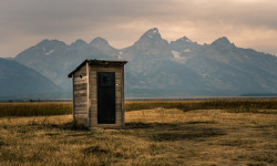
Rangers at Grand Teton National Park Are Battling… Poop?
Aug 27, 2025 from outsideonline.com
The area around a popular lake trail is replete with human waste. Park officials may install a permanent toilet.
The 12 Most Stunning Trails in the U.S.
May 29, 2025 from outsideonline.com
In celebration of National Trails Day, discover some of the best hikes in the U.S.—from slot canyons to grasslands, waterfalls, and secluded...
2024-JHMR Photo Album
Sep 4, 2024 from pinkbike.com
The World's biggest biking photo gallery of photos like, crashes, north shore. 2024-JHMR
Marco Osborne and Lia Westermann Win The 2024 Rendezvous Enduro by MontanaEnduroSeries
Sep 4, 2024 from pinkbike.com
[PI=27181585 width=window][/PI]The Montana Enduro Series wrapped up its 2024 season with the Rendezvous Enduro at Jackson Hole Mountain Resort...
Sub Regions
- Central (299)
- Converse County (22)
- Fremont County (205)
- Natrona County (63)
- Northeast (133)
- Cambell County (22)
- Crook County (42)
- Weston County (70)
- Northwest (610)
- Big Horn County (48)
- Bridger - Teton National Forest (30)
- Grand Teton National Park (13)
- Jackson Hole (170)
- Park County (108)
- Salt River Range (21)
- Washakie County (9)
- Wind River Range (45)
- Wyoming Range (Northern) (12)
- Yellowstone National Park (50)
- Southeast (314)
- Southwest (142)
- Sweetwater County (63)
- Wyoming Range (Southern) (48)
- The Bighorns (89)
- Johnson County (50)
- Sheridan County (38)
Popular Wyoming Mountain Biking Trails
• 100 ★ 3.0 • 1 mile • 4 ft • 1,058 •
Great access paved trail from the Old Pass Road. This is the best way to access Teton Pass on a bike coming from town.
• 90 ★ 3.0 • 741 ft • 32 ft • 1,340 •
Popular green difficulty family friendly singletrack. This mountain bike primary trail can be used downhill only with a 32 ft green climb. It features berm. On average it takes 1 minutes to complete this trail.
• 100 ★ 3.8 • 4,134 ft • 0 ft • 1,295 •
Really the only way to start your descent off the mountain unless you want to ride . This trail connects you to all the really fast fun DH trails at the resort. The trail itself is fun, and has some little jump options and starts with a...
• 100 ★ 4.7 • 746 ft • 4 ft • 1,281 •
Lower section that drops off of the short section of taking you all the way back to the lift.
• 95 ★ 4.5 • 3,812 ft • 0 ft • 1,242 •
Super fun, wide flow, a Trail, with some wooden features and table-top jumps. This trailer is a blast, what’s not to love?
• 100 ★ 3.4 • 2,162 ft • 45 ft • 1,091 •
Popular green difficulty singletrack. This mountain bike primary trail and has a easy overall physical rating with a 45 ft green climb. On average it takes 3 minutes to complete this trail.
• 95 ★ 4.3 • 4 miles • 1,200 ft • 1,032 •
Love this trail going down. You can climb it, and it is a difficult climb up in a few sections. Beautiful view of the Tetons as you crest the highest point. Going down it has organic rock and root jumps even a gap that looks natural....
• 90 ★ 4.7 • 2,759 ft • 0 ft • 1,067 •
Super wide, well burned down Hill Trail. Probably the second easiest downhill from Shoshone lift.
Wyoming Mountain Bike Routes
Sheep Bridge/Middle Fork Shuttle Featured
★ 5.0 • 12 miles • 431 ft • 3 • Shuttled •
Top to bottom Sheep Bridge/Middle Fork Trail Shuttle ride. This is a challenging descent for the advanced...
Full Brewers Shuttle Featured
★ 5.0 • 14 miles • 246 ft • 5 • Shuttled •
Top to bottom Brewers Trail Shuttle ride. is relatively cross country, with lots of whoops and berms to...
Blue Ridge Shuttle Featured
★ 5.0 • 15 miles • 522 ft • 3 • Shuttled •
Standard route for shuttling . Highly recommend popping up Lookout Trail to the Lookout for killer views...
★ 5.0 • 4 miles • 627 ft • 6 • Loop •
The easiest short loop from the trailhead, but still not easy. The trails are all peppered with...
★ 5.0 • 14 miles • 2,150 ft • 28 • Loop •
All the technical climbs and most of the speedy descents at for those spring skill tune-ups before the...
★ 5.0 • 5 miles • 633 ft • 12 • Loop •
This 5.2 mile loop at the Central Wyoming College's Alpine Science Institute near Lander includes 3 miles...
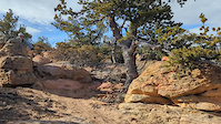
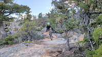
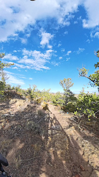
Photos of Wyoming Mountain Bike
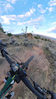
Videos of Wyoming Mountain Bike
trail: Banger
0:05 |
9 |
Apr 8, 2026
trail: The Shiv
0:06 |
23 |
Feb 7, 2026
trail: Above the Law
0:20 |
9 |
Feb 2, 2026
trail: The Shiv
0:26 |
20 |
Nov 17, 2025
trail: The Shank
0:14 |
17 |
Nov 17, 2025
trail: The Shiv
0:09 |
21 |
Oct 13, 2025
trail: The Shiv
0:16 |
15 |
Oct 13, 2025
trail: Anarchy
0:16 |
16 |
Oct 13, 2024
National Scenic Trails & Official Routes
-
Continental Divide Trail
- Mountain Bike
- Hike
- Trail Running
-
Great Western Trail
- Mountain Bike
- E-Bike
- Horse
- Hike
- Trail Running
- Dirtbike/Moto
- ATV/ORV/OHV


Activity Feed
| username | action | type | title | date |
|---|---|---|---|---|
| kellyclimber | wishlist | trail | activity #97366677 | Jun 19, 2026 @ 10:15pm 10 hours |
| kellyclimber | wishlist | trail | activity #97366674 | Jun 19, 2026 @ 10:15pm 10 hours |
| Austinmacey | wishlist | route | activity #97335051 | Jun 19, 2026 @ 11:58am 20 hours |
| woodtroll | add | photo | activity #97333233 and 7 more | Jun 19, 2026 @ 11:33am 21 hours |
| Hrodgers | vote | trail | activity #97330994 and 1 more | Jun 19, 2026 @ 11:01am 21 hours |
Recent Comments
| username | type | title | comment | date |
|---|---|---|---|---|
| trail | this isn't really a trail! avoid it | Jun 18, 2026 @ 9:18pm 1 day | ||
| trail | Ddd | Jun 13, 2026 @ 8:47pm Jun 13, 2026 | ||
| trail | Still snow patches requiring dismounting bike... | Jun 13, 2026 @ 4:08pm Jun 13, 2026 | ||
| trail | the trail needs some love, the first quarter... | Jun 13, 2026 @ 4:04pm Jun 13, 2026 | ||
| report | Hello Bikeram | Jun 9, 2026 @ 4:30pm Jun 9, 2026 |
Local Badges
-

10 Green Trails19 awarded -

Epic Ride 50k2 awarded -

Epic Ride Climb 2k562 awarded -

10 Black Trails96 awarded -
Epic Ride Climb 2k135 awarded -

Climbing 10k Badge96 awarded
Bike & Skill Parks
| name | type | city | rating |
|---|---|---|---|
| Grand Targhee Resort | bike park | Alta | |
| Jackson Hole Mountain Resort | bike park | Teton Village | |
| Jackson Hole Mountain Resort | bike park | Teton Village | |
| Blair Dr. Kids Pump Park | skill park | Jackson | |
| Lander Bike Park | skill park | Lander |
Upcoming Local Events
Activity Type Stats
| activitytype | trails | distance | descent | descent distance | total vertical | rating | global rank | state rank | photos | reports | routes | ridelogs |
|---|---|---|---|---|---|---|---|---|---|---|---|---|
| Mountain Bike | 1,607 | 3,566 miles | 473,100 ft | 1,480 miles | 11,739 ft | #37 | 3,909 | 12,850 | 166 | 120,056 | ||
| E-Bike | 536 | 1,104 miles | 113,707 ft | 435 miles | 7,257 ft | #36 | 12 | 6,945 | 16 | 2,733 | ||
| Gravel Bike | 157 | 490 miles | 36,385 ft | 179 miles | 6,854 ft | #32 | 1,290 | 5 | 691 | |||
| Adaptive Bike | 206 | 505 miles | 46,982 ft | 192 miles | 6,854 ft | #29 | 1,490 | 21 | ||||
| Winter Fat Bike | 279 | 671 miles | 82,562 ft | 305 miles | 10,535 ft | #22 | 11 | 2,174 | 3 | 94 | ||
| Horse | 1,053 | 4,096 miles | 498,560 ft | 1,516 miles | 9,957 ft | #11 | 208 | 2,942 | 4 | 96 | ||
| Hike | 2,428 | 6,786 miles | 848,543 ft | 2,585 miles | 13,694 ft | #23 | 306 | 12,523 | 26 | 32,511 | ||
| Trail Running | 2,388 | 6,676 miles | 835,413 ft | 2,543 miles | 13,694 ft | #21 | 27 | 12,449 | 32 | 9,234 | ||
| Dirtbike/Moto | 191 | 724 miles | 69,209 ft | 293 miles | 7,257 ft | #20 | 7 | 1,884 | 1 | 108 | ||
| Observed Trials | 61 | 180 miles | 14,495 ft | 79 miles | 5,272 ft | #30 | 250 | 37 | ||||
| ATV/ORV/OHV | 157 | 657 miles | 51,624 ft | 247 miles | 7,257 ft | #19 | 1,861 | 1 | 53 | |||
| Snowmobile | 20 | 114 miles | 10,364 ft | 52 miles | 3,816 ft | #32 | 307 | 2 | 42 | |||
| Snowshoe | 419 | 1,359 miles | 118,215 ft | 497 miles | 7,802 ft | #21 | 2 | 983 | 2 | 536 | ||
| Downhill Ski | 549 | 188 miles | 187,228 ft | 171 miles | 4,531 ft | #21 | 164 | 15,327 | ||||
| Backcountry Ski | 80 | 159 miles | 19,997 ft | 60 miles | 6,939 ft | #21 | 2 | 191 | 2 | 9,277 | ||
| Nordic Ski | 274 | 303 miles | 26,896 ft | 124 miles | 4,672 ft | #27 | 7 | 891 | 2 | 6,282 |
Activities
- Wyoming Mountain Biking Trails
- Wyoming E-Biking Trails
- Wyoming Gravel Biking Trails
- Wyoming Adaptive Biking Trails
- Wyoming Winter Fat Biking Trails
- Wyoming Horseback Trails
- Wyoming Hiking Trails
- Wyoming Trail Running Trails
- Wyoming Dirtbiking Trails
- Wyoming Observed Trials Trails
- Wyoming ATVing/Offroading Trails
- Wyoming Snowmobiling Trails
- Wyoming Snowshoeing Trails
- Wyoming Skiing Trails
- Wyoming Backcountry Skiing Trails
- Wyoming Nordic Skiing Trails
Trails
- By canadaka
 Trailforks & contributors
 - Admins: Map Team, IMBA, chuktA, msmcfate, WillieJacobsz, PlumbBobM, ReckitRolley, colinreuter, WP, chuktA
- #3209 - 34,844 views
- wyoming activity log | embed map of Wyoming mountain bike trails | wyoming mountain biking points of interest polygons
Downloading of trail gps tracks in kml & gpx formats is enabled for Wyoming.
You must login to download files.