close
-
Layers w
- Weather Layers
- Pro
- Pro
- Pro
- Pro
- Pro
- Pro
- More Layers
- Pro
- Pro
- Pro
- Pro
-
Upgrade to

3D
Trail Conditions
- Unknown
- Snow Groomed
- Snow Packed
- Snow Covered
- Snow Cover Partial
- Freeze/thaw Cycle
- Icy
- Prevalent Mud
- Wet
- Variable
- Ideal
- Dry
- Very Dry
Trail Flow (Ridden Direction)
Trailforks scans users ridelogs to determine the most popular direction each trail is ridden. A good flowing trail network will have most trails flowing in a single direction according to their intension.
The colour categories are based on what percentage of riders are riding a trail in its intended direction.
The colour categories are based on what percentage of riders are riding a trail in its intended direction.
- > 96%
- > 90%
- > 80%
- > 70%
- > 50%
- < 50%
- bi-directional trail
- no data
Trail Last Ridden
Trailforks scans ridelogs to determine the last time a trail was ridden.
- < 2 days
- < 1 week
- < 2 weeks
- < 1 month
- < 6 months
- > 6 months
Trail Ridden Direction
The intended direction a trail should be ridden.
- Downhill Only
- Downhill Primary
- Both Directions
- Uphill Primary
- Uphill Only
- One Direction
Contribute Details
Colors indicate trail is missing specified detail.
- Description
- Photos
- Description & Photos
- Videos
Trail Popularity ?
Trailforks scans ridelogs to determine which trails are ridden the most in the last 9 months.
Trails are compared with nearby trails in the same city region with a possible 25 colour shades.
Think of this as a heatmap, more rides = more kinetic energy = warmer colors.
- most popular
- popular
- less popular
- not popular
ATV/ORV/OHV Filter
Max Vehicle Width
inches
US Cell Coverage
Legend

Radar Time
Activity Recordings
Trailforks uses anonymized public activity data.
?
Activity Recordings
Trailforks uses anonymized public activity data.
?
Personal Heatmap
▶
Activity Types
all
/
none
▶
Options
2
Date range
month
–
Winter Trails
Warning
A routing network for winter maps does not exist. Selecting trails using the winter trails layer has been disabled.
Missing Trails
Most Popular
Least Popular
Trails are colored based on popularity. The more popular a trail is, the more red. Less popular trails trend towards green.
Jump Magnitude Heatmap
Heatmap of where riders jump on trails. Zoom in to see individual jumps, click circles to view jump details.
BC Backroad Status
![map legend]()
Service Road Atlas is a free to use, community-driven service for viewing and creating reports on the numerous back-country service roads around B.C. and Alberta.

Slope Aspect
Direction the slope faces
Trails Deemphasized
Trails are shown in grey.
Only show trails with no bike usage.
Suggested Layers
Based on selected activity type
Save the current map location and zoom level as your default home location whenever this page is loaded.
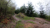
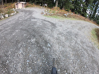
SaveEpic views, leg burning grinds, hero dirt all year, and a stupid grin on your face that you’ll need a plastic surgeon to remove, and if you live in Vancouver, you can have it all after work any day of the week. Less than 45 minutes from Vancouver and 1 hour from the East side of Portland, Cold Creek is the most heavily biked section of the Tarbell trail. It is distinctive enough from the rest of the Tarbell that it deserves its own write up. Locals typically ride this section after work, bringing lights in the winter, and tack it onto other parts of the Tarbell system or combine it with Sixth Sense, Thrillium, Bells Mountain, or Chinook for more epic weekend rides.
eBikes Allowed:
No
Shuttleable: YES
AKA: Cold Creek
Land Status: State Forest
 google parking directions
 Activities Click to view
- Mountain Bike
35 trails
- Horse
18 trails
- Hike
38 trails
- Trail Running
38 trails
Region Details
- 15
- 8
- 13
Region Status
Open as of Jun 26, 2026Stats
- Avg Trail Rating
- Trails (view details)
- 33
- Trails Mountain Bike
- 43
- Trails E-Bike
- 1
- Trails Horse
- 18
- Trails Hike
- 38
- Trails Trail Running
- 38
- Trails Snowmobile
- 1
- Trails Snowshoe
- 1
- Trails Backcountry Ski
- 1
- Total Distance
- 76 miles
- Total Descent
- 15,035 ft
- Total Vertical
- 2,953 ft
- Highest Trailhead
- 3,500 ft
- Reports
- 1,321
- Photos
- 1,055
- Ridden Counter
- 15,655
Popular Yacolt Burn State Forest Mountain Biking Trails
• 100 ★ 4.6 • 3 miles • 25 ft • 1,168 •
has a little of everything and provides challenge to all skill levels of riders. It has sections that are moderately rocky and technical as well as some smooth flowy bits. It was designed and built by Evergreen Southwest for the MTB...
• 90 ★ 4.8 • 2 miles • 18 ft • 1,037 •
is one of the Pacific Northwest's premier DH trails. It features high speed berms and many large tabled jumps that "intermediate" skilled riders can roll. It is a popular trail to shuttle, but the top can also be accessed from the...
• 85 ★ 4.5 • 4 miles • 59 ft • 890 •
The trail is a section of the greater . has a sampling of several types of terrain ranging from carefully crafted berms and rollers to raw rooty and rocky sections. Roughly 5 1/2 miles from top to bottom, it offers some of the most...
• 95 ★ 3.8 • 4,416 ft • 0 ft • 855 •
Upper Murphy's Grade is a bike-only intermediate jump line. It intersects with the section of the at what is know as the toilet bowl.
• 100 ★ 5.0 • 1 mile • 439 ft • 722 •
This is a purpose built climbing trail designed by EMBA for mountain bikers, but shared with hikers and horses. The lower entrance is roughly 0.5 miles up Lower Murphy's grade. It climbs to the midpoint of the crossing the L1070 road...
• 85 ★ 4.0 • 1 mile • 0 ft • 511 •
Murphy's Grade is a multi-use trail that runs parallel to and intersects with it midway, The lower half is a converted railroad bed with a gentle 6% grade and can be used to loop the lower section of .
• 95 ★ 4.0 • 1,043 ft • 120 ft • 460 •
This shortcut is the preferred climbing line from Ross' grade to the parking lot. The bottom of the trail is easy to miss as it is only a faint bench dug into a roadcut. After entering the woods, the trail is much more obvious and easy...
Yacolt Burn State Forest Mountain Bike Routes
Climb from Lower to Upper Lot Featured
★ 5.0 • 4 miles • 1,553 ft • 2 • Point to Point •
This is the easiest route to climb from the Yacolt TH parking lot to the Larch Mountain TH parking.
Tarbell Loop Featured
★ 3.4 • 23 miles • 4,332 ft • 5 •
The loop is that actual continuous trail. It's a varied route with lots of different types of terrain and...
★ 5.0 • 23 miles • 4,053 ft • 6 • Loop •
The counterclockwise way of running the Loop. This route avoids going up or Murphy's Grade upper (Murphy's...
★ 4.0 • 10 miles • 2,339 ft • 7 •
This is a route that gives you a relatively more approachable road climb up to the towers on the top of...
★ 4.0 • 11 miles • 1,513 ft • 1 • Out & Back •
One of the more popular sections of the trail with a turn around point at Hidden Falls. The route is...
★ 5.0 • 13 miles • 2,891 ft • 5 •
Photos of Yacolt Burn State Forest Mountain Bike
Videos of Yacolt Burn State Forest Mountain Bike
trail: Thrillium
0:09 |
329 |
Apr 25, 2024
trail: Thrillium
11:45 |
149 |
Nov 9, 2023
trail: Murphy's Grade - Upper
3:20 |
165 |
Aug 19, 2023
trail: Thrillium
0:27 |
108 |
May 13, 2022

trail: Cold Creek
0:36 |
92 |
Apr 25, 2021

trail: Sixth Sense
2:30 |
57 |
Feb 10, 2021
trail: Thrillium
0:26 |
286 |
Oct 26, 2020
trail: Sixth Sense
0:53 |
243 |
Mar 27, 2020
Recent Trail Reports
| status | trail | date | condition | info | user |
|---|---|---|---|---|---|
| Appaloosa | Jun 26, 2026 @ 10:41am (America/Los_Angeles) Jun 26, 2026 | Ideal | billcarslay | ||
| Tarbell | Jun 26, 2026 @ 10:41am (America/Los_Angeles) Jun 26, 2026 | Ideal | billcarslay | ||
| Beargrass | Jun 26, 2026 @ 9:32am (America/Los_Angeles) Jun 26, 2026 | Very Dry | zachinblack | ||
| Tower to Meadow | Jun 25, 2026 @ 3:19pm (America/Los_Angeles) Jun 25, 2026 | Dry | zachinblack | ||
| Sixth Sense | Jun 24, 2026 @ 9:12am (America/Los_Angeles) Jun 24, 2026 | Ideal | Zachmozach | ||
| Vista Ridge | Jun 24, 2026 @ 9:12am (America/Los_Angeles) Jun 24, 2026 | Ideal | Zachmozach | ||
| Tarbell Access | Jun 20, 2026 @ 4:14pm (America/Vancouver) Jun 20, 2026 | Ideal | RichardDavies | ||
| Murphy's Grade - Upper | Jun 20, 2026 @ 4:19pm (America/Los_Angeles) Jun 20, 2026 | Ideal | tRailzs | ||
| Sword Fern Way | Jun 15, 2026 @ 3:37pm (America/Los_Angeles) Jun 15, 2026 | Unknown | cpresley | ||
| Bells Mountain | Jun 15, 2026 @ 3:36pm (America/Los_Angeles) Jun 15, 2026 | Unknown | cpresley |
Activity Feed
| username | action | type | title | date |
|---|---|---|---|---|
| Hopskipjump | wishlist | route | activity #98045078 | Jun 28, 2026 @ 10:15pm 13 hours |
| zeromberto | ridden | route | activity #98025535 | Jun 28, 2026 @ 2:36pm 20 hours |
| evanjweiler | wishlist | route | activity #97923891 | Jun 27, 2026 @ 11:42am 2 days |
| L5fiyB | wishlist | route | activity #97896346 | Jun 27, 2026 @ 6:13am 2 days |
| Bmitchell35 | wishlist | route | activity #97878622 | Jun 26, 2026 @ 11:28pm 2 days |
Recent Comments
| username | type | title | comment | date |
|---|---|---|---|---|
| trail | Ripping blue flow trail top to bottom. It... | Jun 8, 2026 @ 12:01pm Jun 8, 2026 | ||
| trail | A trail of two halves that deserves a scouting... | Jun 8, 2026 @ 11:58am Jun 8, 2026 | ||
| trail | High speed berms and doubles. Crazy fun. Do... | Jun 8, 2026 @ 11:58am Jun 8, 2026 | ||
| trail | Quite a bit of work going down to keep speed... | Jun 8, 2026 @ 11:57am Jun 8, 2026 | ||
| trail | Updating from the last comment to say a ton of... | Jan 25, 2026 @ 6:09pm Jan 25, 2026 |
Nearby Areas
| name | distance | ||||
|---|---|---|---|---|---|
| Silver Star Scenic Area | 1 | 5 | 9 | 1 | 3.8 km |
| Moulton and Lucia Falls | 4 | 8.5 km | |||
| Green Mountain | 8 | 6 | 8.6 km | ||
| Salmon-Morgan Creeks Natural Area | 2 | 2 | 9.4 km | ||
| Battle Ground Lake State Park | 2 | 2 | 9.9 km |
Local Badges
-

Completionist0 awarded
Local Mountain Biking Directory
-
Evergreen - Southwest ChapterTrail Association
![Evergreen - Southwest Chapter]()
Local Products
Local Trail Supporters
![]()
- Simon Turner
Activity Type Stats
| activitytype | trails | distance | descent | descent distance | total vertical | rating | global rank | state rank | photos | reports | routes | ridelogs |
|---|---|---|---|---|---|---|---|---|---|---|---|---|
| Mountain Bike | 35 | 76 miles | 15,036 ft | 33 miles | 2,953 ft | #1,534 | #526 | 1,040 | 1,329 | 30 | 14,187 | |
| E-Bike | 1 | 3,202 ft | 102 ft | 161 ft | 740 | 1 | 1,658 | |||||
| Horse | 18 | 48 miles | 9,554 ft | 22 miles | 2,953 ft | #768 | #404 | 459 | 4 | 2 | ||
| Hike | 38 | 69 miles | 12,854 ft | 30 miles | 2,953 ft | #1,490 | #685 | 12 | 1,237 | 8 | 261 | |
| Trail Running | 38 | 69 miles | 12,854 ft | 30 miles | 2,953 ft | #2,587 | #635 | 1,234 | 6 | 102 | ||
| Snowmobile | 1 | 4,531 ft | 528 ft | 4,236 ft | 531 ft | |||||||
| Snowshoe | 1 | 4,531 ft | 528 ft | 4,236 ft | 531 ft | 1 | ||||||
| Backcountry Ski | 1 | 4,531 ft | 528 ft | 4,236 ft | 531 ft |
Frequently Asked Questions About Yacolt Burn State Forest
▼
What are the highest rated mountain biking trails in Yacolt Burn State Forest?
The highest rated mountain biking trails in Yacolt Burn State Forest are:
- Thrillium (4.7/5)
- Cold Creek (4.5/5)
- Sixth Sense (4.5/5)
- Vista Ridge (4.2/5)
- Beargrass (4.2/5)
▼
What is the best time of the year to ride in Yacolt Burn State Forest?
Based on ride log data, the most popular months to ride in Yacolt Burn State Forest are:
- July (254 activities)
- June (175 activities)
- September (167 activities)
▼
Where can I park to ride in Yacolt Burn State Forest?
There are 10 parking locations listed in Yacolt Burn State Forest. The most popular parking spots are:
- Yacolt Burn Trailhead Parking
- Bridge/Thrillium Shuttle Parking
- Larch Mountain Trailhead Parking Lot
- Parking
- Parking
▼
What is the longest trail in Yacolt Burn State Forest?
The longest trail in Yacolt Burn State Forest is Bells Mountain at 8.7 miles. View all trails sorted by distance.
Activities
Trails
- Hard trails in Yacolt Burn State Forest
- Easy trails in Yacolt Burn State Forest
- Favorite trails in Yacolt Burn State Forest
- Most ridden trails in Yacolt Burn State Forest
- Singletrack in Yacolt Burn State Forest
- Viewpoint trails in Yacolt Burn State Forest
- Trails with technical features in Yacolt Burn State Forest
- Race routes in Yacolt Burn State Forest
- By brenthillier
 NSMBA TRAILFORKS & contributors
 - Admins: apply
- #14039 - 50,134 views
- yacolt burn state forest activity log | embed map of Yacolt Burn State Forest mountain bike trails | yacolt burn state forest mountain biking points of interest polygons
Downloading of trail gps tracks in kml & gpx formats is enabled for Yacolt Burn State Forest.
You must login to download files.