close
-
Layers w
- Weather Layers
- Pro
- Pro
- Pro
- Pro
- Pro
- Pro
- More Layers
- Pro
- Pro
- Pro
- Pro
-
Upgrade to

3D
Trail Conditions
- Unknown
- Snow Groomed
- Snow Packed
- Snow Covered
- Snow Cover Partial
- Freeze/thaw Cycle
- Icy
- Prevalent Mud
- Wet
- Variable
- Ideal
- Dry
- Very Dry
Trail Flow (Ridden Direction)
Trailforks scans users ridelogs to determine the most popular direction each trail is ridden. A good flowing trail network will have most trails flowing in a single direction according to their intension.
The colour categories are based on what percentage of riders are riding a trail in its intended direction.
The colour categories are based on what percentage of riders are riding a trail in its intended direction.
- > 96%
- > 90%
- > 80%
- > 70%
- > 50%
- < 50%
- bi-directional trail
- no data
Trail Last Ridden
Trailforks scans ridelogs to determine the last time a trail was ridden.
- < 2 days
- < 1 week
- < 2 weeks
- < 1 month
- < 6 months
- > 6 months
Trail Ridden Direction
The intended direction a trail should be ridden.
- Downhill Only
- Downhill Primary
- Both Directions
- Uphill Primary
- Uphill Only
- One Direction
Contribute Details
Colors indicate trail is missing specified detail.
- Description
- Photos
- Description & Photos
- Videos
Trail Popularity ?
Trailforks scans ridelogs to determine which trails are ridden the most in the last 9 months.
Trails are compared with nearby trails in the same city region with a possible 25 colour shades.
Think of this as a heatmap, more rides = more kinetic energy = warmer colors.
- most popular
- popular
- less popular
- not popular
ATV/ORV/OHV Filter
Max Vehicle Width
inches
US Cell Coverage
Legend

Radar Time
Activity Recordings
Trailforks uses anonymized public activity data.
?
Activity Recordings
Trailforks uses anonymized public activity data.
?
Personal Heatmap
▶
Activity Types
all
/
none
▶
Options
2
Date range
month
–
Winter Trails
Warning
A routing network for winter maps does not exist. Selecting trails using the winter trails layer has been disabled.
Missing Trails
Most Popular
Least Popular
Trails are colored based on popularity. The more popular a trail is, the more red. Less popular trails trend towards green.
Jump Magnitude Heatmap
Heatmap of where riders jump on trails. Zoom in to see individual jumps, click circles to view jump details.
BC Backroad Status
![map legend]()
Service Road Atlas is a free to use, community-driven service for viewing and creating reports on the numerous back-country service roads around B.C. and Alberta.

Slope Aspect
Direction the slope faces
Trails Deemphasized
Trails are shown in grey.
Only show trails with no bike usage.
Suggested Layers
Based on selected activity type
Save the current map location and zoom level as your default home location whenever this page is loaded.
Save
No description for Yellow Fork has been added yet!
Login or register to submit one.
Activities Click to view
- Mountain Bike
42 trails
- E-Bike
9 trails
- Horse
29 trails
- Hike
48 trails
- Trail Running
48 trails
- Dirtbike/Moto
3 trails
- ATV/ORV/OHV
1 trails
Region Details
- 3
- 6
- 18
- 12
- 1
Region Status
Caution as of Jun 10, 2026Stats
- Avg Trail Rating
- Trails (view details)
- 45
- Trails Mountain Bike
- 42
- Trails E-Bike
- 9
- Trails Horse
- 29
- Trails Hike
- 48
- Trails Trail Running
- 48
- Trails Dirtbike/Moto
- 3
- Trails ATV/ORV/OHV
- 1
- Total Distance
- 49 miles
- Total Descent
- 13,203 ft
- Total Vertical
- 4,965 ft
- Highest Trailhead
- 10,622 ft
- Reports
- 492
- Photos
- 159
- Ridden Counter
- 8,322
Popular Yellow Fork Mountain Biking Trails
• 85 ★ 3.5 • 3,570 ft • 160 ft • 638 •
Popular green difficulty singletrack. This multi-use trail can be used both directions. On average it takes 7 minutes to complete this trail.
• 90 ★ 3.5 • 4,820 ft • 0 ft • 614 •
Fun section that is often overlooked, but provides some fun technical sections.
• 80 ★ 3.0 • 2,122 ft • 44 ft • 526 • • horse
Popular blue difficulty singletrack. This horse primary trail can be used both directions. On average it takes 3 minutes to complete this trail.
• 80 ★ 3.0 • 1,225 ft • 16 ft • 458 •
Popular blue difficulty singletrack. This mountain bike primary trail can be used both directions. On average it takes 1 minutes to complete this trail.
• 75 ★ 3.8 • 1 mile • 533 ft • 410 •
Easy technical, moderate climb. Popular equestrian trail, so be sure to use caution.
• 70 ★ 4.3 • 1,818 ft • 0 ft • 370 •
Kinda of steep and narrow, but fun and fast as you drop off the road to connect back up with . Only expert because it can be hard to climb when the dirt is often soft going back up.
• 70 ★ 4.1 • 1 mile • 0 ft • 315 •
Steady singletrack uphill that is mostly smooth, but has a few techy spots. Most of the trail is in the shade.
• 65 ★ 3.0 • 3 miles • 871 ft • 310 •
The trail was a double road, but has been over grown so it's mostly singletrack now. Some of the trail from the top of Yellow pine trail and trail is rocky and steep. After climbing that section you are rewarded with some awesome views....
Yellow Fork Mountain Bike Routes
★ 3.0 • 7 miles • 1,366 ft • 10 •
You can ride this route either way. I rated it as moderate for "Physical Rating", although, for me...
• 14 miles • 1,822 ft • 11 •
• 16 miles • 2,396 ft • 11 •
• 20 miles • 2,687 ft • 14 •
• 12 miles • 1,777 ft • 10 •
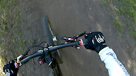
Photos of Yellow Fork Mountain Bike
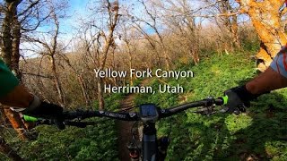
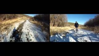
Videos of Yellow Fork Mountain Bike
trail: Yellow Fork
2:23 |
301 |
Mar 16, 2015
trail: Big Rock (Lower)
3:20 |
246 |
Mar 15, 2015

trail: Yellow Fork
9:10 |
1267 |
Jun 11, 2020 , Herriman
trail: Rio Escandido
9:10 |
513 |
Jun 11, 2020 , Herriman

trail: Yellow Fork
543 |
May 31, 2017 , Herriman
trail: Yellow Fork (Lower)
492 |
May 31, 2017 , Herriman
Recent Trail Reports
| status | trail | date | condition | info | user |
|---|---|---|---|---|---|
| BST - Butterknife | Jun 10, 2026 @ 4:30pm (America/Denver) Jun 10, 2026 | Very Dry | Jodiraerod | ||
| Yellow Fork | Jun 10, 2026 @ 4:30pm (America/Denver) Jun 10, 2026 | Very Dry | Jodiraerod | ||
| Yellow Fork (Lower) | May 19, 2026 @ 10:46pm (America/Denver) May 19, 2026 | Unknown | Ewoody12 | ||
| Yellow Fork Canyon Road | May 19, 2026 @ 10:45pm (America/Denver) May 19, 2026 | Unknown | Ewoody12 | ||
| Rio Escandido | Apr 25, 2026 @ 3:44pm (America/Boise) Apr 25, 2026 | Ideal | JasonFarns | ||
| Maple Gulch | Apr 10, 2026 @ 11:04am (America/Denver) Apr 10, 2026 | Ideal | DerailedMtb | ||
| Dans Hill (Upper) | Mar 27, 2026 @ 11:35am (America/Denver) Mar 27, 2026 | Ideal | quarry | ||
| Yellow Fork Connect | Mar 27, 2026 @ 11:35am (America/Denver) Mar 27, 2026 | Ideal | quarry | ||
| Horsin' Around | Mar 27, 2026 @ 11:35am (America/Denver) Mar 27, 2026 | Dry | quarry | ||
| Yellow Fork | Oct 25, 2025 @ 11:16am (America/Boise) Oct 25, 2025 | Ideal | JasonFarns |
National Scenic Trails & Official Routes
-
Bonneville Shoreline Trail
- Mountain Bike
- E-Bike
- Horse
- Hike
- Trail Running
- Snowshoe
- Nordic Ski

Activity Feed
| username | action | type | title | date |
|---|---|---|---|---|
| dfred23 | wishlist | region | activity #97272693 | Jun 18, 2026 @ 1:18pm Jun 18, 2026 |
| mikebike1 | comment | trail | activity #97188814 and 1 more | Jun 17, 2026 @ 9:14am Jun 17, 2026 |
| Jodiraerod | add | report | activity #96712662 and 1 more | Jun 10, 2026 @ 7:16pm Jun 10, 2026 |
| Ewoody12 | add | report | activity #95087511 and 1 more | May 19, 2026 @ 9:45pm May 19, 2026 |
| Ewoody12 | vote | trail | activity #95087496 and 2 more | May 19, 2026 @ 9:45pm May 19, 2026 |
Recent Comments
| username | type | title | comment | date |
|---|---|---|---|---|
| trail | Yes, it’s not for riding up and very... | Jun 17, 2026 @ 9:15am Jun 17, 2026 | ||
| trail | Definitely not for MTB. Steep and rocky.... | Jun 17, 2026 @ 9:14am Jun 17, 2026 | ||
| trail | Fun trail! I descended the side going to... | Apr 10, 2026 @ 10:03am Apr 10, 2026 | ||
| trail | Fun section if your into it and in the area... | Apr 8, 2026 @ 10:54am Apr 8, 2026 | ||
| trail | Blek. Take all the awesomeness of butter knife... | Nov 16, 2025 @ 2:06pm Nov 16, 2025 |
Nearby Areas
| name | distance | ||||
|---|---|---|---|---|---|
| Butterfield Canyon | 11 | 3 | 4 | 3.6 km | |
| South Mountain | 4 | 11 | 2 | 5.1 km | |
| Rosecrest | 5.2 km | ||||
| Herriman City Trails | 21 | 3 | 5.5 km | ||
| Tickville Hollow | 2 | 7.9 km |
Local Badges
-

Completionist3 awarded
Activity Type Stats
| activitytype | trails | distance | descent | descent distance | total vertical | rating | global rank | state rank | photos | reports | routes | ridelogs |
|---|---|---|---|---|---|---|---|---|---|---|---|---|
| Mountain Bike | 42 | 44 miles | 9,259 ft | 19 miles | 3,678 ft | #3,672 | #1,279 | 153 | 490 | 2 | 4,979 | |
| E-Bike | 9 | 7 miles | 2,172 ft | 4 miles | 3,212 ft | #6,324 | #1,798 | 2 | 400 | 606 | ||
| Horse | 29 | 25 miles | 7,543 ft | 15 miles | 3,560 ft | #147 | #219 | 171 | ||||
| Hike | 48 | 49 miles | 13,202 ft | 23 miles | 4,964 ft | #874 | #450 | 4 | 491 | 621 | ||
| Trail Running | 48 | 49 miles | 13,202 ft | 23 miles | 4,964 ft | #455 | #190 | 491 | 364 | |||
| Dirtbike/Moto | 3 | 5 miles | 1,686 ft | 3 miles | 2,520 ft | #203 | #86 | 124 | 2 | |||
| ATV/ORV/OHV | 1 | 3 miles | 1,414 ft | 2 miles | 1,371 ft | #737 | #368 | 121 | 1 |
Frequently Asked Questions About Yellow Fork
▼
What are the highest rated mountain biking trails in Yellow Fork?
The highest rated mountain biking trails in Yellow Fork are:
- Rio Escandido (4.2/5)
- Connector (4.1/5)
- Bear Gulch (4.1/5)
- Maple Gulch (4.1/5)
- Yellow Butter (BST) (4.1/5)
▼
What is the best time of the year to ride in Yellow Fork?
Based on ride log data, the most popular months to ride in Yellow Fork are:
- July (98 activities)
- June (81 activities)
- May (61 activities)
▼
Where can I park to ride in Yellow Fork?
Check the Yellow Fork trail map for trailhead and parking information. Community members regularly update access and parking details for trails in the area.
▼
What is the longest trail in Yellow Fork?
The longest trail in Yellow Fork is Rose Ridge at 3.1 miles. View all trails sorted by distance.
Activities
- By todd
 Trailforks & contributors
 - Admins: HHTA, Herriman CITY
- #4879 - 9,839 views
- yellow fork activity log | embed map of Yellow Fork mountain bike trails | yellow fork mountain biking points of interest
Downloading of trail gps tracks in kml & gpx formats is enabled for Yellow Fork.
You must login to download files.