close
-
Layers w
- Weather Layers
- Pro
- Pro
- Pro
- Pro
- Pro
- Pro
- More Layers
- Pro
- Pro
- Pro
- Pro
-
Upgrade to

3D
Trail Conditions
- Unknown
- Snow Groomed
- Snow Packed
- Snow Covered
- Snow Cover Partial
- Freeze/thaw Cycle
- Icy
- Prevalent Mud
- Wet
- Variable
- Ideal
- Dry
- Very Dry
Trail Flow (Ridden Direction)
Trailforks scans users ridelogs to determine the most popular direction each trail is ridden. A good flowing trail network will have most trails flowing in a single direction according to their intension.
The colour categories are based on what percentage of riders are riding a trail in its intended direction.
The colour categories are based on what percentage of riders are riding a trail in its intended direction.
- > 96%
- > 90%
- > 80%
- > 70%
- > 50%
- < 50%
- bi-directional trail
- no data
Trail Last Ridden
Trailforks scans ridelogs to determine the last time a trail was ridden.
- < 2 days
- < 1 week
- < 2 weeks
- < 1 month
- < 6 months
- > 6 months
Trail Ridden Direction
The intended direction a trail should be ridden.
- Downhill Only
- Downhill Primary
- Both Directions
- Uphill Primary
- Uphill Only
- One Direction
Contribute Details
Colors indicate trail is missing specified detail.
- Description
- Photos
- Description & Photos
- Videos
Trail Popularity ?
Trailforks scans ridelogs to determine which trails are ridden the most in the last 9 months.
Trails are compared with nearby trails in the same city region with a possible 25 colour shades.
Think of this as a heatmap, more rides = more kinetic energy = warmer colors.
- most popular
- popular
- less popular
- not popular
ATV/ORV/OHV Filter
Max Vehicle Width
inches
US Cell Coverage
Legend

Radar Time
Activity Recordings
Trailforks uses anonymized public activity data.
?
Activity Recordings
Trailforks uses anonymized public activity data.
?
Personal Heatmap
▶
Activity Types
all
/
none
▶
Options
2
Date range
month
–
Winter Trails
Warning
A routing network for winter maps does not exist. Selecting trails using the winter trails layer has been disabled.
Missing Trails
Most Popular
Least Popular
Trails are colored based on popularity. The more popular a trail is, the more red. Less popular trails trend towards green.
Jump Magnitude Heatmap
Heatmap of where riders jump on trails. Zoom in to see individual jumps, click circles to view jump details.
BC Backroad Status
![map legend]()
Service Road Atlas is a free to use, community-driven service for viewing and creating reports on the numerous back-country service roads around B.C. and Alberta.

Slope Aspect
Direction the slope faces
Trails Deemphasized
Trails are shown in grey.
Only show trails with no bike usage.
Suggested Layers
Based on selected activity type
Save the current map location and zoom level as your default home location whenever this page is loaded.
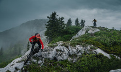
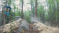
SaveBiking in the Yukon is single-track heaven, and no wonder. It's become a not-so-secret mountain biking hotspot with all the ingredients for fantastic rides. Cross a wildflower-strewn alpine meadow, careen down a mountain path, and ride high along an aspen ridge – all in a morning. Combine it with great guides and camaraderie, and you've got yourself world-class wilderness biking a stone's throw from the city.
source: travelyukon.com
Stats
- Avg Trail Rating
- Trails (view details)
- 739
- Trails Mountain Bike
- 702
- Trails E-Bike
- 666
- Trails Winter Fat Bike
- 3
- Trails Horse
- 68
- Trails Hike
- 747
- Trails Trail Running
- 737
- Trails Dirtbike/Moto
- 74
- Trails Observed Trials
- 15
- Trails ATV/ORV/OHV
- 52
- Trails Snowmobile
- 53
- Trails Snowshoe
- 136
- Trails Downhill Ski
- 1
- Trails Backcountry Ski
- 35
- Trails Nordic Ski
- 90
- Total Distance
- 821 miles
- Total Descent
- 113,166 ft
- Total Vertical
- 6,137 ft
- Highest Trailhead
- 7,184 ft
- Reports
- 7,209
- Photos
- 1,734
- Ridden Counter
- 54,546
Articles
Video: Land of the Midnight Rain - A Perfectly Documented Very Long Day Out
Dec 18, 2025 from pinkbike.com
Featuring one of Pinkbike's bubbliest former staff members.

The Yukon: Land of the Midnight Fun
Sep 8, 2025 from pinkbike.com
Mountain biking the Yukon: deep loam, no lines and the days never end.
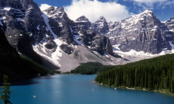
The 10 Most Beautiful National Parks in Canada
Jun 17, 2024 from outsideonline.com
Spectacular mountains and deep fjords, powder-blue lakes and sea stacks: here’s your bucket list of national parks to visit up north
Event Preview: Yukon Canadian Cross-Country Marathon Championships & Yukon Bike Fest
Aug 28, 2023 from pinkbike.com
From August 26th - September 4th, Whitehorse will host the Yukon's first national cycling event.
Popular Trail Networks
view all areas »Sub Regions
- Faro-Ross River (0)
Popular Yukon Mountain Biking Trails
• 100 ★ 4.2 • 1,453 ft • 0 ft • 645 •
Fast and flowy trail without features.
• 100 ★ 4.5 • 3,281 ft • 0 ft • 617 •
Super fun, super fast, super flowy berm trail with some ground level wooden features suitable for almost all riders.
• 100 ★ 3.8 • 1 mile • 49 ft • 548 •
This trail drops down past old squatter cabins to a ridge overlooking Whitehorse before dropping down through a gully. Although the trail is technically bidirectional it "downhill" dominant (i.e. south to north)
• 100 ★ 3.0 • 1,158 ft • 103 ft • 512 •
Popular blue difficulty singletrack. This mountain bike primary trail can be used both directions and has a moderate overall physical rating with a 103 ft blue climb. On average it takes 4 minutes to complete this trail.
• 100 ★ 4.4 • 5,213 ft • 567 ft • 511 •
The grade steepens slightly on this upper part of the “People’s Trail”, but trees provide welcome shade and there are views of Lake Bennett and the rock garden.
• 95 ★ 4.7 • 3,539 ft • 371 ft • 504 •
Built as a singletrack alternative to the Montana Mountain road, this “People’s Trail” follows a steady grade up to .
• 90 ★ 4.9 • 4,523 ft • 12 ft • 450 •
Super fun rock garden mazes. A must ride for advanced bikers.
Yukon Mountain Bike Routes
★ 5.0 • 3 miles • 154 ft • 4 • Point to Point •
Show me the money! Huge mountain vistas and views over looking Whitehorse. Starts from the Grey Mountain...
★ 5.0 • 36 miles • 7,585 ft • 25 • Loop •
If you're pressed for time or just feel like a challenge this route hits every trail on the lower mountain...
2 miles • 313 ft • 4 • Loop •
This Beginner to intermediate loop starts at the bike park parking lot, with a gentle ascend up Lower...
3 miles • 52 ft • 1 • Shuttled •
Great Beginner Shuttle Lap on Grey Mountain. Enjoy wide trails, scenic views, some flow, as well...
6 miles • 1,143 ft • 6 •
Dirt Girls - - - Blues Brothers loop for Advanced riders
2 miles • 371 ft • 2 • Loop •
Beginner Loop on the world famous Montana Mountain in Carcross, YT. Riders will start at the Parking lot,...
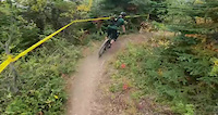
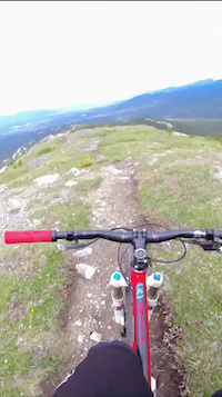
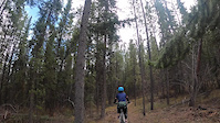
Photos of Yukon Mountain Bike
Videos of Yukon Mountain Bike
trail: Katima Trail
0:32 |
3 |
Jun 11, 2026
0:05 |
9 |
Dec 29, 2025
trail: Lefty Loosey
4:29 |
36 |
Dec 10, 2025
trail: The Dream
0:42 |
18 |
Jul 6, 2025

trail: Rock Lobster
0:22 |
129 |
Dec 30, 2023

trail: Lefty Loosey
4:29 |
94 |
Sep 1, 2023
trail: The Road Runner
4:43 |
72 |
May 23, 2021
trail: Rock Lobster
0:53 |
403 |
May 31, 2020
Activity Feed
| username | action | type | title | date |
|---|---|---|---|---|
| DukeBcweVO | ridden | trail | activity #97594592 | Jun 22, 2026 @ 5:33pm 9 hours |
| michaelbean | wishlist | region | activity #97592994 | Jun 22, 2026 @ 5:02pm 9 hours |
| TxIst | like | directory | activity #97581130 | Jun 22, 2026 @ 1:05pm 13 hours |
| magdee | wishlist | route | activity #97523703 | Jun 21, 2026 @ 3:03pm 1 day |
| PrinceB | add | report | activity #97517709 | Jun 21, 2026 @ 1:47pm 2 days |
Recent Comments
| username | type | title | comment | date |
|---|---|---|---|---|
| trail | Great trail! First one I rode in Carcross. ... | Jun 16, 2026 @ 1:38pm Jun 16, 2026 | ||
| trail | Quit your birch’en… These are birch trees... | Jun 16, 2026 @ 11:55am Jun 16, 2026 | ||
| report | Big tree down when you get in the trees before... | Jun 14, 2026 @ 4:04pm Jun 14, 2026 | ||
| report | Np | Jun 14, 2026 @ 3:55pm Jun 14, 2026 | ||
| trail | Very fun! | Jun 10, 2026 @ 5:41am Jun 10, 2026 |
Local Badges
-

Completionist1 awarded -

Top 10 Trails0 awarded -
Completionist0 awarded -
Completionist1 awarded -
Top 10 Trails3 awarded -

10 Blue Trails16 awarded
Bike & Skill Parks
| name | type | city | rating |
|---|---|---|---|
| Mt. Sima Bike Park | bike park | Whitehorse | |
| Dirt n' Soul Mountain Bike Skills Park | skill park | Whitehorse | |
| Skill park | skill park | Whitehorse | |
| Gunnar Nilsson & Mickey Lammers Bike Skills Park | skill park | Whitehorse | |
| Gunnar Nilsson & Mickey Lammers Research Forest Park | skill park | Whitehorse |
Activity Type Stats
| activitytype | trails | distance | descent | descent distance | total vertical | rating | global rank | state rank | photos | reports | routes | ridelogs |
|---|---|---|---|---|---|---|---|---|---|---|---|---|
| Mountain Bike | 701 | 704 miles | 96,499 ft | 302 miles | 4,613 ft | #52 | 1,552 | 7,067 | 64 | 38,718 | ||
| E-Bike | 666 | 178 miles | 14,911 ft | 70 miles | 3,573 ft | #52 | 36 | 2,547 | 12 | 1,521 | ||
| Winter Fat Bike | 3 | #45 | 14 | 70 | 5 | 137 | ||||||
| Horse | 68 | 164 miles | 14,495 ft | 64 miles | 3,494 ft | #51 | 772 | 3 | ||||
| Hike | 747 | 743 miles | 103,885 ft | 308 miles | 6,138 ft | #55 | 92 | 6,989 | 14 | 6,770 | ||
| Trail Running | 737 | 726 miles | 95,243 ft | 299 miles | 5,515 ft | #53 | 3 | 6,989 | 20 | 6,796 | ||
| Dirtbike/Moto | 74 | 161 miles | 12,628 ft | 61 miles | 4,088 ft | #37 | 2 | 660 | 46 | |||
| Observed Trials | 15 | 41 miles | 2,103 ft | 16 miles | 2,182 ft | #41 | 79 | 8 | ||||
| ATV/ORV/OHV | 52 | 146 miles | 11,152 ft | 54 miles | 4,088 ft | #39 | 664 | 30 | ||||
| Snowmobile | 53 | 152 miles | 12,159 ft | 60 miles | 4,088 ft | #31 | 185 | 19 | ||||
| Snowshoe | 136 | 207 miles | 17,743 ft | 77 miles | 4,777 ft | #38 | 1 | 451 | 5 | 217 | ||
| Downhill Ski | 1 | #47 | 75 | 859 | ||||||||
| Backcountry Ski | 35 | 146 miles | 11,335 ft | 59 miles | 3,104 ft | #30 | 102 | 1 | 552 | |||
| Nordic Ski | 90 | 165 miles | 15,623 ft | 65 miles | 3,104 ft | #28 | 28 | 388 | 2 | 8,169 |
Activities
- Yukon Mountain Biking Trails
- Yukon E-Biking Trails
- Yukon Horseback Trails
- Yukon Hiking Trails
- Yukon Trail Running Trails
- Yukon Dirtbiking Trails
- Yukon Observed Trials Trails
- Yukon ATVing/Offroading Trails
- Yukon Snowmobiling Trails
- Yukon Snowshoeing Trails
- Yukon Backcountry Skiing Trails
- Yukon Nordic Skiing Trails
Trails
Points of Interest
- Angelcomb Peak Summit
- The Alaska Highway Sight
- Tombstone Mountain Campground Camping
- Grey Mountain Summit
- Boréale Explorers Lodge
- Packet Park Other
- Yukon Beringia Interpretive Centre Other
- Tank Creek Monitoring station Other
- Tin Cup Staging yard Other
- AGS trail crew staging area Other
- Mount Logan (5,956 m)
- Mount Saint Elias (5,475 m)
- Mount Lucania (5,195 m)
- By canadaka
 Trailforks & contributors
 - Admins: IMBA Canada, brenthillier, adaptivemike, maddy03, brittseels
- #3192 - 33,542 views
- yukon activity log | embed map of Yukon mountain bike trails | yukon mountain biking points of interest polygons
Downloading of trail gps tracks in kml & gpx formats is enabled for Yukon.
You must login to download files.