close
-
Layers w
- Weather Layers
- Pro
- Pro
- Pro
- Pro
- Pro
- Pro
- More Layers
- Pro
- Pro
- Pro
- Pro
-
Upgrade to

3D
Trail Conditions
- Unknown
- Snow Groomed
- Snow Packed
- Snow Covered
- Snow Cover Partial
- Freeze/thaw Cycle
- Icy
- Prevalent Mud
- Wet
- Variable
- Ideal
- Dry
- Very Dry
Trail Flow (Ridden Direction)
Trailforks scans users ridelogs to determine the most popular direction each trail is ridden. A good flowing trail network will have most trails flowing in a single direction according to their intension.
The colour categories are based on what percentage of riders are riding a trail in its intended direction.
The colour categories are based on what percentage of riders are riding a trail in its intended direction.
- > 96%
- > 90%
- > 80%
- > 70%
- > 50%
- < 50%
- bi-directional trail
- no data
Trail Last Ridden
Trailforks scans ridelogs to determine the last time a trail was ridden.
- < 2 days
- < 1 week
- < 2 weeks
- < 1 month
- < 6 months
- > 6 months
Trail Ridden Direction
The intended direction a trail should be ridden.
- Downhill Only
- Downhill Primary
- Both Directions
- Uphill Primary
- Uphill Only
- One Direction
Contribute Details
Colors indicate trail is missing specified detail.
- Description
- Photos
- Description & Photos
- Videos
Trail Popularity ?
Trailforks scans ridelogs to determine which trails are ridden the most in the last 9 months.
Trails are compared with nearby trails in the same city region with a possible 25 colour shades.
Think of this as a heatmap, more rides = more kinetic energy = warmer colors.
- most popular
- popular
- less popular
- not popular
ATV/ORV/OHV Filter
Max Vehicle Width
inches
US Cell Coverage
Legend

Radar Time
Activity Recordings
Trailforks uses anonymized public activity data.
?
Activity Recordings
Trailforks uses anonymized public activity data.
?
Personal Heatmap
▶
Activity Types
all
/
none
▶
Options
2
Date range
month
–
Winter Trails
Warning
A routing network for winter maps does not exist. Selecting trails using the winter trails layer has been disabled.
Missing Trails
Most Popular
Least Popular
Trails are colored based on popularity. The more popular a trail is, the more red. Less popular trails trend towards green.
Jump Magnitude Heatmap
Heatmap of where riders jump on trails. Zoom in to see individual jumps, click circles to view jump details.
BC Backroad Status
![map legend]()
Service Road Atlas is a free to use, community-driven service for viewing and creating reports on the numerous back-country service roads around B.C. and Alberta.

Slope Aspect
Direction the slope faces
Trails Deemphasized
Trails are shown in grey.
Only show trails with no bike usage.
Suggested Layers
Based on selected activity type
Save the current map location and zoom level as your default home location whenever this page is loaded.
Save
No description for Zeeland has been added yet!
Login or register to submit one.
Region Details
- 5
Stats
- Avg Trail Rating
- Trails (view details)
- 5
- Trails Mountain Bike
- 5
- Trails E-Bike
- 1
- Trails Hike
- 3
- Trails Trail Running
- 3
- Total Distance
- 6 miles
- Total Descent
- 281 ft
- Total Vertical
- 66 ft
- Highest Trailhead
- 70 ft
- Reports
- 16
- Photos
- 11
- Ridden Counter
- 176
Sub Regions
- Burgh-haamstede (1)
- Terneuzen (3)
- Wolphaartsdijk (1)
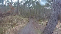
Popular Zeeland Mountain Biking Trails
• 100 ★ 4.2 • 3 miles • 202 ft • 101 •
Really challenging XC trail in Zeeland. Some really challenging climbs and fast descents. Because of the good soil (mainly dirt and little parts of sand) the trail is really weather proof. On a rainy day it's definately worth the drive...
• 70 ★ 0.0 • 3,690 ft • 11 ft • 25 •
Popular green difficulty gravel path. This mountain bike primary trail can be used both directions. On average it takes 4 minutes to complete this trail.
• 100 ★ 0.0 • 1 mile • 44 ft • 21 •
Popular green difficulty gravel path. This mountain bike primary trail can be used both directions. On average it takes 5 minutes to complete this trail.
• 5 ★ 0.0 • 4,134 ft • 22 ft • 3 •
Short MTB trail with narrow paths and small corners, Only has a corner hill feature.
• 5 ★ 0.0 • 1,423 ft • 5 ft • 2 •
Less popular green difficulty gravel path. This mountain bike primary trail can be used both directions. On average it takes minutes to complete this trail.
Zeeland Mountain Bike Routes
15 miles • 219 ft • 0 •
Noord-Beveland is an endless island and consists of 6 villages. The island has about 50 kilometers of...
13 miles • 109 ft • 0 •
Noord-Beveland is an endless island and consists of 6 villages. The island has about 50 kilometers of...
23 miles • 207 ft • 0 •
Noord-Beveland is an endless island and consists of 6 villages. The island has about 50 kilometers of...
3 miles • 52 ft • 0 •
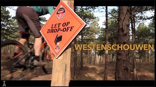
Videos of Zeeland Mountain Bike
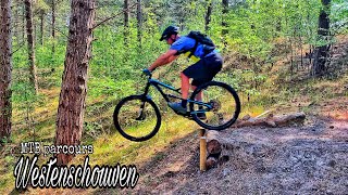
trail: Westenschouwen
2:05 |
179 |
Jan 19, 2018
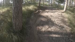
trail: Westenschouwen
0:54 |
730 |
May 16, 2017
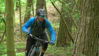
trail: Westenschouwen
20:01 |
274 |
Feb 17, 2014
youtuber
![MTB Challenge // Westenschouwen]()
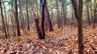
trail: Westenschouwen
6:26 |
159 |
Jan 2, 2024 , Burgh-haamstede
trail: Westenschouwen
6:27 |
426 |
Nov 15, 2022 , Burgh-haamstede
trail: Westenschouwen
17:58 |
241 |
Jun 25, 2021 , Burgh-haamstede
trail: Westenschouwen
0:32 |
371 |
Sep 24, 2019 , Burgh-haamstede
trail: Westenschouwen
0:18 |
276 |
Sep 24, 2019 , Burgh-haamstede
Recent Trail Reports
| status | trail | date | condition | info | user |
|---|---|---|---|---|---|
| Fortdijk West Terneuzen | Jun 9, 2026 @ 7:19pm (Europe/Brussels) Jun 9, 2026 | Ideal | davidrmartin77 | ||
| Fort Nicolaas Terneuzen | Jun 9, 2026 @ 7:19pm (Europe/Brussels) Jun 9, 2026 | Ideal | davidrmartin77 | ||
| Westenschouwen Burgh-haamstede | Jul 27, 2024 @ 9:32am Jul 27, 2024 | Dry | Skyraider350 | ||
| Wegelstuk Terneuzen | May 15, 2021 @ 11:21pm May 15, 2021 | Dry | StephanedERlh1 |
Activity Feed
| username | action | type | title | date |
|---|---|---|---|---|
| davidrmartin77 | add | report | activity #96625942 and 1 more | Jun 9, 2026 @ 1:16pm Jun 9, 2026 |
| maxvandevelde | ridden | trail | activity #93064790 | Apr 21, 2026 @ 12:23am Apr 21, 2026 |
| Eduward8HOyD2 | wishlist | trail | activity #63274037 | Dec 20, 2024 @ 12:28pm Dec 20, 2024 |
| RamonVader | wishlist | route | activity #57684259 | Aug 23, 2024 @ 11:18am Aug 23, 2024 |
| Sanderc7LZkV | ridden | trail | activity #57250673 | Aug 15, 2024 @ 1:25am Aug 15, 2024 |
Recent Comments
| username | type | title | comment | date |
|---|---|---|---|---|
| trail | Nice technical XC trail, blue rating would be... | Dec 8, 2022 @ 9:47pm Dec 8, 2022 | ||
| trail | Track is longer, this file cuts out 2 loops,... | Nov 10, 2022 @ 11:19pm Nov 10, 2022 | ||
| trail | nice track, a bit bumpy (feb 23 2021) | Feb 25, 2021 @ 1:33pm Feb 25, 2021 | ||
| trail | Fun singletrack with a lot of sand but the... | Mar 9, 2020 @ 11:52am Mar 9, 2020 |
Bike & Skill Parks
| name | type | city | rating |
|---|---|---|---|
| Axel MX | skill park | Terneuzen | |
| Finland motocross | skill park | Terneuzen | |
| Vlissingen "Sloehaven" | skill park | Vlissingen | |
| Wemeldinge MX | skill park | Goes |
Activity Type Stats
| activitytype | trails | distance | descent | descent distance | total vertical | rating | global rank | state rank | photos | reports | routes | ridelogs |
|---|---|---|---|---|---|---|---|---|---|---|---|---|
| Mountain Bike | 5 | 6 miles | 279 ft | 2 miles | 66 ft | 11 | 16 | 8 | 13,533 | |||
| E-Bike | 1 | 3,691 ft | 7 ft | 971 ft | 7 ft | 11 | 1 | 1,012 | ||||
| Hike | 3 | 2 miles | 59 ft | 1 mile | 30 ft | 11 | 528 | |||||
| Trail Running | 3 | 2 miles | 59 ft | 1 mile | 30 ft | 11 | 19 |
- By brenthillier
 NSMBA TRAILFORKS & contributors
 - Admins: apply
- #10823 - 2,393 views
- zeeland activity log | embed map of Zeeland mountain bike trails | zeeland mountain biking points of interest
Downloading of trail gps tracks in kml & gpx formats is enabled for Zeeland.
You must login to download files.