close
-
Layers w
- Weather Layers
- Pro
- Pro
- Pro
- Pro
- Pro
- Pro
- More Layers
- Pro
- Pro
- Pro
- Pro
-
Upgrade to

3D
Trail Conditions
- Unknown
- Snow Groomed
- Snow Packed
- Snow Covered
- Snow Cover Partial
- Freeze/thaw Cycle
- Icy
- Prevalent Mud
- Wet
- Variable
- Ideal
- Dry
- Very Dry
Trail Flow (Ridden Direction)
Trailforks scans users ridelogs to determine the most popular direction each trail is ridden. A good flowing trail network will have most trails flowing in a single direction according to their intension.
The colour categories are based on what percentage of riders are riding a trail in its intended direction.
The colour categories are based on what percentage of riders are riding a trail in its intended direction.
- > 96%
- > 90%
- > 80%
- > 70%
- > 50%
- < 50%
- bi-directional trail
- no data
Trail Last Ridden
Trailforks scans ridelogs to determine the last time a trail was ridden.
- < 2 days
- < 1 week
- < 2 weeks
- < 1 month
- < 6 months
- > 6 months
Trail Ridden Direction
The intended direction a trail should be ridden.
- Downhill Only
- Downhill Primary
- Both Directions
- Uphill Primary
- Uphill Only
- One Direction
Contribute Details
Colors indicate trail is missing specified detail.
- Description
- Photos
- Description & Photos
- Videos
Trail Popularity ?
Trailforks scans ridelogs to determine which trails are ridden the most in the last 9 months.
Trails are compared with nearby trails in the same city region with a possible 25 colour shades.
Think of this as a heatmap, more rides = more kinetic energy = warmer colors.
- most popular
- popular
- less popular
- not popular
ATV/ORV/OHV Filter
Max Vehicle Width
inches
US Cell Coverage
Legend

Radar Time
Activity Recordings
Trailforks uses anonymized public activity data.
?
Activity Recordings
Trailforks uses anonymized public activity data.
?
Personal Heatmap
▶
Activity Types
all
/
none
▶
Options
2
Date range
month
–
Winter Trails
Warning
A routing network for winter maps does not exist. Selecting trails using the winter trails layer has been disabled.
Missing Trails
Most Popular
Least Popular
Trails are colored based on popularity. The more popular a trail is, the more red. Less popular trails trend towards green.
Jump Magnitude Heatmap
Heatmap of where riders jump on trails. Zoom in to see individual jumps, click circles to view jump details.
BC Backroad Status
![map legend]()
Service Road Atlas is a free to use, community-driven service for viewing and creating reports on the numerous back-country service roads around B.C. and Alberta.

Slope Aspect
Direction the slope faces
Trails Deemphasized
Trails are shown in grey.
Only show trails with no bike usage.
Suggested Layers
Based on selected activity type
Save the current map location and zoom level as your default home location whenever this page is loaded.
Save
No description for Zeist has been added yet!
Login or register to submit one.
Activities Click to view
- Mountain Bike
5 trails
- Adaptive Bike
0 trails
- Hike
3 trails
- Trail Running
3 trails
Region Details
- 2
- 3
Region Status
Caution as of Apr 17, 2026Stats
- Avg Trail Rating
- Trails (view details)
- 5
- Trails Mountain Bike
- 5
- Trails Hike
- 3
- Trails Trail Running
- 3
- Total Distance
- 19 miles
- Total Descent
- 469 ft
- Total Vertical
- 84 ft
- Highest Trailhead
- 112 ft
- Reports
- 93
- Photos
- 36
- Ridden Counter
- 1,920
Popular Zeist Mountain Biking Trails
• 100 ★ 5.0 • 3 miles • 143 ft • 663 •
Really physical and technical XC trail, lots of small climbs and descents with technical corners. Last part is flatter so you can make some real speed there. Can be combined with the trail.
• 60 ★ 3.0 • 7 miles • 129 ft • 405 •
Nice xc-trail with flow. Trail is very well maintained and one of the many 'new school' trails for Dutch standards.
Zeist Mountain Bike Routes
• 22 miles • 1,161 ft • 26 •
• 26 miles • 1,270 ft • 27 •
• 28 miles • 1,492 ft • 26 •
• 10 miles • 676 ft • 27 •
• 20 miles • 894 ft • 3 •
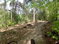
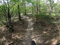
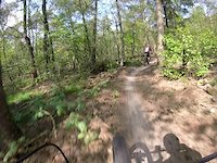
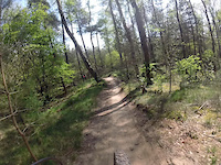
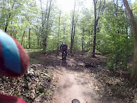
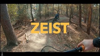
Photos of Zeist Mountain Bike


Recent Trail Reports
| status | trail | date | condition | info | user |
|---|---|---|---|---|---|
| Zeist-Austerlitz | Apr 11, 2026 @ 2:03pm (Europe/Amsterdam) Apr 11, 2026 | Ideal | rjd22 | ||
| Zeist | Apr 11, 2026 @ 5:02am (America/Vancouver) Apr 11, 2026 | Dry | rjd22 | ||
| Austerlitz | Mar 24, 2026 @ 11:35am (Europe/Amsterdam) Mar 24, 2026 | Ideal | rjd22 | ||
| Bornia | Oct 18, 2025 @ 7:46pm (Europe/Amsterdam) Oct 18, 2025 | Unknown | mikemanshanden |
Activity Feed
| username | action | type | title | date |
|---|---|---|---|---|
| st81k3r | ridden | trail | activity #97103435 | Jun 16, 2026 @ 5:55am 3 days |
| uneisingh | wishlist | trail | activity #96661019 | Jun 10, 2026 @ 3:12am Jun 10, 2026 |
| FerryBTQwfl | wishlist | route | activity #94828151 | May 16, 2026 @ 9:56am May 16, 2026 |
| FerryBTQwfl | wishlist | trail | activity #94828043 | May 16, 2026 @ 9:55am May 16, 2026 |
| BasjCfhoK | wishlist | trail | activity #94708497 | May 14, 2026 @ 1:17pm May 14, 2026 |
Recent Comments
| username | type | title | comment | date |
|---|---|---|---|---|
| trail | Cycling is not allowed here! | Aug 22, 2025 @ 5:55am Aug 22, 2025 | ||
| trail | Trail blocked by fallen tree | Jun 23, 2025 @ 6:03am Jun 23, 2025 | ||
| report | Lange koffiepauze bij Beauforthuis | Nov 17, 2019 @ 4:26am Nov 17, 2019 | ||
| trail | I don't really believe that this trail has... | Dec 23, 2018 @ 10:22am Dec 23, 2018 |
Activity Type Stats
| activitytype | trails | distance | descent | descent distance | total vertical | rating | global rank | state rank | photos | reports | routes | ridelogs |
|---|---|---|---|---|---|---|---|---|---|---|---|---|
| Mountain Bike | 5 | 19 miles | 469 ft | 7 miles | 85 ft | #2,174 | #13 | 36 | 93 | 1 | 15,690 | |
| Hike | 3 | 5 miles | 177 ft | 2 miles | 62 ft | #2,886 | #28 | 82 | 229 | |||
| Trail Running | 3 | 5 miles | 177 ft | 2 miles | 62 ft | #2,395 | #29 | 82 | 90 |
- By schralpcc & contributors
- Admins: apply
- #4765 - 4,851 views
- zeist activity log | embed map of Zeist mountain bike trails | zeist mountain biking points of interest
Downloading of trail gps tracks in kml & gpx formats is enabled for Zeist.
You must login to download files.