close
-
Layers w
- Weather Layers
- Pro
- Pro
- Pro
- Pro
- Pro
- Pro
- More Layers
- Pro
- Pro
- Pro
- Pro
-
Upgrade to

3D
Trail Conditions
- Unknown
- Snow Groomed
- Snow Packed
- Snow Covered
- Snow Cover Partial
- Freeze/thaw Cycle
- Icy
- Prevalent Mud
- Wet
- Variable
- Ideal
- Dry
- Very Dry
Trail Flow (Ridden Direction)
Trailforks scans users ridelogs to determine the most popular direction each trail is ridden. A good flowing trail network will have most trails flowing in a single direction according to their intension.
The colour categories are based on what percentage of riders are riding a trail in its intended direction.
The colour categories are based on what percentage of riders are riding a trail in its intended direction.
- > 96%
- > 90%
- > 80%
- > 70%
- > 50%
- < 50%
- bi-directional trail
- no data
Trail Last Ridden
Trailforks scans ridelogs to determine the last time a trail was ridden.
- < 2 days
- < 1 week
- < 2 weeks
- < 1 month
- < 6 months
- > 6 months
Trail Ridden Direction
The intended direction a trail should be ridden.
- Downhill Only
- Downhill Primary
- Both Directions
- Uphill Primary
- Uphill Only
- One Direction
Contribute Details
Colors indicate trail is missing specified detail.
- Description
- Photos
- Description & Photos
- Videos
Trail Popularity ?
Trailforks scans ridelogs to determine which trails are ridden the most in the last 9 months.
Trails are compared with nearby trails in the same city region with a possible 25 colour shades.
Think of this as a heatmap, more rides = more kinetic energy = warmer colors.
- most popular
- popular
- less popular
- not popular
ATV/ORV/OHV Filter
Max Vehicle Width
inches
US Cell Coverage
Legend

Radar Time
Activity Recordings
Trailforks uses anonymized public activity data.
?
Activity Recordings
Trailforks uses anonymized public activity data.
?
Personal Heatmap
▶
Activity Types
all
/
none
▶
Options
2
Date range
month
–
Winter Trails
Warning
A routing network for winter maps does not exist. Selecting trails using the winter trails layer has been disabled.
Missing Trails
Most Popular
Least Popular
Trails are colored based on popularity. The more popular a trail is, the more red. Less popular trails trend towards green.
Jump Magnitude Heatmap
Heatmap of where riders jump on trails. Zoom in to see individual jumps, click circles to view jump details.
BC Backroad Status
![map legend]()
Service Road Atlas is a free to use, community-driven service for viewing and creating reports on the numerous back-country service roads around B.C. and Alberta.

Slope Aspect
Direction the slope faces
Trails Deemphasized
Trails are shown in grey.
Only show trails with no bike usage.
Suggested Layers
Based on selected activity type
Save the current map location and zoom level as your default home location whenever this page is loaded.
Save
No description for Zlín has been added yet!
Login or register to submit one.
This region uses the Uk/Euro style trail grading system.
Activities Click to view
- Mountain Bike
20 trails
- E-Bike
9 trails
- Adaptive Bike
0 trails
- Hike
14 trails
- Trail Running
14 trails
Region Details
- 5
- 5
- 8
- 1
Region Status
Caution as of Oct 8, 2024Stats
- Avg Trail Rating
- Trails (view details)
- 20
- Trails Mountain Bike
- 20
- Trails E-Bike
- 9
- Trails Hike
- 14
- Trails Trail Running
- 14
- Total Distance
- 18 miles
- Total Descent
- 5,032 ft
- Total Vertical
- 1,615 ft
- Highest Trailhead
- 2,222 ft
- Reports
- 45
- Photos
- 9
- Ridden Counter
- 291
Sub Regions
-
Otrokovice
- 2
- 1
-
Slavex Trails
- 1
- 1
Popular Zlín Mountain Biking Trails
• 100 ★ 0.0 • 3,474 ft • 31 ft • 23 •
Popular blue difficulty singletrack. This multi-use trail can be used both directions and has a moderate overall physical rating with a 31 ft green climb. On average it takes 3 minutes to complete this trail.
• 70 ★ 5.0 • 1,671 ft • 40 ft • 23 •
Popular blue difficulty singletrack. This mountain bike primary trail can be used downhill primary and has a moderate overall physical rating. It features drop and jump. On average it takes 2 minutes to complete this trail.
• 90 ★ 5.0 • 1,319 ft • 0 ft • 19 •
Popular black diamond difficulty singletrack. This mountain bike primary trail can be used downhill only. On average it takes 1 minutes to complete this trail.
• 5 ★ 4.0 • 4,821 ft • 70 ft • 16 •
Less popular green difficulty singletrack. This mountain bike primary trail can be used both directions and has a easy overall physical rating with a 70 ft blue climb. On average it takes 22 minutes to complete this trail.
• 25 ★ 5.0 • 2,195 ft • 0 ft • 16 •
Flowtrail se vším všudy. Modrá ti nabídne velké klopenky, boule nebo menší skok. Rychlosti se bát nemusíš, protože na Užovce se do toho půjde slušně opřít. Příjemně navinutý trail s délkou kolem 800m zabaví...
• 95 ★ 0.0 • 1 mile • 3 ft • 15 •
Popular blue difficulty singletrack. This multi-use trail can be used both directions and has a moderate overall physical rating with a 3 ft blue climb. Trail visibility is always easy to follow. On average it takes 4 minutes to complete this trail.
Zlín Mountain Bike Routes
21 miles • 2,155 ft • 0 •
Zkouška z Otrokovic do Lubné a přes Haleny zpět.
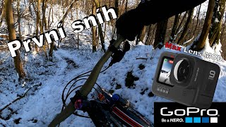
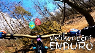
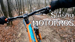
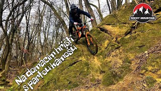
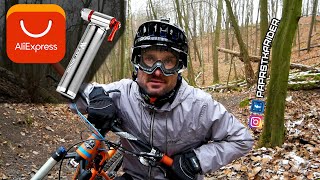
Photos of Zlín Mountain Bike
Videos of Zlín Mountain Bike
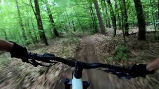
trail: Sjezd Paseky - Vega
3:49 |
456 |
May 3, 2020 , Zlín
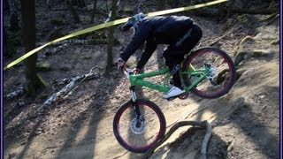
trail: Dualka
0:51 |
712 |
Mar 3, 2018 , Zlín
Recent Trail Reports
| status | trail | date | condition | info | user |
|---|---|---|---|---|---|
| Ta vedle | Oct 8, 2024 @ 3:06pm Oct 8, 2024 | Variable | kalupp | ||
| Mechová | Oct 8, 2024 @ 3:06pm Oct 8, 2024 | Variable | kalupp | ||
| Kapradina | Oct 8, 2024 @ 3:06pm Oct 8, 2024 | Variable | kalupp | ||
| Sjezd Paseky - Vega | Oct 28, 2023 @ 5:54am Oct 28, 2023 | Variable | kalupp | ||
| Komonecké stezky K3 E | Oct 28, 2023 @ 5:54am Oct 28, 2023 | Variable | kalupp | ||
| Kolem Komonce | May 5, 2023 @ 8:02am May 5, 2023 | Ideal | kalupp | ||
| Komonecké stezky K3 D | May 5, 2023 @ 8:02am May 5, 2023 | Ideal | kalupp | ||
| Podél cesty XC | Mar 23, 2023 @ 12:14am Mar 23, 2023 | Ideal | kalupp | ||
| Malenovice Forrest Down | Mar 23, 2023 @ 12:14am Mar 23, 2023 | Ideal | kalupp | ||
| FreeRidovka | Jun 12, 2022 @ 1:21am Jun 12, 2022 | Ideal | kalupp |
Activity Feed
| username | action | type | title | date |
|---|---|---|---|---|
| jakublascek | wishlist | region | activity #85033706 | Dec 1, 2025 @ 3:48pm Dec 1, 2025 |
| Marek14 | ridden | trail | activity #82270416 | Oct 13, 2025 @ 7:25am Oct 13, 2025 |
| Marek14 | ridden | trail | activity #82270408 and 1 more | Oct 13, 2025 @ 7:24am Oct 13, 2025 |
| Marek14 | ridden | trail | activity #82114124 | Oct 11, 2025 @ 3:38am Oct 11, 2025 |
| ondraburygiga | ridden | trail | activity #74584665 | Jun 26, 2025 @ 12:33am Jun 26, 2025 |
Recent Comments
| username | type | title | comment | date |
|---|---|---|---|---|
| trail | I za mokra sjízdné. Na sjezdech popadané... | Oct 2, 2020 @ 11:37am Oct 2, 2020 |
Local Badges
-

Epic Mountain Bike Climb 2k5 awarded -

Climbing 10k Badge18 awarded -

Mountain Biking 100k Badge0 awarded -

Epic Ride Descent 2k5 awarded -

Descent 10k Badge18 awarded -

Descent 100k Badge0 awarded
Bike & Skill Parks
| name | type | city | rating |
|---|---|---|---|
| Slavex Trails | bike park | Zlín |
Activity Type Stats
| activitytype | trails | distance | descent | descent distance | total vertical | rating | global rank | state rank | photos | reports | routes | ridelogs |
|---|---|---|---|---|---|---|---|---|---|---|---|---|
| Mountain Bike | 20 | 18 miles | 5,033 ft | 10 miles | 1,614 ft | #2,563 | #19 | 9 | 45 | 1 | 5,096 | |
| E-Bike | 9 | 14 miles | 2,923 ft | 7 miles | 1,532 ft | #1,453 | #8 | 42 | 323 | |||
| Hike | 14 | 16 miles | 4,022 ft | 8 miles | 1,614 ft | #2,263 | #14 | 43 | 117 | |||
| Trail Running | 14 | 16 miles | 4,022 ft | 8 miles | 1,614 ft | #1,781 | #13 | 43 | 18 |
Frequently Asked Questions About Zlín
▼
What are the best places to ride in Zlín?
Zlín has 2 areas to explore for mountain biking. The top rated areas are:
▼
What are the highest rated mountain biking trails in Zlín?
▼
What is the best time of the year to ride in Zlín?
Based on ride log data, the most popular months to ride in Zlín are:
- August (19 activities)
- June (16 activities)
- May (14 activities)
▼
Where can I park to ride in Zlín?
Activities
Trails
Points of Interest
- By zvirze
 ČeMBA & contributors
 - Admins: ČeMBA, ČeMBA, ČeMBA, ČeMBA, ČeMBA, ČeMBA, ČeMBA, ČeMBA, ČeMBA, ČeMBA
- #25585 - 7,752 views
- zlín activity log | embed map of Zlín mountain bike trails | zlín mountain biking points of interest
Downloading of trail gps tracks in kml & gpx formats is enabled for Zlín.
You must login to download files.