close
-
Layers w
- Weather Layers
- Pro
- Pro
- Pro
- Pro
- Pro
- Pro
- More Layers
- Pro
- Pro
- Pro
- Pro
-
Upgrade to

3D
Trail Conditions
- Unknown
- Snow Groomed
- Snow Packed
- Snow Covered
- Snow Cover Partial
- Freeze/thaw Cycle
- Icy
- Prevalent Mud
- Wet
- Variable
- Ideal
- Dry
- Very Dry
Trail Flow (Ridden Direction)
Trailforks scans users ridelogs to determine the most popular direction each trail is ridden. A good flowing trail network will have most trails flowing in a single direction according to their intension.
The colour categories are based on what percentage of riders are riding a trail in its intended direction.
The colour categories are based on what percentage of riders are riding a trail in its intended direction.
- > 96%
- > 90%
- > 80%
- > 70%
- > 50%
- < 50%
- bi-directional trail
- no data
Trail Last Ridden
Trailforks scans ridelogs to determine the last time a trail was ridden.
- < 2 days
- < 1 week
- < 2 weeks
- < 1 month
- < 6 months
- > 6 months
Trail Ridden Direction
The intended direction a trail should be ridden.
- Downhill Only
- Downhill Primary
- Both Directions
- Uphill Primary
- Uphill Only
- One Direction
Contribute Details
Colors indicate trail is missing specified detail.
- Description
- Photos
- Description & Photos
- Videos
Trail Popularity ?
Trailforks scans ridelogs to determine which trails are ridden the most in the last 9 months.
Trails are compared with nearby trails in the same city region with a possible 25 colour shades.
Think of this as a heatmap, more rides = more kinetic energy = warmer colors.
- most popular
- popular
- less popular
- not popular
ATV/ORV/OHV Filter
Max Vehicle Width
inches
US Cell Coverage
Legend

Radar Time
Activity Recordings
Trailforks uses anonymized public activity data.
?
Activity Recordings
Trailforks uses anonymized public activity data.
?
Personal Heatmap
▶
Activity Types
all
/
none
▶
Options
2
Date range
month
–
Winter Trails
Warning
A routing network for winter maps does not exist. Selecting trails using the winter trails layer has been disabled.
Missing Trails
Most Popular
Least Popular
Trails are colored based on popularity. The more popular a trail is, the more red. Less popular trails trend towards green.
Jump Magnitude Heatmap
Heatmap of where riders jump on trails. Zoom in to see individual jumps, click circles to view jump details.
BC Backroad Status
![map legend]()
Service Road Atlas is a free to use, community-driven service for viewing and creating reports on the numerous back-country service roads around B.C. and Alberta.

Slope Aspect
Direction the slope faces
Trails Deemphasized
Trails are shown in grey.
Only show trails with no bike usage.
Suggested Layers
Based on selected activity type
Save the current map location and zoom level as your default home location whenever this page is loaded.
Save
No description for Zlínský has been added yet!
Login or register to submit one.
AKA: Zlín
This region uses the Uk/Euro style trail grading system.
Region Details
- 27
- 3
- 22
- 46
- 11
- 3
Stats
- Avg Trail Rating
- Trails (view details)
- 116
- Trails Mountain Bike
- 116
- Trails E-Bike
- 20
- Trails Horse
- 1
- Trails Hike
- 98
- Trails Trail Running
- 98
- Trails Snowshoe
- 1
- Trails Nordic Ski
- 1
- Total Distance
- 206 miles
- Total Descent
- 45,856 ft
- Total Vertical
- 3,050 ft
- Highest Trailhead
- 3,657 ft
- Reports
- 483
- Photos
- 74
- Ridden Counter
- 4,228
Sub Regions
- Beskydy - Radhošťská část jih (9)
- Bikeresort Valašsko (76)
- Vsetín (84)
- Bike Arena Vsetín (12)
- Bike Trails Valašsko (1)
- Javorníky (20)
- Traily Velké Karlovice (5)
- Velké Karlovice (0)
- Vsetínské Beskydy (34)
- Zděchov (2)
- Vsetín (84)
- Kroměříž (7)
- Hostýnské vrchy (7)
- Zlín (20)
- Otrokovice (5)
- Slavex Trails (4)
Popular Zlínský Mountain Biking Trails
• 70 ★ 4.8 • 1 mile • 46 ft • 127 •
Highly rated popular green difficulty singletrack. This mountain bike primary trail can be used downhill only and has a moderate overall physical rating with a 46 ft green climb. It features berm, bridge and jump. On average it takes 8 minutes to complete this trail.
• 95 ★ 4.0 • 1 mile • 38 ft • 111 •
Popular blue difficulty singletrack. This mountain bike primary trail can be used downhill primary and has a easy overall physical rating with a 38 ft green climb. On average it takes 13 minutes to complete this trail.
• 90 ★ 4.6 • 3,533 ft • 48 ft • 110 •
Highly rated popular blue difficulty singletrack. This mountain bike primary trail can be used downhill primary and has a moderate overall physical rating with a 48 ft blue climb. It features drop, jump, gap jump and other. On average it takes 10 minutes to complete this trail.
• 70 ★ 4.4 • 1 mile • 3 ft • 103 •
Highly rated popular red difficulty singletrack. This mountain bike primary trail can be used downhill primary and has a moderate overall physical rating with a 3 ft blue climb. It features berm and jump. On average it takes 7 minutes to complete this trail.
• 5 ★ 3.0 • 1,330 ft • 11 ft • 87 •
Short flow trail begins right above top station of T-bar serving Bikepark Kyčerka. It is a connection between Bikepark Kyčerka and trails Štrčková and Baďurka or can be used as a part of way to Javorníček mountain and further to...
• 85 ★ 4.0 • 7 miles • 908 ft • 84 •
Popular green difficulty doubletrack. This mountain bike primary trail can be used both directions and has a moderate overall physical rating with a 908 ft blue climb. On average it takes 1 hour9 minutes to complete this trail.
• 95 ★ 0.0 • 426 ft • 16 ft • 79 •
Popular blue difficulty singletrack. This multi-use trail can be used both directions and has a easy overall physical rating with a 16 ft green climb. Trail visibility is sometimes hard to follow. On average it takes minutes to complete this trail.
Zlínský Mountain Bike Routes
21 miles • 2,155 ft • 0 •
Zkouška z Otrokovic do Lubné a přes Haleny zpět.
Photos of Zlínský Mountain Bike
Videos of Zlínský Mountain Bike
youtuber
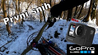
![BIKE ARÉNA Pytlacký 2024]()
0:00 |
86 |
Sep 20, 2024
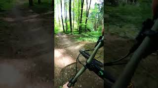
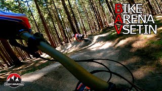
trail: Kasárna-Portáš
0:54 |
124 |
Oct 11, 2023 , Vsetín
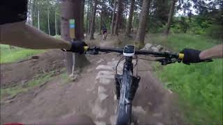
trail: Hájenka
11:32 |
205 |
Sep 25, 2022 , Vsetín
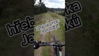
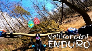
trail: Vsacká Tanečnice hřeben
18:16 |
253 |
Sep 22, 2022 , Vsetín
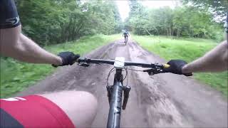
trail: Duhový
10:27 |
266 |
Nov 16, 2021 , Vsetín

Recent Trail Reports
Activity Feed
| username | action | type | title | date |
|---|---|---|---|---|
| lu24ho | add | report | activity #93159836 | Apr 22, 2026 @ 10:54am Apr 22, 2026 |
| lu24ho | ridden | trail | activity #93159754 | Apr 22, 2026 @ 10:53am Apr 22, 2026 |
| waseksk8 | wishlist | trail | activity #90374690 | Mar 11, 2026 @ 1:59am Mar 11, 2026 |
| EPSBIKE | wishlist | trail | activity #87225811 | Jan 15, 2026 @ 4:51am Jan 15, 2026 |
| VlastimilXnO9Fc | add | photo | activity #85215359 and 1 more | Dec 6, 2025 @ 5:43am Dec 6, 2025 |
Recent Comments
| username | type | title | comment | date |
|---|---|---|---|---|
| trail | Nice ride, but not best condition, very rocky... | Aug 14, 2025 @ 7:51am Aug 14, 2025 | ||
| trail | In good condition, nice to ride. Access road... | Aug 14, 2025 @ 7:49am Aug 14, 2025 | ||
| trail | Hravý a zábavný trail. Užije si ho... | Nov 14, 2022 @ 5:10am Nov 14, 2022 | ||
| trail | All clear, trail is in perfect condition. One... | Sep 26, 2022 @ 3:40am Sep 26, 2022 | ||
| trail | Za mě asi nejlepší trail na Bike Arena... | Jul 11, 2022 @ 3:22pm Jul 11, 2022 |
Local Badges
-

Climbing 10k Badge18 awarded -

Epic Ride Descent 2k5 awarded -

Mountain Biking 100k Badge0 awarded -

Descent 10k Badge18 awarded -

Epic Mountain Bike Climb 2k5 awarded -

10 Green Trails11 awarded
Bike & Skill Parks
| name | type | city | rating |
|---|---|---|---|
| Slavex Trails | bike park | Zlín |
Activity Type Stats
| activitytype | trails | distance | descent | descent distance | total vertical | rating | global rank | state rank | photos | reports | routes | ridelogs |
|---|---|---|---|---|---|---|---|---|---|---|---|---|
| Mountain Bike | 116 | 206 miles | 45,856 ft | 109 miles | 3,051 ft | 74 | 477 | 5 | 16,845 | |||
| E-Bike | 20 | 28 miles | 5,597 ft | 12 miles | 2,900 ft | 375 | 621 | |||||
| Horse | 1 | 2 miles | 89 ft | 2,182 ft | 161 ft | 105 | ||||||
| Hike | 98 | 195 miles | 40,607 ft | 101 miles | 3,051 ft | 400 | 1,238 | |||||
| Trail Running | 98 | 195 miles | 40,607 ft | 101 miles | 3,051 ft | 400 | 91 | |||||
| Snowshoe | 1 | 2 miles | 89 ft | 2,182 ft | 161 ft | 3 | 2 | |||||
| Nordic Ski | 1 | 2 miles | 89 ft | 2,182 ft | 161 ft | 3 | 230 |
Activities
Trails
- By brenthillier
 NSMBA TRAILFORKS & contributors
 - Admins: ČeMBA, ČeMBA, ČeMBA, ČeMBA, ČeMBA, ČeMBA, ČeMBA, ČeMBA, ČeMBA, ČeMBA
- #9754 - 7,664 views
- zlínský activity log | embed map of Zlínský mountain bike trails | zlínský mountain biking points of interest
Downloading of trail gps tracks in kml & gpx formats is enabled for Zlínský.
You must login to download files.