close
-
Layers w
- Weather Layers
- Pro
- Pro
- Pro
- Pro
- Pro
- Pro
- More Layers
- Pro
- Pro
- Pro
- Pro
-
Upgrade to

3D
Trail Conditions
- Unknown
- Snow Groomed
- Snow Packed
- Snow Covered
- Snow Cover Partial
- Freeze/thaw Cycle
- Icy
- Prevalent Mud
- Wet
- Variable
- Ideal
- Dry
- Very Dry
Trail Flow (Ridden Direction)
Trailforks scans users ridelogs to determine the most popular direction each trail is ridden. A good flowing trail network will have most trails flowing in a single direction according to their intension.
The colour categories are based on what percentage of riders are riding a trail in its intended direction.
The colour categories are based on what percentage of riders are riding a trail in its intended direction.
- > 96%
- > 90%
- > 80%
- > 70%
- > 50%
- < 50%
- bi-directional trail
- no data
Trail Last Ridden
Trailforks scans ridelogs to determine the last time a trail was ridden.
- < 2 days
- < 1 week
- < 2 weeks
- < 1 month
- < 6 months
- > 6 months
Trail Ridden Direction
The intended direction a trail should be ridden.
- Downhill Only
- Downhill Primary
- Both Directions
- Uphill Primary
- Uphill Only
- One Direction
Contribute Details
Colors indicate trail is missing specified detail.
- Description
- Photos
- Description & Photos
- Videos
Trail Popularity ?
Trailforks scans ridelogs to determine which trails are ridden the most in the last 9 months.
Trails are compared with nearby trails in the same city region with a possible 25 colour shades.
Think of this as a heatmap, more rides = more kinetic energy = warmer colors.
- most popular
- popular
- less popular
- not popular
ATV/ORV/OHV Filter
Max Vehicle Width
inches
US Cell Coverage
Legend

Radar Time
Activity Recordings
Trailforks uses anonymized public activity data.
?
Activity Recordings
Trailforks uses anonymized public activity data.
?
Personal Heatmap
▶
Activity Types
all
/
none
▶
Options
2
Date range
month
–
Winter Trails
Warning
A routing network for winter maps does not exist. Selecting trails using the winter trails layer has been disabled.
Missing Trails
Most Popular
Least Popular
Trails are colored based on popularity. The more popular a trail is, the more red. Less popular trails trend towards green.
Jump Magnitude Heatmap
Heatmap of where riders jump on trails. Zoom in to see individual jumps, click circles to view jump details.
BC Backroad Status
![map legend]()
Service Road Atlas is a free to use, community-driven service for viewing and creating reports on the numerous back-country service roads around B.C. and Alberta.

Slope Aspect
Direction the slope faces
Trails Deemphasized
Trails are shown in grey.
Only show trails with no bike usage.
Suggested Layers
Based on selected activity type
Save the current map location and zoom level as your default home location whenever this page is loaded.
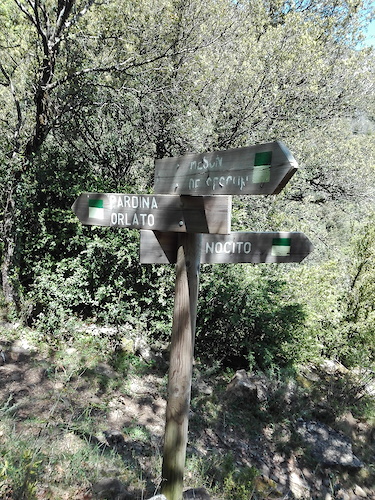
SaveSector original de Zona Zero. Todo empezó aqui.
Se caracteriza por ser una zona de areniscas y margas. Paisajisticamente domina la Peña Montañesa y el embalse de Mediano.
Se caracteriza por ser una zona de areniscas y margas. Paisajisticamente domina la Peña Montañesa y el embalse de Mediano.
Primary Trail Type: All-Mountain & Downhill
eBikes Allowed:
Yes
 google parking directions
This region uses the Uk/Euro style trail grading system.
Activities Click to view
- Mountain Bike
572 trails
- E-Bike
574 trails
- Hike
607 trails
- Trail Running
592 trails
Region Details
- 209
- 11
- 221
- 87
- 7
Region Status
Open as of 18 hoursStats
- Avg Trail Rating
- Trails (view details)
- 544
- Trails Mountain Bike
- 573
- Trails E-Bike
- 574
- Trails Gravel Bike
- 1
- Trails Adaptive Bike
- 1
- Trails Winter Fat Bike
- 1
- Trails Horse
- 1
- Trails Hike
- 607
- Trails Trail Running
- 592
- Trails Dirtbike/Moto
- 1
- Trails Observed Trials
- 1
- Trails ATV/ORV/OHV
- 1
- Trails Backcountry Ski
- 1
- Total Distance
- 518 miles
- Total Descent
- 135,685 ft
- Total Vertical
- 5,905 ft
- Highest Trailhead
- 7,409 ft
- Reports
- 3,204
- Photos
- 2,146
- Ridden Counter
- 40,783
Popular Zona Zero Centro Mountain Biking Trails
• 100 ★ 4.7 • 2,162 ft • 0 ft • 1,007 •
Parte baja del planille. Final apoteosico por margas y curvas peraltadas. Ideal para complementar tanto el Planille upper como el .
• 100 ★ 3.4 • 3,235 ft • 234 ft • 785 •
Subida por sendero hasta la cima de y su famoso banco. Hay tramos exigentes por la fuerte pendiente. No obstante el terreno es noble y ofrece buen grip. Continuos escalones rocosos que obligan a llevar cierta inercia
• 100 ★ 4.4 • 5,075 ft • 418 ft • 727 •
Parte alta del . Esta sección se puede hacer tanto de subida como de bajada. De bajada camino rápido y fluido con algun tramo de pedaleo. Mucho flow.
• 100 ★ 4.7 • 4,400 ft • 23 ft • 668 •
Todo un clásico en la zona. Camino de toda la vida. Hace más de diez años ciclistas locales hicieron saltos con pasarelas. Hoy solo quedan vestigios de aquello y el nombre. No obstante este camino nos ofrece uno de los descensos más...
• 100 ★ 4.2 • 1 mile • 5 ft • 643 •
Bajada bien buena. Terreno mixto de margas y piedras que exige mucho a la bici y al piloto. Se puede ir bastante rápido si se sabe la trazada correcta.
• 100 ★ 4.1 • 3,451 ft • 182 ft • 573 •
Bonito sendero por un pinar que da acceso al Collado de los Murertos, generalmente se hace de subida para bajar el mitico tramo.
• 100 ★ 4.6 • 2,149 ft • 0 ft • 540 •
Camino corto pero no exento de sorpresas ni de dificultad. Esta cresta de margas vio pasar las EWS en 2015. Hay que hacer varias veces este camino para bajar por la linea correcta pues hay multitud de cambios de rasante ciegos que nos...
Zona Zero Centro Mountain Bike Routes
★ 4.4 • 17 miles • 2,770 ft • 14 • Loop •
TIEMPO: 3:30h. - 4 h. h CON BARRO: Factible BALIZADA: SI ZONA: Centro SALIDA: Ainsa LLEGADA: Ainsa...
★ 4.4 • 15 miles • 2,079 ft • 2 • Loop •
Ruta más amplia y fácil que la del Tesoro de los (ruta 14), con la que comparte territorio. También...
★ 5.0 • 13 miles • 2,449 ft • 5 • Loop •
TIEMPO: 3h. - 3:30h. h CON BARRO: Poco recomendable BALIZADA: SI ZONA: Centro SALIDA: Aínsa río Ara y...
★ 5.0 • 15 miles • 2,776 ft • 9 • Loop •
BALIZADA: GPS ZONA: Centro SALIDA: Ainsa LLEGADA: Ainsa Ruta recomendada para Trail Running DESCRIPCIÓN...
★ 5.0 • 20 miles • 3,299 ft • 9 • Loop •
TIEMPO: 3:30 h. - 4 h. h CON BARRO: Nada recomendable BALIZADA: SI ZONA: Centro SALIDA: Ainsa LLEGADA:...
★ 5.0 • 10 miles • 1,888 ft • 5 • Loop •
DESCRIPCIÓN Una de las rutas estrella del Centro BTT Zona Zero Pirineos. No es excesivamente larga, pero...
Photos of Zona Zero Centro Mountain Bike
Videos of Zona Zero Centro Mountain Bike
trail: Conexión Morcat
0:36 |
17 |
Feb 28, 2024
trail: Las Margas del Ena
0:55 |
21 |
Dec 11, 2023
trail: Badlands a Barranco Soto
0:30 |
109 |
Nov 10, 2023
2:19 |
9 |
Aug 16, 2023
trail: Planille Lower
0:45 |
19 |
Jun 19, 2023
trail: La Cresta del Cuervo
0:40 |
18 |
Jun 19, 2023
0:34 |
2 |
Apr 10, 2023

2:13 |
3 |
Apr 9, 2023
Current Trail Warnings
| status | trail | date | condition | user | info |
|---|---|---|---|---|---|
| Silves Bajo | Jun 3, 2026 @ 6:19pm (Europe/Madrid) Jun 3, 2026 | Variable | charybdis | Barrier on the only access to the trail,... | |
| Silves Bajo Acceso | Jun 3, 2026 @ 6:17pm (Europe/Madrid) Jun 3, 2026 | Ideal | charybdis | Sign at the beginning reading "prohibido... |
Recent Trail Reports
| status | trail | date | condition | info | user |
|---|---|---|---|---|---|
| Iglesia de Badaín | Jun 19, 2026 @ 4:05pm (Europe/Andorra) 18 hours | Dry | Monipe | ||
| El Último Onso | Jun 19, 2026 @ 4:05pm (Europe/Andorra) 18 hours | Dry | Monipe | ||
| San Pelay de Ceresa | Jun 19, 2026 @ 4:05pm (Europe/Andorra) 18 hours | Very Dry | Monipe | ||
| Partara Express | Jun 19, 2026 @ 10:33am (Europe/Andorra) 24 hours | Very Dry | Monipe | ||
| Partara Superior | Jun 19, 2026 @ 10:33am (Europe/Andorra) 24 hours | Very Dry | Monipe | ||
| Cerro Cotón - Morillo de Tou | Jun 19, 2026 @ 10:33am (Europe/Andorra) 24 hours | Very Dry | Monipe | ||
| Caseta Royo a Cerro Cotón | Jun 19, 2026 @ 10:33am (Europe/Andorra) 24 hours | Very Dry | Monipe | ||
| Huertas de Muro | Jun 17, 2026 @ 10:50pm (Europe/Madrid) 2 days | Dry | omarki | ||
| Muro Bellos a Morillo San Pietro | Jun 17, 2026 @ 10:49pm (Europe/Madrid) 2 days | Dry | omarki | ||
| A Espierlo | Jun 13, 2026 @ 3:17pm (Europe/Madrid) Jun 13, 2026 | Ideal | MiguelyH6rqv |
National Scenic Trails & Official Routes
-
GR 15 Sendero Prepirenaico
- Mountain Bike
- E-Bike
- Hike
- Trail Running
-
GR 268 Camino de San Urbez
- Mountain Bike
- E-Bike
- Hike
- Trail Running
Activity Feed
| username | action | type | title | date |
|---|---|---|---|---|
| Ibai | ridden | trail | activity #97368330 | Jun 19, 2026 @ 11:26pm 2 hours |
| Monipe | add | report | activity #97329808 and 2 more | Jun 19, 2026 @ 10:45am 14 hours |
| Monipe | comment | trail | activity #97329672 | Jun 19, 2026 @ 10:44am 14 hours |
| Monipe | vote | trail | activity #97329592 and 1 more | Jun 19, 2026 @ 10:43am 14 hours |
| Monipe | add | report | activity #97305825 and 3 more | Jun 19, 2026 @ 3:33am 22 hours |
Recent Comments
| username | type | title | comment | date |
|---|---|---|---|---|
| trail | Increíble, no hay palabras. Vistas, bosques,... | Jun 19, 2026 @ 10:44am 14 hours | ||
| trail | Une superbe trace encore une fois la Zona Zero... | May 18, 2026 @ 8:38am May 18, 2026 | ||
| trail | Derzeit wegen Waldarbeiten... | Apr 29, 2026 @ 5:17pm Apr 29, 2026 | ||
| trail | Partie basse peu praticable | Apr 25, 2026 @ 8:47am Apr 25, 2026 | ||
| trail | Sentier nettoyé récemment | Apr 25, 2026 @ 8:43am Apr 25, 2026 |
Nearby Areas
| name | distance | ||||
|---|---|---|---|---|---|
| Zona Zero La Fueva | 8 | 63 | 8 km | ||
| Zona Zero Río Cinca | 3 | 29 | 8.7 km | ||
| Zona Zero Sierra de Arbe | 4 | 103 | 12.6 km | ||
| Sierra de Guara | 2 | 45 | 12.9 km | ||
| Zona Zero Valle de Chistau | 3 | 19 | 16.1 km |
Local Badges
-

Completionist0 awarded
Bike & Skill Parks
| name | type | city | rating |
|---|---|---|---|
| PUMPTRACK ZONA ZERO | skill park | Ainsa |
Activity Type Stats
| activitytype | trails | distance | descent | descent distance | total vertical | rating | global rank | state rank | photos | reports | routes | ridelogs |
|---|---|---|---|---|---|---|---|---|---|---|---|---|
| Mountain Bike | 572 | 505 miles | 132,037 ft | 243 miles | 5,098 ft | #82 | #9 | 1,940 | 3,221 | 77 | 5,886 | |
| E-Bike | 574 | 505 miles | 132,037 ft | 243 miles | 5,098 ft | #12 | #14 | 82 | 3,196 | 80 | 2,579 | |
| Gravel Bike | 1 | 14 | 59 | |||||||||
| Horse | 1 | 178 | ||||||||||
| Hike | 607 | 518 miles | 135,686 ft | 246 miles | 5,906 ft | #11 | #7 | 4 | 3,226 | 7 | 257 | |
| Trail Running | 592 | 517 miles | 135,676 ft | 246 miles | 5,906 ft | #12 | #9 | 5 | 3,226 | 13 | 359 | |
| Dirtbike/Moto | 1 | 9 miles | 771 ft | 2 miles | 2,211 ft | 176 | ||||||
| Observed Trials | 1 | 9 miles | 771 ft | 2 miles | 2,211 ft | 11 | ||||||
| ATV/ORV/OHV | 1 | 9 miles | 771 ft | 2 miles | 2,211 ft | 176 | ||||||
| Backcountry Ski | 1 | 1 |
Frequently Asked Questions About Zona Zero Centro
▼
What are the highest rated mountain biking trails in Zona Zero Centro?
The highest rated mountain biking trails in Zona Zero Centro are:
- La Coasta Clásica (4.6/5)
- Peñas Cinglas (4.6/5)
- Las Dunas (4.5/5)
- Planille Lower (4.5/5)
- La Cresta del Cuervo (4.5/5)
▼
What is the best time of the year to ride in Zona Zero Centro?
Based on ride log data, the most popular months to ride in Zona Zero Centro are:
- May (41 activities)
- October (27 activities)
- November (26 activities)
▼
Where can I park to ride in Zona Zero Centro?
There are 1 parking locations listed in Zona Zero Centro. The most popular parking spots are:
▼
What is the longest trail in Zona Zero Centro?
The longest trail in Zona Zero Centro is Barranco Rituerto at 5.7 km. View all trails sorted by distance.
Activities
Trails
- By Crisjaca
 & contributors
 - Admins: ZZ
- #55091 - 7,053 views
- zona zero centro activity log | embed map of Zona Zero Centro mountain bike trails | zona zero centro mountain biking points of interest
Downloading of trail gps tracks in kml & gpx formats is enabled for Zona Zero Centro.
You must login to download files.