close
-
Layers w
- Weather Layers
- Pro
- Pro
- Pro
- Pro
- Pro
- Pro
- More Layers
- Pro
- Pro
- Pro
- Pro
-
Upgrade to

3D
Trail Conditions
- Unknown
- Snow Groomed
- Snow Packed
- Snow Covered
- Snow Cover Partial
- Freeze/thaw Cycle
- Icy
- Prevalent Mud
- Wet
- Variable
- Ideal
- Dry
- Very Dry
Trail Flow (Ridden Direction)
Trailforks scans users ridelogs to determine the most popular direction each trail is ridden. A good flowing trail network will have most trails flowing in a single direction according to their intension.
The colour categories are based on what percentage of riders are riding a trail in its intended direction.
The colour categories are based on what percentage of riders are riding a trail in its intended direction.
- > 96%
- > 90%
- > 80%
- > 70%
- > 50%
- < 50%
- bi-directional trail
- no data
Trail Last Ridden
Trailforks scans ridelogs to determine the last time a trail was ridden.
- < 2 days
- < 1 week
- < 2 weeks
- < 1 month
- < 6 months
- > 6 months
Trail Ridden Direction
The intended direction a trail should be ridden.
- Downhill Only
- Downhill Primary
- Both Directions
- Uphill Primary
- Uphill Only
- One Direction
Contribute Details
Colors indicate trail is missing specified detail.
- Description
- Photos
- Description & Photos
- Videos
Trail Popularity ?
Trailforks scans ridelogs to determine which trails are ridden the most in the last 9 months.
Trails are compared with nearby trails in the same city region with a possible 25 colour shades.
Think of this as a heatmap, more rides = more kinetic energy = warmer colors.
- most popular
- popular
- less popular
- not popular
ATV/ORV/OHV Filter
Max Vehicle Width
inches
US Cell Coverage
Legend

Radar Time
Activity Recordings
Trailforks uses anonymized public activity data.
?
Activity Recordings
Trailforks uses anonymized public activity data.
?
Personal Heatmap
▶
Activity Types
all
/
none
▶
Options
2
Date range
month
–
Winter Trails
Warning
A routing network for winter maps does not exist. Selecting trails using the winter trails layer has been disabled.
Missing Trails
Most Popular
Least Popular
Trails are colored based on popularity. The more popular a trail is, the more red. Less popular trails trend towards green.
Jump Magnitude Heatmap
Heatmap of where riders jump on trails. Zoom in to see individual jumps, click circles to view jump details.
BC Backroad Status
![map legend]()
Service Road Atlas is a free to use, community-driven service for viewing and creating reports on the numerous back-country service roads around B.C. and Alberta.

Slope Aspect
Direction the slope faces
Trails Deemphasized
Trails are shown in grey.
Only show trails with no bike usage.
Suggested Layers
Based on selected activity type
Save the current map location and zoom level as your default home location whenever this page is loaded.
SaveZone (Zòne oppure Sù in dialetto bresciano) è un comune italiano di 1 043 abitanti della provincia di Brescia in Lombardia.
Il territorio di Zone è caratterizzato dalla presenta nella località di Cislano delle Piramidi di Erosione, importante testimonianza dell'evoluzione geologica del periodo glaciale e post-glaciale alpino, particolare fenomeno di erosione che ha creato alte guglie che reggono grossi massi.
Il territorio di Zone è caratterizzato dalla presenta nella località di Cislano delle Piramidi di Erosione, importante testimonianza dell'evoluzione geologica del periodo glaciale e post-glaciale alpino, particolare fenomeno di erosione che ha creato alte guglie che reggono grossi massi.
This region uses the Uk/Euro style trail grading system.
Activities Click to view
- Mountain Bike
29 trails
- E-Bike
20 trails
- Adaptive Bike
0 trails
- Hike
21 trails
- Trail Running
22 trails
Region Details
- 4
- 1
- 1
- 12
Region Status
Caution as of Jun 13, 2026Stats
- Avg Trail Rating
- Trails (view details)
- 29
- Trails Mountain Bike
- 29
- Trails E-Bike
- 20
- Trails Hike
- 21
- Trails Trail Running
- 22
- Total Distance
- 25 miles
- Total Descent Distance
- 11 miles
- Total Descent
- 9,368 ft
- Total Vertical
- 5,020 ft
- Highest Trailhead
- 6,332 ft
- Reports
- 88
- Photos
- 28
- Ridden Counter
- 949
Sub Regions
-
Monte Guglielmo
- 1
- 1
- 3
Popular Zone Mountain Biking Trails
• 95 ★ 3.5 • 1 mile • 0 ft • 42 •
Bel singletrack su fondo spesso smosso con pietrame e terra. Sono presenti alcuni punti molto tecnici, ripidi con step e rock garden. Con brevissima deviazione si giunge alla Baita Palmarusso dove è possibile rifocillarsi (acqua).
• 80 ★ 2.3 • 1,358 ft • 0 ft • 40 •
Breve e impegnativo "divertissement"... Comincia con una stretta gradinata e continua su terreno talvolta sciolto con pietrame e tratti rocciosi con step anche alti.
• 70 ★ 3.0 • 5 miles • 4,140 ft • 34 •
Salita dapprima su acciottolato cementato molto ripido, poi sterrato compatto con pendenze più morbide per tornare a farsi molto ripido e faticoso con il cementato prima del Rif. Almici. Da qui fino alla vetta, su mulattiera con fondo...
• 75 ★ 4.0 • 4,203 ft • 23 ft • 33 •
Porzione del Sentiero dell'Uccellatore che si svolge in una bellissima Pineta. Sentiero molto bello, stretto da guidare sempre con la massima concentrazione, alterna brevi discese ripide su terra sciolta a tratti pianeggianti e brevi...
• 5 ★ 0.0 • 4,941 ft • 33 ft • 16 •
sentiero impegnativo con fondo molto smosso e sempre umido
• 70 ★ 0.0 • 5,108 ft • 21 ft • 13 •
il sentiero parte a fianco della strada cementata presenta sassi smossi e pietraie , da evitare se bagnato
• 50 ★ 2.4 • 5,112 ft • 0 ft • 11 •
Gippabile con fondo cementato o ottimamente acciottolato. Veramente molto ripida, in discesa mette a dura prova l'impianto frenante mentre in salita non ha particolare senso: serve più che altro come spiccia "via di fuga" dal Sentiero...
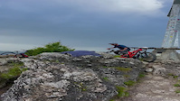
Photos of Zone Mountain Bike
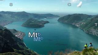
Videos of Zone Mountain Bike
trail: Corna 30 Passi Vetta
0:21 |
|
Sep 16, 2024

trail: Trenta passi Extreme
8:32 |
108 |
Dec 29, 2025 , Zone
trail: Corna 30 Passi Vetta
8:32 |
33 |
Dec 27, 2025 , Zone
Recent Trail Reports
| status | trail | date | condition | info | user |
|---|---|---|---|---|---|
| Piane - Cisliano | Jun 13, 2026 @ 9:20pm (Europe/Rome) Jun 13, 2026 | Ideal | FeliceRasca | ||
| Sentiero dell'Uccellatore ( Cascine Culme - Piane ) | Jun 13, 2026 @ 9:18pm (Europe/Rome) Jun 13, 2026 | Ideal | FeliceRasca | ||
| Pozza del Culmet - Cascine Culme | Jun 13, 2026 @ 9:16pm (Europe/Rome) Jun 13, 2026 | Ideal | FeliceRasca | ||
| Rifugio Almici - Culmet | Jun 13, 2026 @ 9:15pm (Europe/Rome) Jun 13, 2026 | Ideal | FeliceRasca | ||
| Verso il Medelet | May 31, 2026 @ 8:06am (Europe/Vaduz) May 30, 2026 | Ideal | marinome | ||
| El Pincugol | Dec 27, 2025 @ 4:44pm (Europe/Rome) Dec 27, 2025 | Unknown | mtbbresciafederico | ||
| Corna 30 Passi Vetta | Dec 27, 2025 @ 4:51pm (Europe/Rome) Dec 27, 2025 | Unknown | mtbbresciafederico | ||
| Piramidi | Dec 27, 2025 @ 4:47pm (Europe/Rome) Dec 27, 2025 | Unknown | mtbbresciafederico | ||
| Forcella Occidentale - Passo croce di Zone | Dec 27, 2025 @ 4:42pm (Europe/Rome) Dec 27, 2025 | Unknown | mtbbresciafederico | ||
| Monte Guglielmo dal Bosco degli Gnomi | Nov 10, 2025 @ 10:31pm (Europe/Rome) Nov 10, 2025 | Variable | fabioooo |
Activity Feed
| username | action | type | title | date |
|---|---|---|---|---|
| FeliceRasca | difficultyvote | trail | activity #96904698 | Jun 13, 2026 @ 12:18pm Jun 13, 2026 |
| FeliceRasca | add | report | activity #96904517 and 3 more | Jun 13, 2026 @ 12:15pm Jun 13, 2026 |
| marinome | difficultyvote | trail | activity #96493818 | Jun 7, 2026 @ 1:35pm Jun 7, 2026 |
| marinome | add | photo | activity #96177380 | Jun 3, 2026 @ 1:26pm Jun 3, 2026 |
| marinome | comment | trail | activity #96146055 | Jun 3, 2026 @ 4:37am Jun 3, 2026 |
Recent Comments
| username | type | title | comment | date |
|---|---|---|---|---|
| trail | Bella salita dal Medelet verso i stalletti,... | Jun 3, 2026 @ 4:37am Jun 3, 2026 | ||
| report | Confermo👌🏻 | Jan 5, 2026 @ 3:37am Jan 5, 2026 | ||
| trail | ATTENZIONE Sentiero con tratti esposti. | Nov 3, 2025 @ 1:00pm Nov 3, 2025 | ||
| trail | Here a description from a popular blog... | Jul 15, 2025 @ 7:52am Jul 15, 2025 | ||
| trail | Here a description from a popular blog... | Jul 15, 2025 @ 7:51am Jul 15, 2025 |
Local Badges
-

Epic Mountain Bike Climb 2k63 awarded -

Climbing 10k Badge3 awarded -

Mountain Biking 100k Badge0 awarded -

Epic Ride Descent 2k63 awarded -

Descent 10k Badge3 awarded -

Descent 100k Badge0 awarded
Activity Type Stats
| activitytype | trails | distance | descent | descent distance | total vertical | rating | global rank | state rank | photos | reports | routes | ridelogs |
|---|---|---|---|---|---|---|---|---|---|---|---|---|
| Mountain Bike | 29 | 25 miles | 9,367 ft | 11 miles | 5,020 ft | #5,853 | #455 | 28 | 88 | 408 | ||
| E-Bike | 20 | 19 miles | 5,154 ft | 6 miles | 4,288 ft | #4,781 | #460 | 86 | 172 | |||
| Hike | 21 | 16 miles | 3,809 ft | 4 miles | 4,288 ft | #7,894 | #463 | 85 | 224 | |||
| Trail Running | 22 | 17 miles | 4,078 ft | 5 miles | 4,288 ft | #7,229 | #430 | 85 | 37 |
Frequently Asked Questions About Zone
▼
What are the best places to ride in Zone?
Zone has 1 areas to explore for mountain biking. The top rated areas are:
▼
What are the highest rated mountain biking trails in Zone?
The highest rated mountain biking trails in Zone are:
- Verso il Medelet (4.1/5)
- Creste del Guglielmo (4.1/5)
- Sentiero dell'Uccellatore ( Cascine Culme - Piane ) (4/5)
- Track_ValPalot (4/5)
- Pozza del Culmet - Cascine Culme (3.8/5)
▼
What is the best time of the year to ride in Zone?
Based on ride log data, the most popular months to ride in Zone are:
- July (17 activities)
- September (2 activities)
- October (2 activities)
▼
Where can I park to ride in Zone?
There are 3 parking locations listed in Zone. The most popular parking spots are: View all parking and trailhead locations on the map to plan your visit.
Activities
Trails
- By adessoomaipiu
 & contributors
 - Admins: marcoangeletti, adessoomaipiu, micheletraversi
- #46044 - 968 views
- zone activity log | embed map of Zone mountain bike trails | zone mountain biking points of interest
Downloading of trail gps tracks in kml & gpx formats is enabled for Zone.
You must login to download files.