3.2 miles
Distance
377 ft
Climb
-379 ft
Descent
759 ft
High Point
-1 ft
Altitude change
520 ft
Altitude min
693 ft
Altitude start
692 ft
Altitude end
-36.8%
Grade max
17.2%
Grade min
2 miles
Distance climb
1 mile
Distance down
1,709 ft
Distance flat

May Contest time

This is a special YOUTH ONLY loop. Youth riders are more then welcome to drag their parents along with them. Ride this loop and get your name entered for a draw prize. Each time you ride the loop your name will be entered. Not a race, just ride the loop and have fun doing it. Time to Hammer at the Fest in beautiful downtown Errington, BC!

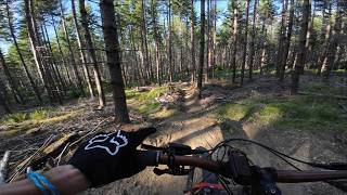
The usual rocks and roots, twists and turns with one hike-a-bike up to Wally Jr. A portion of the new trails in the ER Falls Park are included, give you something super fun and exciting at the end.

Let Roxanne know when and how many loops you've done!

Contest starts Monday, May 3rd and ends on Monday, May 31st.

Detailed Description
ACC Youth Loop is a 3 mile popular easy route located near Parksville British Columbia. This mountain bike only route can be used one direction and has a moderate overall physical rating. This route includes 11 trails. This route climbs 377 ft with a max elevation of 759 ft then descends -379 ft.

Trail Issues on Route

  • Minor Issue / Yellow: 1 trail (newest: Apr 26, 2026)
Local Trail Association
Local trail association
Arrowsmith Cycling Club (arrowsmithcyclingclub.com)
Please consider joining or donating to the local riding association to support trail development & maintenance.
Donate to earn trail karma!

Stats

  • Distance
    3 miles
  • Avg time
    48 min 0 sec
  • Altitude min
    520 ft
  • Altitude start
    693 ft
  • Altitude end
    692 ft
  • Climb
    377 ft
  • Descent
    -379 ft
  • Grade max
    -36.8%
  • Grade min
    17.2%
  • Distance climb
    2 miles
  • Distance down
    1 mile
  • Distance flat
    1,709 ft

12 Reviews & Comments


We hope you've been enjoying Trailforks!

Create a FREE account to view route comments and much more.

Details

  • Riding area
  • Primary Activity
    Mountain Bike
  • Difficulty rating
    Green
  • Route Type
    Loop
  • eBike Allowed
  • Bike type
    XC
  • Direction
    One Direction
  • Physical rating
    Moderate
  • Ridelogs
    2

Directions

  1. Walk southeast on Daryl's.
  2. Continue for 90 meters.
  3. Bear right onto Pit2Pit.
  4. Continue for 700 meters.
  5. Turn left onto Walrus.
  6. Continue for 80 meters.
  7. Make a sharp left onto Wally Jr.
  8. Continue for 200 meters.
  9. Turn left onto Walrus Lower.
  10. Continue for 100 meters.
  11. Bear right onto Big Bang Theory.
  12. Continue for 200 meters.
  13. Turn right onto Big Dipper Loop.
  14. Continue for 800 meters.
  15. Turn right onto Milky Way.
  16. Continue for 900 meters.
  17. Turn left onto Park Access.
  18. Continue for 20 meters.
  19. Turn right onto Cranky.
  20. Continue for 500 meters.
  21. Turn left onto Classic Road Climb.
  22. Continue for 100 meters.
  23. Turn right onto Spur Rd 1.
  24. Continue for 400 meters.
no votes yet
close
3D
Trail Conditions
  • Unknown
  • Snow Groomed
  • Snow Packed
  • Snow Covered
  • Snow Cover Partial
  • Freeze/thaw Cycle
  • Icy
  • Prevalent Mud
  • Wet
  • Variable
  • Ideal
  • Dry
  • Very Dry
Trail Flow (Ridden Direction)
Trailforks scans users ridelogs to determine the most popular direction each trail is ridden. A good flowing trail network will have most trails flowing in a single direction according to their intension.
The colour categories are based on what percentage of riders are riding a trail in its intended direction.
  • > 96%
  • > 90%
  • > 80%
  • > 70%
  • > 50%
  • < 50%
  • bi-directional trail
  • no data
Trail Last Ridden
Trailforks scans ridelogs to determine the last time a trail was ridden.
  • < 2 days
  • < 1 week
  • < 2 weeks
  • < 1 month
  • < 6 months
  • > 6 months
Trail Ridden Direction
The intended direction a trail should be ridden.
  • Downhill Only
  • Downhill Primary
  • Both Directions
  • Uphill Primary
  • Uphill Only
  • One Direction
Contribute Details
Colors indicate trail is missing specified detail.
  • Description
  • Photos
  • Description & Photos
  • Videos
Trail Popularity ?
Trailforks scans ridelogs to determine which trails are ridden the most in the last 9 months. Trails are compared with nearby trails in the same city region with a possible 25 colour shades. Think of this as a heatmap, more rides = more kinetic energy = warmer colors.
  • most popular
  • popular
  • less popular
  • not popular
ATV/ORV/OHV Filter
Max Vehicle Width
inches
US Cell Coverage
Legend
cell carrier legend

Radar Time
Activity Recordings
Trailforks uses anonymized public activity data. ?
Activity Recordings
Trailforks uses anonymized public activity data. ?
Personal Heatmap
Activity Types
all / none
Options
2
Date range month
Winter Trails
Warning A routing network for winter maps does not exist. Selecting trails using the winter trails layer has been disabled.
Missing Trails
Most Popular
Least Popular
Trails are colored based on popularity. The more popular a trail is, the more red. Less popular trails trend towards green.
Jump Magnitude Heatmap
Heatmap of where riders jump on trails. Zoom in to see individual jumps, click circles to view jump details.
BC Backroad Status

Service Road Atlas is a free to use, community-driven service for viewing and creating reports on the numerous back-country service roads around B.C. and Alberta.

map legend
Slope Aspect
Direction the slope faces
Flat N NE E SE S SW W NW
Trails Deemphasized
Trails are shown in grey.
disable
Only show trails with no bike usage.
Enable
Suggested Layers
Based on selected activity type

    Save the current map location and zoom level as your default home location whenever this page is loaded.

    Save
    Trail transparency
    • Singletrack
    55
    47
    43
    37
    More exploring out at HammerFest | Parksville, BC
    More exploring out at HammerFest | Parksville, BC
    trail: Shake&Bake
    11:59 | 8 | comments: 0 | favs:
    May 30, 2026
    More exploring out at HammerFest | Parksville, BC
    More exploring out at HammerFest | Parksville, BC
    11:59 | 5 | comments: 0 | favs:
    May 30, 2026

    Recent Trail Reports Along Route

    statustraildateconditiondescription
    Shake&Bake
    Jun 25, 2026 @ 10:23am (America/Vancouver)
    3 days
    reporter
    Milky Way
    Jun 14, 2026 @ 8:28am (America/Vancouver)
    Jun 14, 2026
    reporter
    Wally Jr
    Jun 12, 2026 @ 1:26pm (America/Vancouver)
    Jun 12, 2026
    reporter
    Pit2Pit
    May 20, 2026 @ 11:52am (America/Vancouver)
    May 20, 2026
    Better
    Betty's Bridge
    May 20, 2026 @ 11:52am (America/Vancouver)
    May 20, 2026
    Good
    more reports »
    • By rapid-royTF Pro TrailsBC ACC & contributors
    • #18139 - 1,813 views

    Hit the Trail

    Open in App

    Get this route on your phone instantly.

    Download Route

    Save to wishlist, Garmin & download.