

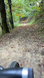
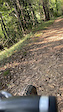
Percorso AM estratto dalla Marathon Brianza, ma girato in senso inverso per divertirsi tanto in discesa. E' consigliata una full suspension da trail e comunque una buona tecnica di discesa. Inoltre, l'impegno fisico non è trascurabile (circa 1000 D+); è quindi richiesto un ottimo allenanamento per chiuderla in sicurezza.
Local Trail Association
Stats
-
Distance18 miles
-
Avg time58 min 36 sec
-
Altitude min978 ft
-
Altitude start1,457 ft
-
Altitude end1,493 ft
-
Climb2,285 ft
-
Descent-2,248 ft
-
Grade max-33.4%
-
Grade min45.5%
-
Distance climb9 miles
-
Distance down7 miles
-
Distance flat1 mile
We hope you've been enjoying Trailforks!
Create a FREE account to view route comments and much more.
Trails in Route
| 1 mile | |||||
| 3,133 ft | |||||
| 3,839 ft | |||||
| 2 miles | |||||
| 1 mile |

Details
-
Riding area
-
Primary ActivityMountain Bike
-
Difficulty ratingBlue
-
Route TypeLoop
-
Bike typeAM, XC
-
DirectionOne Direction
-
Physical ratingHard
- Unknown
- Snow Groomed
- Snow Packed
- Snow Covered
- Snow Cover Partial
- Freeze/thaw Cycle
- Icy
- Prevalent Mud
- Wet
- Variable
- Ideal
- Dry
- Very Dry
The colour categories are based on what percentage of riders are riding a trail in its intended direction.
- > 96%
- > 90%
- > 80%
- > 70%
- > 50%
- < 50%
- bi-directional trail
- no data
- < 2 days
- < 1 week
- < 2 weeks
- < 1 month
- < 6 months
- > 6 months
- Downhill Only
- Downhill Primary
- Both Directions
- Uphill Primary
- Uphill Only
- One Direction
- Description
- Photos
- Description & Photos
- Videos
- most popular
- popular
- less popular
- not popular
Service Road Atlas is a free to use, community-driven service for viewing and creating reports on the numerous back-country service roads around B.C. and Alberta.
Save the current map location and zoom level as your default home location whenever this page is loaded.
Save- Singletrack
- Unpaved
Photos
Videos
Recent Trail Reports Along Route
- By fabioapnea
& contributors - #43408 - 682 views
