


Rated aMTB3 - Support Required
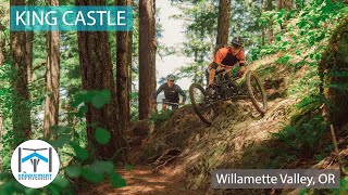
This route is intended for adaptive riders, but anyone can do it. It skips the first section of trail which is exposed with off-camber and not suitable for adaptive. The trail itself has plenty of sidehill and will require assistance. Bring a support rider....or two It isn't so much work that it's not worth it. Be ready for the rock roll at the end. Some riders may require a spotter. Read TRAIL BLOG linked below for more info, video, and pictures.

Links
Local Trail Association
Disciples of Dirt (disciplesofdirt.org)Trail Products
Stats
-
Distance10 miles
-
Altitude min1,229 ft
-
Altitude start1,234 ft
-
Altitude end1,240 ft
-
Climb1,579 ft
-
Descent-1,574 ft
-
Grade max-40.7%
-
Grade min35.5%
-
Distance climb5 miles
-
Distance down4 miles
-
Distance flat4,957 ft
14 Reviews & Comments
We hope you've been enjoying Trailforks!
Create a FREE account to view route comments and much more.

Trails in Route
| 5 miles | |||||
Details
-
Riding area
-
Primary ActivityMountain Bike
-
Other Activities
- Adaptive Bike
-
Difficulty ratingBlack Diamond
-
Route TypeLoop
-
Bike typeAM, XC, Fat, Adaptive MTB
-
DirectionOne Direction
-
Physical ratingHard
- Unknown
- Snow Groomed
- Snow Packed
- Snow Covered
- Snow Cover Partial
- Freeze/thaw Cycle
- Icy
- Prevalent Mud
- Wet
- Variable
- Ideal
- Dry
- Very Dry
The colour categories are based on what percentage of riders are riding a trail in its intended direction.
- > 96%
- > 90%
- > 80%
- > 70%
- > 50%
- < 50%
- bi-directional trail
- no data
- < 2 days
- < 1 week
- < 2 weeks
- < 1 month
- < 6 months
- > 6 months
- Downhill Only
- Downhill Primary
- Both Directions
- Uphill Primary
- Uphill Only
- One Direction
- Description
- Photos
- Description & Photos
- Videos
- most popular
- popular
- less popular
- not popular
Service Road Atlas is a free to use, community-driven service for viewing and creating reports on the numerous back-country service roads around B.C. and Alberta.
Save the current map location and zoom level as your default home location whenever this page is loaded.
Save- Unpaved
Photos
Videos
Recent Trail Reports Along Route
| status | trail | date | condition | description |
|---|---|---|---|---|
Apr 28, 2026 @ 2:22pm (America/Los_Angeles) Apr 28, 2026 | Running perfect. | |||
Mar 22, 2026 @ 1:52pm (America/Boise) Mar 22, 2026 |
- By jpmcghee
Trailforks & contributors - #59995 - 356 views



