25.7 miles
Distance
5,958 ft
Climb
-5,955 ft
Descent
2,621 ft
High Point
3 ft
Altitude change
66 ft
Altitude min
66 ft
Altitude start
69 ft
Altitude end
-90%
Grade max
57.1%
Grade min
14 miles
Distance climb
10 miles
Distance down
1 mile
Distance flat

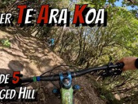
Aorere Enduro - Asia - Pacific Continental Round 1 Day 2

Detailed Description
Aorere Day 2 is a 26 mile advanced race route located near Nelson. This mountain bike only route can be used one direction and has a hard overall physical rating. This route includes 62 trails. This route climbs 5,958 ft with a max elevation of 2,621 ft then descends -5,955 ft.

Trail Issues on Route

  • Closed: 1 trail (newest: May 1, 2026)
  • Significant Issue / Amber: 2 trails (newest: Jun 8, 2026)
  • Minor Issue / Yellow: 1 trail (newest: Apr 28, 2026)
Local Trail Association
Local trail association
Nelson Mountain Bike Club (nelsonmtb.club)
Please consider joining or donating to the local riding association to support trail development & maintenance.
Donate to earn trail karma!
Past Events

Stats

  • Distance
    26 miles
  • Avg time
    10 hr 0 min
  • Altitude change
    3 ft
  • Altitude min
    66 ft
  • Altitude start
    66 ft
  • Altitude end
    69 ft
  • Climb
    1 mile
  • Descent
    -5,955 ft
  • Grade max
    -90%
  • Grade min
    57.1%
  • Distance climb
    14 miles
  • Distance down
    10 miles
  • Distance flat
    1 mile

34 Reviews & Comments


We hope you've been enjoying Trailforks!

Create a FREE account to view route comments and much more.

Route Sections

1 Stage 2
  • 3 miles distance
  • 64 ft climb
  • -2,335 ft descent
2 Stage 3
  • 4,177 ft distance
  • 0 ft climb
  • -844 ft descent
3 Stage 4
  • 1 mile distance
  • 0 ft climb
  • -837 ft descent
4 Stage 5
  • 4,281 ft distance
  • 0 ft climb
  • -896 ft descent

Details

  • Race Course
  • Riding area
  • Primary Activity
    Mountain Bike
  • Difficulty rating
    Advanced
  • Route Type
    Point to Point
  • Direction
    One Direction
  • Physical rating
    Hard
Avg: 5 (1 votes)
close
3D
Trail Conditions
  • Unknown
  • Snow Groomed
  • Snow Packed
  • Snow Covered
  • Snow Cover Partial
  • Freeze/thaw Cycle
  • Icy
  • Prevalent Mud
  • Wet
  • Variable
  • Ideal
  • Dry
  • Very Dry
Trail Flow (Ridden Direction)
Trailforks scans users ridelogs to determine the most popular direction each trail is ridden. A good flowing trail network will have most trails flowing in a single direction according to their intension.
The colour categories are based on what percentage of riders are riding a trail in its intended direction.
  • > 96%
  • > 90%
  • > 80%
  • > 70%
  • > 50%
  • < 50%
  • bi-directional trail
  • no data
Trail Last Ridden
Trailforks scans ridelogs to determine the last time a trail was ridden.
  • < 2 days
  • < 1 week
  • < 2 weeks
  • < 1 month
  • < 6 months
  • > 6 months
Trail Ridden Direction
The intended direction a trail should be ridden.
  • Downhill Only
  • Downhill Primary
  • Both Directions
  • Uphill Primary
  • Uphill Only
  • One Direction
Contribute Details
Colors indicate trail is missing specified detail.
  • Description
  • Photos
  • Description & Photos
  • Videos
Trail Popularity ?
Trailforks scans ridelogs to determine which trails are ridden the most in the last 9 months. Trails are compared with nearby trails in the same city region with a possible 25 colour shades. Think of this as a heatmap, more rides = more kinetic energy = warmer colors.
  • most popular
  • popular
  • less popular
  • not popular
ATV/ORV/OHV Filter
Max Vehicle Width
inches
US Cell Coverage
Legend
cell carrier legend

Radar Time
Activity Recordings
Trailforks uses anonymized public activity data. ?
Activity Recordings
Trailforks uses anonymized public activity data. ?
Personal Heatmap
Activity Types
all / none
Options
2
Date range month
Winter Trails
Warning A routing network for winter maps does not exist. Selecting trails using the winter trails layer has been disabled.
Missing Trails
Most Popular
Least Popular
Trails are colored based on popularity. The more popular a trail is, the more red. Less popular trails trend towards green.
Jump Magnitude Heatmap
Heatmap of where riders jump on trails. Zoom in to see individual jumps, click circles to view jump details.
BC Backroad Status

Service Road Atlas is a free to use, community-driven service for viewing and creating reports on the numerous back-country service roads around B.C. and Alberta.

map legend
Slope Aspect
Direction the slope faces
Flat N NE E SE S SW W NW
Trails Deemphasized
Trails are shown in grey.
disable
Only show trails with no bike usage.
Enable
Suggested Layers
Based on selected activity type

    Save the current map location and zoom level as your default home location whenever this page is loaded.

    Save
    Trail transparency
    • Singletrack
    • Unpaved
    • Paved
    61
    68
    559
    367
    Mud-Mixer ride on revamped lower TAK
    Mud-Mixer ride on revamped lower TAK
    trail: Te Ara Koa
    5:10 | 32 | comments: 0 | favs:
    Jan 15, 2026
    Hira Forest Gravel  loop
    Hira Forest Gravel loop
    trail: Central Rd
    9:41 | 69 | comments: 0 | favs:
    Sep 23, 2025

    Recent Trail Reports Along Route

    statustraildateconditiondescription
    Top Dog
    Jun 20, 2026 @ 4:12am (America/Vancouver)
    15 hours
    running mint right now
    HotBox
    Jun 20, 2026 @ 3:55am (America/Vancouver)
    15 hours
    running mint right now
    Jacks Track (lower)
    Jun 14, 2026 @ 2:28pm (Pacific/Auckland)
    Jun 13, 2026
    Tasman Journeys
    Jun 14, 2026 @ 2:28pm (Pacific/Auckland)
    Jun 13, 2026
    Take Me To Your Leader
    Jun 14, 2026 @ 2:28pm (Pacific/Auckland)
    Jun 13, 2026
    more reports »
    • By NMTBCTF Pro NMTBC & contributors
    • #16165 - 1,669 views

    Hit the Trail

    Open in App

    Get this route on your phone instantly.

    Download Route

    Save to wishlist, Garmin & download.