195.8 miles
Distance
17,172 ft
Climb
-21,200 ft
Descent
2 miles
High Point
-4,028 ft
Altitude change
5,211 ft
Altitude min
9,827 ft
Altitude start
5,801 ft
Altitude end
-0.4%
Grade
-67.6%
Grade max
58.9%
Grade min
83 miles
Distance climb
104 miles
Distance down
8 miles
Distance flat

The Greatest Bicycle Adventure in the American West.

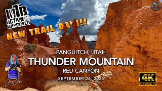
Welcome to Utah’s Color Country, one of the greatest places in the world to ride your bike. Ride the Aquarius Trail and enjoy the marvels and scenery from the peak of Brian Head, through Panguitch, Hatch and Bryce, down to the beautiful town of Escalante.

Detailed Description
Aquarius Route is a 196 mile popular intermediate route located near Brian Head Utah. This mountain bike only route can be used one direction and has a hard overall physical rating. This route includes 10 trails. This route climbs 17,172 ft with a max elevation of 11,057 ft then descends -21,200 ft.

Trail Issues on Route

  • Significant Issue / Amber: 2 trails (newest: May 27, 2026)
  • Minor Issue / Yellow: 3 trails (newest: Jun 16, 2026)
Local Trail Association
Please consider joining or donating to the local riding association to support trail development & maintenance.
Donate to earn trail karma!

Stats

  • Distance
    196 miles
  • Avg time
    33 hr 26 min
  • Altitude change
    -4,028 ft
  • Altitude min
    5,211 ft
  • Altitude start
    9,827 ft
  • Altitude end
    5,801 ft
  • Climb
    3 miles
  • Descent
    -21,200 ft
  • Grade
    -0.4%
  • Grade max
    -67.6%
  • Grade min
    58.9%
  • Distance climb
    83 miles
  • Distance down
    104 miles
  • Distance flat
    8 miles

84 Reviews & Comments


We hope you've been enjoying Trailforks!

Create a FREE account to view route comments and much more.

Route Lines

1 Powell Point

Route POI

Water Fountain/SourceCastle Creek (Filter)Water Fountain/Source
Water Fountain/SourceKing Creek CampgroundWater Fountain/Source
Water Fountain/SourcePine LakeWater Fountain/Source

Details

  • Featured
  • Riding area
  • Primary Activity
    Mountain Bike
  • Difficulty rating
    Blue
  • Route Type
    Point to Point
  • Bikepacking
    Yes
  • Direction
    One Direction
  • Physical rating
    Hard
Avg: 3.65 (3 votes)
close
3D
Trail Conditions
  • Unknown
  • Snow Groomed
  • Snow Packed
  • Snow Covered
  • Snow Cover Partial
  • Freeze/thaw Cycle
  • Icy
  • Prevalent Mud
  • Wet
  • Variable
  • Ideal
  • Dry
  • Very Dry
Trail Flow (Ridden Direction)
Trailforks scans users ridelogs to determine the most popular direction each trail is ridden. A good flowing trail network will have most trails flowing in a single direction according to their intension.
The colour categories are based on what percentage of riders are riding a trail in its intended direction.
  • > 96%
  • > 90%
  • > 80%
  • > 70%
  • > 50%
  • < 50%
  • bi-directional trail
  • no data
Trail Last Ridden
Trailforks scans ridelogs to determine the last time a trail was ridden.
  • < 2 days
  • < 1 week
  • < 2 weeks
  • < 1 month
  • < 6 months
  • > 6 months
Trail Ridden Direction
The intended direction a trail should be ridden.
  • Downhill Only
  • Downhill Primary
  • Both Directions
  • Uphill Primary
  • Uphill Only
  • One Direction
Contribute Details
Colors indicate trail is missing specified detail.
  • Description
  • Photos
  • Description & Photos
  • Videos
Trail Popularity ?
Trailforks scans ridelogs to determine which trails are ridden the most in the last 9 months. Trails are compared with nearby trails in the same city region with a possible 25 colour shades. Think of this as a heatmap, more rides = more kinetic energy = warmer colors.
  • most popular
  • popular
  • less popular
  • not popular
ATV/ORV/OHV Filter
Max Vehicle Width
inches
US Cell Coverage
Legend
cell carrier legend

Radar Time
Activity Recordings
Trailforks uses anonymized public activity data. ?
Activity Recordings
Trailforks uses anonymized public activity data. ?
Personal Heatmap
Activity Types
all / none
Options
2
Date range month
–
Winter Trails
Warning A routing network for winter maps does not exist. Selecting trails using the winter trails layer has been disabled.
Missing Trails
Most Popular
Least Popular
Trails are colored based on popularity. The more popular a trail is, the more red. Less popular trails trend towards green.
Jump Magnitude Heatmap
Heatmap of where riders jump on trails. Zoom in to see individual jumps, click circles to view jump details.
BC Backroad Status

Service Road Atlas is a free to use, community-driven service for viewing and creating reports on the numerous back-country service roads around B.C. and Alberta.

map legend
Slope Aspect
Direction the slope faces
Flat N NE E SE S SW W NW
Trails Deemphasized
Trails are shown in grey.
disable
Only show trails with no bike usage.
Enable
Suggested Layers
Based on selected activity type

    Save the current map location and zoom level as your default home location whenever this page is loaded.

    Save
    Trail transparency
    • Singletrack
    • Unpaved
    1,274
    1,265
    1,382
    2,622 | 1 comments | 16 faves

    Recent Trail Reports Along Route

    statustraildateconditiondescription
    Bunker Creek Ext
    Jun 16, 2026 @ 10:07pm (America/Denver)
    Jun 16, 2026
    Dry and dusty but still good riding. The trail has several large downed trees still. Many have been cleared away but there are still some large ones left. Use caution but totally rideable.
    Bunker Creek Middle
    May 27, 2026 @ 4:52pm (America/Denver)
    May 27, 2026
    Trail dry but tons of trees down. Cut 20+ to clear but still lots that were too big for my saw.
    Thunder Mountain
    May 14, 2026 @ 6:29pm (America/Denver)
    May 14, 2026
    It's in good shape. Seems to be more commercial horse traffic, unfortunately.
    Sidney Peaks
    May 12, 2026 @ 1:13pm (America/Denver)
    May 12, 2026
    Impassable 😩😩
    Proctor Canyon - Badger Creek
    Nov 14, 2025 @ 1:43pm (America/Denver)
    Nov 14, 2025
    Drove this road from Tropic Reservoir to Hatch on 11/11/25. From the high point (3.5mile) to just above Blue Fly Proctor Trail (6.5mile) got nuked pretty bad in the fire, the rest did not burn badly. Road is still in decent shape. Just beyond Grandview trail crossing there is a deep stream channel to cross that is pretty deep. Had to remove and carry bike rack across and even with that my tacoma hitch/bumper dragged badly. It is deeper and steeper than it looks in the photos I added. Not an issue for MTB/moto/SxS.
    more reports »
    • By toddTF Pro Trailforks & contributors
    • #48482 - 9,772 views

    Hit the Trail

    Open in App

    Get this route on your phone instantly.

    Download Route

    Save to wishlist, Garmin & download.