
Open in App
Get this route on your phone instantly.
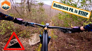
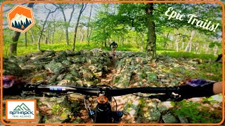
This is a staple loop of the area typically run in the direction of up Bear Meadows Rd, left up Corner Rd to Dylan's Path to the Beer Tap, across the ridge (Tussey Mountain Trail) and back down Lornberger
We hope you've been enjoying Trailforks!
Create a FREE account to view route comments and much more.
| 1 mile | |||||
| 627 ft | |||||
| 1,240 ft | |||||
| 148 ft | |||||
| 2 miles | |||||
| 4,987 ft | |||||
| 1 mile | |||||
| 3 miles | |||||
| 656 ft | |||||
| 3,671 ft |

Service Road Atlas is a free to use, community-driven service for viewing and creating reports on the numerous back-country service roads around B.C. and Alberta.
Save the current map location and zoom level as your default home location whenever this page is loaded.
Save