13.4 miles
Distance
2,764 ft
Climb
-2,755 ft
Descent
977 ft
High Point
9 ft
Altitude change
167 ft
Altitude min
171 ft
Altitude start
180 ft
Altitude end
-53.5%
Grade max
67.1%
Grade min
6 miles
Distance climb
6 miles
Distance down
4,104 ft
Distance flat

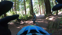
A ROUTE I PUT TOGETHER FOR UPCOMING TRIP.

Detailed Description
BILL V ROUTE is a 13 mile moderately popular intermediate route located near Arcata California. This mountain bike only route. This route includes 37 trails. This route climbs 2,764 ft with a max elevation of 977 ft then descends -2,755 ft.

Trail Issues on Route

  • Minor Issue / Yellow: 1 trail (newest: Aug 17, 2025)
Local Trail Association
Local trail association
Redwood Coast Mountain Bike Association (www.redwoodcoastmtb.org)
Please consider joining or donating to the local riding association to support trail development & maintenance.
Donate to earn trail karma!

Stats

  • Distance
    13 miles
  • Avg time
    2 hr 48 min
  • Altitude change
    9 ft
  • Altitude min
    167 ft
  • Altitude start
    171 ft
  • Altitude end
    180 ft
  • Climb
    2,764 ft
  • Descent
    -2,755 ft
  • Grade max
    -53.5%
  • Grade min
    67.1%
  • Distance climb
    6 miles
  • Distance down
    6 miles
  • Distance flat
    4,104 ft

11 Reviews & Comments


We hope you've been enjoying Trailforks!

Create a FREE account to view route comments and much more.

Details

Avg: 5 (1 votes)
close
3D
Trail Conditions
  • Unknown
  • Snow Groomed
  • Snow Packed
  • Snow Covered
  • Snow Cover Partial
  • Freeze/thaw Cycle
  • Icy
  • Prevalent Mud
  • Wet
  • Variable
  • Ideal
  • Dry
  • Very Dry
Trail Flow (Ridden Direction)
Trailforks scans users ridelogs to determine the most popular direction each trail is ridden. A good flowing trail network will have most trails flowing in a single direction according to their intension.
The colour categories are based on what percentage of riders are riding a trail in its intended direction.
  • > 96%
  • > 90%
  • > 80%
  • > 70%
  • > 50%
  • < 50%
  • bi-directional trail
  • no data
Trail Last Ridden
Trailforks scans ridelogs to determine the last time a trail was ridden.
  • < 2 days
  • < 1 week
  • < 2 weeks
  • < 1 month
  • < 6 months
  • > 6 months
Trail Ridden Direction
The intended direction a trail should be ridden.
  • Downhill Only
  • Downhill Primary
  • Both Directions
  • Uphill Primary
  • Uphill Only
  • One Direction
Contribute Details
Colors indicate trail is missing specified detail.
  • Description
  • Photos
  • Description & Photos
  • Videos
Trail Popularity ?
Trailforks scans ridelogs to determine which trails are ridden the most in the last 9 months. Trails are compared with nearby trails in the same city region with a possible 25 colour shades. Think of this as a heatmap, more rides = more kinetic energy = warmer colors.
  • most popular
  • popular
  • less popular
  • not popular
ATV/ORV/OHV Filter
Max Vehicle Width
inches
US Cell Coverage
Legend
cell carrier legend

Radar Time
Activity Recordings
Trailforks uses anonymized public activity data. ?
Activity Recordings
Trailforks uses anonymized public activity data. ?
Personal Heatmap
Activity Types
all / none
Options
2
Date range month
Winter Trails
Warning A routing network for winter maps does not exist. Selecting trails using the winter trails layer has been disabled.
Missing Trails
Most Popular
Least Popular
Trails are colored based on popularity. The more popular a trail is, the more red. Less popular trails trend towards green.
Jump Magnitude Heatmap
Heatmap of where riders jump on trails. Zoom in to see individual jumps, click circles to view jump details.
BC Backroad Status

Service Road Atlas is a free to use, community-driven service for viewing and creating reports on the numerous back-country service roads around B.C. and Alberta.

map legend
Slope Aspect
Direction the slope faces
Flat N NE E SE S SW W NW
Trails Deemphasized
Trails are shown in grey.
disable
Only show trails with no bike usage.
Enable
Suggested Layers
Based on selected activity type

    Save the current map location and zoom level as your default home location whenever this page is loaded.

    Save
    Trail transparency
    • Singletrack
    • Unpaved
    115
    125
    103
    92
    San's crash in Arcata
    San's crash in Arcata
    0:48 | 254 | comments: 0 | favs:
    Jul 29, 2021
    Mtb crash in Arcata, CA
    Humboldt County - Arcata Community Forest
    Humboldt County - Arcata Community Forest
    18:10 | 801 | comments: 0 | favs:
    Apr 28, 2021

    Recent Trail Reports Along Route

    statustraildateconditiondescription
    Community Forest Loop Road (#8)
    Dec 2, 2025 @ 11:15am (America/Los_Angeles)
    Dec 2, 2025
    Ridge Road (#12)
    Aug 17, 2025 @ 3:19pm
    Aug 17, 2025
    Ridge Loop Spur
    Jul 31, 2025 @ 9:06am
    Jul 31, 2025
    Powerline (15)
    Jul 31, 2025 @ 9:06am
    Jul 31, 2025
    Fickle Hill Grade (#9)
    Jul 31, 2025 @ 9:06am
    Jul 31, 2025
    Parked on Fickle hill. Distances approximate… • Trail #9 (0.90m) to • T8 right (0.27) to • T12 right (0.09m) to • T13 straight (0.13m) to • T13.5 right (0.49m) back down to • T8 left (0.24m) short to • T15 right (0.6m) to • T8 left (0.05 m) • T16 right (0.10m) on • T4 left (0.33) to • T9 right (0.62m).
    more reports »
    • By wavanaukenTF Pro & contributors
    • #14491 - 2,036 views

    Hit the Trail

    Open in App

    Get this route on your phone instantly.

    Download Route

    Save to wishlist, Garmin & download.