5.7 miles
Distance
471 ft
Climb
-474 ft
Descent
396 ft
High Point
0 ft
Altitude change
123 ft
Altitude min
396 ft
Altitude start
397 ft
Altitude end
-24.6%
Grade max
16%
Grade min
2 miles
Distance climb
2 miles
Distance down
1 mile
Distance flat

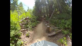
This slow-paced ride is perfect for beginners that want to get a taste of the trails at an easy pace, so you don’t need to feel like you’re always having to “keep up.” Expect about a 3 mile ride with an option to ride Sir-Lance-Alot out and back or continue to the parking lot. Ride starts from the main parking area, descends down Hollerback, Dirty Dishes (with a section that some might prefer to walk) and continues across the lower parking area to The Snag section on the south side of the road. Ride will then loop around The Snag area and continue back up Dirty Dishes with the option to head back to trailhead or ride Sir-Lance-Alot for about 2 more miles. This beginner focused ride will give you a chance to enjoy some of the best of the trails and trees with not too much climbing or difficulty, and plenty of breaks. Beginners will get a chance to learn a few tricks and tips from mountain bike coach and bike enthusiast Erin Kessler to help take your riding to a new level This group ride is perfect for new-to-mountain biking riders who want a supportive and fun atmosphere to learn new skills.

Expect at least a 1-hour ride time.

Detailed Description
Break The Ice is a 6 mile moderately popular easy route located near Coos Bay Oregon. This mountain bike only route. This route includes 19 trails. This route climbs 471 ft with a max elevation of 396 ft then descends -474 ft.

Trail Issues on Route

  • Minor Issue / Yellow: 1 trail (newest: Dec 16, 2024)
Local Trail Association
Local trail association
Wild Coast Trails Association (wildcoasttrails.org)
Please consider joining or donating to the local riding association to support trail development & maintenance.
Donate to earn trail karma!

Stats

  • Distance
    6 miles
  • Avg time
    1 hr 18 min
  • Altitude change
    0 ft
  • Altitude min
    123 ft
  • Altitude start
    396 ft
  • Altitude end
    397 ft
  • Climb
    471 ft
  • Descent
    -474 ft
  • Grade max
    -24.6%
  • Grade min
    16%
  • Distance climb
    2 miles
  • Distance down
    2 miles
  • Distance flat
    1 mile

4 Reviews & Comments


We hope you've been enjoying Trailforks!

Create a FREE account to view route comments and much more.

Details

no votes yet
close
3D
Trail Conditions
  • Unknown
  • Snow Groomed
  • Snow Packed
  • Snow Covered
  • Snow Cover Partial
  • Freeze/thaw Cycle
  • Icy
  • Prevalent Mud
  • Wet
  • Variable
  • Ideal
  • Dry
  • Very Dry
Trail Flow (Ridden Direction)
Trailforks scans users ridelogs to determine the most popular direction each trail is ridden. A good flowing trail network will have most trails flowing in a single direction according to their intension.
The colour categories are based on what percentage of riders are riding a trail in its intended direction.
  • > 96%
  • > 90%
  • > 80%
  • > 70%
  • > 50%
  • < 50%
  • bi-directional trail
  • no data
Trail Last Ridden
Trailforks scans ridelogs to determine the last time a trail was ridden.
  • < 2 days
  • < 1 week
  • < 2 weeks
  • < 1 month
  • < 6 months
  • > 6 months
Trail Ridden Direction
The intended direction a trail should be ridden.
  • Downhill Only
  • Downhill Primary
  • Both Directions
  • Uphill Primary
  • Uphill Only
  • One Direction
Contribute Details
Colors indicate trail is missing specified detail.
  • Description
  • Photos
  • Description & Photos
  • Videos
Trail Popularity ?
Trailforks scans ridelogs to determine which trails are ridden the most in the last 9 months. Trails are compared with nearby trails in the same city region with a possible 25 colour shades. Think of this as a heatmap, more rides = more kinetic energy = warmer colors.
  • most popular
  • popular
  • less popular
  • not popular
ATV/ORV/OHV Filter
Max Vehicle Width
inches
US Cell Coverage
Legend
cell carrier legend

Radar Time
Activity Recordings
Trailforks uses anonymized public activity data. ?
Activity Recordings
Trailforks uses anonymized public activity data. ?
Personal Heatmap
Activity Types
all / none
Options
2
Date range month
Winter Trails
Warning A routing network for winter maps does not exist. Selecting trails using the winter trails layer has been disabled.
Missing Trails
Most Popular
Least Popular
Trails are colored based on popularity. The more popular a trail is, the more red. Less popular trails trend towards green.
Jump Magnitude Heatmap
Heatmap of where riders jump on trails. Zoom in to see individual jumps, click circles to view jump details.
BC Backroad Status

Service Road Atlas is a free to use, community-driven service for viewing and creating reports on the numerous back-country service roads around B.C. and Alberta.

map legend
Slope Aspect
Direction the slope faces
Flat N NE E SE S SW W NW
Trails Deemphasized
Trails are shown in grey.
disable
Only show trails with no bike usage.
Enable
Suggested Layers
Based on selected activity type

    Save the current map location and zoom level as your default home location whenever this page is loaded.

    Save
    Trail transparency
    • Singletrack
    82
    650
    808
    557
    Stay Tuned  Whiskey Run Trails
    Stay Tuned Whiskey Run Trails
    trail: Stay Tuned
    4:55 | 58 | comments: 0 | favs:
    Jan 29, 2025

    Recent Trail Reports Along Route

    statustraildateconditiondescription
    Warmup Loop
    Jun 15, 2026 @ 10:32am (America/Los_Angeles)
    2 days
    The Snag
    Jun 14, 2026 @ 5:29pm (America/Los_Angeles)
    3 days
    Brushed
    Loop, Swoop, & Pull
    Jun 14, 2026 @ 5:28pm (America/Los_Angeles)
    3 days
    Brushed
    Dirty Dishes
    May 21, 2026 @ 10:33am (America/Los_Angeles)
    May 21, 2026
    Started cleaning up the sloppy mud puddle by the S turns. A lot better than when I started, but ran out of rocks and time.
    Hollerback Trail
    Sep 20, 2025 @ 11:03pm (America/Vancouver)
    Sep 20, 2025
    more reports »
    • By whiskeyqueenTF Pro & contributors
    • #7102 - 3,876 views

    Hit the Trail

    Open in App

    Get this route on your phone instantly.

    Download Route

    Save to wishlist, Garmin & download.