8.8 miles
Distance
1,216 ft
Climb
-1,146 ft
Descent
825 ft
High Point
72 ft
Altitude change
231 ft
Altitude min
295 ft
Altitude start
367 ft
Altitude end
0.2%
Grade
-56.4%
Grade max
35%
Grade min
4 miles
Distance climb
4 miles
Distance down
4,026 ft
Distance flat

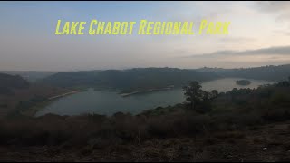
easiest trail for Chabot park

Detailed Description
Chabot is a 9 mile popular easiest route located near Castro Valley California. This mountain bike only route. This route includes 3 trails. This route climbs 1,216 ft with a max elevation of 825 ft then descends -1,146 ft.
Local Trail Association
Local trail association
Bicycle Trails Council of the East Bay (www.btceb.org)
Please consider joining or donating to the local riding association to support trail development & maintenance.
Donate to earn trail karma!

Stats

  • Distance
    9 miles
  • Avg time
    1 hr 25 min
  • Altitude change
    72 ft
  • Altitude min
    231 ft
  • Altitude start
    295 ft
  • Altitude end
    367 ft
  • Climb
    1,216 ft
  • Descent
    -1,146 ft
  • Grade
    0.2%
  • Grade max
    -56.4%
  • Grade min
    35%
  • Distance climb
    4 miles
  • Distance down
    4 miles
  • Distance flat
    4,026 ft

4 Reviews & Comments


We hope you've been enjoying Trailforks!

Create a FREE account to view route comments and much more.

Trails in Route

McGregor George4,790 ft
Towhee2 miles
Honker Bay2 miles

Details

Avg: 2.65 (3 votes)
close
3D
Trail Conditions
  • Unknown
  • Snow Groomed
  • Snow Packed
  • Snow Covered
  • Snow Cover Partial
  • Freeze/thaw Cycle
  • Icy
  • Prevalent Mud
  • Wet
  • Variable
  • Ideal
  • Dry
  • Very Dry
Trail Flow (Ridden Direction)
Trailforks scans users ridelogs to determine the most popular direction each trail is ridden. A good flowing trail network will have most trails flowing in a single direction according to their intension.
The colour categories are based on what percentage of riders are riding a trail in its intended direction.
  • > 96%
  • > 90%
  • > 80%
  • > 70%
  • > 50%
  • < 50%
  • bi-directional trail
  • no data
Trail Last Ridden
Trailforks scans ridelogs to determine the last time a trail was ridden.
  • < 2 days
  • < 1 week
  • < 2 weeks
  • < 1 month
  • < 6 months
  • > 6 months
Trail Ridden Direction
The intended direction a trail should be ridden.
  • Downhill Only
  • Downhill Primary
  • Both Directions
  • Uphill Primary
  • Uphill Only
  • One Direction
Contribute Details
Colors indicate trail is missing specified detail.
  • Description
  • Photos
  • Description & Photos
  • Videos
Trail Popularity ?
Trailforks scans ridelogs to determine which trails are ridden the most in the last 9 months. Trails are compared with nearby trails in the same city region with a possible 25 colour shades. Think of this as a heatmap, more rides = more kinetic energy = warmer colors.
  • most popular
  • popular
  • less popular
  • not popular
ATV/ORV/OHV Filter
Max Vehicle Width
inches
US Cell Coverage
Legend
cell carrier legend

Radar Time
Activity Recordings
Trailforks uses anonymized public activity data. ?
Activity Recordings
Trailforks uses anonymized public activity data. ?
Personal Heatmap
Activity Types
all / none
Options
2
Date range month
Winter Trails
Warning A routing network for winter maps does not exist. Selecting trails using the winter trails layer has been disabled.
Missing Trails
Most Popular
Least Popular
Trails are colored based on popularity. The more popular a trail is, the more red. Less popular trails trend towards green.
Jump Magnitude Heatmap
Heatmap of where riders jump on trails. Zoom in to see individual jumps, click circles to view jump details.
BC Backroad Status

Service Road Atlas is a free to use, community-driven service for viewing and creating reports on the numerous back-country service roads around B.C. and Alberta.

map legend
Slope Aspect
Direction the slope faces
Flat N NE E SE S SW W NW
Trails Deemphasized
Trails are shown in grey.
disable
Only show trails with no bike usage.
Enable
Suggested Layers
Based on selected activity type

    Save the current map location and zoom level as your default home location whenever this page is loaded.

    Save
    Trail transparency
    • Singletrack
    • Unpaved
    89
    82
    78
    79
    Lake Chabot MTB | Ten Hills & Towhee [4K]
    Lake Chabot MTB | Ten Hills & Towhee [4K]
    trail: Towhee
    13:19 | 427 | comments: 0 | favs:
    Dec 13, 2020
    Lake Chabot Mountain Biking - Top to Bottom
    Lake Chabot Mountain Biking - Top to Bottom
    trail: Honker Bay
    7:52 | 323 | comments: 0 | favs:
    Oct 16, 2020

    Recent Trail Reports Along Route

    statustraildateconditiondescription
    McGregor George
    Apr 27, 2026 @ 10:20am (America/Los_Angeles)
    Apr 27, 2026
    Towhee
    Dec 12, 2024 @ 2:37pm
    Dec 12, 2024
    ymvo7bb=5%?
    Honker Bay
    Sep 2, 2024 @ 11:06am
    Sep 2, 2024
    more reports »
    • By rogerduenas & contributors
    • #27947 - 1,068 views

    Hit the Trail

    Open in App

    Get this route on your phone instantly.

    Download Route

    Save to wishlist, Garmin & download.