
Open in App
Get this route on your phone instantly.
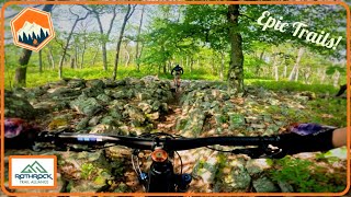
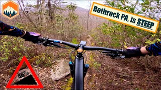
This is the most basic version of a very popular ride plan out of Galbraith Gap in Rothrock State Forest. This version skips Upper Lonberger in favor of the newly-rerouted, flowy Kettle Trail.
We hope you've been enjoying Trailforks!
Create a FREE account to view route comments and much more.
| 354 ft | |||||
| 4,646 ft | |||||
| 1 mile | |||||
| 3,638 ft | |||||
| 1,240 ft | |||||
| 696 ft | |||||
| 367 ft |

Service Road Atlas is a free to use, community-driven service for viewing and creating reports on the numerous back-country service roads around B.C. and Alberta.
Save the current map location and zoom level as your default home location whenever this page is loaded.
Save