12.8 miles
Distance
1,349 ft
Climb
-1,347 ft
Descent
1,149 ft
High Point
0 ft
Altitude change
784 ft
Altitude min
954 ft
Altitude start
955 ft
Altitude end
-43.4%
Grade max
48.8%
Grade min
5 miles
Distance climb
5 miles
Distance down
3 miles
Distance flat

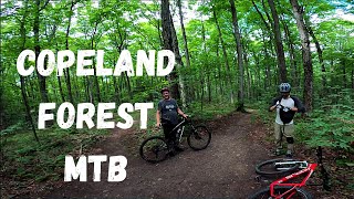
A good 20km route through Copeland, showcasing some of the 'key' trails in the forest. A good variety of flat single track following creaks, punishing climbs and fun descents.

Detailed Description
Copeland Showcase is a 13 mile popular intermediate route located near Barrie Ontario. This mountain bike only route can be used one direction and has a hard overall physical rating. This route includes 95 trails. This route climbs 1,349 ft with a max elevation of 1,149 ft then descends -1,347 ft.

Trail Issues on Route

  • Closed: 1 trail (newest: May 4, 2026)
  • Significant Issue / Amber: 2 trails (newest: Jun 3, 2026)
Local Trail Association
Local trail association
Copeland Forest Friends (www.copelandfriends.ca)
Please consider joining or donating to the local riding association to support trail development & maintenance.
Donate to earn trail karma!

Stats

  • Distance
    13 miles
  • Avg time
    2 hr 38 min
  • Altitude min
    784 ft
  • Altitude start
    954 ft
  • Altitude end
    955 ft
  • Climb
    1,349 ft
  • Descent
    -1,347 ft
  • Grade max
    -43.4%
  • Grade min
    48.8%
  • Distance climb
    5 miles
  • Distance down
    5 miles
  • Distance flat
    3 miles

22 Reviews & Comments


We hope you've been enjoying Trailforks!

Create a FREE account to view route comments and much more.

Details

  • Riding area
  • Primary Activity
    Mountain Bike
  • Difficulty rating
    Blue
  • Route Type
    Out & Back
  • Bike type
    AM, XC
  • Direction
    One Direction
  • Physical rating
    Hard
  • Ridelogs
    4
Avg: 3.15 (7 votes)
close
3D
Trail Conditions
  • Unknown
  • Snow Groomed
  • Snow Packed
  • Snow Covered
  • Snow Cover Partial
  • Freeze/thaw Cycle
  • Icy
  • Prevalent Mud
  • Wet
  • Variable
  • Ideal
  • Dry
  • Very Dry
Trail Flow (Ridden Direction)
Trailforks scans users ridelogs to determine the most popular direction each trail is ridden. A good flowing trail network will have most trails flowing in a single direction according to their intension.
The colour categories are based on what percentage of riders are riding a trail in its intended direction.
  • > 96%
  • > 90%
  • > 80%
  • > 70%
  • > 50%
  • < 50%
  • bi-directional trail
  • no data
Trail Last Ridden
Trailforks scans ridelogs to determine the last time a trail was ridden.
  • < 2 days
  • < 1 week
  • < 2 weeks
  • < 1 month
  • < 6 months
  • > 6 months
Trail Ridden Direction
The intended direction a trail should be ridden.
  • Downhill Only
  • Downhill Primary
  • Both Directions
  • Uphill Primary
  • Uphill Only
  • One Direction
Contribute Details
Colors indicate trail is missing specified detail.
  • Description
  • Photos
  • Description & Photos
  • Videos
Trail Popularity ?
Trailforks scans ridelogs to determine which trails are ridden the most in the last 9 months. Trails are compared with nearby trails in the same city region with a possible 25 colour shades. Think of this as a heatmap, more rides = more kinetic energy = warmer colors.
  • most popular
  • popular
  • less popular
  • not popular
ATV/ORV/OHV Filter
Max Vehicle Width
inches
US Cell Coverage
Legend
cell carrier legend

Radar Time
Activity Recordings
Trailforks uses anonymized public activity data. ?
Activity Recordings
Trailforks uses anonymized public activity data. ?
Personal Heatmap
Activity Types
all / none
Options
2
Date range month
Winter Trails
Warning A routing network for winter maps does not exist. Selecting trails using the winter trails layer has been disabled.
Missing Trails
Most Popular
Least Popular
Trails are colored based on popularity. The more popular a trail is, the more red. Less popular trails trend towards green.
Jump Magnitude Heatmap
Heatmap of where riders jump on trails. Zoom in to see individual jumps, click circles to view jump details.
BC Backroad Status

Service Road Atlas is a free to use, community-driven service for viewing and creating reports on the numerous back-country service roads around B.C. and Alberta.

map legend
Slope Aspect
Direction the slope faces
Flat N NE E SE S SW W NW
Trails Deemphasized
Trails are shown in grey.
disable
Only show trails with no bike usage.
Enable
Suggested Layers
Based on selected activity type

    Save the current map location and zoom level as your default home location whenever this page is loaded.

    Save
    Trail transparency
    • Singletrack
    • Unpaved
    285
    613
    684
    470
    COPELAND FOREST MOUNTAIN BIKING 2020
    COPELAND FOREST MOUNTAIN BIKING 2020
    21:57 | 851 | comments: 0 | favs:
    Feb 6, 2021
    featured Copeland - April 16th, 2017
    Copeland - April 16th, 2017
    4:14 | 906 | comments: 0 | favs:
    Apr 16, 2017
    Three trails from Copeland, in April.

    Recent Trail Reports Along Route

    statustraildateconditiondescription
    Twisted Sister
    Jun 3, 2026 @ 10:22pm (America/Toronto)
    2 days
    reporter
    Around the Top
    Jun 3, 2026 @ 10:19pm (America/Toronto)
    2 days
    Large tree down, blocking the trail, near the southern intersection. Have to bushwhack around it. reporter
    Rock Wall #2
    May 28, 2026 @ 8:53am (America/Toronto)
    May 28, 2026
    reporter
    Up & Over to the Green Lagoon
    May 28, 2026 @ 8:51am (America/Toronto)
    May 28, 2026
    reporter
    Fast Track
    May 28, 2026 @ 8:50am (America/Toronto)
    May 28, 2026
    reporter
    more reports »
    • By CanadmosTF Pro TRAILFORKS & contributors
    • #5013 - 6,172 views

    Hit the Trail

    Open in App

    Get this route on your phone instantly.

    Download Route

    Save to wishlist, Garmin & download.