5.0 miles
Distance
173 ft
Climb
-175 ft
Descent
100 ft
High Point
-1 ft
Altitude change
58 ft
Altitude min
78 ft
Altitude start
79 ft
Altitude end
-13.2%
Grade max
16.3%
Grade min
1 mile
Distance climb
1 mile
Distance down
2 miles
Distance flat

Use trails at your own risk. Hidden hazards may exist.

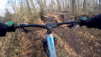
This route included BLUE trails at Cunningham Park.

Detailed Description
Cunningham Blue is a 5 mile popular intermediate route located near Queens New York. This mountain bike only route can be used one direction and has a moderate overall physical rating. This route includes 10 trails. This route climbs 173 ft with a max elevation of 100 ft then descends -175 ft.

Trail Issues on Route

  • Minor Issue / Yellow: 1 trail (newest: May 29, 2026)
Local Trail Association
Local trail association
Concerned Long Island Mountain Bicyclists (climbonline.org)
Please consider joining or donating to the local riding association to support trail development & maintenance.
Donate to earn trail karma!

Stats

  • Distance
    5 miles
  • Avg time
    56 min 23 sec
  • Altitude min
    58 ft
  • Altitude start
    78 ft
  • Altitude end
    79 ft
  • Climb
    173 ft
  • Descent
    -175 ft
  • Grade max
    -13.2%
  • Grade min
    16.3%
  • Distance climb
    1 mile
  • Distance down
    1 mile
  • Distance flat
    2 miles

5 Reviews & Comments


We hope you've been enjoying Trailforks!

Create a FREE account to view route comments and much more.

Trails in Route

Teepee4,035 ft
West Side Connector1,329 ft
Green Apple1 mile
Old Skool1,181 ft
West Loop1,588 ft
By Pass 3794 ft
IMBA1,594 ft
Iguana1,634 ft
Boomerang1,171 ft

Details

  • Featured
  • Riding area
  • Primary Activity
    Mountain Bike
  • Difficulty rating
    Blue
  • Route Type
    Loop
  • Direction
    One Direction
  • Physical rating
    Moderate

Directions

  1. Walk west on West Side Connector.
  2. Continue for 40 meters.
  3. Turn left onto East Loop.
  4. Continue for 200 meters.
  5. Keep right to take Teepee.
  6. Continue for 1.5 kilometers.
  7. Bear right onto East Loop.
  8. Continue for 600 meters.
  9. Turn left onto West Side Connector.
  10. Continue for 300 meters.
  11. Keep left to take Green Apple.
  12. Continue for 2.5 kilometers.
  13. Bear left onto West Loop.
  14. Continue for 50 meters.
  15. Turn left onto Viper West.
  16. Continue for 400 meters.
  17. Turn left onto West Loop.
  18. Continue for 100 meters.
  19. Turn left to stay on West Loop.
  20. Continue for 200 meters.
  21. Keep right to stay on West Loop.
  22. Continue for 100 meters.
  23. Turn left onto West Side Connector.
  24. Continue for 300 meters.
  25. Bear left onto East Loop.
  26. Continue for 200 meters.
  27. Turn right to stay on East Loop.
  28. Continue for 300 meters.
  29. Keep left to take IMBA.
  30. Continue for 1 kilometer.
  31. Walk southeast on East Loop.
  32. Continue for 20 meters.
  33. Turn left to stay on East Loop.
  34. Continue for less than 10 meters.
  35. Turn right onto Boomerang.
  36. Continue for 200 meters.
  37. Bear right onto East Loop.
  38. Continue for 10 meters.
  39. Keep left to stay on East Loop.
  40. Continue for 20 meters.
  41. Keep left to stay on East Loop.
  42. Continue for 10 meters.
  43. Keep right to stay on East Loop.
  44. Continue for less than 10 meters.
  45. Keep straight to stay on East Loop.
  46. Continue for 10 meters.
  47. Keep straight to stay on East Loop.
  48. Continue for less than 10 meters.
  49. Keep right to stay on East Loop.
  50. Continue for 30 meters.
  51. Keep straight to stay on East Loop.
  52. Continue for 30 meters.
  53. Turn left onto West Side Connector.
  54. Continue for 40 meters.
Avg: 5 (1 votes)
close
3D
Trail Conditions
  • Unknown
  • Snow Groomed
  • Snow Packed
  • Snow Covered
  • Snow Cover Partial
  • Freeze/thaw Cycle
  • Icy
  • Prevalent Mud
  • Wet
  • Variable
  • Ideal
  • Dry
  • Very Dry
Trail Flow (Ridden Direction)
Trailforks scans users ridelogs to determine the most popular direction each trail is ridden. A good flowing trail network will have most trails flowing in a single direction according to their intension.
The colour categories are based on what percentage of riders are riding a trail in its intended direction.
  • > 96%
  • > 90%
  • > 80%
  • > 70%
  • > 50%
  • < 50%
  • bi-directional trail
  • no data
Trail Last Ridden
Trailforks scans ridelogs to determine the last time a trail was ridden.
  • < 2 days
  • < 1 week
  • < 2 weeks
  • < 1 month
  • < 6 months
  • > 6 months
Trail Ridden Direction
The intended direction a trail should be ridden.
  • Downhill Only
  • Downhill Primary
  • Both Directions
  • Uphill Primary
  • Uphill Only
  • One Direction
Contribute Details
Colors indicate trail is missing specified detail.
  • Description
  • Photos
  • Description & Photos
  • Videos
Trail Popularity ?
Trailforks scans ridelogs to determine which trails are ridden the most in the last 9 months. Trails are compared with nearby trails in the same city region with a possible 25 colour shades. Think of this as a heatmap, more rides = more kinetic energy = warmer colors.
  • most popular
  • popular
  • less popular
  • not popular
ATV/ORV/OHV Filter
Max Vehicle Width
inches
US Cell Coverage
Legend
cell carrier legend

Radar Time
Activity Recordings
Trailforks uses anonymized public activity data. ?
Activity Recordings
Trailforks uses anonymized public activity data. ?
Personal Heatmap
Activity Types
all / none
Options
2
Date range month
Winter Trails
Warning A routing network for winter maps does not exist. Selecting trails using the winter trails layer has been disabled.
Missing Trails
Most Popular
Least Popular
Trails are colored based on popularity. The more popular a trail is, the more red. Less popular trails trend towards green.
Jump Magnitude Heatmap
Heatmap of where riders jump on trails. Zoom in to see individual jumps, click circles to view jump details.
BC Backroad Status

Service Road Atlas is a free to use, community-driven service for viewing and creating reports on the numerous back-country service roads around B.C. and Alberta.

map legend
Slope Aspect
Direction the slope faces
Flat N NE E SE S SW W NW
Trails Deemphasized
Trails are shown in grey.
disable
Only show trails with no bike usage.
Enable
Suggested Layers
Based on selected activity type

    Save the current map location and zoom level as your default home location whenever this page is loaded.

    Save
    Trail transparency
    • Singletrack
    • Unpaved
    40
    108
    99
    139
    Cunningham shred
    Cunningham shred
    trail: IMBA
    0:00 | 403 | comments: 0 | favs:
    Dec 25, 2017
    Xmas ride #loamyhomies
    Mountain Creek - Women's Ride Days
    Mountain Creek - Women's Ride Days
    trail: IMBA
    2:43 | 2808 | comments: 2 | favs: 6
    Aug 11, 2014
    Mountain Creek Bike Park is proud to be the home of Dirt, Rock N Root Training offering women's specific downhill mountain biking camps, clinics...

    Recent Trail Reports Along Route

    statustraildateconditiondescription
    Teepee
    May 30, 2026 @ 4:20pm (America/New_York)
    May 30, 2026
    Removed huge trees
    West Loop
    May 30, 2026 @ 4:20pm (America/New_York)
    May 30, 2026
    Removed huge trees
    Iguana
    May 29, 2026 @ 8:29am (America/New_York)
    May 29, 2026
    Tree down...
    Green Apple
    May 8, 2026 @ 3:36pm (America/New_York)
    May 8, 2026
    Large low tree branch, at neck/head level. Very dangerous, esp for tall riders
    Old Skool
    Nov 20, 2025 @ 1:13pm (America/New_York)
    Nov 20, 2025
    Leafy
    more reports »
    • By MTBMarcinTF Pro CLIMB & contributors
    • #40456 - 756 views

    Hit the Trail

    Open in App

    Get this route on your phone instantly.

    Download Route

    Save to wishlist, Garmin & download.